Thursday, July 30, 2015

Upper Narrow River - July 30, 2015

Gilbert Stuart Birthplace
I’ve paddled the lower section of the Narrow River several times, but today I decided to paddle the upper section from the Gilbert Stuart Birthplace to Bridgetown Road.  I put into the Gilbert Stuart Stream and pushed my way through the shallow water into the Upper Pond. I then paddled south to the Casey’s Sill - a shallow sandbar between the Upper and Lower Ponds named for nearby Casey Farm (c. 1750).  I paddled through the Lower Pond to Bridgetown Road before turning around and heading back.

Lower Pond
Links:

Wednesday, July 29, 2015

Port of Galilee - July 29, 2015

Port of Galilee
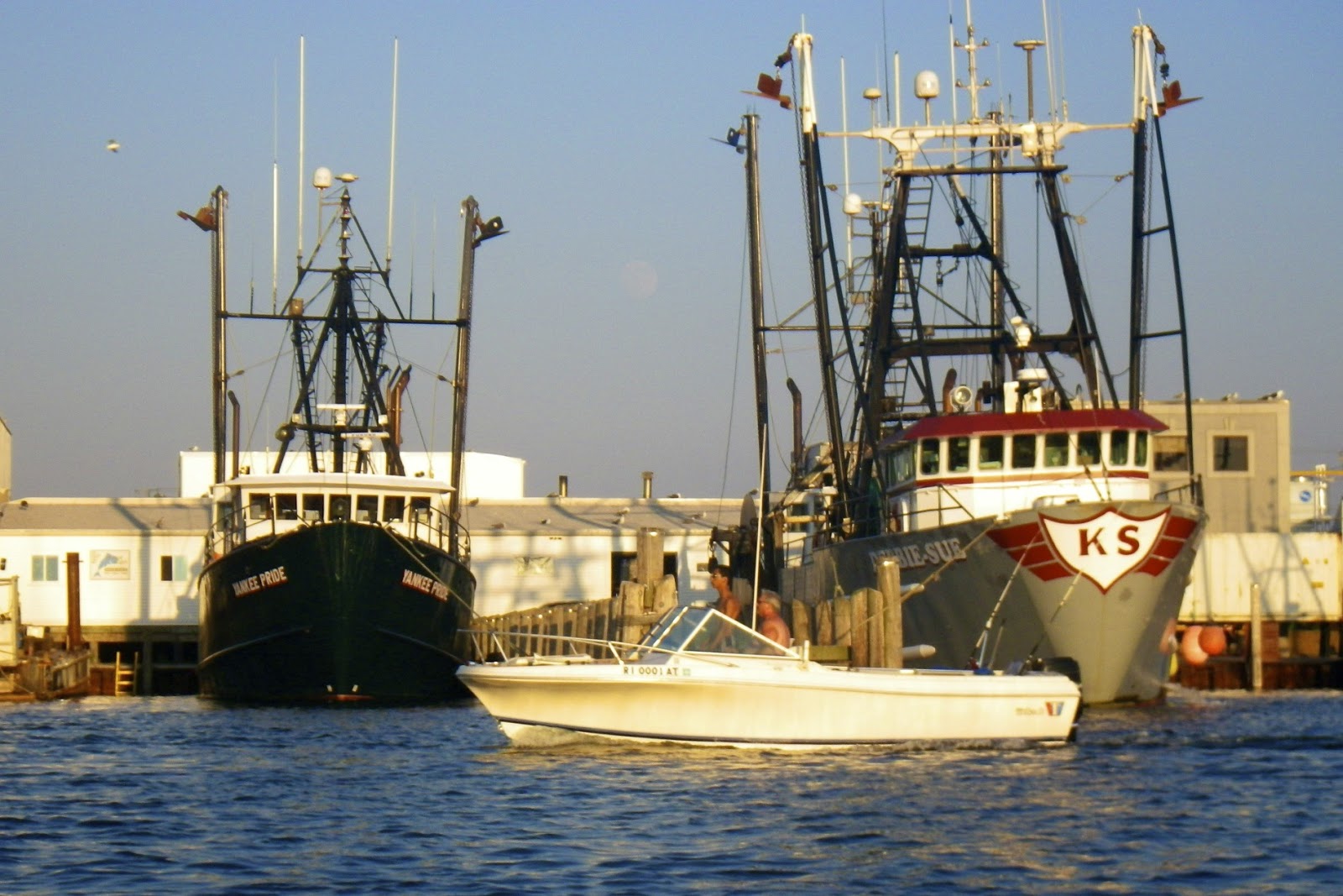
I didn’t get to paddle this morning, so I put my boat in the water at the dock near the cottage after supper, and padded south along Great Island to the Port of Galilee.  I knew that the evening light would be better for getting pictures of the fishing boats in the harbor.

Great Island is about 2 miles long and 1/2 mile wide, and full of summer cottages.  I headed south into a moderate headwind and easy rolling waves past Thomas Point and Little Comfort and into the Port of Galilee.  

Fishing boats
The Port of Galilee was created in 1935 when a harbor was dredged and a dock constructed at the mouth of Point Judith Pond. Connected to the ocean by the Harbor of Refuge and Breachway, both completed in 1910, Galilee eventually became the home port for much of Rhode Island's fishing industry.

There was an eclectic collection of ships docked in the harbor - large fishing trawlers, smaller lobster and shellfish boats and charter boats. Generations of fishermen have sailed from the Port of Galilee to work the waters of the Point Judith Pond, the Rhode Island and Block Island Sounds and beyond at the edge of the continental shelf.

Lobster boat
Links: 

Wickford Harbor - July 28, 2015

Jamestown Verrazzano Bridge
The morning was cloudy, but the water was calm and still as I put-in to Wickford Harbor at Wilson Park. This would be my first trip at this popular paddling location.

Wickford is located on the West Passage of Narragansett Bay, and is built around a large, well-protected harbor. Like the Pawtuxet Village, it was settled in the early 17th century when Roger William purchased land from the Narragansett Indians and established a trading post. Wickford grew to become a major port and shipbuilding center, and today contains a large collection of 17th and 18th century homes.

Beach Rose Cafe
While the backwaters around Rabbit Island and Cornelius Island looked interesting to explore, I headed out into Wickford Harbor, through the breakwater, and south down the West Passage. I wanted to get some pictures of the Plum Island Light. I made it as far as Bissel Cove before deciding that the haze and fog would be too much. 

I returned to Wickford Harbor to explore the Wickford Cove. With the exception of a couple of fishing boats, the marinas were quiet. I paddled under the Brown Street Bridge, and snapped a few pictures at the Beach Rose Cafe. Then, I continued down the cove toward the Kayak Center before turning around at the Route 1A Bridge. There really is a lot to explore.

Seagull in Wickford Cove
Links:

Saturday, July 25, 2015

Pier 5 - July 25, 2015

I headed over to Pier 5 or South Pier yesterday, and paddled down to the Narragansett Town Beach. In the late 19th century, this section of Narragansett became a thriving resort community with 10 hotels and many Victorian and Shingle style cottages. The Towers is all that remains of the old hotels, but many summer cottages - old and new - can still be seen along the shore.

The Towers
Links:
My Pictures

Friday, July 24, 2015

Harbor of Refuge - July 24, 2015

New parking lot and view of the breakwater
The water was clear and calm as I put in at the beach at Camp Croning to paddle the Harbor of Refuge. Construction of the Harbor of Refuge, which protects the Breachway and the Port of Galilee, began in 1890 with the construction of the east and west jetties. The breakwater was not completed until 1910 with the completion of the center jetty.

When I arrived at Camp Cronin, I was surprised to see the work done to repair the damage done by Superstorm Sandy in 2013. After that storm, most of the parking lot had been washed away, and the sand dunes had been replaced by steep cliffs. 

Break in the wall with a view to Block Island
Easy 1 to 2 foot rollers were breaking on the shore as paddled along the east breakwater. Boat traffic was light, so I hurried across the east entrance to the center breakwater. Once reached the center breakwater I was amazed how many birds were on the rocks. Most were cormorants, but there were also sea gulls, egrets and others. 

The water was crystal clear, and the many breaks in the breakwater gave great views out into Long Island Sound with Block Island beyond. At the west end of the breakwater, I sat and watched the fishing boats, charter boats, and ferries entering and leaving the harbor. I paddled back across the beach to Camp Cronin.

Block Island Ferry entering the Breachway
Links:

Thursday, July 23, 2015

Lower Narrow River - July 23, 2015

Cormorant Point
It was high tide when I put in at the Sprague Bridge to paddle the Lower Narrow River and the Pettaquamscutt Cove. Like Point Judith Pond, this section of the Narrow River is a tidal estuary. At low tide it attracts hundreds of birds looking for breakfast. At high tide, not so many.

As I padded through the Narrows, it looked like it would be easy to break through the 1 to 2 foot waves breaking on the beach, but instead I took a sneak route through the rocks. Cormorant Point lived up to its name with hundreds of birds out on the rocks. I snapped a few pictures before heading back for an easy paddle around Pettaquamscutt Cove.

Pettaquamscutt Cove
Links:
My Pictures
Lower Pettaquamscutt River and Cove from the Narrow River Preservation Association

Wednesday, July 22, 2015

Upper Point Judith Pond - July 22, 2015

Having pretty much covered the lower section of Point Judith Pond, decided to paddle north today into the Upper Point Judith Pond.  Boat traffic was light as it has been all week as paddled around Betty Hull Point and the Narrows into the Upper Pond.  Long Cove was quiet, and the osprey nest appeared to be empty.  I paddled back out the Narrows and along the west side of Point Judith Pond through Condon Cove, Smelt Brook Cove and Turner Cove before crossing back to the cottage near Jonathan Island.


Smelt Brook Cove
Links: 
My Pictures