Showing posts with label Biscuit City. Show all posts

Saturday, May 18, 2019

Great Swamp - May 18, 2019

Running the beaver dam above
the South County Bike Path
Chuck was supposed to lead to RICKA trip at Great Swamp today, but with reports of many downed trees, he decided to cancel. Instead, we did an early morning power-paddle of the route to scout it for a future trip. 

We met at the take out at Biscuit City Landing at 8:00 for the shuttle up to Taylor's Landing. The day was warm with a slight breeze, which we knew we would feel a lot more on Worden Pond. The river was at a nice level – 6.5 feet, 45 cfs on the West Kingstown gage. 

View of Worden Pond from the
Stony Point campsite
The trip itself is a Rhode Island classic. We put in on the narrow Chipuxet River, and weaved our way through swamp grass and over beaver dams down to Worden Pond. At Worden Pond, we paddled along the northern shore to checkout the campsite at Stony Point before continuing over to the Pawcatuck River.  

While the Chipuxet River feels like a marsh, the Pawcatuck River feels more like a jungle as it twists and turns though a hardwood forest covered with wild grape and poison ivy vines. We took a break to check out the Impound at the Great Swamp Management Area before heading down to the take out.

Pawcatuck River approaching
the Usquepaug River 
It took us just under 4 hours to complete the 7-mile trip. The upper section of the Chipuxet was clear (except for one beaver dam at the South County Bike Path bridge), but there were a lot of blow-downs on the Pawcatuck between Worden Pond and Biscuit City. We were able to paddle over or around all but one, which required a short portage. In lower water there would be a lot more portages.

The trip was uneventful except for one swim – me. I was just downstream of the put in when I leaned over to go from kneeling to sitting, and over I went. Not the place I would expect to have my first swim of the year, but you never know.

First swim of the year - you never know!
Links:

Monday, May 29, 2017

Great Swamp - May 28, 2017

Heading out
I’ve been paddling regularly for the past ten years, and its nice that there are still plenty of new trips for me to do.  I was able to do one yesterday – Great Swamp in the towns of West Kingstown and Richmond in Rhode Island’s South County.

Great Swamp is one of the classic Rhode Island paddling trips.  In his book Canoeing Massachusetts, Rhode Island and Connecticut, Ken Weber described it as “perhaps the most intriguing canoe trip in the state” and “an excursion into jungle like retreats that cannot be reached any other way”.  It sure sounds interesting.

Through the swamp grass
Henry D. has been running the Great Swamp trip for RICKA for years, but it is always run in the spring when I have visions of whitewater dancing in my head. This year, I decided it was time, and that was definitely the right decision.  The trip doesn’t have any rapids, but it has everything else – beautiful scenery, lots of challenging twists and turns to maneuver through, and an open water crossing on a wind-blown lake.

We met at Taylor’s Landing (3348 Kingstown Road, West Kingston) for the shuttle down to Biscuit City Landing (Biscuit City Road, Richmond).  We had 11 paddlers in 10 boats  - 3 canoes and 7 kayaks.  The river was at a nice level – 6’. 75 cfs on the West Kingstown gage.

Crossing Worden Pond
We put-in on the Chipuxet River at Taylor’s Landing, and headed south through the Great Swamp Management Area.  At times, shrubs and swamp grass almost overgrew the river.  Fortunately, with the higher water levels, we were able to paddle through without too much difficulty.  The higher water also allowed us to float over the frequent beaver dams along the way.

As we approached Worden Pond, we could see a strong wind from the south kicking up small whitecaps on this large, shallow lake. We hung to the north shore as we headed out into the waves.  After passing Stony Point, we headed for the site of an old seaplane hanger on the northwest corner of the lake, which is an easy place to stop for lunch.  We then headed south past Case Point to resume our trip down the river. 

Great Swamp Impound
From here, there are some differences of opinion on the name of this section of river. Many guidebooks refer to Worden Pond as the source of the Pawcatuck River. In other guides, this is a continuation of the Chipuxet River, which becomes the Charles River when it merges with the Usquepaug (Queens) River just above Biscuit City. The Charles River eventually merges with the Wood River above Burdickville to form the Pawcatuck River.  

Whatever it is called, the river itself is beautiful.  It twists and turns through a pretty hardwood swamp covered with vines – especially poison ivy, which grows so lush that I saw leaves as big as my hand drooping down from many trees. We stopped for a look at the huge impound of the Great Swamp Management Area, and watched as an Osprey brought a fish back to its nest high atop the power lines. 

Approaching Biscuit City Landing
Shortly after the convergence of the Chipuxet and Usqupaug Rivers to form the Charles, we turned right up the small channel that leads to the Biscuit City Landing.  It was a 7-mile trip that took us about 4 hours to run.  I definitely made the right decision on this one. 

That's me enjoying a great day on the river
Links:
My Pictures

Sunday, July 6, 2014

A touch of Arthur - Biscuit City to Richmond - July 5, 2014

Running the fish ladder
at the Kenyon Dam
I wouldn’t say Hurricane Arthur was a bust, but it didn’t produce enough rain to bring the local whitewater rivers up.  The ones that were running were too far away, so Paul and I decided to do something local - the Pawcatuck from Old Biscuit City Road to Richmond.  Paul was looking for something with a little current, and he had never been on this section. 

The river was at a nice level – 3 feet, 300 cfs on the Wood River Junction gage.  We did a couple of laps at the Kenyon Dam fish ladder, portaged the Horseshoe Dam, and did a couple more laps at the Lower Shannock Falls.  From there it is basically flatwater to the Richmond Dam.

Half way down, Paul remembered that he forgot his keys in my car.  This is the third time that one of us had forgotten the keys – it's tough to get old.

Paul running Lower Shannock Falls

Links:

Sunday, March 9, 2014

Good for Fish, Good for Paddlers - Pawcatuck River - Biscuit City to Richmond - March 8, 2014

Jim C. running the Kenyon Dam
There has been a lot of work done on rivers in this area to restore access to migratory fish.  I can think of several trips that I have done in the past few months where dams were removed to improve access.  This includes Pawtuxet Falls Dam on the Lower Pawtuxet River and the Spoonville Dam on the Tville section of the Farmington River.   The removal of these dams has restored miles of free-flowing river habitat to river herring, alewife and shad.  These fish are an important part of the ecosystem, providing food for bluefish, striped bass, largemouth bass, herons, ospreys and many other predators.

Perhaps nowhere has this restoration work been more active than on the Pawcatuck River near the Shannock Village.   At one time, this short section of the river contained three dams that blocked access not just to fish, but to paddlers as well.  With the completion of the new Kenyon Dam, access along this section has improved dramatically. 

Approaching the portage at the Horseshoe Dam
I met up with Jim C. and Jim S. to run the section from Biscuit City Road down to Richmond. The Biscuit City Fishing Area launch site was iced in, so we will put in just downstream on Biscuit City Road. The water level was low, but runnable – 2.75 feet,180 cfs on the Wood River Junction Gage.

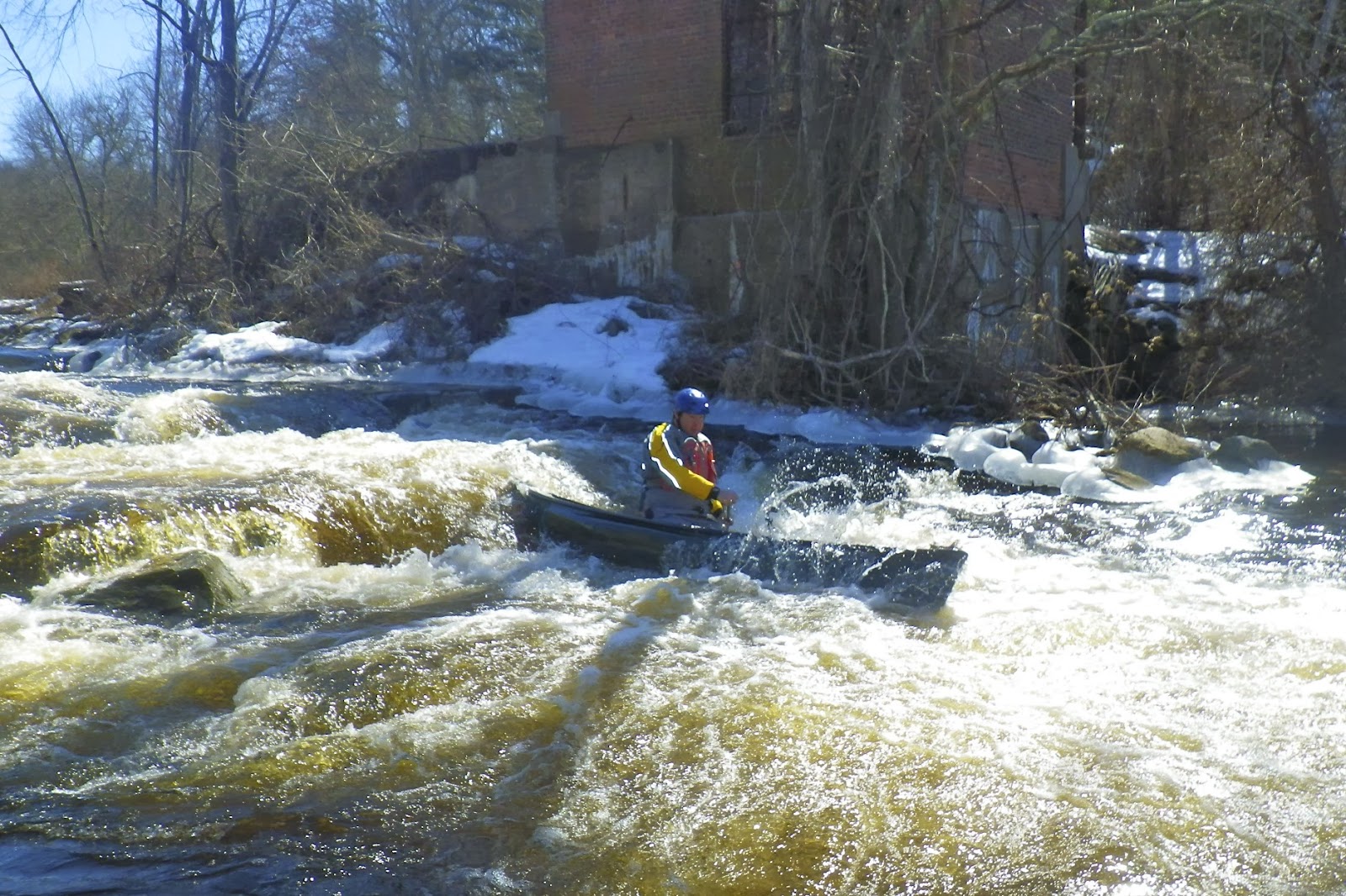
Just downstream from the put-in is the new Kenyon Dam. As water flows down this minefield of rocks, you might think you are looking at a natural rapid. An 85-foot-long ramp has been constructed on the downstream side of the dam.  This ramp is made up of five gradually ascending stone weirs, which serve like terraced steps. Gaps were left in the weirs to create channels for the water to flow and the fish to swim, including a main current down the middle that forms a nice channel for paddlers. This main channel is a little tricky with a gradual curve to the right, but we all made it through fine. 

Running the Lower Shannock Falls
From the Kenyon Dam to the Horseshoe Dam in Shannock Village, the river twists and turns through a pretty marshland.  We portaged the Horseshoe Dam on the left, and continued down through some easy rapids to the Lower Shannock Falls.

The dam at the site of what is now the Lower Shannock Falls was removed in 2010.  This rocky section of the river curves gradually to the left before ending in a couple of large drops.  Open boats will often take in water at the bottom, but the rapid can easily be portaged on the right. 

Below the Lower Shannock Falls, the river is a combination of flatwater and easy quick water until you reach the Route 112 Bridge and the Carolina Mill Raceway.  We stopped for lunch and a campfire at the Carolina Canoe Campsite before taking out below the Richmond Dam.  

Taking a break at the Carolina Canoe Campsite
Links: