Showing posts with label Ninigret Pond. Show all posts

Thursday, June 8, 2023

Saltwater Paddling for Everyone

In Rhode Island, we are fortunate to have great saltwater paddling not just for sea kayakers, but also for flatwater paddlers. Here are some of our favorite flatwater and sea kayaking venues.

Flatwater (These sites are somewhat protected and are suitable for experienced flatwater paddlers, but you may experience wind and wind-blown waves.)

Exploring the coves
Point Judith Pond
South Kingstown

Point Judith Pond, or the Great Salt Pond is the second largest of the Rhode Island’s South County salt ponds. It is a shallow, four-mile long pond located behind the barrier beaches and sand dunes that form Point Judith. The easiest put-in is boat ramp at Marina Park. From there, you can paddle out into the Upper Pond, through the Narrows, and into Point Judith Pond itself. There are numerous coves and island to explore as you head down to the Port of Galilee at the southern end.

West end of the pond
Ninigret Pond
Charlestown

Ninigret Pond is the largest of Rhode Island’s South County salt ponds. Ningret is separated from the ocean by the fragile barrier island that forms East Beach. It is connected to Green Hill Pond by a small tidal inlet. Putting in at Ninigret Park allows you to explore the west end of the pond, including a short hike across the barrier island for a view of the beach. Putting in at the Charlestown Beach put-in allows you to explore the east end of the pond including the Charlestown Breachway and Green Hill Pond.

Upper Narrows
Narrow River
South Kingstown and Narragansett

The Narrow River, also known at the Pettaquamscutt River, arises at Carr Pond Dam at the Gilbert Stuart Birthplace and flows south for 6-miles forming the border between South Kingstown and Narragansett. There are five distinct sections of the Narrow River – the Upper Pond, the Lower Pond, the Upper Narrows, Pettaquamscutt Cove, and the Lower Narrows. Putting in at the Narrow River Fishing Area allows you to paddle upstream exploring the Upper Narrows and the Upper and Lower Ponds. Putting in at the Sprague Bridge provides easy access to Pettaquamscutt Cove and the Lower Narrows where the river flows into Narragansett Bay.

Wickford Harbor
Wickford Harbor
North Kingstown

Wickford is located on the West Passage of Narragansett Bay, and is built around a large, well-protected harbor. Today, it is a picturesque village whose waterfront streets are lined with shops, restaurants and colonial-era homes. Putting in a Wilson Park allows you to explore the backwaters around Rabbit and Cornelius Islands before heading into Wickford Harbor and down into the Cove.

Sea Kayak (These sites are in open water and more exposed, and are suitable for experienced sea kayakers.)

Sakonnet Point Light
Sakonnet Point
Little Compton

Sakonnet Point includes West Island, East Island, Little Cormorant Rock and the Sakonnet Point Lighthouse. It is one of RICKA’s most popular rock garden venues. The water around the islands is very exposed and can be quite active. RICKA members also enjoy surfing when conditions are right at Surfer’s Beach near the Haffenreffer estate. 

Mansion on Ocean Drive
Kings Beach
Newport

Launch at Kings Beach and you are paddling along the amazing rocky shore of southern Aquidneck Island. If you head east you will pass mansions on the rocky cliffs along Newport’s Ocean Drive and Cliff Walk. Seal Rock lies a third of a mile to the south - a wild, exposed area that is a favorite for advanced rock gardening. If you head west you will pass Brenton Point and will enter the open waters of Narragansett Bay. 

Beavertail Light
Bay Campus
Narragansett

The URI Bay Campus provides access the West Passage of Narragansett Bay. To the south lies Bonnet Shores and Whale Rock - a frequent rock gardening site. From there you can cross to Beavertail at the southern tip of Jamestown - one of the most scenic and exposed-coast locations in RI. 
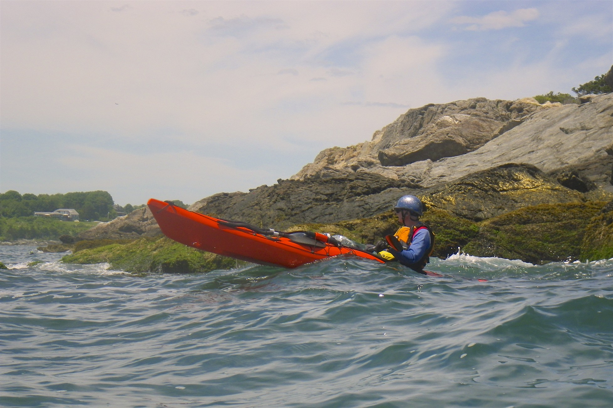
Rock gardening
Fort Wetherill
Jamestown

Fort Wetherill provides access to the lower East Bay. The southern Jamestown shoreline provides outstanding rock gardening and coastal touring, or head north to The Dumplings for easy tide race play during peak flows. Head east across the East Passage, with due caution in very busy waters, to reach Castle Hill Lighthouse, and from there around Brenton Point for rock gardening and coastal touring.

Newport Bridge
Potter Cove
Jamestown

Potter Cove gives you access to Jamestown, Newport and the coves and islands of the upper East Bay. If you head south, you will pass under the Newport Bridge and into Jamestown Harbor. From there you can cross to Newport Harbor, Rose Island and Gould Island.

Monday, August 10, 2020

Ninigret Pond - August 10, 2020

Bob waits at the put in
My options for yesterday were a whitewater run on the Deerfield (too late and too far), a solo bike shuttle on the Pawcatuck (check out the campsites from Alton to Bradford), or the RICKA trip at Ninigret. I went for the RICKA trip.  

Ninigret Pond is the largest of Rhode Island’s South County salt ponds, which includes Point JudithGreen HillQuonochontaug and Winnapaug Ponds. Ningret was formed by the retreating glaciers 12,000 years ago, and is separated from the ocean by the fragile barrier island that forms East Beach. It is connected to Green Hill Pond by a small tidal inlet.

Terry checks out the cormorants
With fertile farmland and rich fishing grounds, the land around Ninigret attracted Native Americans for thousands of years. In fact, the pond itself is named for Ninigret, a 17th-century sachem of the Narragansett tribe. They grew corn, beans, and squash and supplemented their diet by fishing and hunting. 

The area around Ninigret remained agricultural until the 1940s when the Navy built the Naval Auxiliary Air Station Charlestown – a satellite airfield to the nearby Quonset Naval Air StationIt had three runways, numerous hangers and was used for testing and training. In 1974 the base was decommissioned along with Quonset Point

Taking a break at East Beach
After it was closed, large sections of the old Charlestown Naval Air Station were designated as the Ninigret National Wildlife RefugeThe refuge is characterized by salt marshes, kettle ponds and freshwater wetlands and is inhabited by hundreds of species of birds. 

We put in at the boat launch at Ninigret Park and paddled west along the northern shore before crossing over to the barrier island. We hiked across the barrier island for lunch and a quick swim at the beach before heading back. We did try to head over to the Charlestown Breachway, but decided at low tide that it wasn’t worth the effort. That is a trip for another day.

That's me - picture by Pat
Links:

Friday, August 2, 2019

Green Hill, Ninigret and the Charlestown Breachway – August 1, 2019

Green Hill Pond
I’m not big on paddling in salt ponds, but decided to head down to Charlestown to check out the Charlestown Breachway and the two salt ponds that it feeds – Ninigret Pond and Green Hill Pond.  

I parked at the Charlestown Beach put-in, but I was a little concerned since the signage is vague about parking without trailers, and I was told that some RICKA members had recently received tickets there. Never the less, I headed east under the Creek Bridge on Charlestown Beach Road into Green Hill Pond.

Charlestown Breachway
Green Hill Pond is located primarily in South Kingstown with the western edge in Charlestown. Like Potter Pond it is does not have direct access to the ocean, but is linked through an inlet from Ninigret Pond. The sun was rising, and there were great views to the east. The pond is shallow, and it was low tide, so I didn’t venture far into the pond.

From there I paddled west through the slat flats at the eastern end of Ninigret to the Charlestown Breachway. Like the Breachway in Galilee, the Charlestown Breachway was constructed in 1904 to provide a consistent flow of seawater in and out of Ninigret Pond, and to provide access from Ninigret to the ocean for boats. The current though the breachway is strong, and even motorboats can have difficulty getting through.  

Ningret Pond
On the way back I explored the salt flats at the eastern end of Ninigret Pond. Ninigret is the largest of Rhode Island’s South County Salt Ponds. It is protected on the south by the barrier beach that forms East Beach. Usually we put in at the Ningret National Wildlife Refuge and paddle west, so it was nice to explore the eastern end. At low tide it was shallow and tough to paddle, but there were plenty of birds.

I was back to the cottage by 9:00 – another nice paddle.

Charlestown Breachway
Links:

Tuesday, September 22, 2015

Ninigret Pond - September 19, 2015

Paddling with Bill in the Spirit II
Although I have done a lot of paddling in South County, I had never paddled Ninigret Pond in Charlestown.  That changed when the RICKA Picnic was held there last Saturday.

Ninigret Pond is the largest of Rhode Island’s South County salt ponds, which include Point Judith Pond (a tidal estuary), and Green Hill, Quonochontaug and Winnapaug Ponds (coastal lagoons).  Like all coastal lagoons, the Ninigret Pond itself is separated from the ocean by a barrier island.  It is also connected to Green Hill Pond by a small channel

Taking a break at the beach
We put in at the boat launch at Ninigret Park and paddled west along the barrier island.  Other than a few houses on the north shore along Route 1, it is quiet and undeveloped.  We hiked across the barrier island to take a quick swim at the beach before heading back for the picnic. 

It was a nice trip, and nice to paddle tandem with Bill in my Spirit II.

View across Ninigret Pond
Links:
