Sunday, January 29, 2023

Three Amigos on the Willimantic - January 29, 2023

The three amigos - Erik, Paul and Jeff
It has been an unusual January in southern New England. To the north and west it has been cold and snowy, but here in southern New England it has been warm and rainy. Great if you can get out and paddle, but kind of depressing if you can’t. Family obligations have kept me close to home, so my recent trips have been short and local. That changed when I got out with Jeff and Paul for a run on the Willimantic - the return of the "three amigos".

I've been paddling with Jeff and Paul for years. I’m pretty sure my first trip with Paul was a 2008 Icebreaker trip on the Branch River. I’m not sure when I started paddling with Jeff, but he is mentioned regularly in my early posts on this blog, which I started in 2009. His video of our Crystal trip in July of 2009 is one of my favorites. Along with Andy, Jeff, Paul and I would become the four amigos of the RICKA Whitewater group. The first video I can find of the four of us (young and slim) plus Eric D. is at the Millville Rapid in 2009. One of our more memorable trips was the fall dam release on the West in 2010. A lot of water under the bridge, or over the dam between us – literally.

Paul running the broken dam
With another warm weekend in the forecast, I put out the word to see who would be interested in paddling on Saturday. I was glad when Paul and Jeff signed on – it would be like the old days. We had lots of choices, but decided to do a run on the Willimantic

The Willimantic River arises in Stafford Springs and flows south for 25-miles to Willimantic where it joins the Natchaug River to form the Shetucket River. There has been talk of building a whitewater park in the class III/IV section below Bridge Street in Willimantic, but nothing has happened recently. I'd like to try the class I/II section from the Eagleville Dam to Bridge Street sometime. 

Jeff running the broken dam
We would be running the 6-mile section from the Municipal Parking Lot on River Road in Stafford Springs to Nye-Holman State Forest in Willington. 
We met at 9:00 at the Dunkin Donuts in Willington to run the shuttle. After leaving Jeff’s car at the take-out, we headed up to the put-in. The river was at a nice level – 5-feet, 800 cfs on the Coventry gage and 2.7-feet, 500 cfs on the Merrow Road Gage. To be honest, it would be even better with another foot of water, but 5 feet is my new minimum for this run.

The easy rapids start right at the put-in and continue for a mile down to an old broken dam that includes a small low-head dam at the top. We ran the dam to the left and made it through fine. From there, the river is mostly quickwater as it twists and turns along Route 32 and then I-84 to the Nye-Holman State Forest. We could have continued another 5-miles down to Merrow Road, or another 8-miles down to the Eagleville Dam, but for today 6-miles was enough.  

The shuttle back - matching Bell Yellowstone Solos (and Paul's kayak)
Links:

Sunday, January 22, 2023

Manville Dam - January 22, 2023

Selfie at the Manville Dam
It has been raining here on-and-off for weeks. Up north they are getting snow, but here in southern New England we keep getting rain. All the rivers were up, so I tried to drum up a crew for a quickwater run yesterday. No one was interested. Today I had some family obligations to take care of in the morning, but I did get out in the afternoon for an up-and-back trip at the Manville Dam. 

Typically, this section of the river is flatwater with very little current. Today it was cranking along at 4.2 feet, 1,750 cfs. I decided to take my kayak since it would be easier paddling upstream. It was still a slog - especially up at the top near the Hamlet Avenue Bridge. 

Hamlet Avenue Bridge - 3-miles upstream
Going upstream the boat was all over the place, and I wasn’t sure why. I assumed it was the current and tried to manage it by edging the boat. Eventually I gave in and put down the skeg. It was a lot easier. When I turned around at the top of the run I realized that I had been paddling upstream with a pretty strong tail wind, so the boat had been weathercocking. P
utting down the skeg was the right thing to do.

The run was 6-miles – 3-miles up and 3-miles back. It was a gray day, but it was still nice to get out.

Monday, January 16, 2023

River Island Park - January 16, 2023

Putting in at River Island Park
With the recent controversy about the city removing homeless camps along the Blackstone River, I decided to do a run at River Island Park. This would be my 40th trip here since I started keeping track in 2009, so I am pretty familiar with the area. The river was at a nice level - 3.6 feet, 1,300 cfs. There was a little snow on the ground when I put-in, and a few more flurries when I was out on the river. It was starting to feel like winter.

The Blackstone River has suffered many indignities over the years. It was dammed and used as a power source for industry in the nineteenth century, and it became a cesspool for the disposal of sewage and industrial waste in the twentieth century. With the establishment of the Blackstone River Valley National Heritage Corridor in 1986 and the ongoing construction of Blackstone River Bikepath, much has been done in recent years to improve conditions on the river. 

Campsite along the river in
January 2022
Unfortunately, one section of the river that has not benefited from this progress is downstream of 
River Island Park. This isolated area, hidden from view behind retaining walls from Woonsocket’s industrial past and the flood control levee that protects the city from potential flood waters, has become something of a no-man’s land. 

I am one of the few people who regularly paddles this section of the river. I launch my canoe at River Island Park, paddle downstream to enjoy the rapids below the Bernon Street, Court Street and P&W Railroad bridges, then walk back to my car along the flood control levee and Main Street Bypass. Along the way I get a view that few others see, and it is not always pretty.

The same site after the clean-up in
January 2023
With its location near Woonsocket’s downtown, this isolated section of the river has become a magnet for homeless camps. Before the recent clean-up, trash from these camps littered the banks. While paddling here I have had some interesting interactions with local residents - 'nuf said on that. The number of people I see hanging out in the area has definitely increased in recent years - maybe because a local social service agency encourages camping by giving out tents and sleeping bags. 

Of course, I realize that there is a serious problem with homelessness in the city. The fact that we have people living along the river in tents in the dead of winter is an indication of just how serious the problem is. I'm not sure what the answer is, but giving people the means to live “out of sight and out of mind” in decrepit camps along the river doesn't seem like the solution. 

On the bikepath heading back
to River Island Park
The city's recent clean-up included 13 workers who spent an entire day removing eight dump trucks loads of debris from the area. As I paddled down the river on this trip I was amazed at how much better the area looked after the clean-up. And of course, all that trash won't end up in the river next time that it floods. 

With plans to extend the bikepath into Market Square and build a greenway along the Main Street Bypass, this area has the potential to be transformed from a no-man's land into an attractive recreational space - further linking the river to the city's historic downtown. I would love to see that happen. We'll see. Already, a couple of new tents have appeared along the river. Definitely a cold, snowy day to be living outside along the river. 

New tent along the river - January 2023

Sunday, January 15, 2023

Harold Parker State Forest/Skug River Reservation - January 14, 2023

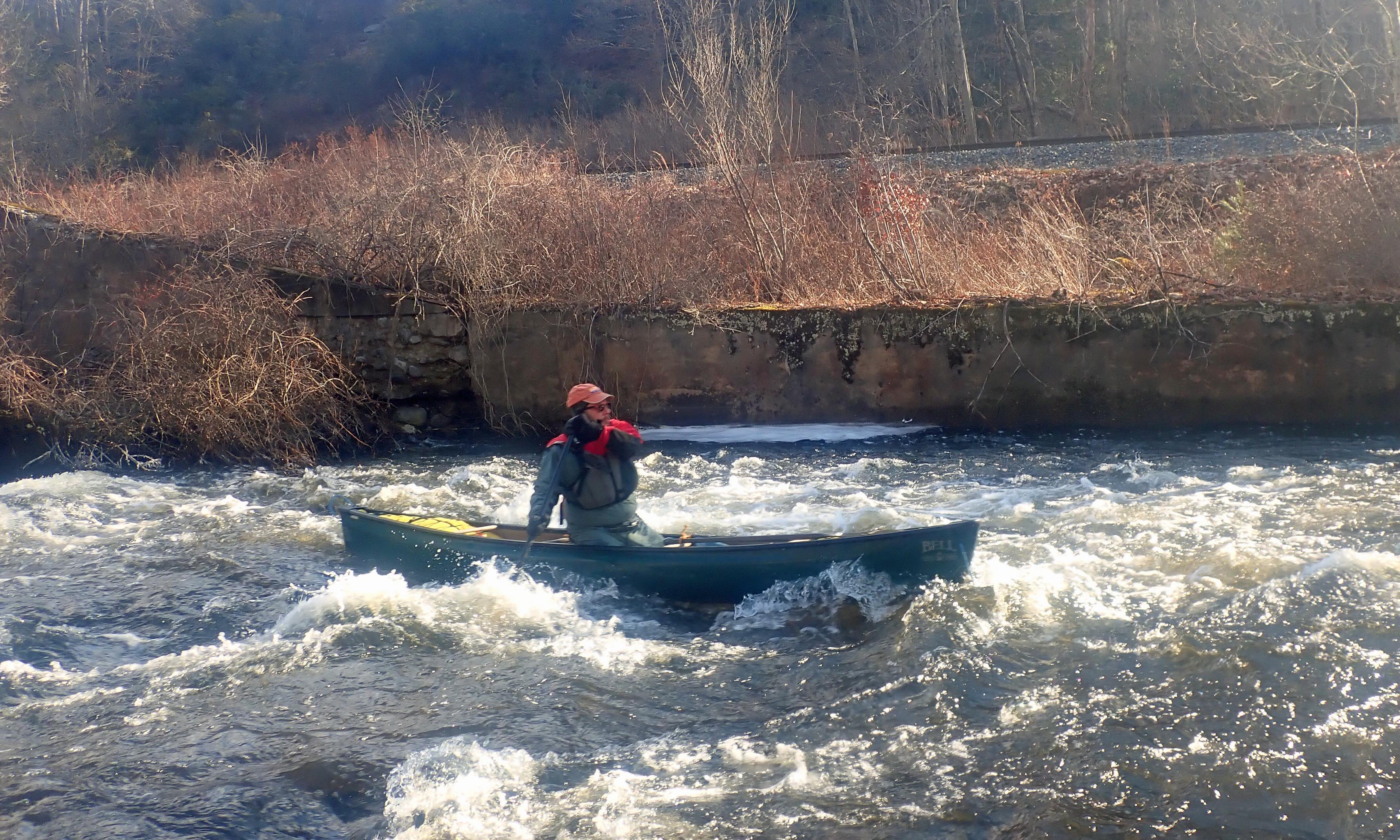
Paddlers on dry land -
Bob, Erik, Bill and Jonathan
Its been a while since I've been out with Papa Joe and the crew, so I decided to join this week's hike at Harold Parker State Forest/Skug River Reservation. The drive was a little longer than I would usually do for a hike, but I really needed to get out and get some exercise.

The Harold Parker State Forest in Andover includes over 3,000 acres of forest with over 35 miles of logging roads and trails. The area was inhabited by Pentacook Indians until it was settled by English farmers around 1650. By the middle of the nineteenth century the farms were abandoned and the fields have slowly been replaced by woodlands.
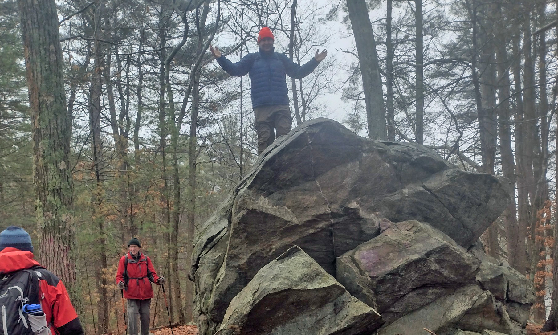
King of the rock -
now how do I get down?
We met at the trailhead at the Skugg River Reservation (315 Salem Street, Andover, MA) and headed out on boardwalks and bridges through the wetlands. The trail eventually climbed into a pretty pine forest as we wove our way around the Delano, Brakett, Field, Collins and Bear Ponds. 

The trail was littered with huge glacial erratics. I used my climbing skills to get up on one, and then had a hard time getting back down. We were on the Bay Circuit Trail for a short time on the way back to the cars. My knee was fine, and it was nice to see Bill, Jonathan and Bob.

Links:

Monday, January 2, 2023

Providence - January 1, 2023

I-way Bridge and the Hurricane Barrier
On New Year’s Day there are always a lot of options for trips. Although I should have been more ambitious (something like the Lower Winni), I was leaning toward a trip on the Upper Winni with Conrad. A trip with the CTAMC led by Paul D. on the Crystal section of the Farmington was also in the running. In the end, the decision was easy since I had to stay local due to family obligations. I decided to take my kayak out for a trip on the Providence River.

The Providence River is formed at the convergence of the Woonasquatucket and Moshassuck Rivers. It flows south through downtown Providence for a mile to its convergence with the Seekonk River at Bold Point/India Point. It then opens up into Providence Harbor.

Approaching the convergence of the
Woonasquatucket and Moshassuck Rivers
I put-in at 11:30 at Bold Point in East Providence and headed out across Providence Harbor towards the I-way Bridge and the Fox Point Hurricane Barrier. The wind was from the west producing small wind-blown waves, and the tide was going out so the current was strong at the mouth of the Seekonk River and at the Fox Point Hurricane Barrier. I passed through the hurricane barrier and into downtown Providence.

In the heart of Providence the river passes along the Riverwalk. I paddled up past the convergence of the Woonasquatucket and Moshassuck Rivers and into the Cove at Waterplace Park before heading back down through the city and back to Bold Point. It was a mellow paddle, but at least I was out on the water on New Year's Day.


Downtown Providence
Links: