This summer has been dry and the rivers have been low. Two flatwater trips that I was scheduled to lead for RICKA this summer had to be cancelled due to low water – Pawcatuck (Bradford to Potter Hill) and Charles (Needham to Wellesley). I had a trip on the calendar today at Tully Lake, but even that was low. Rather than cancelling again, I decided to move today’s trip to the Narrow River. It is tidal, so I knew there would be water.
The Narrow River, also known at the Pettaquamscutt River, is the tidal extension of the Mattatuxet River. It begins below the Carr Pond Dam at the Gilbert Stuart Birthplace and flows south for 6-miles forming the border between South Kingstown and Narragansett before entering Pettaquamscutt Cove and flowing out into Narragansett Bay above the Narragansett Town Beach and the Dunes Club.
Gilbert Stuart Stream
There are five distinct sections of the Narrow River – the Upper Pond, the Lower Pond, the "Upper Narrows" from Bridgetown Road and Middlebridge Road, the “Flats” at Pettaquamscutt Cove, and the “Lower Narrows” at Cormorant Point where the river flows into the sea.
My original plan was to do a round-trip on the section from the Sprague Bridge on Boston Neck Road to Bridgetown Road – about 6-miles. The tide was high at 11:30, so we would launch around 10:30 and paddle up on an incoming tide and back down on an outgoing tide. As it turned out, we didn't follow that plan.
Birds at Pettaquamscutt Cove
We put in at the Sprague Bridge and headed upstream into the "Flats" at Pettaquamscutt Cove and the John H Chafee National Wildlife Refuge. Established in 1973, the refuge includes over 300-acres of saltmarsh around Pettaquamscutt Cove that provides habitat for shore birds like gulls, egrets, herons, and cormorants. For many years it was also home to the little red shack on Sedge Island, which was demolished in 2016.
We continued past Middlebridge Road and the Narrow River Fishing Area on Pollock Avenue. This is also a nice put-in, but has limited parking for a group. From there we entered the Upper Narrows between Middlebridge Road and Bridgetown Road. This section of the river is lined with boat docks and summer houses.
Cormorant Point
When we got to Bridgetown Road we decided to change the plan and keep going. We paddled up the Lower Pond, through Casey's Sill, across the Upper Pond, and up Gilbert Stuart Stream as far as we could before turning around.
The trip back was a bit of a slog. The wind picked up and it actually takes several hours for the tide to turn that far upstream - who knew. We were paddling into a headwind and against the tide. Once we got back to Sprague Bridge, Tony and I paddled down to the beach at the Lower Narrows. Total distance for the day was around 12-miles - glad I was in my sea kayak.
I was back on the Narrow River today to paddle the Narrows from Middlebridge Road to Bridgetown Road and the Lower and Upper Ponds.
The Narrow River, also known at the Pettaquamscutt River, is the tidal extension of the Mattatuxet River. It begins below the Carr Pond Dam at the Gilbert Stuart Birthplace and flows south for 6-miles forming the border between South Kingstown and Narragansett before entering Pettaquamscutt Cove and then flowing out into Narragansett Bay.
View up Lower Pond
There are five distinct sections of the Narrow River – the Upper Pond, the Lower Pond, the “Narrows” from Bridgetown Road to Middlebridge Road, the “Flats” at Pettaquamscutt Cove, and the “Narrows” where the river flows into Narragansett Bay at Cormorant Point.
I paddle the Flats and Narrows at Cormorant Point yesterday, so today I put in at the Narrow River Fishing Area off Pollock Avenue and paddled upstream into the “Narrows” between Bridgetown Road and Middlebridge Road. This section of the river is lined with boat docks and summer houses.
Above Bridgetown Road, I paddled through the Lower Pond, and into the Upper Pond. I saw racing shells on the Lower Pond and a family of river otters in the Upper Pond. The trip back was a bit of a slog – into the current and the wind, but it was still a nice trip.
I headed over to the Narrow River today to paddle around Pettaquamscutt Cove and down to the Narrows at Cormorant Point
I put in at the Sprague Bridge on Boston Neck Road at the John H Chafee National Wildlife Refuge. Established in 1973, the refuge includes over 300-acres of saltmarsh around Pettaquamscutt Cove that provides habitat for shore birds like egrets, herons, cormorants and osprey. Then I headed down to the beach at the Narrows. It was high tide, so it was easy to get out into the rocks at Cormorant Point.
I was back on the Narrow River this morning to paddle down to the beach at the Narrows at Cormorant Point
I put in at the Sprague Bridge on Boston Neck Road at the John H Chafee National Wildlife Refuge. Established in 1973, the refuge includes over 300-acres of saltmarsh around Pettaquamscutt Cove that provides habitat for shore birds like egrets, herons, cormorants and osprey.
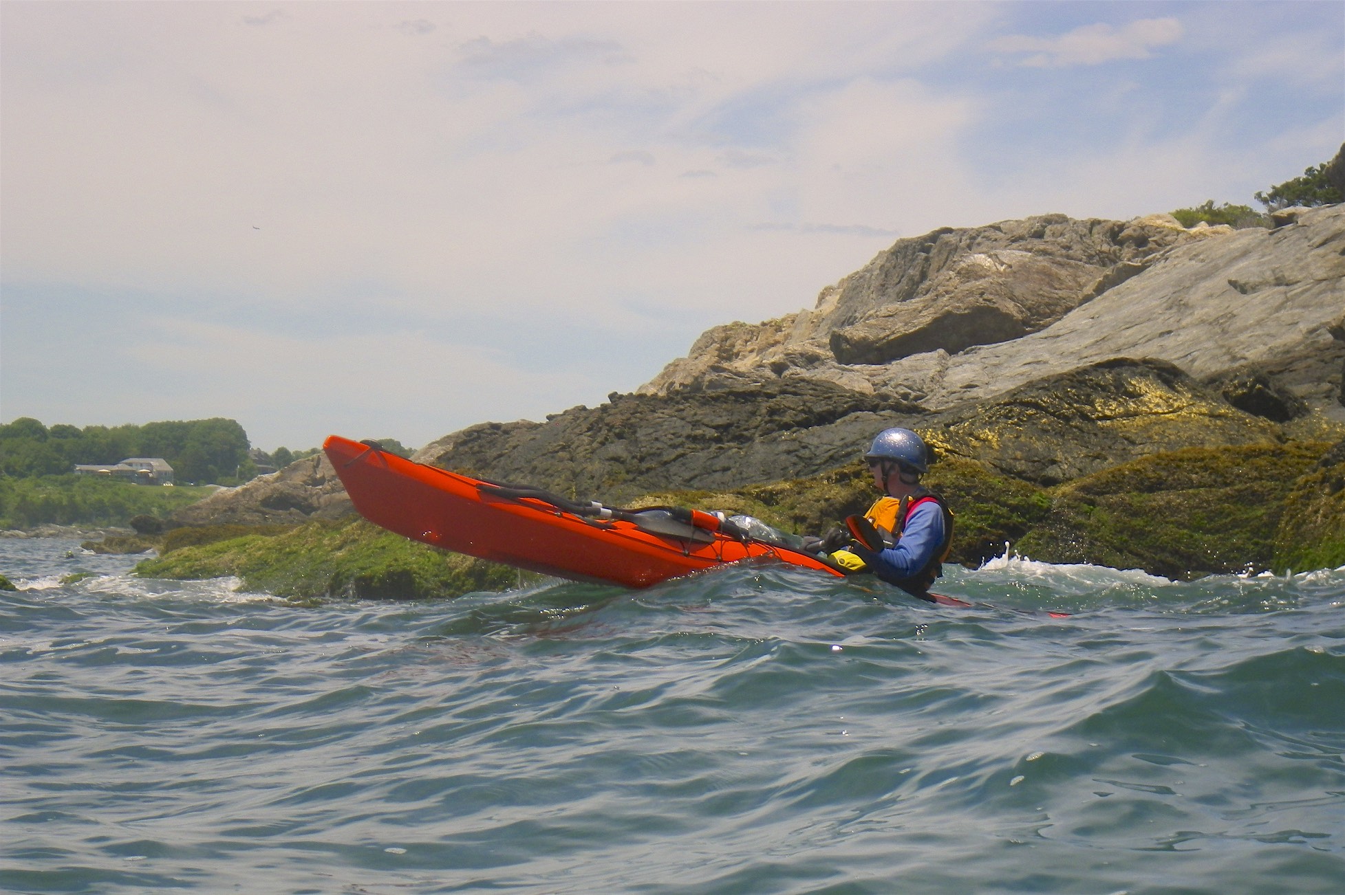
Waves at the beach at Cormorant Point
I headed the other way down to the beach. I paddled out behind the rocks to check out the waves at Cormorant Point and down the beach past the Dunes Club and the Narragansett Town Beach.
On the way back, I took a dump taking a picture of an egret, but was able to do a self-rescue with a paddle float and pump. At least the picture came out OK.
It was windy and cloudy this morning, and I wanted to go someplace protected from the wind, so I decided to paddle the upper section of the Narrow River.
The Narrow River, also known at the Pettaquamscutt River, is the tidal extension of the Mattatuxet River. It begins below the Carr Pond Dam at the Gilbert Stuart Birthplace and flows south for 6-miles forming the border between South Kingstown and Narragansett before entering Pettaquamscutt Cove and then flowing out into Narragansett Bay above the Narragansett Town Beach and the Dunes Club.
There are five distinct sections of the Narrow River – the Upper Pond, the Lower Pond, the “Narrows” from Bridgetown Road and Middlebridge Road, the “Flats” at Pettaquamscutt Cove, and the “Narrows” at the mouth of the river where it flows into Narragansett Bay.
I put in at the Narrow River Fishing Area off Pollock Avenue and paddled upstream into the “Narrows” between Bridgetown Road and Middlebridge Road. This section of the river is lined with boat docks and summer houses. Above Bridgetown Road is the Lower Pond, and then the Upper Pond. With the wind I got lazy and didn’t paddle up there.
I was back on the Narrow River this afternoon to paddle with Michelle down to the beach at the Narrows at Cormorant Point.
We put in at the Sprague Bridge on Boston Neck Road at the John H Chafee National Wildlife Refuge. Established in 1973, the refuge includes over 300-acres of saltmarsh around Pettaquamscutt Cove that provides habitat for shore birds like egrets, herons, cormorants and osprey.
Cormorant Point
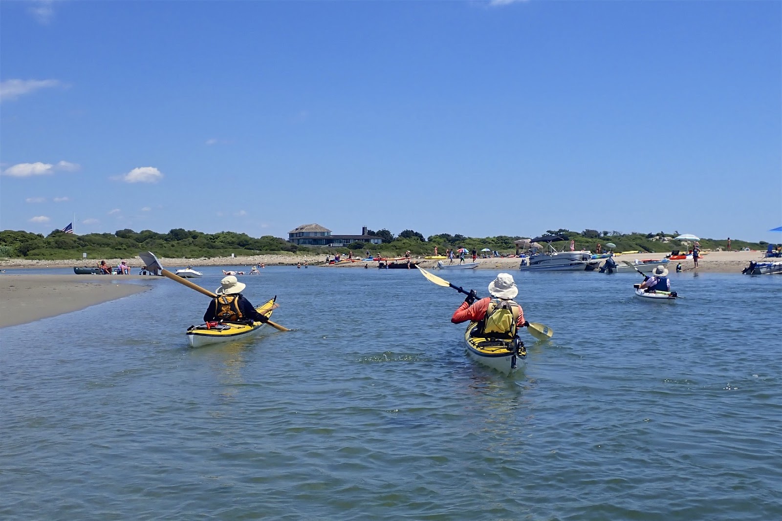
We headed the other way through the Narrows down to the beach. As always, the shore was lined with motor and paddle boats, but there were very few people on the beach itself. We sat on the ocean side to enjoy the waves at Cormorant Point and down the beach to the Dunes Club and the Narragansett Town Beach.
The trip back was a little tricky with the out-going tide, but we managed just fine.
After three days of paddling on Point Judith Pond, I was looking for something different. It needed to be someplace that wouldn’t have too many waves, so I decided to paddle the upper section of the Narrow River.
The Narrow River, also known at the Pettaquamscutt River, is the tidal extension of the Mattatuxet River. It begins below the Carr Pond Dam at the Gilbert Stuart Birthplace and flows south for 6-miles forming the border between South Kingstown and Narragansett before entering Pettaquamscutt Cove and then flowing out into Narragansett Bay above the Narragansett Town Beach and the Dunes Club.
The bridge at Bridgetown Road
There are five distinct sections of the Narrow River – the Upper Pond, the Lower Pond, the “Narrows” from Bridgetown Road and Middlebridge Road, the “Flats” at Pettaquamscutt Cove, and the “Narrows” at the mouth of the river where it flows into Narragansett Bay.
I put in at the Narrow River Fishing Area off Pollock Avenue and paddled upstream into the “Narrows” between Bridgetown Road and Middlebridge Road. This section of the river is lined with boat docks and summer houses.
Casey's Sill between Upper and Lower Ponds
Above Bridgetown Road, I paddled through the Lower Pond, and then the Upper Pond before paddling up a short section of the river that leads to the Gilbert Stuart Birthplace. It was too shallow for me to go up very far, so I turned around had headed back downstream.
Nice trip, and even with a strong wind it was easy to do in my sea kayak.
View up the Lower Pond from the Bridgetown Road Bridge
In Rhode Island, we are fortunate to have great saltwater paddling not just for sea kayakers, but also for flatwater paddlers. Here are some of our favorite flatwater and sea kayaking venues.
Flatwater (These sites are somewhat protected and are suitable for experienced flatwater paddlers, but you may experience wind and wind-blown waves.)
Exploring the coves
Point Judith Pond
South Kingstown
Point Judith Pond, or the Great Salt Pond is the second largest of the Rhode Island’s South County salt ponds. It is a shallow, four-mile long pond located behind the barrier beaches and sand dunes that form Point Judith. The easiest put-in is boat ramp at Marina Park. From there, you can paddle out into the Upper Pond, through the Narrows, and into Point Judith Pond itself. There are numerous coves and island to explore as you head down to the Port of Galilee at the southern end.
West end of the pond
Ninigret Pond
Charlestown
Ninigret Pond is the largest of Rhode Island’s South County salt ponds. Ningret is separated from the ocean by the fragile barrier island that forms East Beach. It is connected to Green Hill Pond by a small tidal inlet. Putting in at Ninigret Park allows you to explore the west end of the pond, including a short hike across the barrier island for a view of the beach. Putting in at the Charlestown Beach put-in allows you to explore the east end of the pond including the Charlestown Breachway and Green Hill Pond.
Upper Narrows
Narrow River
South Kingstown and Narragansett
The Narrow River, also known at the Pettaquamscutt River, arises at Carr Pond Dam at the Gilbert Stuart Birthplace and flows south for 6-miles forming the border between South Kingstown and Narragansett. There are five distinct sections of the Narrow River – the Upper Pond, the Lower Pond, the Upper Narrows, Pettaquamscutt Cove, and the Lower Narrows. Putting in at the Narrow River Fishing Area allows you to paddle upstream exploring the Upper Narrows and the Upper and Lower Ponds. Putting in at the Sprague Bridge provides easy access to Pettaquamscutt Cove and the Lower Narrows where the river flows into Narragansett Bay.
Wickford Harbor
Wickford Harbor
North Kingstown
Wickford is located on the West Passage of Narragansett Bay, and is built around a large, well-protected harbor. Today, it is a picturesque village whose waterfront streets are lined with shops, restaurants and colonial-era homes. Putting in a Wilson Park allows you to explore the backwaters around Rabbit and Cornelius Islands before heading into Wickford Harbor and down into the Cove.
Sea Kayak (These sites are in open water and more exposed, and are suitable for experienced sea kayakers.)
Sakonnet Point Light
Sakonnet Point
Little Compton
Sakonnet Point includes West Island, East Island, Little Cormorant Rock and the Sakonnet Point Lighthouse. It is one of RICKA’s most popular rock garden venues. The water around the islands is very exposed and can be quite active. RICKA members also enjoy surfing when conditions are right at Surfer’s Beach near the Haffenreffer estate.
Mansion on Ocean Drive
Kings Beach
Newport
Launch at Kings Beach and you are paddling along the amazing rocky shore of southern Aquidneck Island. If you head east you will pass mansions on the rocky cliffs along Newport’s Ocean Drive and Cliff Walk. Seal Rock lies a third of a mile to the south - a wild, exposed area that is a favorite for advanced rock gardening. If you head west you will pass Brenton Point and will enter the open waters of Narragansett Bay.
Beavertail Light
Bay Campus
Narragansett
The URI Bay Campus provides access the West Passage of Narragansett Bay. To the south lies Bonnet Shores and Whale Rock - a frequent rock gardening site. From there you can cross to Beavertail at the southern tip of Jamestown - one of the most scenic and exposed-coast locations in RI.
Rock gardening
Fort Wetherill
Jamestown
Fort Wetherill provides access to the lower East Bay. The southern Jamestown shoreline provides outstanding rock gardening and coastal touring, or head north to The Dumplings for easy tide race play during peak flows. Head east across the East Passage, with due caution in very busy waters, to reach Castle Hill Lighthouse, and from there around Brenton Point for rock gardening and coastal touring.
Newport Bridge
Potter Cove
Jamestown
Potter Cove gives you access to Jamestown, Newport and the coves and islands of the upper East Bay. If you head south, you will pass under the Newport Bridge and into Jamestown Harbor. From there you can cross to Newport Harbor, Rose Island and Gould Island.
It was a beautiful day, so I decided to head back to the Narrow River. I put in at the Sprague Bridge on Boston Neck Road, and paddled down to the Narrows to take some pictures of the rocks and waves at Cormorant Point before heading back and paddling up into Pettaquamscutt Cove.
Pettaquamscutt Cove is part of the John H Chafee National Wildlife Refuge. Established in 1973, the refuge includes over 300-acres of saltmarsh that provides habitat for shore birds like egrets, herons, cormorants and osprey. For many years, it was also home to the little red shack on Sedge Island.
Sedge Island today
The little red shack was a landmark for paddlers and boaters for years. It was originally built as a summer cottage, later served as the headquarters for a small lobstering company, and after that was an overnight destination for girl scouts paddling down from Camp Nokewa on the Upper Pond.
In 2004, the US Fish and Wildlife Service purchased Pettaquamscutt Cove. While they tried to maintain the little red shack, time and exposure took its toll and it began to deteriorate. The first picture that I have of the shack is from 2011. By 2014 a hole had appeared in the roof, and by 2016 most of the south facing wall had collapsed. The shack was demolished later that year.
I woke up to clouds and gusting winds, so I needed to find someplace to paddle that would be sheltered from the wind. I decided to head over to the Narrow River.
The Narrow River, also known as the Pettaquamscutt River, forms the boundary between the towns of Narragansett, South Kingstown and North Kingstown. Not truly a river, it is actually a 7-mile long tidal estuary connected to Narragansett Bay by a narrow channel above the Narragansett Town Beach and the Dunes Club.
There are five distinct sections of the Narrow River – the Upper Pond, the Lower Pond, the “Narrows” from Bridgetown Road and Middlebridge Road, the Pettaquamscutt Cove, and the “Narrows” at the mouth of the river where it enters into Narragansett Bay.
I put in at the Narrow River Fishing Area off Pollock Avenue and paddled up into the the “Narrows” between Bridgetown Road and Middlebridge Road. This section of the river is lined with boat docks and summer houses. Above Bridgetown Road are the Upper and Lower Ponds. Below Middlebridge Road is the Pettaquamscutt Cove. Unfortunatley, it was too windy to try to paddle these.
I needed to get back early for a conference call for work, so I decided to head down to the Narrow River.
The Narrow River, also known at the Pettaquamscutt River, is the tidal extension of the Mattatuxet River. It begins below the Carr Pond Dam at the Gilbert Stuart Birthplace and flows south for approximately 6.3-miles forming the border between South Kingstown and Narragansett before entering Pettaquamscutt Cove and then flowing out into Narragansett Bay.
The Narrow River gets its name from either the long narrow section from Bridgetown Road to Middlebridge Road, or the narrow mouth of the river below the Sprague Bridge where it empties into Narragansett Bay.
The day was clouding up fast, and rain was in the forecast, so I decided to head over to the Narrow River to paddle down to the Narrows. The Narrow River, also known as the Pettaquamscutt River, originates in North Kingstown and flows south into Narragansett Bay above the Narragansett Town Beach.
I put in at the Sprague Bridge on Boston Neck Road, and paddled down to take some pictures at the rocks at Cormorant Point before heading back. Above the bridge is the John H Chafee Wildlife Refuge. Established in 1973, the refuge at Pettaquamscutt Cove includes over 550 acres of wetland that attracts bird of all species. I'll paddle that another day.
I woke up this morning to light rain but no fog, so I decided to head over to the Narrow River to paddle the Narrows. I had paddled the Narrow River last week, but it was low tide so we didn’t paddle out into the bay
It was high tide as I put in at the Sprague Bridge and headed downstream. Fishermen in rain gear lined the banks. As I came out around the beach the water was calm immediately behind rocks, but one-foot waves were breaking over on the beach. I paddled around Bass Rock and about halfway to Cormorant Point before heading back.
I got an email for Bill that Gregg and Jean Marie were organizing a trip in the Narrow River. Michelle had a doctor’s appointment anyway so I decided to join in.
The Narrow River (also known at the Pettaquamscutt River) is the tidal extension of the Mattatuxet River. It begins below the Carr Pond Dam at the Gilbert Stuart Birthplace and flows south for approximately 6.3-miles forming the border between South Kingstown and Narragansett before entering Pettaquamscutt Cove and then flowing out into Narragansett Bay. The Narrow River gets its name from either the long narrow section from Lacy Bridge (Bridgetown Road) and the Mettatuxett Yacht Club (Middlebridge Road), or the narrow mouth of the river where it empties into Narragansett Bay.
Into the Upper Pond
We put in at the town boat launch near Bridgetown Road (40 Pettaquamscutt Ave, Narragansett, RI 02882). Not wanting to paddle back up stream, I decided to do a bike shuttle from the Sprague Bridge. There were 7 kayaks (Gregg O’Brien, Jean Marie Josephson, Bill Luther, Bill Hahn, Bill Rush, Mike Rinaldi and Mike Krabach) and one canoe (me). The day was sunny and warm with a slight breeze from the south
We headed upstream into the Upper Pond. After a quick break at the old Girl Scout Camp Nokewa (now owned by the Nature Conservancy) we paddled up the narrow section of the river that leads to the Gilbert Stuart Birthplace (too shallow for me) before heading back downstream.
Through the Narrows
After paddling through the Upper Pond and the Lake, we entered the Narrows between Lacy Bridge (Bridgetown Road) and the Mettatuxett Yacht Club (Middletown Road). I had never paddled this section before. From there, we paddled through the Flats (Pettaquamscutt Cove) and under the Sprague Bridge to the beach.
The beach was crowded with motor boats and every type of paddlecraft imaginable. Unfortunately, it was low tide, so paddling out through what I think of as the Narrows into Narragansett Bay wasn’t an option. I paddled back to my car at the Sparague Bridge and the rest of the crew continued back to the put-in.
It was another beautiful morning, so I decided to head over to the Narrow River to paddle out to the Narrows. The Narrow River, also known as the Pettaquamscutt River, originates in North Kingstown and flows south into Narragansett Bay at the Narrows above the Narragansett Town Beach.
I put in at the Sprague Bridge on Boston Neck Road, and paddled down to take some pictures at the rocks at Cormorant Point before heading back. Above the bridge is the John H Chafee Wildlife Refuge. Established in 1973, the refuge at Pettaquamscutt Cove includes over 550 acres of wetland that attracts bird of all species.