Saturday, June 24, 2023

Paddling between the rain drops - Assbet River from Acton to Concord - June 24, 2023

At the picnic site below Damondale
Bill and I were scheduled to run a RICKA trip on the Sudbury River through Great Meadows today. Unfortunately, the forecast was for rain and possible thunderstorms and there is no shelter in that wide open marshland, so the Sudbury trip got cancelled. Instead, we decided to run the Assabet River from Acton down to Concord.

The Assabet River arises in Westborough and flows approximately 34 miles west to its convergence with the Sudbury River to form the Concord River. I’ve done a couple of sections of the Assabet including the flatwater section from Gleasondale to the Ben Smith Dam and the whitewater section through Maynard.

Al and Bill navigate the blow-downs
Al had checked the forecast and advised that we should have a window of storm-free weather from 11:00 to 4:00. I met Bill at 9:30 for the drive up to Acton, and it rained the entire time. We ran the shuttle at 10:30, and the rain had stopped by the time we got on the water at around 11:00 – Al was right. I was paddling tandem with Jonathan in my Mohawk - first trip for Jonathan after his hip surgery. Bill was paddling tandem with Al in his Wenonah – first trip for Al in a canoe in years.

The river was low - 1.8 feet, 60 cfs - so finding the deep channels and avoiding rocks and strainers was the order of the day. We ran through the site of the old Damondale Dam, and took a break for lunch at the new picnic site just downstream.

Erik and Jonathan at Egg Rock
From there we entered a section with numerous blow-downs. A couple were tricky, but we were able to paddle over or around them all without getting out of the boat. We stopped again at the boat ramp in West Concord and walked over to D&D for a coffee - it was an leasurly trip. (There is also a new picnic site downstream of the bridge in West Concord). From there it is an easy paddle down to Leaning Hemlocks with its memorial to paddler and poet George Bartlett with the words from his poem Floating Hearts. We continued down to Egg Rock at the convergence of the Assabet and Sudbury Rivers.

As is tradition, we continued down the Concord River to the Old North Bridge and the Minute Man National Historic Park. It was approaching 4:00, and sure enough the rain started up again. It was a brief shower and we took refuge under the Old North Bridge until it passed. It did rain for much of the ride home. Our timing was good.

Jonathan and Erik at the Old North Bridge
Links:
My Pictures
Maynard Gage
Floating Hearts – Poem by George Bartlett

Wednesday, June 21, 2023

Rice City Pond with the Blackstone Valley Paddle Club - June 20, 2023

Up the old Blackstone Canal
It was my turn to lead the Blackstone Valley Paddle Club at River Bend Farm. I scouted the canal/river loop last weekend, but the water was a little low and there were too many strainers, so we decided to stay on Rice City Pond.

The Blackstone Valley Paddle Club was established in 2000 by the Blackstone River Valley National Heritage Corridor (now Park and Corridor). I became a paddle club leader in 2007. Over the years, the club has led Tuesday night trips throughout the summer, getting thousands of people out on the waterways of the Blackstone River Valley. We had a good turn-out for this trip with around 19 boats.

At the Goat Hill Lock
Rice City Pond is part of the Blackstone River Canal and Heritage Park – a 1,000-acre state park in Uxbridge, MA with hiking trails, paddling on the Blackstone River and Canal and historical sites like the Blackstone Canal’s Goat Hill Lock, King Philip’s Lookout and the Stanley Woolen Mill.

We put-in at the Tri-River Medical Center and paddled upstream under the Stone Arch Bridge at Hartford Avenue and up an old section of the Blackstone Canal to the Goat Hill Lock - one of only two remaining locks. The other is the Millville Lock above the Blackstone Gorge.

Up the Blackstone River
Following the demise of the Blackstone Canal, this section of the canal was purchased by the Taft family who converted it to a mill race for the Stanley Woolen Mill. They built the dam that created Rice City Pond, and constructed new headgates to control the flow of water down to the mill.

We paddled across the top of Rice City Pond and up a section of the Blackstone River before shallow water forced us to turn around and head back to the put-in – nice night.

Heading back to the put-in
Links:

Saturday, June 17, 2023

Scouting at River Bend Farm - June 17, 2023

I will be leading the Blackstone Valley Paddle Club trip this Tuesday at River Bend Farm. We will be offering two trips, so today I scouted them both. The level was 3.5 feet, but the rain will bump it up a little.

First I scouted the Rice City Pond.


Scouting Rice City Pond from Erik Eckilson on Vimeo.

Then I scouted the Blackstone Canal/River Loop.


Scouting the Blackstone Canal-River Loop from Erik Eckilson on Vimeo.

Thursday, June 15, 2023

Hanging with the single bladers - June 15, 2023

Looked like it was going to be a busy weekend, so I was glad to have the option for a Thursday night run at Tville. The level was low (1.5 feet, 500 cfs), but fine for what I like to do. It was nice to hang out with a bunch of single bladers, even if they were on paddle boards rather than in canoes.

Links:
My Pictures

Sunday, June 11, 2023

RICKA Flatwater Training - June 11, 2023

I was at Stump Pond today for the RICKA Flatwater Training. Bill and I have been involved in this training since at least 2010. Paul helped out this year as well. New paddlers learned basic strokes, and for the first time we also did solo canoe training. The water was cold, but we still had several people do wet exits and assisted rescues.  

Crew for the Flatwater Training
Links:

Thursday, June 8, 2023

Saltwater Paddling for Everyone

In Rhode Island, we are fortunate to have great saltwater paddling not just for sea kayakers, but also for flatwater paddlers. Here are some of our favorite flatwater and sea kayaking venues.

Flatwater (These sites are somewhat protected and are suitable for experienced flatwater paddlers, but you may experience wind and wind-blown waves.)

Exploring the coves
Point Judith Pond
South Kingstown

Point Judith Pond, or the Great Salt Pond is the second largest of the Rhode Island’s South County salt ponds. It is a shallow, four-mile long pond located behind the barrier beaches and sand dunes that form Point Judith. The easiest put-in is boat ramp at Marina Park. From there, you can paddle out into the Upper Pond, through the Narrows, and into Point Judith Pond itself. There are numerous coves and island to explore as you head down to the Port of Galilee at the southern end.

West end of the pond
Ninigret Pond
Charlestown

Ninigret Pond is the largest of Rhode Island’s South County salt ponds. Ningret is separated from the ocean by the fragile barrier island that forms East Beach. It is connected to Green Hill Pond by a small tidal inlet. Putting in at Ninigret Park allows you to explore the west end of the pond, including a short hike across the barrier island for a view of the beach. Putting in at the Charlestown Beach put-in allows you to explore the east end of the pond including the Charlestown Breachway and Green Hill Pond.

Upper Narrows
Narrow River
South Kingstown and Narragansett

The Narrow River, also known at the Pettaquamscutt River, arises at Carr Pond Dam at the Gilbert Stuart Birthplace and flows south for 6-miles forming the border between South Kingstown and Narragansett. There are five distinct sections of the Narrow River – the Upper Pond, the Lower Pond, the Upper Narrows, Pettaquamscutt Cove, and the Lower Narrows. Putting in at the Narrow River Fishing Area allows you to paddle upstream exploring the Upper Narrows and the Upper and Lower Ponds. Putting in at the Sprague Bridge provides easy access to Pettaquamscutt Cove and the Lower Narrows where the river flows into Narragansett Bay.

Wickford Harbor
Wickford Harbor
North Kingstown

Wickford is located on the West Passage of Narragansett Bay, and is built around a large, well-protected harbor. Today, it is a picturesque village whose waterfront streets are lined with shops, restaurants and colonial-era homes. Putting in a Wilson Park allows you to explore the backwaters around Rabbit and Cornelius Islands before heading into Wickford Harbor and down into the Cove.

Sea Kayak (These sites are in open water and more exposed, and are suitable for experienced sea kayakers.)

Sakonnet Point Light
Sakonnet Point
Little Compton

Sakonnet Point includes West Island, East Island, Little Cormorant Rock and the Sakonnet Point Lighthouse. It is one of RICKA’s most popular rock garden venues. The water around the islands is very exposed and can be quite active. RICKA members also enjoy surfing when conditions are right at Surfer’s Beach near the Haffenreffer estate. 

Mansion on Ocean Drive
Kings Beach
Newport

Launch at Kings Beach and you are paddling along the amazing rocky shore of southern Aquidneck Island. If you head east you will pass mansions on the rocky cliffs along Newport’s Ocean Drive and Cliff Walk. Seal Rock lies a third of a mile to the south - a wild, exposed area that is a favorite for advanced rock gardening. If you head west you will pass Brenton Point and will enter the open waters of Narragansett Bay. 

Beavertail Light
Bay Campus
Narragansett

The URI Bay Campus provides access the West Passage of Narragansett Bay. To the south lies Bonnet Shores and Whale Rock - a frequent rock gardening site. From there you can cross to Beavertail at the southern tip of Jamestown - one of the most scenic and exposed-coast locations in RI. 

Rock gardening
Fort Wetherill
Jamestown

Fort Wetherill provides access to the lower East Bay. The southern Jamestown shoreline provides outstanding rock gardening and coastal touring, or head north to The Dumplings for easy tide race play during peak flows. Head east across the East Passage, with due caution in very busy waters, to reach Castle Hill Lighthouse, and from there around Brenton Point for rock gardening and coastal touring.

Newport Bridge
Potter Cove
Jamestown

Potter Cove gives you access to Jamestown, Newport and the coves and islands of the upper East Bay. If you head south, you will pass under the Newport Bridge and into Jamestown Harbor. From there you can cross to Newport Harbor, Rose Island and Gould Island.

Flatwater to Sea Kayak - making the transition to Ocean Paddling

You’ve been paddling your kayak on rivers and lakes, and now you want to venture out along the coast. Whether along sandy beaches, the rocky coast or open waters, sea kayaking provides the perfect blend of stunning views and unpredictable conditions that will allow you to experience paddling in a whole new way. For flatwater paddlers looking to add sea kayaking to their repertoire, here are some of the issues that need to be considered.

You’ll need a sea kayak

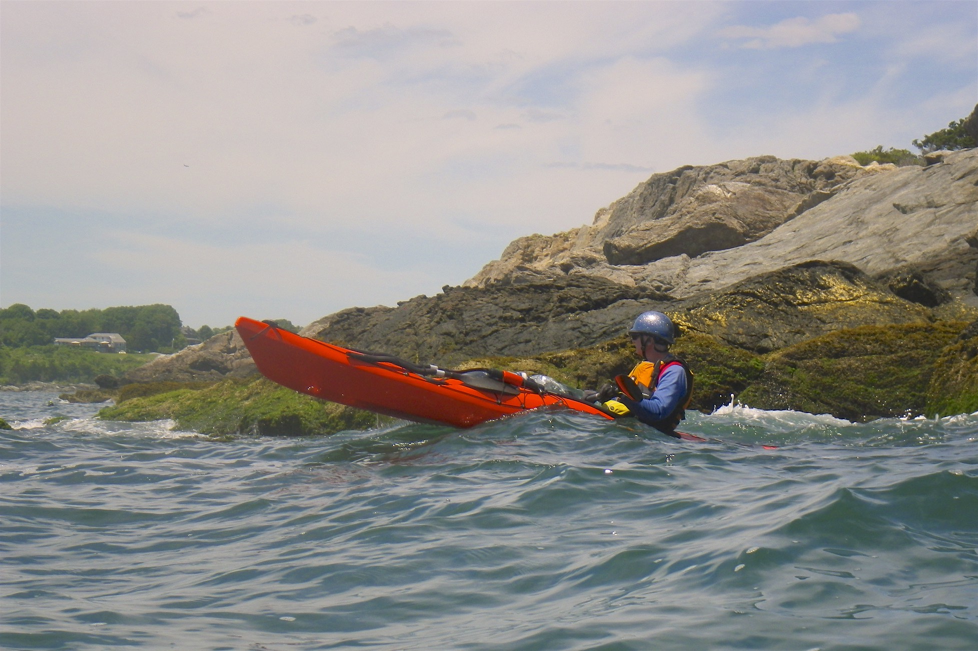
To paddle in this unique environment, you will need a specialized boat. Sea kayaks are designed for long-distance cruising with water-tight bulkheads for ease of emptying in the event of capsize, perimeter deck lines for use during self or assisted rescues, skegs or rudders to assist tracking in the wind, and foot pegs to help transfer paddling power to the boat.

Other equipment

As you move out into open water you will also need a spray skirt, pump, paddle float and appropriate clothing for the conditions. Of course, you must always wear your PFD. 

Conditions you will face

What really differentiates sea kayaking from flatwater paddling are the dynamic conditions that you encounter in open water driven primarily by wind and waves. 

Wind – wind has a much bigger impact on salt water than on all but the largest of fresh water lakes. A southwest wind that might make paddling more difficult on a small lake or river can quickly create large waves in more exposed coastal environments. Winds can also push you off course and be difficult to paddle against. 

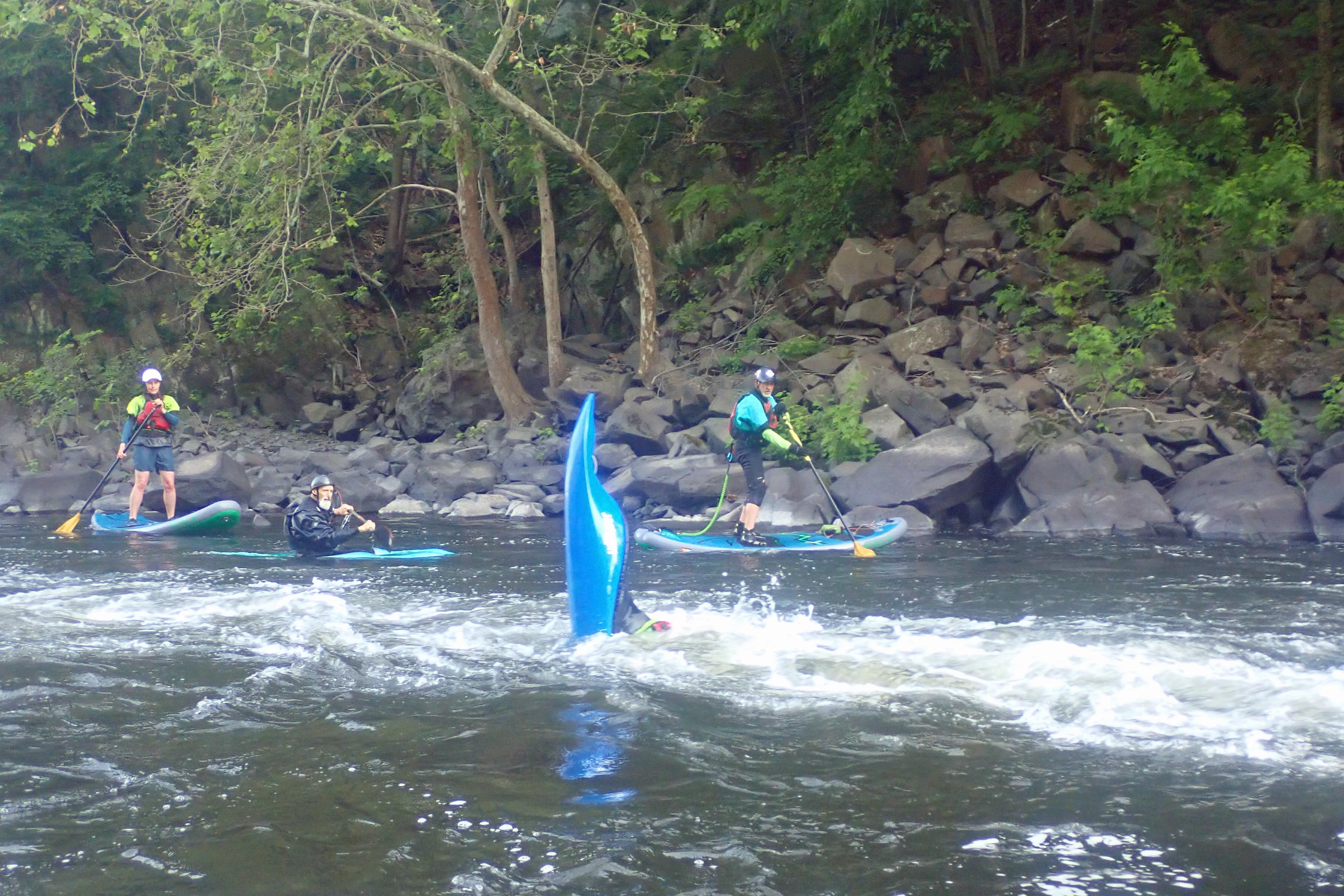
Waves – paddling through waves is inevitable when paddling on salt water. Waves can be tidal or wind-blown, and are often both. Small rolling waves are relatively easy to navigate, but larger waves and breaking waves can be more difficult - especially as you start out. 

Skills you’ll need

Paddling in these conditions is fun, but requires strong paddling skills. In addition to basic strokes, you will need to master advanced maneuvers like edging, bracing and ruddering. Taking a class with a certified instructor can help get your paddling technique up to good standard. The Kayak Centre offers classes on basic and advanced strokes. Kayak Wavology also provides basic and advanced training.  

And it isn’t just stronger paddling skills that you will need as you progress into sea kayaking. More advanced trips will require reliable rescue skills, and knowledge of navigation and marine communication. Being prepared is key, and this especially true on the ocean where conditions can often be unpredictable. 

Getting out on trips

As you progress, the best way to experience new and challenging conditions is to get out there and be exposed to them, but do so in incremental steps with other paddlers who are experienced in the conditions. You should assess your comfort level for participating in a trip based on the difficulty level, the forecasted conditions, your skills and experience, and your comfort with the other participants in the group. Each participant shares the responsibility for the group’s safety and enjoyment with the entire group.  

Sunday, June 4, 2023

Pawcatuck River Overnight - June 3-4, 2023

Burlingame Canoe Campsites
What's not to like about canoe camping? You paddle in, set up camp, have dinner, and then settle in for a relaxing evening around the campfire. I did my first canoe camping trip with the RICKA Wilderness Group in 2012, and I’ve been hooked ever since. This time we would be doing an overnight trip at the Burlingame Canoe Campsites on the Pawcatuck River.

We are fortunate to have a several very nice campsites on the Pawcatuck. There is Stoney Point on Worden Pond, the Carolina Canoe Campsite just upstream from the Richmond Landing, the "bootleg" site at the confluence of the Wood River, and of course, the Burlingame Canoe Campsites in the Burlingame Management Area. At Burlingame there is a large open field suitable for groups, and five smaller wooded sites. All these sites are available on a first come first serve basis, and can get crowded in the warm summer months.

The camp is set up
The weather forecast was mixed with rain Saturday morning, and again on Sunday afternoon. It was raining as I drove down I-95, but stopped by the time I met the group at the Bradford Landing. We loaded the boats and set out for the 3-mile trip up to Burlingame.

When we arrived at Burlingame, we were surprised to find a group already set up in the field. We scouted out the wooded sites and decided to take the third site down – one site down from where we camped last spring, and one site up from the grassy site where we camped in 2014. We hauled our gear up the steep hill from the river and began to set up camp.

Enjoying the evening fire
The first thing up was the rain fly – fortunately we never needed it – followed by the kitchen and then the tents. I pitched my tent in the grassy site, which is now over-grown appears rarely used. I decided to try out my new Alps Mountaineering Lynx one-man tent.

After setting up camp we took a break to enjoy cocktails before cooking dinner. Dinner was hamburgers and hot dogs with garden and macaroni salad. The wind picked up after dinner, but we never got any rain. We settled in around the fire for watermelon, and a relaxing evening.

Dan cooks breakfast in the 20" skillet
After many tall-tales and war-stories we finally turned in for the night at around 10:30. My one-man tent was tight, but it was still comfortable. It will work well for sea kayak camping in the Capella. 

Before I knew it, morning light was streaming through my tent. I got up around 6:00, and found that Danny was already up enjoying coffee. I got my coffee pot perking.

Heading back to Bradford
Dan was up shortly after and got the fire started. He would be cooking breakfast in his 20" Camp Chef Lumberjack Maine-guide skillet. After pulling out some coals he cooked our entire breakfast in this pan – bacon, home fries, grilled English muffins, omelets and fried eggs. He was able to set up different heat zones for cooking and keeping things warm - pretty cool.

He had blue sky and puffy clouds in the morning, so we took our time enjoying breakfast around the fire. After breakfast we packed up camp for the trip back to Bradford Landing. Storm clouds were rolling in as we loaded up the cars and said our goodbyes, and the rain started up again as I drove home on I-95. The rain gods had smiled on us - we timed it perfect!

The crew at Bradford Landing
Links:

Thursday, June 1, 2023

History of the Blackstone Valley Paddle Club by Ranger Dan Meharg

Back in 1999, I took my wife and my parents for a paddle down the Blackstone River in Rhode Island. The air was warm, the sky and water blue, and birds soared overhead, but as for humans, we were the only ones on the river. As we paddled our canoes, we talked about how it was a shame that more locals were not enjoying the many beautiful rivers that flowed past their backyards.

In fact, the word "backyard" was accurate. People in the Blackstone River Valley had turned their backs to the river, literally. Homes and businesses faced away from the river, and trees and bushes blocked the view. There was a good reason for this. For decades textile mills dumped toxic dyes and chemicals into the many rivers running through the Blackstone Valley. People kept away from the foul smelling foam that blew off the river into the streets, they did not want to see the strange orange and green colored water that swirled behind their homes.

Since the 1980's thanks to the efforts of local towns, wastewater treatment plants, and the National Park Service, Blackstone Valley rivers were much cleaner. Beaver, coyotes, and deer returned to the river banks, fish swam downstream once again. As we paddled along enjoying the beauty, we wondered what it would take to get people to return to the water in boats.

I did some research and discovered to my surprise that from about 1920 and through the 1940s, there had been several "Canoe Clubs" in both the Massachusetts and Rhode Island sections of the Blackstone River Valley. One evening along the Ten Mile River, I met with some elderly residents. Back in their twenties, they had once been members of a "Canoe Club." They told me that paddling on the less polluted rivers and ponds in the Blackstone Valley was very popular before World War Two. After the war, they told me once people had cars, they wanted to travel to faraway places to paddle and camp. And so the Canoe Clubs slowly died away.

My hunch was that locals would return to the river to paddle after work if the whole process of getting on and off the river was made easy, safe and fun. So in 1999, I pitched my idea to the one surviving paddle club in Rhode Island, RICKA, the Rhode Island Canoe and Kayak Association.

I told the RICKA members that if they could provide experienced people to provide on the water leadership, and take this new canoe club under their administrative wing as a junior member, I could get the National Park Service to handle all the other logistics. The RICKA folks kindly agreed.

At the time I was working as a park ranger for the Blackstone River Valley National Heritage Corridor, part of the National Park Service. My supervisor and my ranger co-workers agreed to partner with me on this project twice a week. My most valuable helper was Suzanne Buchanan, the park's volunteer coordinator. She wisely suggested we name the group the Blackstone Valley Paddle Club, since people these days were paddling canoes and kayaks. Suzanne found seven volunteers, experienced paddlers to act as team leaders, to paddle beside the boats of inexperienced people so that they would feel safe as they learned a new skill.

Best of all the Heritage Corridor Commission granted us money for free boats. I contracted with local canoe and kayak companies to bring six free boats to each paddle location. People without boats signed up in advance for the free boats each week. The plan was beginning to gel. The Heritage Corridor Commission understood my end goal for the paddle club. The more local people who rediscovered the beauty of their backyard rivers, the more they would want to protect them from harm.

Each week I served as the logistics guy, making sure that for locals the entire experience was an enjoyable after-work experience. As a group, at the beginning of the season, we would vote on locations to paddle. I sent out detailed instructions to everyone who signed up for the trip. In the days before GPS I sent out emails with instructions like "take a right down the dirt road next to the red house and park beside the huge sycamore tree." 

A vehicle shuttle plan made sure that there was transportation back to the starting point after each trip. When people arrived, RICKA trip leaders, our volunteer team leaders, and park rangers helped everyone unload boats and get safely on the river. Rangers gave a safety talk, team leaders briefly told people about the wildlife they could expect to see and the results of the most recent water quality tests on that stretch of river. Then we would all enjoy a leisurely evening paddle. Some evenings, sixty people would join us.

The Blackstone River could accommodate us all with ease. Twenty-three years later, the Blackstone Valley Paddle Club continues to paddle the rivers of the Blackstone Valley on summer evenings. Just like in the days of the Canoe Clubs, there are now community organizations with boat houses near the river. Paddling has returned to the Blackstone River Valley.

Suzanne Buchanan in the bow and Dan Meharg in the stern
Not sure where but my guess is Hopedale Pond around 2000