Showing posts with label Lake Umbagog. Show all posts

Sunday, June 13, 2021

Umbagog Lake Camping - June 7 – 10, 2021

Looking north up Umbagog Lake
really wanted to get out to do some camping this spring but nothing was coming together. Rather than wait I decided to plan a trip on Umbagog Lake and see who was interested. Most of the usual camping crew was busy, but Bill and Earl signed on so we had a trip!

Umbagog Lake is located along the border of NH and ME near Errol, NH. The lake runs almost 11 miles north to south and is fed by the Magalloway, Rapid and Dead Cambridge Rivers, and is the source of the Androscoggin River. The lake is part of the Umbagog National Wildlife Refuge and Umbagog Lake State Park.

Dead Cambridge River
Umbagog Lake State Park includes a base camp at the southern end of the lake and 33 remote campsites around the lake that are accessible only by boat. I crossed the upper end of Umbagog Lake when we did the Magalloway trip last fall. On this trip we would be site-hopping from south to north. I’d be paddling with Bill in my Spirit II. Earl would be paddling his sea kayak.

We meet at Umbagog Lake State Park and shuttled a car to the take out at the Errol Dam. Once all the boats were loaded we set out to explore the southern end of the lake. The day was sunny and warm, but the wind was blowing from the west giving us following waves and a strong tail wind as we paddled east toward the Dead Cambridge River. From there we paddled west and north before crossing over to Big Island at Tidswell Point.

Ribeye steaks on the fire
Our first campsite was site R9 on Big Island – a large wooded site on a point with water views on both sides. We quickly fell into the usual ritual – gather wood, set up camp, cook dinner and settle in around the fire for the night. Dinner was ribeye steaks cooked over the fire with shrimp macaroni salad. It was an early night – we turned in around 9:00. Paddling for the day was around 6-miles.

I woke up around 5:00 and crawled out of my tent to get some pictures of the sunrise. Bill and Earl weren’t far behind so we lit the fire, cooked breakfast (omelets and home fries) and started packing up camp. The day started off cloudy and the plan was to be on the water by 8:30 in hopes of avoiding some of the afternoon wind.
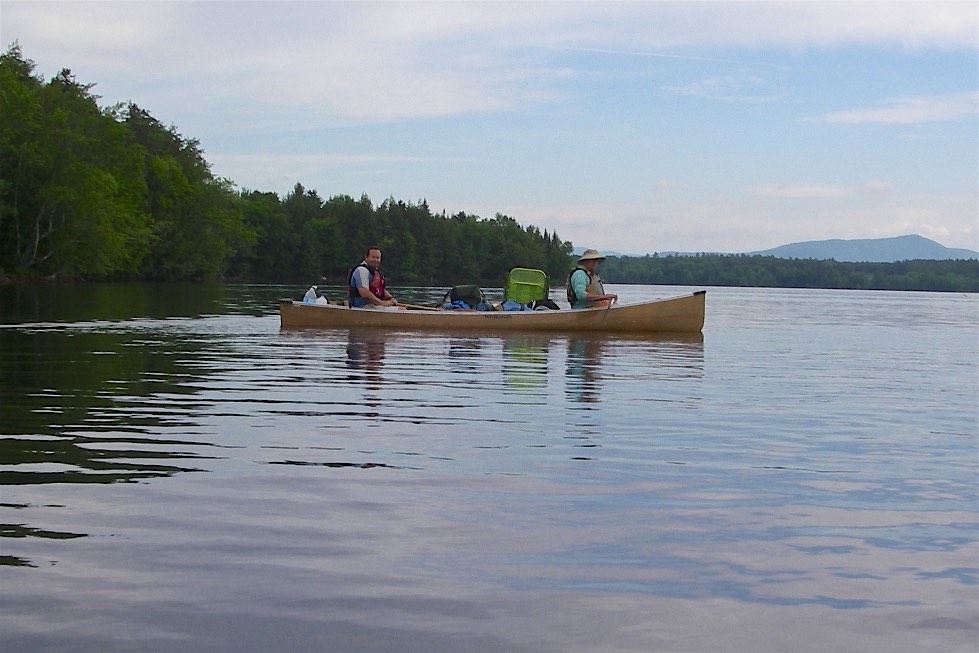
Heading out on day 2
We headed out across the lake at Tidswell Point and paddled through a series of small islands (Bear Island, Blake Islands and Matallak Island) to Tyler Point. From there we had a 2-mile crossing to Pine Point. 
As we set out for Pine Point the wind was blowing from the west creating challenging crosswinds and waves. We did out best to quarter the waves. When we reached Pine Point we looked back and saw Earl quite far behind. We pulled around the point to get out of the wind and wait for him to catch up.

After 10 or 15 minutes I climbed out on Pine Point to see how Earl was progressing, but there was no sign of him. We paddled back around the point, and in an abundance of caution along the shore all the way back to Tyler Point to see if he stopped for a break or retraced his steps – still no sign of him.

Crossing to Pine Point
At that point we started to get a little nervous, so we called the rangers to see if they could check our next site (R15) in case we had somehow missed him and he had gone ahead to campsite. Shortly after I got a call from Earl telling us that he was at the campsite. He had pulled over the take a break (not sure how we missed him), and continued on when he couldn’t find us at the point.

Bill and I were relieved, but now faced a third crossing to Pine Point. The wind was stronger and we were getting tired, but we made the crossing fine. From there we headed west to the mouth of the Rapid River, and then north toward Sunday Cove to our next site R15.

Windy afternoon in camp
As the afternoon progressed, the wind picked up considerably, and we were glad not to be out on the water. We took a break for lunch, and then set up camp. We even set up the tarp in case we got some evening rain – we didn’t.

Dinner was Jonathan’s fried fish (egg wash and bread crumbs) and Maine Guide Potatoes (boiled potatoes and onions with butter). Then we settled in around the fire for the night. Paddling for the day was 10-miles for Earl, 14 miles for Bill and I due to the multiple crossings at Tyler/Pine Points.

Earl makes the crossing on day 3
We woke the next day to sunny skies and light wind. The original plan was to paddle over to the Rapid River and hike up the portage trail before crossing the lake to our next site R28 at the mouth of the Magalloway River. Concerned about afternoon winds, though, we decided to skip the Rapid River and head over to the campsite first thing. This would allow us to cross in lighter winds and smaller waves.

Even in the morning we had winds out of the northwest, but we made the crossing fine. We dropped our gear at the campsite and headed south to Molls Rock. Bill had stayed at this site several years ago when he did this section of the Northern Forest Canoe Trail. The sun was hot so we jumped in the lake for a swim. From there we headed up a section of the Magalloway River before retuning to the campsite to set up camp.

Chef Bill cooks dinner
We had a leisurely afternoon in camp, but no one seemed to mind. Dinner was Chef Bill’s pasta with gravy (tomato sauce with onions, peppers and sausage - breakfast, not Italian). After sitting around the fire it was another early night. Paddling for the day was around 6 miles.

I slept late the next day, not crawling of my tent until around 6:30. By then, Bill had the fire going, and Earl was already starting to pack. We got the coffee going and cooked breakfast (pancakes and bacon) before Bill and I started to pack. It was a leisurely 4-mile paddle down the Androscoggin River to our take out at the Errol Dam. After retrieving cars and packing up we snapped a couple of final pictures before beginning the 4-½ hour drive home.


Links:

Friday, April 30, 2021

Planning for Spring Camping – Lake Umbagog - June 7 - 10 , 2021

I really want to get out to do some spring camping, but nothing was coming together, so I booked some sites on Lake Umbagog for June 7 - 10.  

Umbagog Lake is located along the border of NH and ME near Errol, NH. The lake runs almost 11 miles north to south and is fed by the Magalloway River, the Rapid River, and the Dead Cambridge River. It is the source of the Androscoggin River. The lake is part of the Umbagog National Wildlife Refuge and Umbagog Lake State Park.  

Umbagog Lake State Park includes a base camp with 27 sites at the southernmost end of the lake that can be accessed from NH Rt. 26. There are 33 wilderness campsites located around the lake that are accessible only by boat. I crossed the upper end of Lake Umbagog when we did the Magalloway, Rapid and Androscoggin Rivers last fall.  

Bill and Earl have signed on, and here is the trip we planned:

Day 1 – meet at Umbagog Lake State Park and shuttle a car to the Errol Dam. Put in at the base camp and explore the southern end of the lake including the Dead Cambridge River. Head north to Big Island. Camp at site R9 on Big Island - 6 miles.

Day 2 – paddle north past Pine Tree Point and east to the mouth of the Rapid River. Camp at site R15 – 10 miles.

Day 3 – paddle up the Rapid River to the whitewater section - hike up the trail if we want. Paddle back along the north shore to the mouth of the Androscoggin. Camp at site R28 - 7 miles. 

Day 4 – paddle back down the Androscoggin to the dam - 4 miles.

Bill and I will be paddling my Spirit II. Earl will be in his kayak.  Extended forecast looks good for now - partly clouding and in the 80's. We can get firewood at the base camp, but Earl says we shouldn't need it - there is plenty around.

Lake Umbagog from the Magalloway River
Links:

Tuesday, September 29, 2020

Magalloway River and Lake Umbagog - September 25-27, 2020

Heading out from Wilson's Mills
Work has been crazy – so busy that I didn’t even start to pack for this trip until 8:00 the night before. Fortunately my ”kit” as Jonathan calls it is pretty self-contained so I quickly got everything together – I hoped.
 

I missed my spring camping trip this year due to COVID-19, so I was bound and determined to do something in this fall. Conrad was interested as well, so along with Julie we decided to paddle the Magalloway River down to Lake Umbagog, a short section of the Rapid River, and then down the Androscoggin to Errol. The trip was dictated by the availability of campsites. The State of NH campsites were closed, but Conrad was able to book the Northern Waters sites.


Covered Bridge at Aziscoos Valley 
I left my house at 7:00 to get to the put in at Wilson’s Mill by noon. It was sunny and warm when I left my house, but the clouds rolled in as I passed through the Franconia Notch. The leaves also got more colorful as I headed north.  

I passed the Village of Stark on the Upper Ammonoosuc and the 13-Mile Woods on the Androscoggin. The last time I was here was 2009 with the RICKA crew, but I also did my first whitewater run with my father on the Androscoggin back in 1990. As I passed through Errol I checked out the Errol Rips before heading up Route 16 to the put in at Wilson’s Mills.  


Canoes at Diamond Peaks
Conrad and Julie arrived around 1:00, and we ran the shuttle down to the dam in Errol. On the way back we stopped at the Aziscoos Valley Camping Area to buy some firewood. It would be a pain lugging firewood around, but it would also be nice not to have to forage for wood each day.

We got on the water around 3:00 for the 6-mile trip down the Magalloway to the first campsite. The Magalloway River flows south out of Aziscohos Lake to the outlet of Umbagog Lake where it forms the Androscoggin River. The upper section is a well-known whitewater run, but the lower section from Wilson’s Mills down is flatwater. It was cloudy as we headed downstream, but the foliage was still beautiful.


Beautiful foliage
We paddled under a pretty covered bridge at Aziscoos Valley Camping Area, and before we knew it we were at our first campsite - Diamond Peaks. It was a grassy and well-maintained site that gave us plenty of room to spread out. (Unfortunately, it is no longer a campsite available from Northern Waters.) We set up camp and got the fire going. It was nice not to have to go foraging for wood, because there didn’t seem to be a lot around. We cooked a late dinner and sat around the fire until 10:00 when we all turned in.

I woke up around 6:30 and got up to start the coffee. Conrad was up right behind me and got the fire going. Breakfast was the usual omelets with home fries.  We broke camp and were on the water by 10:00 for the 14-mile trip down to Cedar Stump on the Rapid River.


Sneak route to Lake Umbagog
It was a fast trip for the first 6-miles.  We took a break near Route 16 before paddling the last 2-miles down to Lake Umbagog. Big lakes tend to reveal themselves in the distance with a narrow foreground, a big void in the middle and a far-off background. That perspective then disappears, as you get closer. That’s the way it happened here.

After a mile or two of paddling the background disappeared but I came to a small channel with a view out to the lake – it looked promising, so that was the way I went. The lake opened up with beautiful views of the Presidential range to the east.


Mountain view from Lake Umbagog
Lake Umbagog is a pristine lake that forms the border between NH and ME. The lake is 11-miles long north to south, and about a mile wide east to west.  The lake is part of the Umbagog National Wildlife Refuge and Umbagog Lake State Park. There are 33 wilderness campsites on the lake operated by the State of NH, but unfortunately due to COVID-19 those sites were already closed for the season

We took a break at site 29, and planned out our route for the crossing. There were a pair of eagles sitting in a tree at a nearby island, but they were just out of camera range. We set out across the lake toward Pine Tree Point with a slight wind from the east and small wind blown waves. The views got better the further we got across the lake.


Breakfast fire at Cedar Stump
From Pine Tree Point it is about a 4-mile paddle across the top of Lake Umbagog and up a short section of the Rapid River. The Rapid River arises at Lower Richardson Lake and flows about 6-miles down to Lake Umbagog. Water from Rangeley Lake, Mooselookmeguntic Lake, and Upper and Lower Richardson Lakes all flows down the Rapid River into Lake Umbagog. The upper section of the Rapid River is another well-known whitewater run.  

We arrived at our Cedar Stump campsite to find a group of local fishermen using the group site for lunch. No problem – there were plenty of other sites across the river. Like Diamond Peaks, Cedar Stump has numerous sites so we were able to spread out. Once again we set up camp, got the fire going and settled in for a nice evening around the fire. Dinner was salmon and grilled vegetables cooked on the fire. After the 14-mile day we didn’t even last until 10:00.  


S-Turn rapid on the Rapid River
I woke up the next morning at around 7:00 and got up to start the coffee. Once again, Conrad was right behind me to start the fire. Breakfast was bacon, egg and cheese sandwiches with extra bacon. We decided to pack up early and then take a hike up the Rapid River to see the rapids.

According to Conrad the river was around 500 cfs compared to 1,800 cfs on a normal release day. Even at this low level the rapids seemed to be flowing at what we decided would be a technical class III.  We made it up as far as S-Turn Rapid before we had to turn around. On returning to camp, we packed up our remaining gear and got on the water around noon. 


The crew at the take out
The wind was blowing from the south as we headed out so we knew it would be an interesting crossing of the lake. As we came around Pine Tree Point we could see whitecaps and 1-foot rollers out on the lake. We headed out into the waves and made it across without too much difficulty. Once again, we stopped at site 29 for a break, and once again there was an eagle in the tree at the nearby island. This time I decided to head over to get some pictures, and the eagle cooperated. 

We cut through a channel into the Magalloway River and down a short distance to the headwaters of the Androscoggin. The Androscogin River flows 178-miles south and east to join the Kennebec River at Merrymeeting Bay where its waters empty the Gulf of Maine on the Atlantic Ocean. From here, it was a short paddle down to the dam in Errol and the end of our trip.  


Links:
