Showing posts with label Connecticut River. Show all posts

Tuesday, October 22, 2019

Connecticut River Camping - Orford to the Wilder Dam - October 18-20, 2019

The put-in at Orford
The rules are simple – cocktails at 5:00, dinner at 6:30, no one goes to bed before 10:00 (we break that one a lot), first one up in the morning starts the fire, and everyone needs to be packed up and ready to go by 10:00 (we break that one a lot too – sometimes earlier and sometimes later). Why work hard when you don’t have to!

For the past couple of years, Bill and I have been camping our way down the Connecticut River Paddlers Trail along the NH and VT border. The Connecticut River is the longest river in New England flowing south for approximately 400 miles from the Canadian border through four states before emptying into Long Island Sound. Its tough for me to get away to do long camping trips, so Bill and I and a few friends have been doing 3-day weekends.

Covered bridge at Clay Brook
We started in Canaan, VT near the Canadian border, and have been slowly working our way south. So far we have done the sections from Canaan, VT to Blooomfield, VT; Bloomfield, VT to Lunenburg, VT; day trips on the reservoirs from Lunenburg, VT to Woodville, NH; and Woodsville, NH to Orford, NH. On this trip we would be paddling the 20-mile section from Orford, NH to the Wilder Dam in White River Junction, VT with Jonathan and Conrad.

As hard as I tried to get Friday off from work, I still ended up with an 8:00 meeting in Waltham. Fortunately, it only took an hour and I was soon on my way up to VT. I met the crew at 11:30 at the Wilder Dam to run the shuttle up to Orford. We had two tandem canoes, and a ton of gear. We are not known to travel light.

Breakfast at Roaring Brook
We loaded our boats at the Orford Boat Ramp and headed out for the 5-mile trip downstream. The sky was cloudy, but it never rained. We paddled past the Edgell Covered Bridge at Clay Brook and the Birch Meadow Campsite before arriving at the Roaring Brook Campsite.

Roaring Brook is a popular grassy campsite on the VT side where Roaring Brook joins the river. It is close to the road and the railroad tracks, so there can be a lot of traffic noise, but it was big enough for us to spread out a little.  

Bill takes the stern
After a short break, Jonathan did some work rebuilding the fire pit while the rest of us spread out to collect firewood. The area was pretty picked over, but we soon had a pile that would last us through the night and into the morning. With that done, we set up the tents and started thinking about dinner.  

Jonathan would be cooking fried fish and “Maine Guide” potatoes. He originally planned to cook on the fire, but it ended up being easier to cook on the stove. As it was, it was dark before we sat down to dinner. After that, we settled in around the fire for the night.

Taking a break at Patchen's Point
I finally headed into my tent for the night at around 10:00. We didn’t have a hard frost, but temperatures were in the 30’s. I buried myself in the sleeping bag and tried to stay warm. I should have put on another layer.

We woke Saturday morning to cloudy skies and a beautiful sunrise. Bill got up first and started the fire. I followed and started the coffee. Soon everyone was sitting around the fire. I cooked breakfast – omelets, home fries and bacon – and then we broke camp for the 10-mile trip down to Patchen’s Point.

A well loaded canoe
This section of the river is wide with lots of boat docks and vacation houses. We stopped for lunch near Wilson’s Landing before continuing down to Patchen’s Point.

Patchen’s Point is a pretty site on the VT side below a stand of huge pine trees. Surprisingly, there was no picnic table or fire pit, but there was a privy. We made due. We went through our usual routine – gather firewood, set up camp, cook dinner and settle in around the campfire for the night. Bill cooked spaghetti and meatballs for dinner, and it was great. I called in a night at around 9:00 - yup, broke that rule.
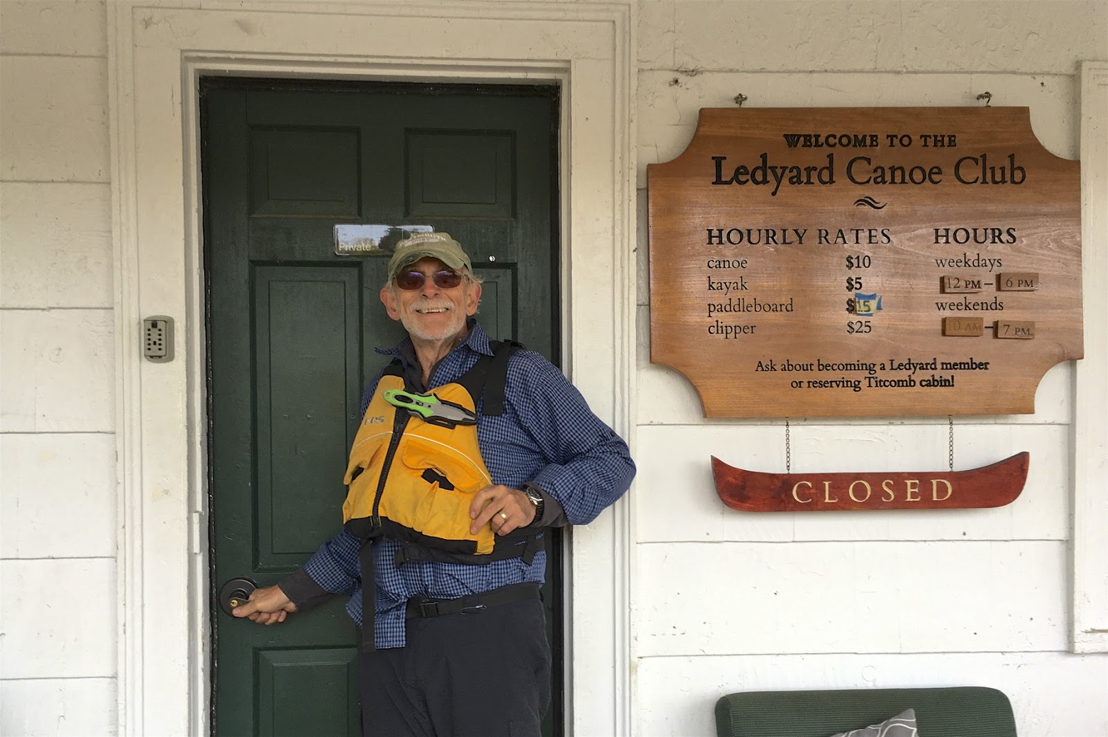
Ledyard Canoe Club
The night temperatures were again in the 30’s, but this time I added a second layer, so I was much warmer. We awoke the next morning to mist on the river. Once again, Bill started the fire, and I got the coffee going. Breakfast was pancakes and sausage, except for Jonathan who had fried eggs and tomatoes. We packed up camp and headed downstream for the last 5-miles of our trip. 

This section passes though Hanover, and Dartmouth College’s famous Ledyard Canoe Club. As we paddled by some Dartmouth students were heading out for a trip in 8-person Clipper canoes.

At the take-out
After passing through Hanover we stopped to check out the Gilman Island Campsite before continuing down to our take out at Wilder Dam. It is a nice, big campsite maintained by the L.L. Bean Outdoor Discovery Schools.

As always, it was a great trip, and we have many miles to go before we hit the ocean. Time to start thinking about a trip for the spring.


Links:

Sunday, May 26, 2019

Connecticut River Camping – Gilman Dam to McIndoe Falls - May 22-24, 2019

Shuttle to Gilman Boat Launch
I left work early on Tuesday in hopes of beating the rush hour traffic up I-93 into New Hampshire. I was meeting the crew in  Littleton for our next Connecticut River camping trip. Clouds and rain hung over the Franconia Notch as I drove through, and I had visions of having to set up my tent in the rain. Fortunately it was clear on the other side.  

For the past couple of years, Bill and I have been camping our way down the Connecticut River Paddlers Trail along the NH and VT border. The Connecticut is the longest river in New England flowing south for approximately 400-miles from the Canadian border through four states before emptying into Long Island Sound. On this trip we would have two canoes (me/Bill and Jonathan/Steve) and 3 kayaks (Al, Earl and Conrad). Everyone else had the day off, so I would be the last to arrive.

Taking a break on Moore Reservoir
Since Bill and I have done the sections from Canaan to BlooomfieldBloomfield to Lunenburg, and Woodsville to Orford, my original plan was to paddle the section from Lunenberg to Woodville to fill in that gap. Not surprisingly, the rest of the crew wasn't big on the idea of portaging five dams in three days. Instead, we decided to set up a base camp at Crazy Horse Family Campground in Littleton and run day trips on the reservoirs from there. 

We ended up padding the section from the Gilman Dam to the McIndoe Falls. At one time this section was known as the Fifteen-Mile Falls, and it was as one of the longest whitewater runs in New England. With a 320-foot drop, it was also an excellent place for the construction of hydroelectric dams, which started in the 1930’s with the Comerford and McIndoe Falls Dams. There are now five dams including the Gilman, Moore, Comerford, McIndoe Falls and Ryegate. 

Erik and Bill
As I got close to Littleton I got a call from Bill telling me to meet the crew at the 99 Restaurant for dinner. After that, we returned to the campsite and sat round the campfire to plan our trip for Wednesday. Since the forecast called for gusty winds, we decided to start with a one-way trip down the Moore Reservoir from the Gilman Dam to the Moore Dam – about 10-miles.

We got up early on Wednesday morning for a breakfast of omelets, home fries, sausage and blueberry bread from the dutch oven. By 9:30 we were on our way to the put in at the Gilman Boat Launch below the Gilman Dam. We unloaded our boats on Cozy Nook Road in Gilman VT, and lugged them down a short path to the put in. 

View of the White Mountains
From the put in we headed south into the Moore Reservoir. The trip was surprisingly scenic with views of the White Mountains to the east and the Green Mountains to the west. As it turned out, the wind was blowing out of the northeast, so it was to our backs and pushing us along nicely. 

There were several nice bootleg campsites on the VT side of the reservoir. We stopped at one for a break, and at another for lunch. By 2:00 we were approaching the Moore Dam to check out the portage trail. After that, we headed over to the take out at the Pattonville Boat Launch. By 4:30 we were back at the campsite for cocktails and dinner. We enjoyed Jonathan’s fried fish before settling in around the fire for the night.

Below the Moore Dam
We were up early on Thursday for breakfast and a lively discussion on our next paddling destination. It was decided that we would paddle the Comerford Reservoir from the Comerford Dam to the Moore Dam and back – about 14 miles.  

We put in at the Pinegrove Boat Launch and paddled a short distance down to the Comerford Dam to check out the portage trail. When I was getting back in the boat, I tipped over taking Bill with me into the knee deep water – oh well!

Conrad cooking dinner in the rain
We paddled about 7-miles up to the to Moore Dam, which looks entirely different from the downstream side towering 175-feet above the river. From there we paddled back to the put in – 14-miles at an average speed of 3.4 miles/hour. After the trip we headed back to the campsite for cocktails, dinner and another night around the fire. 

Dinner was pasta with meat sauce cooked by Conrad in the poring rain while the rest of us huddled under the tarp.  Fortunately, the rain let up and we were able to spend the rest of the night around the fire.


Portage at Comerford Dam
It rained on and off through out the night, but stopped at around 6:30 on Friday morning as we emerged from our tents for breakfast and to break camp.  It’s funny how everyone falls back easily into familiar routines – coffee, breakfast, break camp, and paddle.  We would be losing Jonathan, Steve and Earl, but the rest of us would be paddling the McIndoe Falls Reservoir from the Moore Dam down to the McIndoe Falls Dam - about 6.5-miles.  

The portage trail at the Comerford Dam takes you down the backside of the dam on the NH side to a fast moving shoot just below the powerhouse. We knew the water was fast, but we had no idea how fast until Bill and I attempted to ferry over to the VT side, and flipped in the fast moving current. Bill was quickly swept downstream, but I was able to stay with the boat, and with Conrad’s help, slowly push it into an eddy on the VT side.

Below Mcindoe Falls
Once we got back in the boat, it was a quick ride down to McIndoe Falls. The 6.5-mile trip took us about 1.5 hours at an average speed of 4.8 miles/hour. About a mile below the dam, Al clocked our speed at 7 miles/hour, and we weren’t even paddling.  Our top speed just below the dam was 10 miles/hour.  It was a quick trip.

From the take out at McIndoe Falls, we packed up our boats and shuttled everyone back to the Moore Dam for the ride home. As I headed down Route 93 in NH that afternoon, I was amazed at the amount of traffic heading up to NH for the long weekend. I was glad that we got our trip in early. We still need to paddle a couple of short stretches to complete this section - Lunenberg to Gilman and Monroe to Woodville.  Maybe in the fall, or maybe Orford to the Wilder Dam.

Tuesday, October 9, 2018

Connecticut River Camping - Woodsville to Orford - October 6 - 8, 2018

Woodville Access
Bill arrived at my house at my house at 6:00 a.m. for the drive up to New Hampshire. We planned to be at the boat launch in Orford, NH by 10:00 a.m. for our next trip on the Connecticut River. 

The Connecticut River is the longest river in New England flowing south for approximately 400 miles from the Canadian border through four states before emptying into Long Island Sound. With work and family obligations, its tough for me to do long camping trips, so Bill and I have been doing 3-day trips on the upper Connecticut River. We ran the section from Bloomfield, VT to Lunenburg, VT last fall. In the spring, we ran the section from Canaan, VT to Blooomfield, VT. This trip would be on the section from Woodsville, NH to Orford, NH. 

Bath-Haverhill Covered Bridge
When we arrived at the boat launch in Orford (mile 240), Al and Jonathan were already there, and Conrad arrived shortly after. With the crew complete, we consolidated our gear for trip up to Woodsville (mile 268).  We put-in at a small beach off Connecticut Street just below the Route 302/Railroad Street Bridge. 

Before heading downstream, we paddled upstream to the mouth of the Ammonoosuc River to see the Bath-Haverhill Covered Bridge. Built in 1827, this bridge is the oldest covered bridge in the State of New Hampshire. The bridge was closed in 1999 and restored for foot traffic in 2004. After checking out the bridge, we started our trip downstream.

Hartdale Farm
About 2 miles below the Route 302/Railroad Street Bridge we came to the Howard Island Campsite (mile 265) on the New Hampshire side – a grassy campsite accessible from a cobblestone bank. We continued downstream to our destination for the evening - Harkdale Farm Campsite (mile 259). Hartdale Farm is a wooded site on the VT side. We set up the camp, gathered firewood, and had a nice supper of fried fish and Maine guide potatoes cooked by Jonathan before settling in around the campfire for the night.

We awoke the next morning to drizzle, so I took my tent down early to try to keep it dry. I got the fire lit and the coffee started, and Jonathan prepared a tradition English breakfast with eggs-in-a-hole, sausage and fried tomatoes. After a leisurely breakfast, we packed up and headed out for our 13-mile paddle down to the Underhill Campsite. 

Paddle the Border Cookout
After 4-miles we took a break at Bedell Bridge State Park (mile 255) – the site of an old covered bridge.  As we continued past the Newbury Boat Launch (beside the Haverhill/Newbury Bridge on the VT side), we noticed lots of kayaks heading downstream. We learned that this was the Paddle the Border event sponsored by the Upper Valley Land Trust, who maintains many of the campsites on the VT side. About 100 participants were headed down to Bugbee Landing for a cookout and music by the Strawberry Farm Band. It sounded good to us, so we joined in. 

We paddled past the Vaughan Meadow Campsite (mile 253) – a wooded campsite on the VT side about a mile below the old Bedell Bridge abutment. After another 4-miles we came to the Waits River on river right. We paddled a short way up the Waits River to the Bugbee Landing in Bradford (mile 249).  We had our fill of hamburgers, hot dogs and pulled pork, and enjoyed the bluegrass music before heading out again.  From there, we had about 4-miles to paddle to the Underhill Campsite.  (Camping is also allowed at Bugbee Landing in a mowed area adjacent to the boat launch.)

Heading to the Take-out
The Underhill Campsite (mile 246) is located just west of Piermont Village at the mouth of Eastman Brook. It is a wooded site up a steep bank on the New Hampshire side of the river. We lugged our gear up the stairs and followed our usual routine - set up camp, gather firewood, cook supper (pasta and sauce prepared by Bill), and then gather around the campfire for the night.

We awoke the next day to foggy skies and mist. Once again Jonathan prepared breakfast, and then we packed up for the final leg of our journey. The Connecticut River is not known for its wilderness feel, but this section seemed a little more remote with hemlocks lining the banks in several sections. We also paddled past the steep cliffs of Saywer Mountain and the Palisades in Fairlee, VT before taking out at Orford Boat Launch (mile 240) near the Pastures Campground.  The rain started just as we pulled out of the boat launch for the ride home. Perfect timing.

Saturday, May 12, 2018

Connecticut River Camping - Canaan to Bloomfield - May 9-11, 2018

Put-in in Canaan with the
class III rapids upstream
I left my house early Wednesday morning and was driving north up Route I-495 in rush hour traffic. As I came to Route 3 the commuter traffic was headed south toward Boston, but I left the traffic behind and headed north into New Hampshire. It felt good!

After running the section of the upper Connecticut River from Bloomfield, VT (North Stratford, NH) to Lunenburg, VT (South Lancaster, NH) last fall, Bill and I wanted to run the section from Canaan, VT (West Stewarstown, NH) to Blooomfield, VT (North Stratford, NH). We had been planning the trip for months, and it had finally arrived. I met Bill at the Visitor Center in Hooksett for the rest of the drive to the river.  

Monadnock Mountain in VT
When we arrived at the take-out, Earl and Jonathan were already there, and Conrad arrived shortly after. With the crew complete, we consolidated our boats and gear for trip up to the put-in in Canaan. The river was at a great level – 6 feet, 4,000 cfs on the North Stratford gage.  

We unloaded our boats at the boat ramp below the Canaan-West Stewartstown Bridge. Above the bridge, we could see the class III rapids below the Canaan Dam. The river was running fast as we headed out and paddled downstream. This section of the river meanders though farms and fields as it circles Monadnock Mountain in Vermont. After passing the Colebrook Bridge we pulled into the Holbrook Point Campsite.

Campfire cooking
The picnic table and stairs were still chained to a tree when we arrived, so we were likely the first campers to use the site this year. We set up the camp, gathered firewood, and had a nice supper of Fried Fish and Maine Guide Potatoes cooked on the fire by Jonathan before we settling in around the campfire for the night.

On Thursday we were in no rush to get started since we had a relatively short paddle down to the Lyman Falls. Breakfast included Omelets, Home Fries, and Sausage with lots of coffee. After breakfast we started loading our boats. Unfortunately, I wasn’t paying attention and my fully loaded canoe drifted out into the river. Fortunately, Conrad had his drysuit and was able swim out and retrieve it before it hit the current and got swept downstream.  

Campsite at Lyman Falls State Park
The Connecticut River is not known for its wilderness feel, but this section seemed a little more remote with hemlocks lining the banks in several sections. Below the Columbia Covered Bridge there was two miles of intermittent quickwater and class I rips leading to the Lyman Falls - a washed out dam and our destination for the night.

Before running the dam, we checked out the campsites upstream on the NH side, but found them poorly maintained. I ran the dam on the left, and ferried over to the Vermont side to check out the campsites at the Lyman Falls State Park, which were much nicer. In fact, they were the nicest sites that I had seen so far on the river. Jonathan, Bill and Earl followed my lead, and Conrad ran the dam just right of center. 

Conrad surfing at Lyman Falls
We set up camp and had a long lazy afternoon. We were only the second group to use the site this year, so firewood was easy to find and soon we had a large pile to burn. After a little exploring around the campsite, we lit the fire and Jonathan cooked a great dinner of Curried Chicken. After that, there was nothing left to do but enjoy the fire.

It had cooled off significantly when we woke up on Friday morning. The rapids on Thursday had dumped enough water in my boat to contaminate the fuel in my Coleman stove, so all cooking would have to be on the fire. Good thing we brought Jonathan along. We got a fire started, the coffee perking, and breakfast cooking - bacon, pancakes and left-over curried chicken.

Luther's Troopers (or the Canaan Five)
Bill, Conrad, Earl, Jonathan and Erik
After breakfast, we cleared some logs and debris from the launch area (always leave the site better than you found it) before loading our boats. By now the river had dropped about a foot - 5 feet, 3,000 cfs on the North Stratford gage. Conrad and I did a little surfing below the dam before we all headed downstream.

Even at this level, there were some nice class I rips immediately below the Lyman Dam. We were surprised that these easy rapids continued for several miles down to Bloomfield. Unfortunately, Earl and I had to take out there, but Bill, Jonathan and Conrad continued down to the Maidstone Bridge.  

Connecticut River Camping - Canaan to Bloomfield from Erik Eckilson on Vimeo.

Links:

Monday, October 9, 2017

Connecticut River Camping – Bloomfield to Lunenburg - October 6-9, 2017

Typical section of the Connecticut River
Bill arrived at my house at around noon for the drive up to the Connecticut River in Vermont. We had been planning this trip for months, but the weather didn’t look promising. Oh well…

The Connecticut River is the longest river in New England flowing south for approximately 400 miles from the Canadian border through four states before emptying into Long Island Sound. We would be paddling the section of the Connecticut River Paddlers Trail from Bloomfield, VT (North Stratford, NH) to Lunenburg, VT (South Lancaster, NH). From the put-in near the mouth of the Nulhegan River to the convergence with the Upper Ammonoosuc near Groveton, NH we would also be paddling a section of the Northern Forest Canoe Trail.

At the Old Man of the Mountain
As we drove through the Franconia Notch, we decided to take a break and check out the Old Man of the Mountain. I can remember stopping to see the “Old Man” as a kid. It was actually a series of five granite cliffs on Cannon Mountain that appeared as the profile of an old man’s face when viewed from the north. The rock formation was 1,200 feet up, and came crashing down on May 3, 2003. It’s still a pretty view.

We arrived in Lancaster, NH at around 5:00, and stopped at a local pub for dinner. On the way to the campsite, we stopped to check out the Wyoming Dam Portage in Guildhall, VT, and Tommy and Mena pulled up behind us. We followed them up Route 102 in VT to the Belnap Campsite where we would be spending the night

Belnap Campsite
Belnap Campsite is a small campsite at the convergence of the Connecticut River and the Nulhegan River. The Nulhegan River arises in Brighton, VT, and flows generally northeast across Vermont to its convergence with the Connecticut River in Bloomfield village. There is a whitewater run on the Nulhegan, but it probably above may skill level.

We parked at the Northern Forest Canoe Trail kiosk, and carried our gear to the site for the night. No campfire this night. We set up camp and chatted in the dark enjoying the stars until it was time for bed. 

Breakfast with Bill
I woke up early on Saturday, made a cup of coffee, and walked over to the bridge over the Nulhegan River to watch the sunrise.  The morning was cloudy so the sun was mostly obscured.  By 7:00, everyone was up and we were having our breakfast and making plans for the day. 

We would put in at Debanville Landing – a grassy landing across the street from the campsite (mile 348) - and shuttle down to the Mount Orne Covered Bridge (mile 307) in Lunenburg, VT - a trip of 41 miles. This section of the river generally follows Route 3 in NH and Routes 102 and 2 in VT.

A well loaded boat
By 9:30, we had run the shuttle and we were anxious to the trip underway. On this day we would paddle 13 miles to the Samuel Benton Campsite (mile 334). Once Bill and I got our gear to the put-in, we wondered if it would all fit in the boat. It did, but just barely.

The river was wide, but very shallow at the put-in. With our heavy load, Bill and I had to wade out quite ways to find water deep enough to float the boat, and we still put in a couple of good scratches in the hull.

Heading downstream
We headed out under mostly sunny skies, but clouds rolled in as the day progressed, and we got some scattered rain in the afternoon. With our heavy load, Bill and I had to be careful to avoid the many rocks and sandbars. The foliage was just about peak, but with the cloudy skies it wasn’t as bright as I would have liked. 

After 13 miles we arrived at the Samuel Benton Campsite (mile 334). The campsite is situated in a grove of trees on a sandy bluff at the edge of large hay field. The nice grassy site gave us plenty of room to spread out. We quickly settled into to a familar routine – set up camp, gather firewood, cook supper, and gather around the campfire for the night. The sun setting over the mountains was spectacular.

Breakfast at the Samuel Benton Campsite
We got up on Sunday morning to fog and mist. The morning routine was similar to the evening – make coffee, get a small fire going, eat breakfast, break camp and head out. A light rain at about 7:30 got us moving quickly, and we were on the river by 8:30 heading downstream. 

The river continued to be shallow, but was not a boney as the previous day. Throughout the morning showers passed, so it was rain gear on, and rain gear off. As we passed the confluence of the Upper Ammonoosuc River, the river opened up a bit. 

Wyoming Dam Portage
The Upper Ammonoosuc River flows north and then west across New Hampshire to empty into the Connecticut River near Groveton. I had run a portion of the Upper Ammonoosuc as part of the Northern Forest Canoe Trail several years ago. There are also a couple of whitewater runs on the Upper Ammo (class IV/II and class II) that I would like to try.

After 11 miles, we approached the Maidstone Bridge and the Wyoming Dam Portage. The old Wyoming Dam is a hazard due to rebar jutting into the river. Even without rebar, it looked too boney to run at this level anyway. Fortunately the rain let up as we hiked the portage trail. After a quick lunch we continued downstream to the South Guildhall Campsite. 

Rain gear on
As we headed out, the wind picked up and rain came down in sheets. It looked like it would be long 5-mile slog down to the campsite. Fortunately, the rain and wind passed as quickly as it started, and we had clear blue skies as we pulled into the South Guildhall Campsite (Mile 317). 

The South Guildhall Campsite is a wooded site up a steep bank with great views of the White Mountains to the south. We lugged our gear up the stairs and followed our usual routine - set up camp, gather firewood, cook supper, and then gather around the campfire for the night. 

The crew - Erik, Bill, Tommy and Mena
I turned in at around 9:00, and woke up the next morning at around 5:30 to Tommy taking down his tent. The sky was cloudy, and it was pretty clear that it was going to be a rainy day, so he wanted to keep his tent dry.  I figured I would have time for a cup of coffee, and I was right, but just barely.  I had to race to get my gear packed before the skies opened up. We loaded the boats, took a picture of the group, and were on the river by 7:30.

Monday would be a short day (10 miles) down to the take-out at the Mount Orne Covered Bridge (mile 307). The river was wider and deeper in this section. It twists and turns through corn fields that seem to go on forever.  The wind was calm, but the rain got heavier as the morning went on.  We passed the confluence of the Israel River, which runs general northwest across New Hampshire before emptying in to the Connecticut River in Lancaster. There is also a whitewater run on the Israel that I would like to try. 

Mount Orne Covered Bridge
We arrived at the Mount Orne Covered Bridge at around noon. We were wet and tired, but excited about a great trip. We retrieved our cars, packed up our gear and said goodbyes before the long drive home in the holiday traffic.
