Showing posts with label Providence. Show all posts

Wednesday, August 6, 2025

Providence - August 5, 2025

Under the I-way Bridge
With most of the crew up in the Adirondacks, I agreed to lead the Blackstone Valley Paddle Club Trip on the Providence River.

The Providence River is formed at the convergence of the Woonasquatucket and Moshassuck Rivers in downtown Providence. It flows south through Providence for a mile to its convergence with the Seekonk River at Bold Point/India Point. It then opens up into Providence Harbor and continues south for 8-miles to the narrows between Conimicut Point in Warwick and Nayatt Point in Barrington where it becomes Narraganset Bay.

Skyline from Water Street
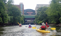
We had a group of 14 boats – all kayaks, although Danny joined us at Water Street in his canoe. It was high tide when we put in at Bold Point and headed out across Providence Harbor towards the Fox Point Hurricane Barrier. We passed the tugboats and paddled under the I-way Bridge and through the hurricane barrier into downtown Providence.

Providence was established in 1636 by Puritan theologian Roger Williams who was fleeing religious persecution in Boston. It became a trading center in the 18th century, a manufacturing center in the 19th century, and a financial center in the 20th century. This history can be seen today in the warehouses, mills and office buildings that line the river.

Skyline from the Cove
In the heart of Providence the river passes through Waterplace Park. Completed in 1994, Waterplace Park includes pedestrian bridges over the river that connect over a mile of cobblestone-paved walkways known as the Riverwalk. The park is home to the popular summertime Waterfire events

We continued up the Woonasquatucket River into the Cove at Waterplace Park. We paddled under Providence Place before turning around, and had a leisurely paddle back through the city.


Links:

Friday, July 5, 2024

Providence - July 4, 2024

Crossing Providence Harbor
I have led a RICKA Flatwater trip on the Providence River on July 4th for the past few years. It seems appropriate since one of the first insurrections of the Revolutionary War – the Gaspee Affair – was carried out on the Providence River in 1772. Providence was also the first colony to declare independence on May 4, 1776, and Rhode Island was the last state to ratify the Constitution in 1790 after additional protections were added by the Bill of Rights.

The Providence River is formed at the convergence of the Woonasquatucket and Moshassuck Rivers in downtown Providence. It flows south through Providence for a mile to its convergence with the Seekonk River at Bold Point/India Point. It then opens up into Providence Harbor and the Green Jacket Shoal before continuing south for 8-miles to the narrows between Conimicut Point in Warwick and Nayatt Point in Barrington where it becomes Narraganset Bay.

Under the I-way Bridge and
through the hurricane barrier
We had a group of nine boats – two canoes and seven kayaks. Surprisingly, this time I was in my sea kayak. It was cloudy and a little windy as we put in at Bold Point across from India Point - the base of operations for the Brown family’s merchant fleet in the second half of the 18th century.

Further up the Seekonk River is the Washington Bridge that carries Route 195 across the Seekonk River. In 1776, George Washington marched his army across the Seekonk River at this point on his way to New York after successfully driving the British out of Boston.

The Providence skyline
We headed out across Providence Harbor towards the Fox Point Hurricane Barrier. The tide was going out and there were a few wind-blown waves. Rounding Fox Point we fought the outgoing current as we passed the tugboats and paddled under the I-way Bridge and through the hurricane barrier into downtown Providence.

Providence was established in 1636 by Puritan theologian Roger Williams who was fleeing religious persecution in Boston. It became a trading center in the 18th century, a manufacturing center in the 19th century, and a financial center in the 20th century. This history can be seen today in the warehouses, mills and office buildings that line the river. We paddled under the Michael S. Van Leesten Memorial Bridge, a pedestrian bridge built on the piers of the old I-195 bridge, and into downtown Providence.

Up the Woonasquatucket River
In the heart of Providence the river passes through Waterplace Park. Completed in 1994, Waterplace Park includes pedestrian bridges over the river that connect over a mile of cobblestone-paved walkways known as the Riverwalk. The park is home to the popular summertime
Waterfire events. Volunteers for Waterfire were loading the braziers for that night's event as we paddled upstream.

We followed the path of Roger Williams up the Providence River to its headwaters at the confluence of the Woonasquatucket and Moshassuck Rivers. We continued up the Woonasquatucket River into the Cove at Waterplace Park. The Woonasquatucket River arises near Primrose Pond and Stump Pond in Smithfield and flows generally southeast for 16-miles to Providence. We paddled under Providence Place and up past the Foundry mill complex before turning around.

Back to Providence Place
It was on the Moshassuck River that Roger Williams established the Providence colony in 1636. The Moshassuck River arises near Lime Rock in Lincoln and flows generally south for 9-miles to Providence. The river became important during the Industrial Revolution, powering numerous mills (including the Moffett Mill on Great Road) and becoming the lower section of the Blackstone Canal.

We had a leisurely paddle back through the city. A strong headwind made crossing back to Bold Point a little more challenging, but we all made it fine. Traffic on the Washington Bridge on the way home wasn’t bad, and I was home by noon to put the awnings on the house.

The crew at the Cove
Links:

Tuesday, July 4, 2023

Providence River - July 4, 2023

Crossing Providence Harbor
I have led a RICKA Flatwater trip on the Providence River on July 4th for the past few years. It seems appropriate since one of the first insurrections of the Revolutionary War – the Gaspee Affair – was carried out on the Providence River in 1772. Providence was also the first colony to declare independence on May 4, 1776, and Rhode Island was the last state to ratify the Constitution in 1790 after protections were added by the Bill of Rights.

The Providence River is formed at the convergence of the Woonasquatucket and Moshassuck Rivers in downtown Providence. It flows south through Providence for a mile to its convergence with the Seekonk River at Bold Point/India Point. It then opens up into Providence Harbor and the Green Jacket Shoal before continuing south for 8-miles to the narrows between Conimicut Point in Warwick and Nayatt Point in Barrington where it becomes Narraganset Bay.

Through the Hurricane Barrier
It was raining as we put-in at Bold Point and paddled up the Seekonk River though the narrows between Bold Point in East Providence and India Point in Providence. India Point was the base of operations for John Brown’s merchant fleet in the second half of the 18th century. John Brown and his brothers would go on to found Brown University.

We paddled past the Brown University Boat House and up to the George Washington Bridge that carries Route 195 over the Seekonk River. In 1776, George Washington marched his army across the Seekonk River at this point on his way to New York after successfully driving the British out of Boston. 

Approaching downtown Providence
We then headed out across Providence Harbor towards the Fox Point Hurricane Barrier. The water was calm and the tide was high, but the rain was coming down heavy. Rounding Fox Point we passed the tugboats before paddling under the I-way Bridge and through the hurricane barrier into downtown Providence.

Providence was established in 1636 by Puritan theologian Roger Williams who was fleeing religious persecution in Boston. It became a major trading center in the 18th century, a manufacturing center in the 19th century, and a financial center in the 20th century. This history can be seen today in the warehouses, mills and office buildings that line the river. We paddled under the Michael S. Van Leesten Memorial Bridge, a pedestrian bridge built on the piers of the old I-195 bridge, and into downtown Providence.

Skyline from the Cove
In the heart of Providence the river passes through Waterplace Park. Completed in 1994, Waterplace Park includes pedestrian bridges over the river that connect over a mile of cobblestone-paved walkways known as the Riverwalk. The park is home to the popular summertime Waterfire events.

We followed the path of Roger Willams up the Providence River to its headwaters at the confluence of the Woonasquatucket and Moshassuck Rivers. We continued up the Woonasquatucket River into the Cove at Waterplace Park. The Woonasquatucket River arises near Primrose Pond and Stump Pond in Smithfield and flows generally southeast for 16-miles to Providence. We paddled under Providence Place and up past the Foundry mill complex before turning around.

Above Providence Place
Since the tide was high, we were also able to paddle up the Moshassuck River to the site where Roger Williams established the Providence colony at the Roger Williams National Memorial. The Moshassuck River arises near Lime Rock in Lincoln and flows generally south for 9-miles to Providence. The river became important during the Industrial Revolution, powering numerous mills (including the Moffett Mill on Great Road) and becoming the lower section of the Blackstone Canal.

By then, the rain has stopped, and we had a leisurely paddle back through the city and across the harbor. I brought my sea kayak so I could practice some of the strokes that I learned at the kayak training on Saturday. We arrived back at Bold Point at around noon - plenty of time to enjoy the rest of the day. Too bad the rest of the day was filled with rain and thunderstorms.

In my sea kayak in front of Providence Innovation District Park
Links:

Monday, January 2, 2023

Providence - January 1, 2023

I-way Bridge and the Hurricane Barrier
On New Year’s Day there are always a lot of options for trips. Although I should have been more ambitious (something like the Lower Winni), I was leaning toward a trip on the Upper Winni with Conrad. A trip with the CTAMC led by Paul D. on the Crystal section of the Farmington was also in the running. In the end, the decision was easy since I had to stay local due to family obligations. I decided to take my kayak out for a trip on the Providence River.

The Providence River is formed at the convergence of the Woonasquatucket and Moshassuck Rivers. It flows south through downtown Providence for a mile to its convergence with the Seekonk River at Bold Point/India Point. It then opens up into Providence Harbor.

Approaching the convergence of the
Woonasquatucket and Moshassuck Rivers
I put-in at 11:30 at Bold Point in East Providence and headed out across Providence Harbor towards the I-way Bridge and the Fox Point Hurricane Barrier. The wind was from the west producing small wind-blown waves, and the tide was going out so the current was strong at the mouth of the Seekonk River and at the Fox Point Hurricane Barrier. I passed through the hurricane barrier and into downtown Providence.

In the heart of Providence the river passes along the Riverwalk. I paddled up past the convergence of the Woonasquatucket and Moshassuck Rivers and into the Cove at Waterplace Park before heading back down through the city and back to Bold Point. It was a mellow paddle, but at least I was out on the water on New Year's Day.


Downtown Providence
Links:

Tuesday, July 5, 2022

Providence River – July 4, 2022

Heading out from Bold Point
I decided to lead a RICKA trip on the Providence River on July 4th. 
It seemed appropriate since one of the first insurrections of the Revolutionary War – the Gaspee Affair – was carried out by Providence patriots on the Providence River in 1772. Providence was also the first colony to declare independence on May 4, 1776, and Rhode Island was the last state to ratify the Constitution in 1790 after protections were added by the Bill of Rights.

The Providence River is formed at the convergence of the Woonasquatucket and Moshassuck Rivers in downtown Providence. It flows south through Providence for a mile to its convergence with the Seekonk River at Bold Point/India Point. It then opens up into Providence Harbor and the Green Jacket Shoal before continuing south for 8-miles to the narrows between Conimicut Point in Warwick and Nayatt Point in Barrington where it becomes Narraganset Bay.

Past the tug boats
We put-in a little after 9:00 a.m. at Bold Point in East Providence and headed out across Providence Harbor towards the Fox Point Hurricane Barrier. The water was calm with just a slight hint of wind-blown waves. Rounding Fox Point we passed the tugboats before paddling under the I-way Bridge, through the hurricane barrier, and into downtown Providence.

Providence was established in 1636 by Puritan theologian Roger Williams who was fleeing religious persecution in Boston. It became a major trading center in the 18th century, a manufacturing center in the 19th century, and a financial center in the 20th century. This history can be seen today in the warehouses, mills and office buildings that line the river. We paddled under the new pedestrian walking bridge built on the piers of the old I-195 bridge and into downtown Providence.

Providence skyline
In the heart of Providence the river passes through Waterplace Park. Completed in 1994, Waterplace Park includes pedestrian bridges over the river that connect over a mile of cobblestone-paved walkways known as the Riverwalk. The park is home to the popular summertime Waterfire events.

We followed the path of Roger Willams up the Providence River to its headwaters at the confluence of the Woonasquatucket and Moshassuck Rivers. Roger Williams continued up the Moshassuck River and settled on its east bank on land that is now the Roger Williams National Memorial. The Moshassuck River arises near Lime Rock in Lincoln and flows generally south for 9-miles to Providence. The river became very important during the Industrial Revolution, powering numerous mills (including the Moffett Mill on Great Road) and becoming the lower section of the Blackstone Canal.

Up the Woonasquatucket River
We paddled up the Woonasquatucket River into the Cove at Waterplace Park. The Woonasquatucket River arises near Primrose Pond and Stump Pond in Smithfield and flows generally southeast for 16-miles to Providence. The tide was up, so we were able to paddle up about a mile to the US Rubber Lofts before turning around.

We paddled back down through the city and arrived back at Bold Point at around noon - plenty of time to enjoy the rest of the day.

In the Cove at Waterplace Park
Links:

Monday, May 23, 2022

Providence – May 22, 2022

Boat ramp at Bold Point
I was up early and out the door to paddle a trip that I will be leading this summer for RICKA – the Providence River on July 4th. Cheryl had mentioned that parking might be limited due to construction. When I arrived parking was limited, but due to a large number of boat trailers rather than construction. If we had to, we could drop boats and park on the street in front of Tockwotton on Waterfront Drive.

Providence skyline
Links:
My Pictures

Tuesday, July 6, 2021

Providence – July 5, 2021

With the rain on Friday and Saturday, and my birthday party on Sunday, I decided to move the RICKA Providence River trip to Monday morning. The day was partly cloudy with a slight breeze as we headed out from Bold Point. It was low tide, so we made it up as far as the old US Rubber mill. I forgot to bring my camera, but fortunately Cheryl brought hers.

Sunday, September 6, 2020

Providence River – September 6, 2020

I got a text from Paul that he and Fran would be doing the Providence River trip, so I decided to join in. We put in at Bold Point in East Providence at around 11:00 and headed out across the harbor. After rounding Fox Point we paddled through the Fox Point Hurricane Barrier, under the I-way Bridge, and into downtown Providence. At the the confluence of the Woonasqatucket and Moshassuck Rivers we took a left and paddled up the Woonasqatucket River into the Basin at Waterplace Park. The tide was up, so we paddled under the Providence Place Mall and upstream as far as Olneyville. Fun trip, as always!


Links:

Monday, February 17, 2020

Providence River/Waterplace Park – February 16, 2020

Danny and Bill at the put-in
The forecast was cold on Saturday, but warming on Sunday, so Sunday was the day to paddle. Fortunately, I can always count on Bill to join me. His only requirement was that we do something local, so we decided on the Providence River from Bold Point. I posted it on the RICKA Flatwater Board, and Danny joined us as well.

“Many years ago - before there was a Waterplace Park, Waterfire or a River Relocation Project - there was the Woonasquatucket River and the many parking spaces over it in downtown Providence.” This is a quote from story that Bill wrote for the Paddler about his first RICKA trip on the Providence River back in 1978. In those days the river was covered with a deck along what is now Memorial Boulevard. “When someone asked what the widest bridge in the US was in 1978, the answer was the bridge and parking spaces over the Woonasquatucket River” Bill continued. 

Providence Skyline
Today, a paddle in downtown Providence is one of the finest urban paddles in the country thanks to the removal of that bridge deck and the completion of Waterplace Park in 1994. Located along sections of the Moshassuck, Woonasquatucket, and Providence Rivers, Waterplace Park is a four-acre park located in the heart of the city. Pedestrian bridges over the river connect over a mile of cobblestone-paved walkways known as the Riverwalk. The park is home to the popular summertime Waterfire events.

We put in at the Bold Point in East Providence and headed out across Providence Harbor towards the Fox Point Hurricane Barrier. The water was calm with just a slight hint of wind-blown waves. Rounding Fox Point and entering into the Providence River we passed some tugboats before paddling through the hurricane barrier.

Danny near South Water Street
As we paddled upstream we passed under the new pedestrian walking bridge built on the piers of the old I-195 Bridge. We continued upstream past the South Water Street Landing and through downtown Providence to the confluence of the Woonasqatucket and Moshassuck Rivers. Bearing to the left we paddled up the Woonasqatucket River into the Basin at Waterplace Park.

The tide was up, so we paddled under the Providence Place Mall and upstream as far as the US Rubber Mill. The river was getting low, and I didn’t want to scratch my Spirit II, so we turned around there and headed back downstream. After a few pictures in the Cove, we headed back to Bold Point. Fun trip, as always!

Bill and Erik in the Cove
Links:

Sunday, June 14, 2015

Providence and Woonasquatucket Rivers - June 12, 2015

We had a nice group for the “Paddled into History” trip on the Providence and Woonasquatucket Rivers with the Woonasquatucket River Watershed Council.  I was the historical tour guide and spoke about the history of Providence and its links tot the industrial development of the Blackstone River Valley.

Pointing out a local landmark - hope I got my facts straight!
Links:

Sunday, June 7, 2015

Providence River - June 7, 2015

I’ll be leading a "Paddle into History" trip for the Woonasquatucket River Watershed Council on the Providence River on Friday.  They asked me to talk about the history of Providence, so I decided to head down to the river for some inspiration.  When I arrived at the South Water Street Landing, the area was mobbed with people – absolutely no place to park.  I ended up parking on North Main Street. I felt a little like the PARI guys as I carried my canoe down Steeple Street to the river.  It was a nice day on the water, and a great day for pictures.


Wednesday, August 21, 2013

Providence River – August 20, 2013

At the put-in
We had our last Blackstone Valley Paddle Club trip of the year on the Providence River in downtown Providence. 

We put in at the Bold Point access in East Providence and headed out across Providence Harbor towards the Fox Point Hurricane Barrier. The water was calm with just a slight hint of some rolling waves. Century old pier pilings dot the surface. Rounding the corner we passed some tugboats before heading through the Fox Point Hurricane Barrier and into the Providence River. 

Riverwalk
I was surprised how developed the riverfront had become in this area. The lower section of the Providence River includes the Riverwalk. Passing through downtown Providence we will came to the confluence of the Woonasqatucket and Moshassuck Rivers. Bearing to the left we paddled up the Woonasqatucket River into the Basin at Waterplace Park. 

The tide was up, so a few people paddled further up the river to enjoy the sunset. I was content to enjoy the view from the Basin before heading back.


Fox Point Hurricane Barrier
Links:
My Pictures

Saturday, August 14, 2010

Waterplace Park

A post on the paddling.net message board got me thinking about one of the nicest urban paddles around - Waterplace Park in Providence.  The Moshassuck and Woonasquatucket Rivers converge in Providence to form the Providence River which then flows into Narragansett Bay. Up until the mid-90’s, these rivers were literally paved over. With the construction of Waterplace Park, the city has an entirely different feel, and the big event in town is Waterfire.  It cost millions to do, but it sure is nice. 


Heading up to the Deerfield River today to do a joint RICKA Flatwater/Whitewater trip below the Zoar Gap.  Release doesn't start until 12:00, which means that we won't get on the water until 2:00.  Its going to be a looooong day.