Showing posts with label Bay Campus. Show all posts

Sunday, August 4, 2024

Time to Step-up – URI Bay Campus – August 3, 2024

Heading out
The last time that I paddled out of the URI Bay Campus was July, 2019. Tony needed to return the Volunteer of the Year trophy, so we decided to paddle the West Passage checking out the lighthouses. This time, I would be doing the RICKA Sea Kayak Step-up trip, and getting the Volunteer of the Year trophy from Cat Ratcliff. I wonder who will be getting the trophy this year.

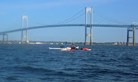
The URI Bay Campus provides access the West Passage of Narragansett Bay. To the south lies Bonnet Shores and Whale Rock - a frequent rock gardening site. From there, more experienced paddlers can cross to Beavertail at the southern tip of Jamestown - one of the most scenic and exposed-coast locations in Rhode Island. To the west is Dutch Island and Conanicut Island. To the north is the Jamestown Bridge and the more sheltered waters of the West Passage.

Rounding the point at Bonnet Shores
We would be doing a step-up/training trip to give paddlers who have done mostly Level 2 or even flatwater trips the opportunity to paddle in swells, current, rocks, and other dynamic conditions. We met at the Bay Campus for a 10:00 launch. We had 11 paddlers with 4 step-up paddlers, including me. Conditions were SW winds 10 to 15 kt with gusts up to 20 kt. Waves 2  ft. Tide going out with low tide at 1:00.

We headed south from the Bay Campus toward Bonnet Shores. The swells increased as we left the more protected waters of the West Passage and ventured out into Rhode Island Sound. Some played in the rocks on the way out. I stayed a little further out to get used to the rolling swells.

Bonnet Rock
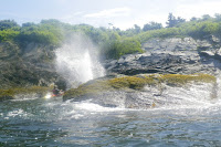
When we reached Bonnet Rock we gathered up for the crossing of the cove at Bonnet Shores. We were now paddling across the waves and the wind. The water on the other side of the cove along Anawan Cliffs was considerably calmer, and we played in the rocks as we continued south.

With an outgoing tide and a wind from the south, the swells were 2-feet as we left Bonnet Shores and entered into Rhode Island Sound. It was a bit of work paddling into the wind, but fun to ride up and down on the swells. We could see waves breaking over Whale Rock in the distance when the decision was made to turn around and head back to Bonnet Shores.

The crew at the lunch break
On the return trip we were in a following sea, and riding down the face of a wave for the first time was a blast. The main concern in a following sea is broaching when the wind turns the kayak sideways in the waves. A stern rudder can help keep you going straight.

We stopped for lunch inside the cove on a small rocky beach with a great view of Jamestown and the Beavertail Light. We played in the rocks as we worked out way back down the cove for the crossing.

Rock gardening on the way back
The wind had picked up in the afternoon, and I found myself repeatedly having to correct my course while crossing the cove. With smaller swells and stronger winds, I also felt the boat’s tendency to broach in the following sea on the way back to the Bay Campus, but it was nothing that I felt uncomfortable with - I’m making progress.

Once back at the Bay Campus we did assisted rescue practice - I was a rescuer and rescuee, and did fine with both. We also did some towing demonstrations. Rick said this was a solid Level 3 trip, so I felt good about that.


Bay Campus Step-up Paddle from Erik Eckilson on Vimeo.
Links:
My Pictures
Cam's Video
Tony's Video

Thursday, June 8, 2023

Saltwater Paddling for Everyone

In Rhode Island, we are fortunate to have great saltwater paddling not just for sea kayakers, but also for flatwater paddlers. Here are some of our favorite flatwater and sea kayaking venues.

Flatwater (These sites are somewhat protected and are suitable for experienced flatwater paddlers, but you may experience wind and wind-blown waves.)

Exploring the coves
Point Judith Pond
South Kingstown

Point Judith Pond, or the Great Salt Pond is the second largest of the Rhode Island’s South County salt ponds. It is a shallow, four-mile long pond located behind the barrier beaches and sand dunes that form Point Judith. The easiest put-in is boat ramp at Marina Park. From there, you can paddle out into the Upper Pond, through the Narrows, and into Point Judith Pond itself. There are numerous coves and island to explore as you head down to the Port of Galilee at the southern end.

West end of the pond
Ninigret Pond
Charlestown

Ninigret Pond is the largest of Rhode Island’s South County salt ponds. Ningret is separated from the ocean by the fragile barrier island that forms East Beach. It is connected to Green Hill Pond by a small tidal inlet. Putting in at Ninigret Park allows you to explore the west end of the pond, including a short hike across the barrier island for a view of the beach. Putting in at the Charlestown Beach put-in allows you to explore the east end of the pond including the Charlestown Breachway and Green Hill Pond.

Upper Narrows
Narrow River
South Kingstown and Narragansett

The Narrow River, also known at the Pettaquamscutt River, arises at Carr Pond Dam at the Gilbert Stuart Birthplace and flows south for 6-miles forming the border between South Kingstown and Narragansett. There are five distinct sections of the Narrow River – the Upper Pond, the Lower Pond, the Upper Narrows, Pettaquamscutt Cove, and the Lower Narrows. Putting in at the Narrow River Fishing Area allows you to paddle upstream exploring the Upper Narrows and the Upper and Lower Ponds. Putting in at the Sprague Bridge provides easy access to Pettaquamscutt Cove and the Lower Narrows where the river flows into Narragansett Bay.

Wickford Harbor
Wickford Harbor
North Kingstown

Wickford is located on the West Passage of Narragansett Bay, and is built around a large, well-protected harbor. Today, it is a picturesque village whose waterfront streets are lined with shops, restaurants and colonial-era homes. Putting in a Wilson Park allows you to explore the backwaters around Rabbit and Cornelius Islands before heading into Wickford Harbor and down into the Cove.

Sea Kayak (These sites are in open water and more exposed, and are suitable for experienced sea kayakers.)

Sakonnet Point Light
Sakonnet Point
Little Compton

Sakonnet Point includes West Island, East Island, Little Cormorant Rock and the Sakonnet Point Lighthouse. It is one of RICKA’s most popular rock garden venues. The water around the islands is very exposed and can be quite active. RICKA members also enjoy surfing when conditions are right at Surfer’s Beach near the Haffenreffer estate. 

Mansion on Ocean Drive
Kings Beach
Newport

Launch at Kings Beach and you are paddling along the amazing rocky shore of southern Aquidneck Island. If you head east you will pass mansions on the rocky cliffs along Newport’s Ocean Drive and Cliff Walk. Seal Rock lies a third of a mile to the south - a wild, exposed area that is a favorite for advanced rock gardening. If you head west you will pass Brenton Point and will enter the open waters of Narragansett Bay. 

Beavertail Light
Bay Campus
Narragansett

The URI Bay Campus provides access the West Passage of Narragansett Bay. To the south lies Bonnet Shores and Whale Rock - a frequent rock gardening site. From there you can cross to Beavertail at the southern tip of Jamestown - one of the most scenic and exposed-coast locations in RI. 

Rock gardening
Fort Wetherill
Jamestown

Fort Wetherill provides access to the lower East Bay. The southern Jamestown shoreline provides outstanding rock gardening and coastal touring, or head north to The Dumplings for easy tide race play during peak flows. Head east across the East Passage, with due caution in very busy waters, to reach Castle Hill Lighthouse, and from there around Brenton Point for rock gardening and coastal touring.

Newport Bridge
Potter Cove
Jamestown

Potter Cove gives you access to Jamestown, Newport and the coves and islands of the upper East Bay. If you head south, you will pass under the Newport Bridge and into Jamestown Harbor. From there you can cross to Newport Harbor, Rose Island and Gould Island.

Friday, July 26, 2019

West Passage Lighthouse Tour - July 25, 2019

View from the put-in at the Bay Campus
There are three lighthouses on the West Passage of Narragansett Bay that I have been trying to get pictures of from the water – Dutch Island Light, Beavertail Light, and Plum Beach Light. Dutch Island Light is easy being just outside Dutch Harbor. Beavertail is also easy if you take the pictures from shore – not so much from the water. Plum Beach Light has always eluded me being just outside my comfort level for paddling alone. That changed yesterday when Tony agreed to take me out in one of his sea kayaks. 

Tony needed to return the RICKA Volunteer of the Year trophy, so we decided to take the opportunity to do some paddling. Tony gave me lots of options, but we decided to launch from the URI Bay Campus. We met at 8:30 and unloaded the boats. The day was beautiful, with wind out of the north kicking up 1’ waves. Combined with the usual boat wake, it would be easy for Tony, but a little challenging for me.

Dutch Island Light
We decided to cross over to Dutch Island, and then head south to Beavertail. I would be paddling a 17’ Heritage sit-on-top sea kayak. It seemed a little tippy at first, but I got use to it. My first real test came about half way across the West Passage when a large motorboat sped by creating 2-3’ wake. I bounced over fine and we continued to Dutch Island.

Dutch Island took its name from the Dutch East India Company that established a trading post here around 1636. The first lighthouse was completed on the southern tip of the island in 1826. The original tower was replaced with the current tower in 1857. The lighthouse remained in service until 1979 when it was replaced with a flashing buoy.  It then fell into disrepair until 2007 when it was restored by the Dutch Island Lighthouse Society.

Beavertail Light
From Dutch Island we headed south toward Beavertail. Records from the town of Jamestown make reference to a beacon here as early as 1712. A wooden tower known as the “Newport Light” was built in 1749. It burned and was replaced with a stone tower 4-years later. In 1856, the original stone tower was replaced with the current granite tower. It is 10’ square and 64’ tall. The lighthouse was restored and opened to the public in 1989 and includes a museum is operated by the Beavertail Lighthouse Museum Association.

As we headed south it took me a little while to get use to paddling in a following wind. As we approached Beavertail we also had to deal with rolling waves coming in from the open water. I did my best to click a few pictures of the lighthouse, but I was more concerned about staying upright. When Tony rose up and then disappeared behind a 3 ' rolling wave, I decided that I gone far enough. I clicked my last picture, and we turned around and headed north, taking a break in one of the secluded beaches in the cliffs.  

Tony get a shower
We headed back to Dutch Harbor and took a break for lunch near the boat dock at Fort Getty. From there we crossed back to Dutch Island to get a few more pictures of the lighthouse. We continued up the west side of the island, and then we had a decision to make. We could play it safe and explore Dutch Harbor, or we could head north toward the Jamestown Bridge to get some pictures of the Plum Beach Light. We decided to head to Plum Beach Light.

The sparkplug shaped Plum Beach Light was built in 1899 using pneumatic caisson engineering – a new innovation at the time. The granite base was added in 1922. The light was deactivated in 1941 when the first Jamestown Bridge was built. It remained abandoned until 2003 when the lighthouse's exterior was completely restored by the Friends of the Plum Beach Light.

Plum Beach Light
In order to get to the Plum Beach Light we had to cross the boat channel to the North Kingstown side, and then head north under the Jamestown Bridge.  The wind had died down, but boat wake continued to roll in from across the bay.  Still, it was amazing to sit at the base of this lighthouse that had always seemed just out of reach.  

After clicking a few pictures we turned and headed back to the put-in. In total we paddled 14-miles if you believe Google Maps – it didn’t seem that far, but no wonder I was tired.

Links:

Friday, July 25, 2014

URI Bay Campus – July 24, 2014

Put-in at the URI Bay Campus
The sea kayakers seem to run a lot of trips from the URI Bay Campus, so I decided to check it out. 

The Bay Campus is at the site of the old South Ferry Village.  In the eighteenth century, this was a small port involved the trade of local marine and agricultural products.  By the nineteenth century, it had grown to be a thriving village.  All that remains of the old South Ferry Village today is the stone remnants of the old pier.

I put in around sunrise and paddled north toward the Jamestown Verrazzano Bridge.  Across the West Passage, I could see the Dutch Island and Beavertail Lights, and the Newport Bridge.  My original objective was to get a picture of the Plum Beach Light, but I wimped out when I saw how far out in the channel it was.

Jamestown Verrazzano Bridge
Links: