Showing posts with label Dutch Island. Show all posts

Sunday, July 23, 2023

Dutch Island - July 23, 2023

Jamestown Bridge from Dutch Harbor
It was a beautiful morning, so I decide to head over to Dutch Harbor to paddle out to the Dutch Island Light. The bay was calm, winds were light and conditions were perfect.

Dutch Island is located in the West Passage of Narragansett Bay and took its name from the Dutch East India Company that established a trading post here around 1636. After the Revolutionary War the island was fortified to protect the West Passage from invasion by sea. In the 1890’s the Army established Fort Greble here. Like Fort Weatherill on the East Passage, Fort Greble was active through World War II and was part of a series of heavily fortified artillery placements that protected Narragansett Bay.

Dutch Island Light
The first lighthouse was completed on the southern tip of Dutch Island in 1826. The original tower was replaced with the current tower in 1857. The lighthouse remained in service until 1979 when it was replaced with a flashing buoy. It then fell into disrepair until 2007 when it was restored by the Dutch Island Lighthouse Society.

I put in at Dutch Harbor and paddled out toward the Dutch Island Light. After snapping a few pictures, I continued around the west side of island before retuning to the take out.

Newport Bridge
Links:

Thursday, July 29, 2021

Dutch Island – July 29, 2021

Dutch Harbor from the put-in
After my aborted attempt yesterday, I went back to Dutch Harbor today to paddle out to Dutch Island and the Dutch Island Light. The bay was calm, winds were light and conditions were perfect.


Dutch Island is located in the West Passage of Narragansett Bay and took its name from the Dutch East India Company that established a trading post here around 1636. After the Revolutionary War the island was fortified to protect the West Passage from invasion by sea. In the 1890’s the Army established Fort Greble here. Like Fort Weatherill on the East Passage, Fort Greble was active through World War II and was part of a series of heavily fortified artillery placements that protected Narragansett Bay.

Dutch Island Light
The first lighthouse was completed on the southern tip of Dutch Island in 1826. The original tower was replaced with the current tower in 1857. The lighthouse remained in service until 1979 when it was replaced with a flashing buoy. It then fell into disrepair until 2007 when it was restored by the Dutch Island Lighthouse Society.


I put in at Dutch Harbor and paddled out toward the Dutch Island Light. After snapping a few pictures, I continued around the west side of island before retuning to the take out.

Newport Bridge
Links:

Tuesday, July 28, 2020

Dutch Harbor and the Dutch Island Light - July 28, 2020

View from the put-in
I didn't get to paddle yesterday, so I decided to head over to Jamestown today to paddle out to Dutch Island and the Dutch Island Light. 

Dutch Island is located on the West Passage of Narragansett Bay and took its name from the Dutch East India Company that established a trading post here around 1636. In 1654 English colonists purchased the island from the Narragansett Indians.

Dutch Island Light (c. 1857)
For many years, the island was fortified to protect the West Passage from invasion by sea. In the 1890’s the Army established Fort Greble here. Like Fort Weatherill on the East Passage, Fort Greble was active through World War II and was part of a series of heavily fortified artillery placements that protected Narragansett Bay including Fort Greene on Point Judith and Fort Adams in Newport.

The first lighthouse was completed on the southern tip of Dutch Island in 1826. The original tower was replaced with the current tower in 1857. The lighthouse remained in service until 1979 when it was replaced with a flashing buoy. It then fell into disrepair until 2007 when it was restored by the Dutch Island Lighthouse Society.

Looking west to the URI Bay Campus
Dutch Island is located about a mile from either the URI Bay Campus or Dutch Harbor, but the crossings couldn't be different. From the Bay Campus you cross the West Passage of Narragansett Bay with boat traffic and big rolling waves. I did that crossing last year with Tony on one of his sit-on-top sea kayaks, and it was an interesting trip.  From Dutch Harbor the crossing is more protected. 

I put in at Dutch Harbor, and paddled out into the calm water toward the Dutch Island. The waves increased as I approached the lighthouse on the southern tip of the island, so I decided not to paddle around the point or up the west side. I landed and took some pictures from shore before heading back.

Dutch Island Light
Links:
My Pictures
Dutch Island Lighthouse Society

Friday, July 26, 2019

West Passage Lighthouse Tour - July 25, 2019

View from the put-in at the Bay Campus
There are three lighthouses on the West Passage of Narragansett Bay that I have been trying to get pictures of from the water – Dutch Island Light, Beavertail Light, and Plum Beach Light. Dutch Island Light is easy being just outside Dutch Harbor. Beavertail is also easy if you take the pictures from shore – not so much from the water. Plum Beach Light has always eluded me being just outside my comfort level for paddling alone. That changed yesterday when Tony agreed to take me out in one of his sea kayaks. 

Tony needed to return the RICKA Volunteer of the Year trophy, so we decided to take the opportunity to do some paddling. Tony gave me lots of options, but we decided to launch from the URI Bay Campus. We met at 8:30 and unloaded the boats. The day was beautiful, with wind out of the north kicking up 1’ waves. Combined with the usual boat wake, it would be easy for Tony, but a little challenging for me.

Dutch Island Light
We decided to cross over to Dutch Island, and then head south to Beavertail. I would be paddling a 17’ Heritage sit-on-top sea kayak. It seemed a little tippy at first, but I got use to it. My first real test came about half way across the West Passage when a large motorboat sped by creating 2-3’ wake. I bounced over fine and we continued to Dutch Island.

Dutch Island took its name from the Dutch East India Company that established a trading post here around 1636. The first lighthouse was completed on the southern tip of the island in 1826. The original tower was replaced with the current tower in 1857. The lighthouse remained in service until 1979 when it was replaced with a flashing buoy.  It then fell into disrepair until 2007 when it was restored by the Dutch Island Lighthouse Society.

Beavertail Light
From Dutch Island we headed south toward Beavertail. Records from the town of Jamestown make reference to a beacon here as early as 1712. A wooden tower known as the “Newport Light” was built in 1749. It burned and was replaced with a stone tower 4-years later. In 1856, the original stone tower was replaced with the current granite tower. It is 10’ square and 64’ tall. The lighthouse was restored and opened to the public in 1989 and includes a museum is operated by the Beavertail Lighthouse Museum Association.

As we headed south it took me a little while to get use to paddling in a following wind. As we approached Beavertail we also had to deal with rolling waves coming in from the open water. I did my best to click a few pictures of the lighthouse, but I was more concerned about staying upright. When Tony rose up and then disappeared behind a 3 ' rolling wave, I decided that I gone far enough. I clicked my last picture, and we turned around and headed north, taking a break in one of the secluded beaches in the cliffs.  
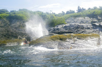
Tony get a shower
We headed back to Dutch Harbor and took a break for lunch near the boat dock at Fort Getty. From there we crossed back to Dutch Island to get a few more pictures of the lighthouse. We continued up the west side of the island, and then we had a decision to make. We could play it safe and explore Dutch Harbor, or we could head north toward the Jamestown Bridge to get some pictures of the Plum Beach Light. We decided to head to Plum Beach Light.

The sparkplug shaped Plum Beach Light was built in 1899 using pneumatic caisson engineering – a new innovation at the time. The granite base was added in 1922. The light was deactivated in 1941 when the first Jamestown Bridge was built. It remained abandoned until 2003 when the lighthouse's exterior was completely restored by the Friends of the Plum Beach Light.

Plum Beach Light
In order to get to the Plum Beach Light we had to cross the boat channel to the North Kingstown side, and then head north under the Jamestown Bridge.  The wind had died down, but boat wake continued to roll in from across the bay.  Still, it was amazing to sit at the base of this lighthouse that had always seemed just out of reach.  

After clicking a few pictures we turned and headed back to the put-in. In total we paddled 14-miles if you believe Google Maps – it didn’t seem that far, but no wonder I was tired.

Links:

Thursday, July 19, 2018

Dutch Island and the Dutch Island Light – July 19, 2018

Dutch Harbor
The winds died down and the waves didn't look too bad, so I took a ride over to Jamestown to paddle out to Dutch Island and the Dutch Island Light. Dutch Island is located in the West Passage of Narragansett Bay and took its name from the Dutch East India Company that established a trading post here around 1636. In 1654 English colonists purchased the island from the Narragansett Indians.

For many years, the island was fortified to protect the West Passage from invasion by sea. In the 1890’s the Army established Fort Greble here. Like Fort Weatherill on the East Passage, Fort Greble was active through World War II and was part of a series of heavily fortified artillery placements that protected Narragansett Bay.

Dutch Island Light
The first lighthouse was completed on the southern tip of Dutch Island in 1826.  The original tower was replaced with the current tower in 1857. The lighthouse remained in service until 1979 when it was replaced with a flashing buoy.  It then fell into disrepair until 2007 when it was restored by the Dutch Island Lighthouse Society.

I put in at Dutch Harbor, and paddled out into the calm water toward the Dutch Island Light. After snapping a few pictures, I continued around the west side of island before retuning to the take out.

Links:

Tuesday, July 26, 2016

Dutch Island – July 26, 2016

Verrazano Bridge from Dutch Harbor
I took a road trip over to Jamestown to paddle at Dutch Harbor. The wind was quiet, and the West Passage was dead flat, so I paddled out to Dutch Island to check out the Dutch Island Light. 

Dutch Island is located in the West Passage of Narragansett Bay and took its name from the Dutch East India Company that established a trading post here around 1636. In 1654 English colonists purchased the island from the Narragansett Indians.

Remnant of Fort Greble
For many years, the island was fortified to protect the West Passage from invasion by sea. During the Civil War, soldiers of the 14th Rhode Island Heavy Artillery, an African American regiment who later served in the Battle of New Orleans, constructed first earthwork defenses on the island.

In the 1890’s the Army established Fort Greble here. Like Fort Weatherill on the East Passage, Fort Greble was active through World War II and was part of a series of heavily fortified artillery placements that protected Narragansett Bay.

Dutch Island Light
The first lighthouse was completed on the southern tip of Dutch Island in 1826.  The original tower was replaced with the current tower in 1857. The lighthouse remained in service until 1979 when it was replaced with a flashing buoy.  It then fell into disrepair until 2007 when it was restored by the Dutch Island Lighthouse Society.

I put in at Dutch Harbor, and paddled out into the calm water toward the Dutch Island Light.  After snapping a few pictures, I continued around the west side of island before retuning to the take out.

Dutch Island Light