Sunday, July 30, 2017

Wickford Harbor - July 30, 2017

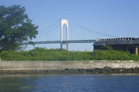
I ended my vacation back where it started – in South County. I joined the RICKA trip in Wickford.  We padded the backwaters around Rabbit and Cornelius Islands, and then paddled along the breakwater into Wickford Harbor and around Wickford Cove. 

Links:

Friday, July 28, 2017

Newport/Kings Beach and Gooseneck Cove Marsh - July 28, 2017

Looking out from the put-in
I’ve been working my way through the Newport launch sites on Rhode Island Blueways, and today I got up early to paddle among the rocks at Kings Beach off Ocean Drive. 

Kings Beach is is typically a sea kayak put-in since conditions can change quickly due to tides and weather. To the west is Brenton Point and the East Passage of Narragansett Bay. To the east is the rocky coast along Ocean Drive and the Cliff Walk. 

Cormorants on the rocks
The sea was relatively calm when I arrived with 1-2 foot rolling waves. Unfortunately, fog was rolling in as I launched, and visibility eventually dropped to zero, so I was forced to return to the put-in. With my original trip cut short, I decided to paddle Gooseneck Cove Marsh at Green Bridge, to the east of King’s Beach on Ocean Drive.

Gooseneck Cove Marsh is a wetland that has undergone a 10-year restoration by Save the Bay. A dam was removed and culverts installed along Ocean Drive to improve the flow of sea water into and out of the marsh. I put in at Green Bridge and paddled up the marsh as far as Hazard Road. Green Bridge would also be a good place to put in to paddle the ocean since it would avoid the paddle around Price Neck to the west of Kings Beach - I may try that next time.

Old boat in Gooseneck Cove Marsh
Links:

Thursday, July 27, 2017

Newport/Fort Adams - July 27, 2017

Fort Adams
It was another nice morning, so I headed back to Newport to check out the put-in at Fort Adams. 

Fort Adams was established in 1799, and the current fort was built from 1824 to 1857. During World War II, Fort Adams was part of a network of coastal forts that protected Narragansett Bay including Fort Greble on Dutch Island and Fort Wetherill, Fort Hamilton on Rose Island, and Camp Cronin on Point Judith.

Newport Folk Festival Stage
In 1965, the fort and most of the surrounding land was given to the State of Rhode Island for use as a state park. The park is best know for hosting the Newport Jazz Festival and Newport Folk Festival.  The park was preparing for the Newport Folk Festival the day I paddled by.

I paddled out past the fort and into the east passage before paddling back to check out the harbor.

Newport Harbor
Links:

Wednesday, July 26, 2017

Newport/Rose Island – July 26, 2017

Newport Harbor (Goat Island) Light
After several rainy days the sky finally cleared, so I headed over to Newport to paddle out to Rose Island.

I put-in at the Washington Street Boat Ramp, paddled out through the Goat Island Marina, and past the Newport Harbor (Goat Island) Light. The first lighthouse was constructed on Goat Island in 1823, but it was moved to Prudence Island in 1851 where the structure still remains as the Prudence Island Light. The current Newport Harbor Light was constructed in 1842.

Rose Island Light
I paddled out into the channel for the 1-mile crossing to Rose Island. With its strategic location on the East Passage of Narragansett Bay, fortifications were constructed on Rose Island as early as the American Revolution. In 1798, the U.S. government began constructing Fort Hamilton on Rose Island. Like Fort Adams, Fort Greble on Dutch Island, Camp Cronin on Point Judith and Fort Wetherill, Fort Hamilton was a coastal defense battery during World War II, and was also used store explosives as part of the Naval Torpedo Station.

With increased shipping traffic around Newport in the mid-1800s, Rose Island seemed like an ideal place to build a lighthouse. The Rose Island Light was completed in 1870. The lighthouse stands atop a bastion of Fort Hamilton, which was built in 1798-1800. The wooden keeper's dwelling features a mansard roof with an integrated 35-foot light tower.

Barracks from Fort Hamilton
The government stopped using Rose Island as a military base after World War II. After the Newport Bridge was completed in 1969, the lighthouse was also abandoned and fell into disrepair. 

In 1984, the Rose Island Lighthouse Foundation was established to restore the lighthouse. The lighthouse now functions as a bed & breakfast, and the island is a wildlife refuge. 

Newport Bridge
Links:

Monday, July 24, 2017

Waves at Black Point - July 24, 2017

With rain and winds out of the northeast, there will be no paddling for me today.  I knew it, but just to convince myself, I went down to Black Point to see the waves.  Yup...

Sunday, July 23, 2017

Snug Harbor – July 23, 2017

Winds from the northeast
It was high tide, and my original plan was to paddle down to Potter Pond. It seemed fine as I left the cottage, but by the time I reached Snug Harbor, a strong wind from the northeast was kicking up 1 to 2 foot waves. I paddled into the inlet behind Snug Harbor, but never made it to Potter Pond. I decided that paddling back to the cottage into the wind would be enough of a workout today. I crossed over to the east side of Great Island at Galilee, and did my best to stay out of the wind on the way back up to the cottage. I made it back fine, but it was a slog!

Fishing boats in the Port of Galilee
Links:
My Pictures

Point Judith Pond with RICKA – July 22, 2017

Put on at the Upper Pond
It was a beautiful day, so I decided to join the RICKA crew on a joint Flatwater/Sea Kayak trip on Point Judith Pond. I paddled up to Marina Park in the Upper Pond where the group was meeting. We had twelve boats, and the toughest part of this trip was launching at the busy boat ramp.

In all the years we have been staying at the cottage, I've never done an end-to-end trip on Point Judith Pond. We headed out of the Upper Pond, and headed down the the east side of Point Judith Pond along Harbor Island, Ram Island and Great Island. 

Ready for the crossing
On entering the Port of Galilee, we bobbed in the waves and debated where to stop for lunch.  We finally decided on the beach in Jerusalem.  Of course, that meant crossing the busy boat channel.

From there, we paddle up the west side of the pond along Snug Harbor to Plato where we crossed the busy boat channel again.  I stayed with the group until we reached Gardener Island, and then I headed back to the cottage. 

Lunch at the beach in Jerusalem
Links:

Friday, July 21, 2017

Harbor of Refuge – July 21, 2017

Harbor of Refuge from Camp Cronin
After several aborted attempts due to fog, I finally got to paddle around the Harbor of Refuge from Camp Cronin. Its not a long trip – about 3 miles, a mile each leg – but its great for paddling in waves.

Construction of the Harbor of Refuge, which protects the Breachway and the Port of Galilee, began in 1890 with the construction of the east and west jetties. The breakwater was not completed until 1910 with the completion of the center jetty.

Fisherman on the east jetty
During World War II, much of the land on Point Judith was part of Fort Greene, a major coastal defense battery that included what is now Camp Cronin. Named for Revolutionary war hero Nathanael Greene, Fort Greene was part of a network of forts protecting Narragansett Bay including Fort Adams in Newport, Fort Greble on Dutch IslandFort Weatherill in Jamestown, and Fort Hamilton on Rose Island.

There were a couple of fishermen on the rocks when I put in at around 6:30. The tide had just peaked and was going out. I was paddling into 1-foot rolling waves along the east side of the jetty. When I reached the east passage the wave increased to 2-feet - it's easier and less stressful at low tide.

Waves breaking on the center jetty
I hurried across the east passage, and was amazed how much of the center jetty was missing or underwater. Birds were everywhere, and waves were breaking on the rocks and flowing through the openings. By the time I got to the bend at the center, the east side seawall was almost gone.

As I paddled down the west jetty the waves were coming from behind. When I reached the west passage, I stayed out of the main channel and headed toward Salty Brine Beach and the Breachway. The Block Island Ferry pulled in just as I reached the Breachway. From there, I paddled perpendicular to the waves along the beach past Sand Hill Cove, and back to Camp Cronin.


Block Island Ferry in the Breakaway at Salty Brine Beach
Links:

Thursday, July 20, 2017

Saugatucket River – July 20, 2017

Saugatucket River
The sky was clear and the birds were singing, and since we were going to RiverFire, I decided to paddle to the upper Point Judith Pond and then up the Saugatucket River.

The Saugatucket River arises in North Kingstown and flows south through South Kingstown before flowing into the Point Judith Pond at Silver Spring Cove.

Main Street Dam
The lower section of the Saugatucket flows through a pretty saltwater swamp.  I passed Mews Tavern and squeezed under two blow-downs before I reached the Main Street Dam – the end of the tidal river.

I thought about portaging around the dam, but it looked like a lot of work for a river choked with weeds.  I was proved right when I saw it from the top at RiverFire that night.

RiverFire in Wakefield
Links:

Wednesday, July 19, 2017

SUPing in Wickford – July 19, 2017

Justin and Michelle had come to the RICKA Paddle Board demo at Lincoln Woods last summer and liked it, so we decided to try it again.  We rented paddle boards at the Kayak Centre in Wickford, and explored the Wickford Cove. The wind was to our back on the way out, but made it a little more challenging on the way back in.


Links:

More Fog in the Morning – Camp Cronin and the Narrow River – July 19, 2017

Point Judith Light in the fog
I got an early start and headed down to Camp Cronin.  Just like yesterday, it was too foggy to paddle, but I did take some pictures before heading off to my alternative paddling location – the Narrow River.

The Narrow River, also known as the Pettaquamscutt River,   originates in North Kingstown and flows south into Narragansett Bay at the Narrows above the Narragansett Town Beach.

A fisherman in the Narrows
I put in at the Sprague Bridge on Boston Neck Road, and paddled south toward the Narrows. At the Narrows, a lone fisherman stood in the waves breaking along the beach.  I paddled out to get some pictures of the rocks at Cormorant Point before heading back. 

Above the bridge is the John H Chafee Wildlife Refuge. Established in 1973, the refuge at Pettaquamscutt Cove includes over 550 acres of wetland that attracts bird of all species. I was sad to see that the little red cottage that had been falling into disrepair for many years had been removed.  Too bad – it made a nice picture.

The little red cottage is gone - kind of sad...
Links:

Tuesday, July 18, 2017

Fog in the Morning – July 18, 2017

I made three attempts to paddle the Harbor of Refuge at Camp Cronin (6:30, 10:30 and 1:30), but it was too foggy all three times.  Instead, I took a quick spin around the cottage.  Unfortunately, I forgot my camera, so no pictures from me.  Michelle took this one.

Launching from the cottage

Monday, July 17, 2017

Around the Upper Pond – July 17, 2017

Oyster Farm in the fog
It looked relatively clear when I woke up at around 5:00, but by the time I had finished my coffee, a “pea soup” fog had rolled in. I decided to paddle up into upper Point Judith Pond. 

As I paddled past Ram Island, a large oyster farm made and interesting scene in the fog. Aquiculture is becoming a very important industry in Point Judith Pond, and in Potter Pond nearby. 

Boats at Harbor Island
The fog made for some interesting pictures. I stayed close to shore and took my time as I paddled up along Harbor Island. As I paddled around Pine Tree Point into the Narrows, I noticed heavy fog in the marinas in the upper pond. 

Since the fog was beginning to lift in the main pond, I decided to paddle west into Congdon Cove, and south into Smelt Brook Cove, before crossing back to the east side of the pond at Ram Island. From there, it is a short paddle back to the cottage.

Birds in the Narrows
Links:

Sunday, July 16, 2017

Around Great Island – July 16, 2017

Horseshoe Point
For the past five years, we have spent our summer vacation at a small cottage on Horseshoe Point at the tip of Great Island in Point Judith Pond.  As I usually do, I decided to start off my vacation with a trip around Great Island. 

Point Judith Pond is the largest of Rhode Island’s salt ponds - 4 miles long, 1 mile wide, and about 20 miles in circumference. Separated in the south behind sand dunes and barrier beaches, Point Judith Pond is connected to the ocean through the Breachway at Galilee. 

Fishing Boats in Galilee
Great Island is one of two large islands on the pond - the other is Harbor Island.  Great Island is 2 miles long and 1/2 mile wide, and full of summer cottages.  I put-in at our cottage and headed south past Franks Neck, into Bluff Hill Cove, and under the new Great Island Bridge into Galilee.

The fishing village of Galilee was developed in 1935 when the State of Rhode Island dredged out a harbor suitable for commercial fishing vessels.  Unlike other fishing villages that developed into tourist centers, Galilee retains the feel of a commercial fishing village. I checked out the lobster boats and large trawlers that call Galilee home

Snug Harbor Light
I stayed outside the main channel and paddled down to the Breachway that connects Galilee to the Harbor of Refuge.  I crossed over to Jerusalem and paddled up to the large marina at Snug Harbor.  A steady stream of boats was coming down the channel from marinas in upper Point Judith Pond.

From there, I crossed back over to Great Island, and paddled past Thomas Point before returning to the cottage.


Last Buoy before the Breachway
Links:

Saturday, July 15, 2017

Manville Dam - July 11, 2017

Finally made it to a Tuesday night paddle club trip - Manville Dam.  Paddled tandem with Danny in his Explorer.  Good time.

Sunday, July 9, 2017

Pawcatuck - Shannock to Richmond - July 8, 2017

Running Lower Skannock Falls
I was thinking about going up the NH for a low water run on the Winni, but the threat of thunderstorms killed those plans.  Instead, I stayed local and paddled the Pawcatuck from Shannock to Richmond with RICKA.  The sun was out and the river was at a nice level – 2.5’,130 cfs on the Wood River gage.

Since I had the float bags in the boat from the trip to the Deerfield, I decided to run the the Lower Shannock Falls.  It’s an easy line that goes from left to right and then back to left.  I took in a little water in the drops at the end.  After a little bit of surfing below the falls we headed down.

Above the Richmond Dam
This is a short but pretty section of river – about 3.5 miles.  The Carolina Raceway provides a little excitement, and the Carolina Canoe Campsite is a great place to stop for lunch.  Before long we were down at the Richmond Dam.

I’ve run the Richmond Dam several times in the past, so rather than looking myself I asked Chuck if it was runnable. He said it was, so I did.  The drop was a little bigger than I expected, but I ran it fine, and followed up with a little surfing. 

Surfing at the Richmond Dam
Links:
My Pictures

Tuesday, July 4, 2017

Lower Deerfield - July 3, 2017

Over the years, I’ve done a lot of trips on the Lower Deerfield. I can remember my first RICKA trip there with Jim Cole, Alan August and Henry Dziadosz, which was probably back in 2006. 

A few shots from 2006
It’s the perfect trip for an easy summer afternoon – the water moves enough to keep it interesting, but not enough that you need to work too hard. I had a good time there yesterday with Adam, Sandi and Brian. We put in at the Zoar Gap Picnic Area and paddled down to Charlemont Academy.  The river was running at about 1000 cfs, which kept things moving.  Nice day.

It doesn't get much better than this!
Links: