Showing posts with label New Years. Show all posts

Monday, January 2, 2023

Providence - January 1, 2023

I-way Bridge and the Hurricane Barrier
On New Year’s Day there are always a lot of options for trips. Although I should have been more ambitious (something like the Lower Winni), I was leaning toward a trip on the Upper Winni with Conrad. A trip with the CTAMC led by Paul D. on the Crystal section of the Farmington was also in the running. In the end, the decision was easy since I had to stay local due to family obligations. I decided to take my kayak out for a trip on the Providence River.

The Providence River is formed at the convergence of the Woonasquatucket and Moshassuck Rivers. It flows south through downtown Providence for a mile to its convergence with the Seekonk River at Bold Point/India Point. It then opens up into Providence Harbor.

Approaching the convergence of the
Woonasquatucket and Moshassuck Rivers
I put-in at 11:30 at Bold Point in East Providence and headed out across Providence Harbor towards the I-way Bridge and the Fox Point Hurricane Barrier. The wind was from the west producing small wind-blown waves, and the tide was going out so the current was strong at the mouth of the Seekonk River and at the Fox Point Hurricane Barrier. I passed through the hurricane barrier and into downtown Providence.

In the heart of Providence the river passes along the Riverwalk. I paddled up past the convergence of the Woonasquatucket and Moshassuck Rivers and into the Cove at Waterplace Park before heading back down through the city and back to Bold Point. It was a mellow paddle, but at least I was out on the water on New Year's Day.


Downtown Providence
Links:

Saturday, January 1, 2022

Blackstone Gorge - January 1, 2022

Heading out
There were lots of options for a New Year’s Day/First Day paddle – the Winni, Tville, Crystal or the Ware. After hiking yesterday I decided that I wanted to stay close to home, so I paddled the Blackstone Gorge with the RICKA crew.

We put in at the Rolling Dam and paddled up to Millville. We had six boats – 2 canoes and 4 kayak’s. The temperature was a balmy 50-degrees, there was mist on the water which added a magical touch, and the rain held off until we packed up to leave. Nice way to start 2022.

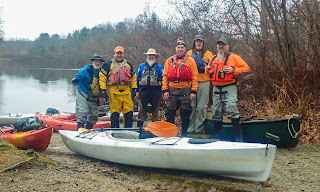
The crew - Steve, Erik. Earl Jim, Frank and Chuck
Links:

Saturday, January 2, 2021

New Year's Day on the Upper Winni - January 1, 2021

Heading out
New Year’s Day trips are a tradition for many northeast boaters. The superstitious among us believe that in order to have a good paddling year you must be out on the water on New Year’s Day. I don’t take it that far, but I do try to get out on January 1st whenever I can. This year I decided to join Jonathan, Conrad, and Nancy for an Icicle Run on the Upper Winni.

The Winnipesaukee River (otherwise known as the Winni) is a 10-mile river that that runs from Lake Winnipesaukee to Franklin where it joins with the Pemigewasset River to form the Merrimack. There are two whitewater runs on the Winnipesaukee. The Upper Winni runs from Tilton Road to Riverfront Park in Tilton. It’s an easy class I/II run that is the site of an annual slalom race. I have run it many times in the past. The Lower Winni runs from Cross Mill Road Bridge to Trestle View Park in Franklin. Its a class III(+) run that is above my comfort level in my canoe, but I did it a few years ago with the MVP in a shredder.


Running Cribworks
With the annual New Year’s Day release the river was at a nice level – 4.4 feet, 1,100 cfs. We met at 10:30 at the Holiday Inn on Route 140 (the usual put-in was iced in) for the shuttle. Jonathan suggested that that we walk-shuttle the 2-miles from the take-out across from River Front Park (behind the train museum) on the Winnipesaukee River Trail, which runs parallel to Route 3 from a little above Tilton center to Route 140. It worked great, and we met the group at noon as planed.  

Canoes outnumbered kayaks on this trip with 5 canoes (Jonathan, Nancy, John, Ken and Erik) and one kayak (Conrad). The river starts off with quickwater along Route I-93. The first railroad bridge starts the slalom course through First Trestle and Cribworks, followed by Second Trestle and waves below the School Street Bridge. It took us two hours to do the run, playing as we went.


The crew takes a socially distanced break
Links:

Wednesday, January 1, 2020

New Year's Day on the West River – Northbridge – January 1, 2020

Forgot my hat, so the helmet had to do!
“Winter is not just about skiing”. That’s what Jo-Ann told a reporter from the Hartford Courant who came to get some pictures of our 2015 New Year’s Day trip on the Tville section of the Farmington, and she was right. New Year’s Day runs are definitely a tradition around here, and some consider it bad luck if you are not out in your boat on January 1st.

This year I had the usually options for whitewater runs including the Upper and Lower Winni, Tville and Crystal. In the end, I decided to stay close to home and do a section of a river that I had not done before – the West River in Northbridge. Although Bill is not big on cold weather paddling (he has become more of a winter hiker), he agreed to paddle tandem with me. 

The crew at Harrington Pool Picnic Area
The West River is a 13-mile long tributary of the Blackstone River. It originates at Silver Lake in Grafton, and flows though Northbridge and Uxbridge before entering into the Blackstone south of Wheelockville (above Route 122) in Uxbridge. After devastating floods in the 1950’s, the Army Corps of Engineers constructed the West Hill Dam on the West River in 1960. The dam includes a 567-acre reserve upstream in the towns of Uxbridge, Northbridge and Upton.  

We met 717 Mendon Road in Northbridge, and carted out boats down to the put in below the bridge. The river twists and turns through the backwaters of the West Hill Dam. We paddled about a mile down to the Harrington Pool Picnic Area. We talked about portaging over the street and down to the dam, but decided instead to find a sunny spot out of the wind and take a break. Then we headed back up stream to the put in. From there, most of the crew continued upstream of another mile, but Bill, Louise and I decided to call it a day. It was a fun and easy way to start the New Year, and just enough to guarantee good paddling mojo in 2020.

A pretty section of the West River
Links:

Sunday, January 1, 2017

New Year’s Day on the Housatonic – January 1, 2017

West Cornwal Covered Bridge
One of the rivers that has been on my to-do list for a while is the Housatonic.  When I saw that a group would be paddling it on New Year’s Day, I decided to tag along. 

The Housatonic originates in the Berkshire Hills of western MA and flows south for 150 miles along the western border of MA and CT before emptying into Long Island Sound.  There’s lots of great paddling along the Housatonic River. The best-known whitewater section is a class IV run known as Bulls Bridge - it's well above my skill set.  There is also a pretty flatwater section from Ashley Falls (MA) to Falls Village (CT), and a nice quickwater run from Falls Village to Kent.  We would be running part of the quickwater run – putting in above the Covered Bridge in West Cornwall, and taking out at the at Housatonic Meadows State Park.

Running the Covered Bridge Rapid
The day was sunny and traffic was light as I did the 3-hour drive out to western CT.  A light snow covered the Northwest Hills as I met the group at the Covered Bridge in West Cornwall.  We ran the shuttle, dropping our boats off on River Road above the Covered Bridge, and leaving cars at the picnic area below the campground at the Housatonic Meadows State Park.  The river was at a medium-low level – 3 feet, 900 cfs. I guess you can run it down to about 500 cfs, and medium flow is around 2,000 cfs.

The West Cornwall Covered Bridge was first constructed in 1762, and is one of the earliest bridges across the Housatonic River.  Beneath the Covered Bridge is a short class I/II rapid known appropriately enough at the “Covered Bridge Rapid”.  This is the site of an annual spring slalom race.  We spent some time playing in the rapids before heading downstream.

Playing in the Covered Bridge Rapid
A little ways below the Covered Bridge Rapid is a shorter class I/II rapid known at the Ledges.  From there, the river alternated between flatwater, quickwater and riffles.  It took us a couple of hours to do the 5-mile run. 

I’d love to come back in the summer and spend a night or two at the Housatonic Meadows Campground.  We could paddle from Falls Village to the campground on day 1. Paddle from the Campground to Kent on day 2.  And maybe even do the section from Ashley Falls to Falls Village on day 3.  We’ll see.

A pretty section of the Housatonic
Links:

Saturday, January 2, 2016

First Swim of 2016 – Winni Icicle Run – January 1, 2016

The boats are loaded
As I was driving up to New Hampshire I heard a report on the radio about all the college football “bowl games” that would be played on New Year’s Day.  The final comment was that it would be a “great day to hang out on the couch”.  I don’t think so!  I was on my way up to First Day in Franklin to paddle the New Year’s Day Icicle Run with the Merrimack Valley Paddlers.

New Year’s Day trips are a tradition among northeast whitewater paddlers, and probably many others.  I’ve spent New Year’s Day on the Branch River, at Fife Brook on the Deerfield, and at Crystal and Tville on the Farmington.  This would be my first run at the best known of these events – the Merrimack Valley Paddler (MVP) run on the Lower Winni. 

At the put-in
The Winnipesaukee River (otherwise known as the Winni) is a 10-mile river that that runs from Lake Winnipesaukee to Franklin where it joins with the Pemigewasset River to form the Merrimack.  There are two distinct sections of the Winni. The upstream section connects a chain of lakes from Lake Winnipesaukee to Winnisquam Lake, and finally to Silver Lake.  The lower section begins at Silver Lake and passes though Tilton before entering a narrow valley that runs into Franklin. 

There are two whitewater runs as the Winnipesaukee flows through Tilton and Franklin. The Upper Winni runs from Tilton Road to Riverfront Park in Tilton.  It’s an easy class I/II run that is the site of an annual slalom race.  I have run a couple of times in the past. 

The first shredder heads out
The Lower Winni runs from Cross Mill Road Bridge to the Trestle View Park in Franklin.  This is a class III(+) run that is a little above my comfort level in my canoe. When I heard that the MVP would be doing shredder runs, I jumped at the opportunity. This would give me a chance to see the rapids at this higher water level, and what can go wrong in a shredder.  Famous last words!

A shredder is a two-man cataraft designed specifically for paddling big whitewater. It is relatively easy to control with forward and backstrokes, and is very stable as long as you keep it straight and moving forward as you punch through holes and drops.

I
Taking the left line at Coliseum
would be one six paddlers in the MVP’s three shredders.  We met at the Unitarian Universalist Church at the other end of Central Street from Trestle View Park to change and inflate the boats. We then shuttled up to the put-in at the Cross Mill Road Bridge. The river was at a typical level for this event – 4 feet, 1,100 cfs.  Above 1,500 cfs. several of the rapids are rated class IV.  I’d like to do a first run in my canoe at between 500 cfs and 700 cfs.   It’s a relatively short run at about a mile-and-a-half, and most people run it a couple of times. 

The river starts off with waves and rocks as we ran through Snowmobile and Iron Ring.  The first major rapid is known as Coliseum. At higher water levels this can be a very dangerous rapid since about a third of the river channels into the foundation of an old mill building – the “Room of Doom”. At higher water levels there is a centerline that follows a boulder-strewn drop to the left of the foundation wall.  Most paddlers take the left line that catches an eddy and takes you in “Z” pattern through the rapid avoiding the rock in the center. We went left on both runs.

View from the bridge of Zippy's
Another half-mile downstream is the next major rapid – Railroad. The river splits around the center trestle of a railroad bridge with routes on the right and the left.  The left channel is probably easier, but we went right on both runs where there is a 3-foot drop directly below the bridge.  We punched through the drop fine on the first run, but on the second we got turned sideways in the hole.  As we got sucked back into the hole, I hit the current coming down the drop and got swept off the boat. It was a short swim, and fortunately Bob was able to stay in the boat. I was soon back on board and we continued downstream

There were more rocks and waves as we ran through Sulphite to the the last rapid - Zippy's Final Plunge.  The river runs under another railroad bridge – this time with three abutments creating five channels.  The second channel from the left is usually the easiest, with the middle channel being passable at higher water.  We hit the middle channel perfectly on our first run. On our second run, we lined up to run the middle channel, but drifted too far left.  At the last minute we shifted hard to the left and hit the left channel.

First run through Zippy's
We took out at Trestle View Park and enjoyed some hot chocolate and chili between runs.  The Central Street Bridge was closed for most of the morning to allow spectators to watch the paddlers coming through Zippy’s.  It was a great event.


Links:

Friday, January 2, 2015

New Year's Day run at Tville - January 1, 2015

Heading to the put-in
“Winter is not just about skiing”. That’s what Jo-Ann told the reporter from the Hartford Courant who came to get some pictures of our New Year’s Day trip on the Tville section of the Farmington, and she was right. New Year’s Day runs are definitely a tradition around here. Ian said “to have a good year if you’re a whitewater boater, you have to be in the water on the first”. Well, I was!

This year, I had a couple of options for trips on New Year’s Day, but I decided to join a group from the Where’s the Whitewater at on Facebook to run the Tariffville Gorge or Tville section of the Farmington. The run itself is short - just 1.5 miles - but there are play spots for paddlers of all skill levels.  At yesterday’s level (2.1 feet, 900 cfs on the Tariffville gage) it is a class II/III run. The difficulty increases as the level rises.

Running the Ledges
We met at Tariffville Park to run the shuttle down to the take-out on Tunxis Road below the Route 187 Bridge. The temperature was around 30º so we didn’t spend a lot of time hanging around. The river starts off easy with the few small ledges and nice surf waves. The best of these are Cathy’s Wave and the ledge below it. At this water level, you can surf these waves for hours. 

As you enter the gorge the intensity picks up a bit. I ran the Bridge Abutment Rapid to the right, and the rapid approaching the play hole to the left. Below the play hole is a small ledge. I eddied out on the left before ferrying to the middle to run the drop. I ran the ledges further downstream by doing the opposite - eddying out on the right, and ferrying to the left to run the drop. There is a nice surf wave (Typewriter) as the river turns left around an island, but I wimped out and didn't try to surf it. Good time as always – Happy New Year!

The crew takes a break
Links:

Wednesday, January 2, 2013

New Year's at the Blackstone Gorge - January 1, 2013

I was debating where to paddle yesterday, and was leaning toward a long drive out to the Crystal section of the Farmington, but was happy when Earl posted an afternoon trip at the Blackstone Gorge.  I was there two weeks ago, but I just wasn’t up for a long drive anywhere else.  It was pretty with the snow on the ground, but cold and very windy.  We made it up to the gravel bar below the Millville Rapids and called it quits.  Easy paddle, and nice way to start off 2013.

Links:
My Pictures

Monday, January 2, 2012

Almost New Year's on the Willimantic – January 2, 2012

Heading downstream
I started off 2012 on a river that I haven’t paddled in several years – the Willimantic. I pass this river frequently on my way out to the Farmington, but the last time I ran it was with RICKA in April 2007. It was great to paddle it again today.

The Willimantic River is located in northeast CT and flows south along Rt. 32 from Stafford Springs to Willimantic where it joins the Natchaug River to form the Shetucket River. It takes its name from a section just upstream from its confluence with the Natchaug where the river drops of ninety feet in a mile. This section was named "Wilimentuck" (land of swiftly moving waters) by the Native Americans who fished there. Almost the entire river (24 miles) can be paddled, except for the dammed section in the city of Willimantic, which has been proposed as a future whitewater park.

A typical section of quickwater
We had a nice group of paddlers - two canoes (Erik and Tommy) and five kayaks (Earl, Frank, Al, Brian and Natalie). We met and Nye-Holman State Park at 10:00 to run the section from Plains Road to Merrow Road - about 8 miles. After running the shuttle, we got on the river around 11:00. The level was OK – 4.2’, 400 cfs on the Coventry gage. This is a fun level, but just about the minimum for a fluid run.  We had to be careful not to get hung up on the many rocks lurking just below the surface. It would have been a great level for poling.

The river starts off narrow and rocky as it twists and turns through a pretty hemlock forest. Small riffles and easy rapids alternate with quickwater for most of the run. Below the Nye-Holman State Park (where we stopped for lunch) the river widens out, but is still shallow. There are a couple of easy surf waves below the Route 195 Bridge, and we did our best to take advantage of them. We arrived at the take out at Merrow Road at around 3:00. Nice run – great way to start off the new year.

Surfing a wave below the Route 195 Bridge
Links:

Paddling on the Willimantic from the Willimantic River Alliance
Coventry Gage

Saturday, January 2, 2010

A New Year Begins - Farmington River - Jan. 1st

Jeff, Andy, Steve and I headed out to the Farmington River yesterday for a New Year’s Day run from Collinsville down to Route 4 in Farmington. The open boats were outnumbered on this trip – 3 canoes, 13 kayaks - but definitely a nice group. The level was OK (950 cfs), but nothing spectacular – mostly a class I. Crystal had some nice surf waves, and Boateater was a fun ride.


I can report that the First Swim Award for 2010 goes to.....(insert drum roll here).....Andy - but only to check for leaks in his new drysuit. No leaks were reported.


Scenery was pretty with new snow on the ground, but it was colder than I expected.

Hope everyone has a great 2010.

Links:
My Video
River Description from American Whitewater