Showing posts with label Hiking. Show all posts

Wednesday, August 12, 2026

Woodward Forest - August 12, 2026

Heading out
The mid-week hiking crew (Bill, Al, Danny and me) was out again. This time at the Woodward Forest in Norton, MA.

We met at the trailhead at the end of Gateway Lane. The trails are mostly compacted ground through Hemlock and Beech trees. We hiked about 2.5-miles, and then went out for breakfast at the Hanger 12 at the Mansfield Airport.

The crew - Bill, Al, Danny and Erik
Links:
My Pictures
Land Preservation Trust of Norton
Trail Map

Thursday, August 6, 2026

Hiking at Lincoln Woods - August 5, 2026

I found a walking stick
The mid-week hiking crew with Bill, Alan, Danny and Nancy was back at Lincoln Woods State Park yesterday for a 5-mile hike.

Lincoln Woods is RI’s oldest state park. It opened in 1909 after acquiring farmland and woodlots from the Olney, Arnold, Comstock, and Mitchell families. Over the years, it has grown to 627-acres around Olney Pond bordered by Route 146 to the west, Breakneck Hill Road to the north and Great Road/Route 123 to the east.

Danny at the stone steps
This time Bill took us further out into the woods out near Breakneck Hill Road. In addition to large boulder outcroppings, we found old foundations, stairs carved into the bedrock and other remnants of the old homesteads from the days before this became a state park. And we didn’t get lost - too often.

Breakfast after the hike was at the 9 Twenty Cafe in Lonsdale.


The crew - Alan, Bill, Erik, Danny and Nancy
Links:

Thursday, July 23, 2026

High Rock Area in the F. Gilbert Hills State Forest - July 23, 2026

At the Stone Staircase
This week’s hike with Bill and the crew was at the High Rock Area in the F. Gilbert Hills State Forest. We met near the Southeastern Massachusetts Emergency Communications Center (SEMRECC) at 100 High Rock Rd, Wrentham. We did a 4.5-mile loop down a section of the Warner Trail that includes the Stone Staircase (one of many structures built by the Civil Conservation Corps in the 1930’s), over to Sunset Ledge, past the Dolmen Rock and finally over to the shelter near High Rock before returning to the cars. We stopped for brunch at the Commons Neighborhood Eatery in Foxborough. 

Thursday, July 9, 2026

Back to Diamond Hill - July 8, 2026

It was just me and Bill hiking yesterday at Diamond Hill. We are getting better at navigating. The loop Bill mapped out was supposed to be 3.5-miles - we ended up doing around 4-miles. Breakfast after at Modern Bistro.

Thursday, July 2, 2026

Mercy Woods - July 1, 2026

Checking the map
I met up with Bill and Nancy for another hike very close to my house – Mercy Woods.

The Mercy Woods is a Cumberland Land Trust property that has 5.7-miles of trails including the Mercy Loop (2.3-miles), the Ridge Trail (2.1-miles) and the Stone Wall, Fisher, Fern, Fiske, Deer and Grape connecting trails. A short section of the Ridge Trail north of the Fern connecting trail is also part of the Warner Trail connecting Sharon, MA to Diamond Hill.

Trail through the ferns
We met at 8:00 at the trailhead on Sumner Brown Road and headed to the south on the Mercy Trail. At the southern end, we cut down to the Diamond Hill Reservoir along a section of the Warner Trail before heading back up one of the connecting trails to the Mercy Trail. Overall we did a little over 4-miles.

After the hike we went out for breakfast at Ollie's Dinner. Nice way to start the day.

Links:

Wednesday, June 24, 2026

Diamond Hill Managment Area - June 24, 2026

Diamond Hill Management Area
Today’s hike couldn’t have been much closer to my house. We hiked at the Diamond Hill Management Area in Cumberland.

Diamond Hill is a 400-foot outcropping of white quartz located in Cumberland on the border with Wrentham and Plainville. In the 1930's the Civilian Conservation Corps acquired land on both sides of Diamond Hill Road and established the Diamond Hill Reservation. Eventually, the land was transferred to the State of Rhode Island. The Town of Cumberland now owns Diamond Hill Park on the east side of Diamond Hill Road. The state still owns the Diamond Hill Management Area on the west side of Diamond Hill Road. 

Navigating the trails
The Diamond Hill Management Area includes about 400-acres bounded by Burnt Swamp Road to the north, West Wrentham Road to the west, Nate Whipple Highway to the south and Diamond Hill Road to the east. It is a wooded area with rolling hills and granite boulders that has a maze of hiking and mountain biking trails.

Our intention was to follow the Scout Trail - about a 5-mile loop. Bill and Al had the map downloaded on their phones, but it was tough even with the map and we were often off on side trails. There was a lot of discussion about how to get back to the cars, but teamwork and a good sense of direction got us through. Nice hike and a lot of fun.

The Scout Trail - not sure how much of this we actually followed

Friday, June 19, 2026

Blue Hills Reservation – June 18, 2026

Top of Buck Hill
I joined Bill, Al and Nancy for another nice hike – this time led by Nancy at the Blue Hills Reservation. The 7,000-acre Blue Hills Reservation stretches from Dedham to Quincy and includes more that 120-miles of trails. There are 22 hills in the Blue Hills chain with Great Blue Hill being the tallest at 635-feet. We would be climbing Buck Hill at 493-feet

We met at 8:30 at Triboro Plaza to carpool up to the Houghton’s Pond Recreation Area. I couldn’t help thinking about all the times I drove by the exit for Houghton’s Pond on the way to work. It was nice to be able to stop and visit. After a quick stop at the Visitor Center to pick up a trail map we headed out.

View of Boston from Buck Hill
Nancy led us on the Buck Hill Red Dot Trail to the top of Buck Hill. We then came down the Summit Trail, to the Forest Path White Triangle Trail and back on to the Buck Hill Red Dot Trail – about 5-miles. The trails were moderately strenuous with some rocky sections and lots of hills to climb, but the view of the Boston skyline from the top of wind-swept Buck Hill was pretty amazing. Again, I was glad to be on the hilltop looking at the office buildings of Boston rather than working in them.

We stopped for lunch at the Hillside Pub in Canton. Next week we will hike at Diamond Hill, but I would like to come back here again sometime. 

Wednesday, June 10, 2026

Hiking at Lincoln Woods - June 10, 2026

I joined Bill, Alan and Nancy for a early morning hike at Lincoln Woods State Park.

Lincoln Woods is RI’s oldest state park. It opened in 1909 after acquiring farmland and woodlots from the Olney, Arnold, Comstock, and Mitchell families. Over the years, it has grown to 627-acres around Olney Pond bordered by Route 146 to the west, Breakneck Hill Road to the north and Great Road/Route 123 to the east.

We would be hiking the Lincoln Woods Trail, which loops around the northern end of the park. 
It is a very pretty woodland littered with large glacial erratics. It is also a maze of unmarked trails and we pretty quickly got off course. We still did about 3.5-miles, and then went out for breakfast at 9 Twenty Cafe in Lonsdale.

Sunday, March 8, 2026

Noon Hill - March 8, 2026

Foggy as we headed out
Temp’s are warming and the rivers are starting to ice out, but with my sore knee I decided to join Papa Joe for his hike at Noon Hill in Medfield, MA.

Noon Hill is a Trustees of Reservations property with a prominent summit and scenic vista surrounded by 204-acres of open space. It offers 4.5 miles of hiking trails and is part of a larger network of open space that includes the Shattuck Reservation along the Charles River. A system of trails spans the two properties, some of which are part of the Bay Circuit Trail.

Selfie with the crew
It was a foggy morning as we headed out from the parking lot at 158 Noon Hill Road in Medfield. We followed the yellow trial to the red trail to the top of Noon Hill. At 370-feet, Noon Hill rises gently above the surrounding landscape giving great views to the southeast of neighboring Walpole and Norfolk.

From there the followed the red trail back to the yellow trail as we looped back to the parking lot. Distance was only 3-miles, but with the partially frozen snow, the footing wasn't the best.

The crew at the summit of Noon Hill
Links:
My Pictures
Noon Hill Reservation
Shattuck Reservation

Saturday, January 31, 2026

Snowshoeing at F. Gilbert Hills State Forest - January 31, 2026

Warner Trail
I’ve been nursing a sore knee for a couple of months, so I probably should have skipped this trip. Then again, conditions were just about perfect, and it was only a half-hour from my house, so I made a last-minute decision to join Papa Joe and the crew for a snowshoe hike at the F. Gilbert Hills State Forest.

The F. Gilbert Hills State Forest (previously known as Foxboro State Forest) is a 1,000-acre site with 23-miles of trails in the towns of Foxborough and Wrentham. It is adjacent to the Harold B. Clark Town Forest to the north, and connects to Wrentham State Forest to the west. The park is also part of the 30-mile Warner Trail that stretches from Sharon to Diamond Hill.

Queued up to break the trail
We met near the Southeastern Massachusetts Emergency Communications Center (SEMRECC) at 100 High Rock Rd, Wrentham, MA 02093. The temperature was around 3-degrees when we headed out, but it got up to around 19-degrees by the time we finished. No one was cold – snowshoeing is a good workout.

We we did a 2.3-mile loop down a section of the Warner Trail that includes the Stone Staircase (one of many structures built by the Civil Conservation Corps in the 1930’s), then over to Sunset Ledge, and finally over to the shelter near High Rock before returning to the cars. Conditions were perfect - nice light powdery snow. It was a great trip, even if my knee was a little sore at the end.


The crew near High Rock

Saturday, November 15, 2025

Borderland State Park - November 15, 2025

I didn’t see any paddling trips today, so I decided to join Papa Joe and the crew for a hike at Borderland State Park. We started at the main entrance and hiked 5-miles up into the woods on the West Side, French and Granite Trails before looping back around Leach Pond on the Pond Walk and Swamp Trails.

The Borderland Estate was established in 1906 when Oakes Ames, a Harvard botanist and his wife Blanche purchased land on the border of Sharon and Easton. There they built a mansion and created a nature preserve with woodland paths, roadways and man-made ponds. The estate remained in the family for 65 years until it was acquired by the Commonwealth of Massachusetts 1971 and opened as a state park. Today the park 
includes 1,843 acres with more than 20 miles of trails including sections of the Bay Circuit Trail.

Links:

Sunday, March 2, 2025

Noon Hill - March 2, 20205

From the top of Noon Hill
It was another chilly morning with no paddling trips that I could see, so I decided to join Papa Joe for his trip at Noon Hill in Medfield, MA.

Noon Hill is a prominent summit and scenic vista surrounded by 204-acres of open space. It offers 4.5 miles of hiking trails and is part of a larger network of open space that includes the Shattuck Reservation located to the northwest along the Charles River. A system of trails spans the two properties, some of which are part of the Bay Circuit Trail.

Along Holt Pond
We headed out from the parking lot at 158 Noon Hill Road in Medfield. At 370-feet, Noon Hill rises gently above the surrounding landscape giving great views to the southeast of neighboring Walpole and Norfolk.

Icy conditions along with rocks and roots that could snag on micospikes made the trails a little treacherous. We followed the trail over to the Shattuck Reservation, and then around Holt Pond to return to the cars. Distance was 4.1-miles.

Links:

Saturday, January 20, 2024

Gardner Hill Town Forest - January 20, 2024

It was too cold for paddling this weekend, so I decided to join Papa Joe and the crew for a hike at the Gardner Hill Town Forest in Stow, MA.

We met at the main parking lot at 86 Bradley Lane in Stow. Gardner Hill includes over 200 acres of white pine forest with lots of interesting glacial features. The 4.1-mile hike took us along Elizabeth Brook and the Assabet River, and then up the wooded summit of Gardner Hill.

Saturday, December 9, 2023

Noanet Woods - December 9, 2023

Noanet Peak
It has been a while since I have been out on a hike, and I didn’t see any paddling trips today, so I decided to join Papa Joe and the crew at Noanet Woods in Dover, MA.

Noanet Woods has 17 miles of trails adjacent to the Hale Reserve. We started our hike at the Powissett Street entrance and hiked into the Hale Reserve. From there, we hiked over to the Mill Ponds to check out the old mill site and dam. Then, we hiked up to the Noanet Peak to check out the view of Boston before heading back to the cars.

Sunday, October 22, 2023

Moore State Park - October 22, 2023

Artist Overlook on Turkey Hill Brook
My original plan was to do a Tville run with the CTAMC, but with yesterday’s rain the river rose from 2.5-feet to 4.5-feet overnight. I knew it was too high for me, and wasn’t surprised when I got an email that the trip was cancelled. Fortunately, Papa Joe was doing a hike at the Moore State Park.

Moore State Park (290 Sawmill Road, Paxton, MA) has 400-acres of well-maintained trails through open fields and woodlands.The section along Turkey Hill Brook, which falls 90-feet in less than a quarter mile, was once the home to at least five 18th and 19th century mills. Old foundations and a restored sawmill stand on the site today. In the early 20th century, the property became a private estate and was heavily planted with azaleas, rhododendrons, and mountain laurels.

The crew
We started on the Davis Hill Field and Laurel Loop Trails, which wind through the fields and woodlands across the street from the parking lot. From there we headed up the Azalea Path to the restored sawmill on Turkey Hill Brook, and then up the Old Bringham Road, Secret Garden Loop and Stairway Loop Trails.

We ended up doing 4.6-miles. The leaves were just about peak. I also hear that it is beautiful here in June when the azaleas, rhododendrons, and mountain laurels are in bloom. 

Sunday, March 12, 2023

Moose Hill – March 12, 2023

The crew on the Summit Trail
I was thinking about doing a Tville run today to try out my new drysuit, but the group wasn’t meeting until noon, which would have made for a long day. Instead, I decided to stay close to home and do the Papa Joe hike at the Moose Hill Wildlife
Sanctuary in Sharon, MA.

Moose Hill was established in 1916 and is Mass Audubon’s oldest wildlife sanctuary. Moose Hill has 20-miles of trails through forests, fields, and wetlands. We started on the Summit Trail, which takes you up the to the highest point on the sanctuary - 534-feet with an abandoned fire tower at the top.

View of Gillette from the Bluff Overlook
From there, we worked our way over to the Bluff Trail which includes the Allens Ledge Chimney and the Bluff Overlook with its great views of Gillette Stadium. Shaped by glaciers thousands of years ago, you can still see striations in the bedrock that were left by glaciers.

Billing's Loop was closed for maple sugaring tours, but we worked our way back to the parking lot, and we finished up with a loop around the Vernal Pool Trail. The Bay Circuit and Warner trails pass through this property as well.

Links:
My Pictures
Moose Hill Trail Map

Monday, March 6, 2023

Mercy Woods Preserve - March 5, 2023

The crew - Sue, Mike, Steve and Erik
With a new drysuit on order and a family party scheduled for Saturday, I decided to put a hike on the RICKA Message Board for Sunday at the Mercy Woods Preserve. We met at 9:30 at the trailhead on Sumner Brown Road. We had about an inch of snow on the ground, which was frozen when we headed out, but wet and slushy about an hour later. We did the Ridge Trail to the south and then the Mercy Trail (behind the nursing home rather than along the road) to the north – about 3.5-miles. The hills were a little slick with the wet, slushy snow, but otherwise it was fine. It took us a little over 2-hours.

Links:

Sunday, January 15, 2023

Harold Parker State Forest/Skug River Reservation - January 14, 2023

Paddlers on dry land -
Bob, Erik, Bill and Jonathan
Its been a while since I've been out with Papa Joe and the crew, so I decided to join this week's hike at Harold Parker State Forest/Skug River Reservation. The drive was a little longer than I would usually do for a hike, but I really needed to get out and get some exercise.

The Harold Parker State Forest in Andover includes over 3,000 acres of forest with over 35 miles of logging roads and trails. The area was inhabited by Pentacook Indians until it was settled by English farmers around 1650. By the middle of the nineteenth century the farms were abandoned and the fields have slowly been replaced by woodlands.

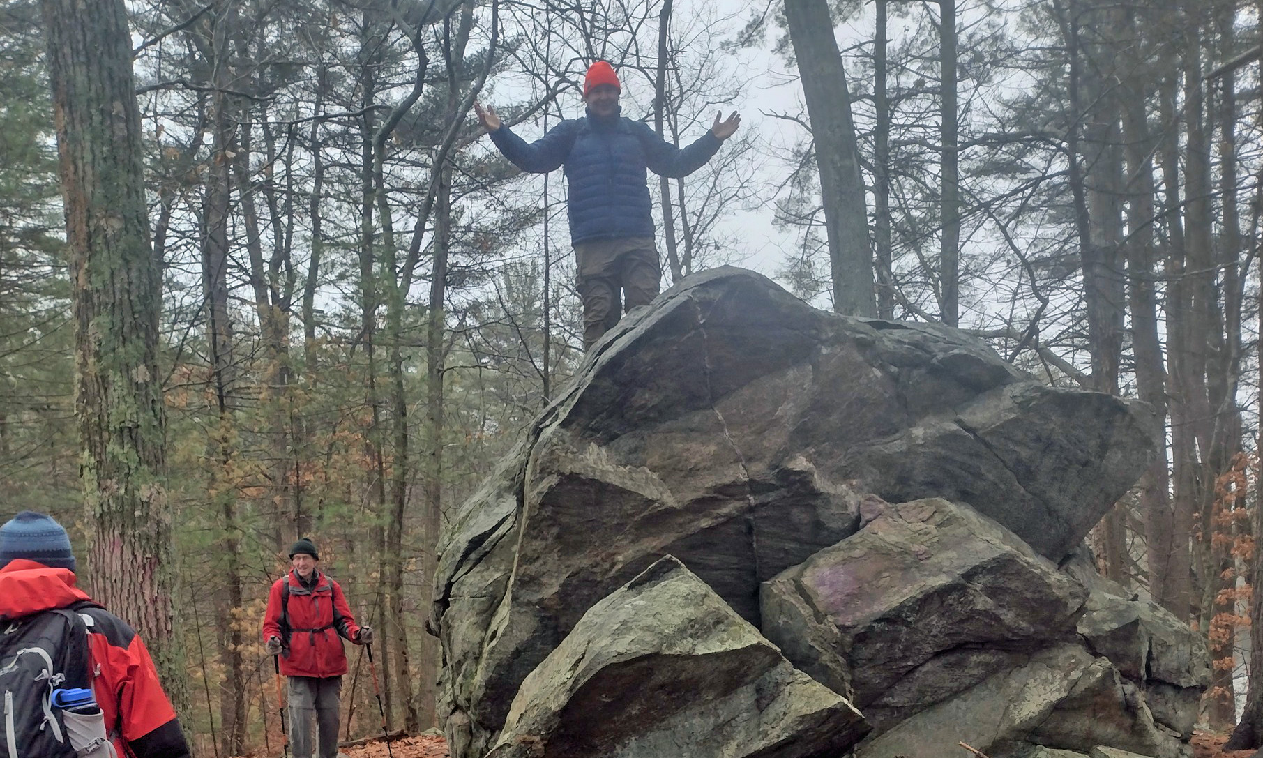
King of the rock -
now how do I get down?
We met at the trailhead at the Skugg River Reservation (315 Salem Street, Andover, MA) and headed out on boardwalks and bridges through the wetlands. The trail eventually climbed into a pretty pine forest as we wove our way around the Delano, Brakett, Field, Collins and Bear Ponds. 

The trail was littered with huge glacial erratics. I used my climbing skills to get up on one, and then had a hard time getting back down. We were on the Bay Circuit Trail for a short time on the way back to the cars. My knee was fine, and it was nice to see Bill, Jonathan and Bob.

Links:

Monday, March 28, 2022

Broadmoor Wildlife Sanctuary - March 27, 2022

I didn’t see a paddling trip, so I decided to join Papa Joe and the crew for what for me would be the last Papa Joe hike of the 2021-22 season at Broadmoor Wildlife Sanctuary.

Broadmoor is a 624-acre Mass Audubon property with 9-miles of trails through a nice mix of woodlands and marshland. We took the Marsh Trail to the Indian Brook Trail, to the Glacial Hill Trail/Loop, to the Charles River Loop, to the Mill Pond and then back on the boardwalks of the All Persons Trail – about 4.5 miles. I was home in time to do some yard work.

Links:

Sunday, February 20, 2022

Hiking the Mighty Quin - February 20, 2022

Along the Mighty Quin
I wanted to do some paddling, but both Pauls had other plans and it ended up being a really cold day anyway, so I decided to join Papa Joe and the crew for one of my favorite hikes along the “Mighty Quin”.

The Quinapoxet River (aka the “Mighty Quin”) arises in Princeton, MA, and is part of the MWRA system supplying drinking water to greater Boston. The Quinapoxet Dam in Holden impounds a billion gallons of water in the Quinapoxet Reservoir. Below the dam, the Quinapoxet River flows 8-miles east to the Wachusett Reservoir, joining the Stillwater River to become the South Branch of the Nashua River in West Boylston. The section of the Quinapoxet from Canada Mills to the Wachusett Reservoir is a well-known whitewater run.

The crew (with half of Al)
We met at the
Mass Central Rail Trail (265 Manning Street, Jefferson (Holden), MA) for a 5.2-mile hike down to the old Springdale Mill. The Mass Central Rail Trail follows the route to the old Massachusetts Center Railroad that connected Boston to Northampton. The rail trail itself was wide and clear, but we broke off into the woods in several places to follow the river. 

I have now done 5 hikes along the Might Quin, but only 4 paddling runs – I'll need to work on that. The river was running a little over 9-feet, which looked low and boney in places, but my open boater friends say it is a good level. I have run it clean at 10-feet (two runs) and 11-feet with a swim at 10.5-feet.

Links: