Showing posts with label canoeswithduckheads. Show all posts

Monday, August 11, 2025

Dead - Spencer Stream to West Forks - August 9, 2025

The boats get loaded
There are rivers that aren’t too difficult if you take the right lines, but can be brutal if you don’t. I was on one of these rivers on Saturday – the Dead in ME, and I paid the price for a bad line on the last rapid - Lower Poplar. My first swim of the year.

The Dead is one of the longest continuous whitewater runs in the Northeast with approximately thirty rapids along a fourteen-mile stretch. The river is mostly boulder-type rapids with lots of holes and pour-overs. The shoreline has thick vegetation that grows right up to the river's edge that can make it difficult to rescue swimmers or bail out an open boat. The major named rapids are:
  • Spencer Rips –big weaves are to the right, big eddy below on left to stop and regroup.
  • Minefield (2 miles) – long boulder garden with big waves and lots of holes – difficulty increases where the river turns left.
  • Hyden’s – (3 miles) good lunch spot – run in middle and stay out of holes.
  • Gravel Pit (4.5 miles)
  • Enchanted Stream (7 miles) – another good lunch spot.
  • Elephant Rock – (7.5 miles) a river wide ledge immediately below Enchanted Stream. You can run the big waves in the center, or the slot on the right between Elephant Rock and the rock wall.
  • Mile Long (8.5 miles) – another long boulder garden with big waves and lots of holes. There is an eddy on the left about half-way down
  • Upper Spruce Ledge (10.5 miles)
  • Lower Spruce Ledge (11 miles)
  • Upper Poplar Falls (11.5 miles) – short but intense rapid filled with rocks and holes. Go right and stay away from holes – stop in big eddy bottom right.
  • Lower Poplar Falls (12 miles) – a longer intense rapid that tumbles down the left side in huge wave trains and large holes. Left is hero line with lots of dangerous holes. The right line along the boulder garden is the usual open boat route.
Heading out
I picked up Paul for the six hour drive up to the Forks. We stayed in a two-person cabin-tent at Northern Outdoors. We had a small fire on Friday before settling in for the night.

We were up early Saturday morning to meet our group and the shuttle. We were paddling with the Penobscot Paddle and Chowder Society - aka the Chowder Heads. We had a group with 13 boats – 6 canoes, 6 kayaks and 1 shredder.

Charlie in one of the unnamed rapids
Old-time Dead River paddlers probably remember Webb’s Shuttle Service run by Ed Webb. Webb's (later Riverdrivers) no longer provides shuttle service, so we met the new shuttle company - Ironbound Outdoors - at 8:00 at the Public Takeout on Dead River Roar in West Forks.

With the large group of MVP'ers running the Dead for a step-up weekend, it took forever to load the boats. We finally got on the road around 9:30, and got to the river about 45 minutes later after a long, bumpy, dusty trip down 20-miles of dirt logging roads. We finally got on the water around 11:00.

Paul running Lower Poplar
The release was supposed to be 2,400 cfs, but was closer to 2,100 cfs with 25 cfs from Spencer Stream - a nice class II/III. At lower levels (1,200 cfs to 1,800 cfs) it is primarily class II except for the very first, and last couple of rapids. At medium levels (2,000 cfs to 3,500 cfs) it is mostly class III. At higher levels (4,500 cfs to–8,000 cfs) it is class IV.

We ran through Spencer Rips, Minefield and some other unnamed rapids before stopping for lunch at Hayden's. Then we ran Hayden's, Gravel Pit and some other unnamed rapids before taking a break at Enchanted Stream. Paul wanted to get some video so I ran the big waves in the middle of the ledge at Elephant Rock rather than the shoot on the right.

Erik running Lower Poplar
The next major rapid was Mile Long – another long boulder garden with big waves and lots of holes I filled my boat about half way down, but was able to empty it in a big eddy on the left before finishing the rapid. After running the Upper and Lower Spruce Ledges we took a break at the Poplar Portage Trail before taking on Upper and Lower Poplar.

Upper Poplar is a short but intense rapid filled with rocks and holes. Most of us ran it to the right and made it through fine. Lower Poplar was another story. The river turns right along a boulder garden as the water tumbles down the left side in huge wave trains and large holes.

Swimming Lower Poplar
Most of the open boats took the right line along the seam between the boulder garden and the big holes. As I was coming down I saw Charlie flip in front of me. I got around him to the left, but now I was  out in the big holes and pour-overs. Before long, my boat was full of water and I was struggling to keep it upright, never mind avoiding the rocks and holes. About half way down, I went sideways over a large rock into a hole, and over I went.

As I swam downstream I looked back to see my canoe still stuck in the hole. That was the least of my problems. Swimming through rapids is something that I try to practice, but it doesn’t match the real experience. First, I swam though a series of “haystacks” or standing waves where you have to breathe in the trough, and hold your breath as you go through the wave - breathe, glug, breathe, glug, breathe, glug.

Reunited with my boat at
the bottom of Lower Poplar
After the waves, I could see a horizon line downstream indicating that I was approaching a rock with a hole on the other side. I tucked into a ball as best I could as I went into the hole. When I came out the other side Paul was yelling at me to swim hard to the left shore since I was approaching another big hole. I wasn’t making much progress so I threw away my paddle thinking that would allow me to swim better. After more waves, rocks and holes, I finally got myself to shore. It was about a 200-yard swim, but it seemed like forever.

After I caught my breath I looked over and could see Paul on the other side of the river with my boat. I was about to jump in the shredder for a ride to the other side when Craig paddled over towing my boat. I had paddled through 30 rapids over 14-miles only to swim the last 200-yards. We had 3 other open boaters swim Lower Poplar, so I guess I shouldn't feel too bad. 


The swim earned me a new poem from Tom.

It’s really not an Outrage,
until one’s stood on end.
But chill we will baptised beginning,
again, again, again.

If that ol’ paddler’s adage, “Ya ain’t really learnin’ unless yer gettin’ wet,” holds any water, we’re gonna have t’call ya, Doctor Dunk, Erik.

Man’s gotta do what a man’s gotta do.
TW

Monday, June 24, 2024

Third Swim of the Year – Pawcatuck River – Bradford to Potter Hill - June 23, 2024

Bradford Fish Weirs
It rained as I drove down, but we ended up with a nice day for our trip on the Pawcatuck River. The last time that we did this trip was in 2020 during COVID, and back then we did a bike shuttle. No need for that this year.

The Pawcatuck River arises at Worden Pond in South Kingstown and flows southwest for 34-miles to Westerly where it flows into Little Narragansett Bay on Long Island Sound. Along with the Beaver, Queen - Usquepaug, Wood, Chipuxet, Shunock and Green Fall - Ashaway, the Pawcatuck received Wild and Scenic River status in 2019. We would be paddling the section from Bradford to Potter Hill – about 8-miles.

Polly Coon Footbridge
I met Bill, Paul, Bob, Aaron and Mike at the put-in at the Bradford Landing. We dropped off our boats and headed down to the take-out at Potter Hill. Parking is available at Post Office Landing – a DEM boat launch across the street from the take-out that is down a dirt road that looks like someone’s driveway. At least they have put a sign up now.

With all the rain over the past few days the river was at a nice level – 3-feet, 200 cfs on the Wood River Junction gage. We put in and headed down to run the Bradford Fish Weirs – a series of six gradually ascending stone steps that replaced the old Bradford Dam. Paul went first and ran the fish weirs clean. Bill and I went next. We hit a rock in the 4th weir, and over we went – 3rd swim of the year for me. Bob ran it last and made it through fine.

Marshland above the Potter Hill Dam
After the Fish Weirs, the river twists and turns through conservation land owned by the Westerly Land Trust and Hopkinton Land Trust. We passed under the Polly Coon Footbridge and continued downstream to the beach off Narragansett Way where we stopped for lunch. Below Route 3 there is more development as the river meanders through marshland formed by the deadwater of the Potter Hill Dam.

The take out is on the Westerly side of the river just above the Potter Hill Road Bridge at the Whiteley Preserve - a Westerly Land Trust property. We loaded up our boats and I drove Bill and Paul back to Bradford to pick up their cars. I forgot to bring my camera, but Mike got some great pictures and video.


Bradford Fish Weirs from Erik Eckilson on Vimeo.

We did earn another poem from Tom.

Bill seemed to hem and haw.
His stirring starboard would get them yawl.
Erik bowed to Bill’s stern grace.
Damp Bradford weirs on them in place.
TW

Links:
My Pictures and Video on Flickr
Mikes Pictures and Video on Facebook
Wood River Junction Gage

Sunday, December 17, 2023

The Christmas Canoe

Another one to save for the future...

Not sure it beats my big red canoe Christmas Story, but it is good. Ray saw this on Facebook and posted about a Quebec beer - La Maudite - that uses the flying canoe as its logo. It evokes the legend of La Chasse-galerie - the flying canoe - that tells the story of men who would made a deal with the devil to fly home in a canoe to spend a night with their loved ones. This also earned another poem from Tom.

a Chasse-galerie,
the Devil put in play.
Feather paddle through sky. Curse words won't fly.
Avec mon cher dans Christmas Day.
TW

Links:

Sunday, December 3, 2023

Santa Paddle at Wickford Harbor - December 2, 2023

Santa's elves are ready to launch
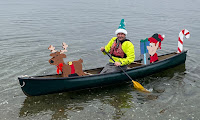
Its that time of the year when Santa visits cities and towns around the country to get kids excited for Christmas. Usually he arrives by fire truck, but in the coastal village of Wickford he arrives by fire boat, and RICKA members dress-up like elves to escort him down the harbor into town. This year, Michelle decided to come along as well to watch and take some pictures 
from shore.

Wickford is located on the West Passage of Narragansett Bay, and is built around a large, well-protected harbor. It was settled in the early 17th century when Roger William purchased land from the Narragansett Indians and established a trading post. Wickford grew to become a major port and shipbuilding center.

This elf is ready to go
Today, Wickford is a picturesque village whose waterfront streets are lined with shops, restaurants and colonial-era homes. Each year the North Kingstown Chamber of Commerce organizes a Festival of Lights with holiday themed actives. Since 2010, RICKA has participated in this event by escorting Santa down the harbor for his big arrival at the Town Dock.

We arrived at the put-in at the end of Main Street next to Gardners Wharf Seafood at around 11:30 to decorate our boats and get our elf hats and candy canes from Pat. At around 12:10, Michelle walked down to the dock and the rest of us headed over to meet up with Santa for the paddle into town. I am always amazed at the crowd that gathers for this event. 


And I got another poem from Tom - this time on Facebook.

What is appeal
neath cone of teal
with a Blitzen towards the bow?
Well is not it pleasant
that behind the present
canoe there's an elfish pal?
TW

Links:

Sunday, March 26, 2023

Branch River - March 26, 2023

Jeff running Whipple Drop
Yesterday I was on the Scantic River to paddle the Scantic Spring Splash. Today I was on the Branch River to paddle the race course for the old Rhode Island Whitewater Championship.

The Branch River Race, later the Rhode Island Whitewater Championship, was established by RICKA in 1980 and was always run on the third weekend in March. It was the first race of the year on calendar of the NECKRA Downriver Series. The race continued for 25 years, but was eventually discontinued due to the high cost of insurance and problems with river access.

Mike running Glendale
RICKA has continued the tradition of running a spring trip on the Branch River. This year we were a week late and the group was small - me, Mike and Jeff. We met at the put-in below the Stillwater Mill at 10:00 to run the shuttle. Since the usual take out is now posted “No Trespassing”, we decided to take out a Mike’s house. The river was at 3-feet, 175 cfs. – low but runnable. The day was sunny and in the high 50’s/low 60's - it felt like spring.

The first half of this trip is actually on the Clear River. There were lots of blowdowns in this upper section. I got spun sideways on one strainer and dumped when the boat moved and I didn’t – second swim of the weekend, and the year. We ran Whipple Drop down the center and continued to Oakland, where the Branch is formed at the confluence of the Clear and Chepachet Rivers.

Jeff running Atlas Pallet
After portaging the Oakland Dam we headed down to Glendale. The Glendale Rapid was shallow and boney, but we bounced down using the left of center line. From there it is a nice quickwater run down to the Atlas Pallet rapid. We ran Atlas Pallet left of center and made it through fine.

The remainder of the trip is quickwater with one portage at the Nasonville Dam. The take-out at Mike's house worked out fine – “head straight for the fire station”. We often call this trip the Branch River "Icebreaker", but there was no ice to break this year!

The crew - Mike, Jeff and Erik - at the Oakland Portage
This picture earned us another poem from Tom on P-net.

!!!
From Idaho,
there’s a ghostly rustle.
Spiratoose Papa,
has grab ahold Mike Bussell!

To Have and Have Not?
I’d say what’s had here’s wicked style,
with The Old Man and I see,
melted Snows of to kill a man Rhode Isle. 
TW

Links:

Saturday, February 11, 2023

Millville Rapid - February 11, 2023

Millville Rapid under the Central Street Bridge
I didn’t see any trips posted for today, and the Papa Joe hike was out in Hingham, so I decided to stay local and take my canoe out for a few laps at the Millville Rapid. 

Millville is one of the oldest, and one of the youngest towns in Massachusetts. Originally settled in 1662, it was organized as Mendon's South Parish in 1766, and became part of the town of Blackstone in 1845. It wasn't until 1916 that it was incorporated as an independent town. 

Historic mills in Millville
Early in its history Millville was primarily a farming community. A saw mill and grist mill were operating along the river by 1725. By 1830, woolen mills lined the banks on both sides of the river and the Blackstone Canal had been completed linking Providence to Worcester (Millville Lock downstream). Growth would continue with the competition of the Providence & Worcester Railroad in 1847 (Triad Bridge site downstream). Millville would eventually become home to a large rubber mill, which would become part of the 
US Rubber Company (later Uniroyal) in 1892. Remnants of this industrial past can be seen in the foundations and mill races along the river.

My original plan was to paddle upstream from the Blackstone Gorge, but the current was strong and it was pretty windy. Instead, I drove up to Millville to put-in upstream of the Central Street Bridge. I parked on Bow Street next to the Post Office and carried my boat down to the river. The river was at a nice level – 3.8 feet on the Northbridge gage, 8.4 feet, 570 cfs on the Rt. 122 gageI did a several runs, but wasn’t very good at catching them on video.


Millville Rapid from Erik Eckilson on Vimeo.

This one earned me another poem from Tom on p.net:

Sixty-four degrees of frost!!!
River bottom’s no longer tossed,
nor shaken, stirred, while on the rocks,
non-migratories stuck there in blocks,

along with depths once on the go,
now one big sheet of H-2-Nooo
you don’t take fresh air facial
or black-n-blue frost bites all glacial!

“I’m just going outside and may be some time.”
(be sure to bring the ponies in)
TW

Sunday, November 13, 2022

Wonalancet River - November 12, 2022

A typical section of the Wonalancet
The remnants of Hurricane Nicole reached New England Friday night with heavy rain that brought up a lot of local rivers. I was thinking about doing a Tville run with Paul and the CTAMC, but instead made a last minute decision to head north to run the Wonalancet River with Frank and the NHAMC.

The Wonalancet River is named for the Pennacook sachem Wonalancet and arises in the Bowl Natural Area in North Sandwich – a glacial cirque lying between Mount Whiteface to the west, Mount Passaconaway to the north, and Mount Wonalancet to the east. It flows 7-miles south and east to join the southern Swift River before flowing into the Bearcamp River, Ossipee Lake, and the Saco River on its way to the Atlantic Ocean. The Wonalancet can be tough to catch, but when it comes up it is considered one of the best class III runs in New Hampshire - a little tougher than the Mighty Quin, but not quite as tough as the middle section at New Boston.

First drop - Forest Run Rapids
We would be running the middle section from Fowlers Mill Road to the “Short Run Take-out” on Route 113A in Tamworth – about 3.25 miles. The level was .9 (dropping to .75 by the time we finished) on the painted gage on the Route 113A bridge - a medium low level. Above 2 the rocks start to disappear and the river becomes more pushy. The Bearcamp River gage in South Tamworth (downstream USGS gage) was at 5.5 feet, 550 cfs.

The river is narrow and creek-like and alternates between class II and III rapids as it twists and turns through the Hemingway State Forest and Big Pines Natural Area. Rock dodging was the order of the day. Stainers are always an issue on this river, and we encountered one river-wide strainer that I portaged – the kayaks were able to paddle through. The most challenging section is the Forest Run Rapids, which we scouted before running down the center. Three-hour drive each way, but so worth it.

Second drop - Forest Run Rapids

I made a comment on p-net about not getting out in my sea kayak much, and earned another poem from Tom - my new favorite:

The seas immense they dwarf all lands,
they heave in waves or doldrum stand,
ebb and rise to beckoning moon,
unfathomable depths intrigue with gloom.

And traverse there in reverent awe,
this salt of earth from such liquid spalled,
finds not la Mer to nurture soul,
but her vast indifference that swallows whole.

So find me along the riverbanks,
where earth and water entwine their flanks,
as springs that rise and skies that weep,
sweep changing braids shallow and deep.

And there like rock and soil and tree,
I, too, can stand a most earthly,
to let myself be swept in flow,
then eddy out in time’s crooked bow.

Monday, May 3, 2021

White - Hancock to Stockbridge – May 2, 2021

Warm and dry to start
It always happens when you least suspect it, and that is why you need to live by the Boy Scout motto – be prepared. Yesterday I wasn’t.

I was joining a group to paddle the White River from Hancock to Stockbridge in VT – (all canoes - 2 tandem, 3 poling and 3 solo). It’s a beautiful, 11-mile quickwater trip through the hills and cow fields of central VT. It’s also a three-hour drive for me, and I was running late. I was the last to arrive at the put-in, and I could tell by the looks when I drove in that the rest of the group was ready to go.

Cold and wet in the middle
As far as I knew the forecast for the day was sunny and warm, but I hadn’t checked in a few days. I didn’t want to hold the group up any longer so I grabbed my boundary boots, left my hat, drysuit and spare cloths in the car, and headed out. It would be fine. Its just quickwater, and the river was at a nice level – 6.5 feet, 3,500 cfs.

About a mile downstream I was navigating through a boney section of quickwater and it happened. I hit a rock and over I went. The recovery was quick, but the damage was done. I was sopping wet. I got my boat to shore, put on my splash top (the only spare cloths that I had) and hoped for the best. I’d be fine when sun came out.

Wet but warm at the end
Unfortunately, the sun didn’t come out. Instead, it started to rain. The clouds increased and we had a torrential downpour. Everyone pulled out their raingear, but I just got colder and wetter. I was able to borrow a hat from Bob, and that helped for a while. When my teeth started to chatter I knew I needed to get some dry cloths. I borrowed a fleece from Jonathan, and replaced the wet shirt under my splash top. That felt much better, and I started to warm up.

Fortunately, the rain eventually stopped, and the sun did come out. By the time we reached the take out it was sunny and warm, but it is still a lesson learned (or an important reminder) – BE PREPARED! Fortunately for me this time, my paddling friends were.

Blue sky at the take out
If nothing else, at least I earned another poem from Tom on p-net:

Whatever doesn’t kill us,
just might make us stronger.
But some so-called friends dip in their dry bags
to address undry bagless so much wronger.

Twas good the hat and fleece of canoe’s companions
was there to unsaturate your fish-count way,
else baggy plaid pants and bridesmaid chiffon you dance,
such friendly fashion sense of ole Mike McCrea.
(Whyyy, he wouldn’t ease yer shiverin’ any other way!)

Just don’t wet-exit a second time, because you don’t want to see what’s inside that purple drybag Sharpied, “Victoria Shoulda Kept It a Secret/Dammit Eric!”
TW

Links:

Monday, November 30, 2020

Nashua River – Ayer to Groton – November 29, 2020

On the Bike Shuttle
Last weekend we were hiking along the banks of the Nashua River in the Groton Town Forest. This weekend we decided to go back and paddle that section of the river.


We would be paddling on the South Branch of the Nashua River, which arises at the Wachusett Reservoir in Clinton, MA and flows generally north for 56 miles through north-central MA and southern NH before emptying into the Merrimack River in Nashua, NH. The North Branch of the Nashua River arises west of Fitchburg and flows generally south for 30 miles until it joins the South Branch near Lancaster.

Approaching Groton Town Forest
This would be the third trip on the Nashua River this year for me, Jonathan and Conrad.  Our first trip was at the
Oxbow Wildlife Refuge in Harvard, and the second was the confluence of the North Branch and the South Branch of the Nashua in Lancaster.  Today we would be paddling the section from Ayers to Groton.  I have also paddled the section of from Groton to Pepperell with RICKA, and the section of the North Branch from Leominster to Lancaster.

We put in at the northern end of the Oxbow Wildlife Refuge (Filter Bed Rd E, Ayer, MA 01432) and took out at the Petapawag Canoe Launch (Nod Rd, Groton, MA 01450) – about 6.5 miles. Jonathan and I did a 6-mile bike shuttle on the Nashua River Rail Trail. The river is pretty with huge pine trees lining the banks. It opens up significantly after the Squannacook River enters at the southern end of the Groton Town Forest.


And I earned another poem from Tom on p-net:

New England river badges,
begin to form its Morningstar.
Like diamond midst the granite rough,
she travels timeless far.

And in the flow path’s oft not seen,
so passage finds scar and scrape.
But pressing on comes wondrous light
through these facets in nature’s shape.
TW

Links.

Tuesday, December 31, 2019

2019 Year End Review

Running Sweet Tooth in 2005
It's hard to believe that it has been 15 years since I started paddling. In the late 80's/early 90's I did some tandem paddling with my father up on the Androscoggin. It was a blast, but with little kids at home there was no time for paddling. I started up again in 2004 and quickly caught the bug. I took the NHAMC Whitewater School in spring of 2005, and bought a whitewater boat (Impluse) and flatwater boat (Yellowstone Solo) later that year. In 2006 I bought a waterproof camera, and the rest is history.

Due to family obligations and a bad cold I missed the traditional New Year's Day trip this year, so my first paddle of 2019 was the Upper Wood River on January 5th with Jonathan. The year started off with more hiking than paddling, but it was still a great year.

The "Mighty Quin"
I did 53 paddling trips for the year, which is a little below my ten-year average of 59 trips. I also did 8 hikes, three camping trips and had five swims (Great SwampFife Brook (twice in one day, bad day), the playhole at Tville, and the Mighty Quin). I only  did two trips with the Blackstone Valley Paddle ClubNipmuc and Slatersville. I did run a Trip Leader Training and trips at Bradford, the Lower Deerfield and Point Judith Pond for the RICKA Flatwater group. I also paddled in all six New England states.

Here are some of my more significant trips:
Here are some of my favorite trips for the year.

Favorite Trips of 2019 from Erik Eckilson on Vimeo.

I paddled almost every day of my summer vacation in South County, including a great trip with Tony on the West Passage and a trip with RICKA on Point Judith Pond

Scenes from  South County Vacation from Erik Eckilson on Vimeo.

I did two camping trips on the Connecticut River with Bill, Conrad and Jonathan - Gilman Dam to McIndoe Falls in the spring.

Camping on the Connecticut River from Erik Eckilson on Vimeo.

And Orford to Wilder Dam in the fall.

Camping on the Connecticut River from Erik Eckilson on Vimeo.

I also did the RICKA Overnight on the Pawcatuck with Bill and Chuck.

Camping on the Pawcatuck River from Erik Eckilson on Vimeo.

Quinapoxet River Hike
I got out for quite a few hikes with the Papa Joe hiking group, and even a couple with Michelle.
And of course, I bought a new whitewater boat – a Mad River Outrage.

Running the Dumplings
In terms of my resolutions from last year, I didn’t do so well on rolling practice (never do), but I did get to one pool session with my C1. I did get on a couple of more challenging rivers – Quaboag, the Mighty Quin (April, December) and the Dead ( Day 1, Day 2) – but missed some old favorites – Lower Millers, Knightville and Otter Brook.

In terms of resolutions for next year: 
  • Take a class III paddling class – especially with my new boat
  • Get back to the Dead – always a great trip
  • Keep camping - Connecticut River, or maybe up in Maine
  • Practice rolling – I’ll keep including it until I do it
Overall it was another great year, and there are still plenty of rivers to paddle, plenty of trails to hike, and plenty of places to go camping. And my year-end post on Pnet got another poem from Tom:

Y-2-K plus two decades on wall nail pound,
whoever would’ve thunk earth still be makin’ rounds?
Cult Kool-Aid sippy trippers twenty years in the ground,
wonder what now they’d all drink if they had chose to stick in town?
(Guess 20-20 in foresight was tad too much for thought’s abound)

May the Flow, and a Happy New Year, be with all. That way, this time next year, one might say, “Hindsight is a finely aged 20-20.”

Oh! And if the flow ain’t with you, attain, my friend! Attain! I use a pole and some occasional tumblehome. (The later being shorthand for, “A Pisces’ Riparian Reunion.”)
TW

Saturday, December 14, 2019

Paddling (or should I say hiking) the Mighty Quin – December 14, 2019

At the put-in
With all the rain over past couple of days my original plan was to run Pork Barrel, but I wasn’t looking forward to the 2-hour drive or the potentially high water. I was determined to go, but wasn’t disappointed when the leader canceled. Instead, Paul and I decided to hook up with Peter and Michael for a run on the Mighty Quin. It's a run I had done several times before, so I didn't expect any problems - silly me!

After dropping my boat at the put-in, I met Paul and Peter at the take-out for the shuttle. Michael was waiting for us back at the put-in. By the time we got on the river the level was around 10.5 feet, 700 cfs. The run starts off with a two-foot drop and large surf wave at an old broken dam. As we headed downstream, the river twists and turns though a pretty hemlock forest. We enjoyed the waves and rock-dodging down to the Springdale Mill.  

One of many drops
I got a bit of a surprise as I pulled into an eddy above the Springdale Dam. I floated back into a strainer, leaned the wrong way, and over I went. I was out of the water quickly, but lost my paddle and couldn’t hold on to my boat as it floated back into the main current. 

I watched as my boat bounced through the old Springdale Dam. It continued downstream through a mile of continuous rapids and the big drop below I-190 before the guys were finally able to push it to shore. Of course, when I caught up with it I was on the wrong side of the river and my spare paddle was gone. Still, I was relieved that my boat didn’t get pinned or float over the dam into the Wachusett Reservoir.  That is swim number 5 for the year. Definitely not my best day, but as Paul also says "Its an adventure!" 

Paul heads back after retreiving my boat
And I earned another poem from Tom on p-net:

OUT you go
in water’s RAGE,
and the Erik Epic turns 'nother page,
or is that hull
that turns Erik,
when that sneaky Eddy
takes a turn with stick?


Glad you didn’t have to follow your prodigal prow for all of its wintry semi-sub ride downstream. And, sorry the riparian riever decided to take a prize in your paddle. Well, Christmas is comin’. Howabout 'nother paddle? Please put a Millbrook Norge in by an old man’s saddle. Hats off (even though riparian riever already possesses several of my own) to the undaunted frother!
TW

Links:

Friday, September 7, 2018

Second Swim of the Year - Thursday Night Tville – September 6, 2018

There were thunderstorms on the drive down, and heavy rain on the drive back, but in between we had just a few sprinkles and another fun night on the river. Level was 1.5 feet, 500 cfs – low but still fluid. We put in at the Mill off Route 189 just above Cathy’s Wave.  I had my second swim of the year at the playhole. I immediately got spun around, then the stern sank back into the hole and the boat filled up with water – over I went.  Easy self rescue though and another poem from TW.
Within those holes that spin us,
is found some thoughts to pin us,
corkboard mementos
soddenly to dry, 
so laugh at failures

hope there shan't die,
and should the blackness
take in our light,

to other worlds
let's flow a flight,
up from such depths
by aqueous assist, 
non-acquiescent

of waters' persist.
Learnin' and turnin' the riparian dawn,
an E-squared factor keeps paddlin' on.

TW


Links