Showing posts with label Potter Cove. Show all posts

Sunday, June 7, 2026

Potter Cove - June 6, 2026

Getting ready to launch at Potter Cove
The weather has been sunny and hot, so I decided to take my sea kayak to the RICKA trip at Potter Cove. This was a joint trip for the Flatwater and Sea Kayak groups.

The RICKA Sea Kayak group assigns levels to trips, not to paddlers. Trip levels range from Level 1 (no previous skill required) to Level 5 (long distances in extremely challenging conditions). It is recommended that newer paddlers start off with Level 2 before moving up to Level 3. Level 2 trips tend to be protected coastal paddling, while Level 3 trips tend to be open water with bigger swells and longer crossings.

Heading out from Potter Cove
This would be a level 2 trip. The plan was to put in at Potter Cove and follow the shore though Jamestown Harbor to the Dumplings and back. We had 15 boats for the trip, and it was nice to see several new faces. We had a couple of folks who attended our “Get to Know RICKA Night”, and a couple who were just looking to check things out. Winds were from the SW 10 to 15 kt with waves of 1-2 feet and a high tide at 1:00 p.m.

We launched at around 9:30 into the calm waters of Potter Cove. Potter Cove is a long sandy beach facing the East Passage of Narragansett Bay. The beach and Taylor Point, which is just south of the beach, are both part of a town park that is popular for swimming, fishing and boating, so parking can be difficult. On days when the wind blows out of the south, which is most days, Potter Cove is somewhat protected. We knew the conditions would change once we got around Taylor Point.

Taylor Point and the Newport Bridge
As you round Taylor Point the amazing view of the Newport Bridge rises up in front of you. The Newport Bridge was completed in 1969 and is the longest suspension bridge in New England. The main span is over 1,600 feet long, and the road deck is more 200 feet above the water. The towers themselves are over 400 feet tall. Its massive size allowed large Navy ships to access the old Newport Navy Base. The big ships are gone, but Naval Station Newport with the Naval War College is now the Navy’s premiere learning center.

As expected, the wind and waves picked up as we came around Tylor Point. We paddled under the Newport Bridge and into Jamestown Harbor with some light chop and a strong headwind. We took a break near the East Ferry Boat Ramp to make sure everyone was feeling OK. From there we headed out into Jamestown Harbor. It is early in the season, so the mooring field was still relatively empty. You could see the masts of large sailboats still sitting onshore in the nearby boatyards.

Clingstone - the House on a Rock
At the southern end of Jamestown Harbor lies the Dumplings – a grouping of rocks just off Bull Point. These jagged, granite boulders were deposited at the end of the last ice age and resemble dumplings in soup. They are often covered by cormorants and other shore birds.

The most prominent of the Dumplings is Clingstone or the "House on the Rock". This massive post and beam home was built in 1905 and has been recently restored.

Into the open water of the East Passage
We took a break at an isolated beach on the southern end of Jamestown Harbor with great views of the Newport Bridge, the Dumplings and the sailboats out in the East Passage.

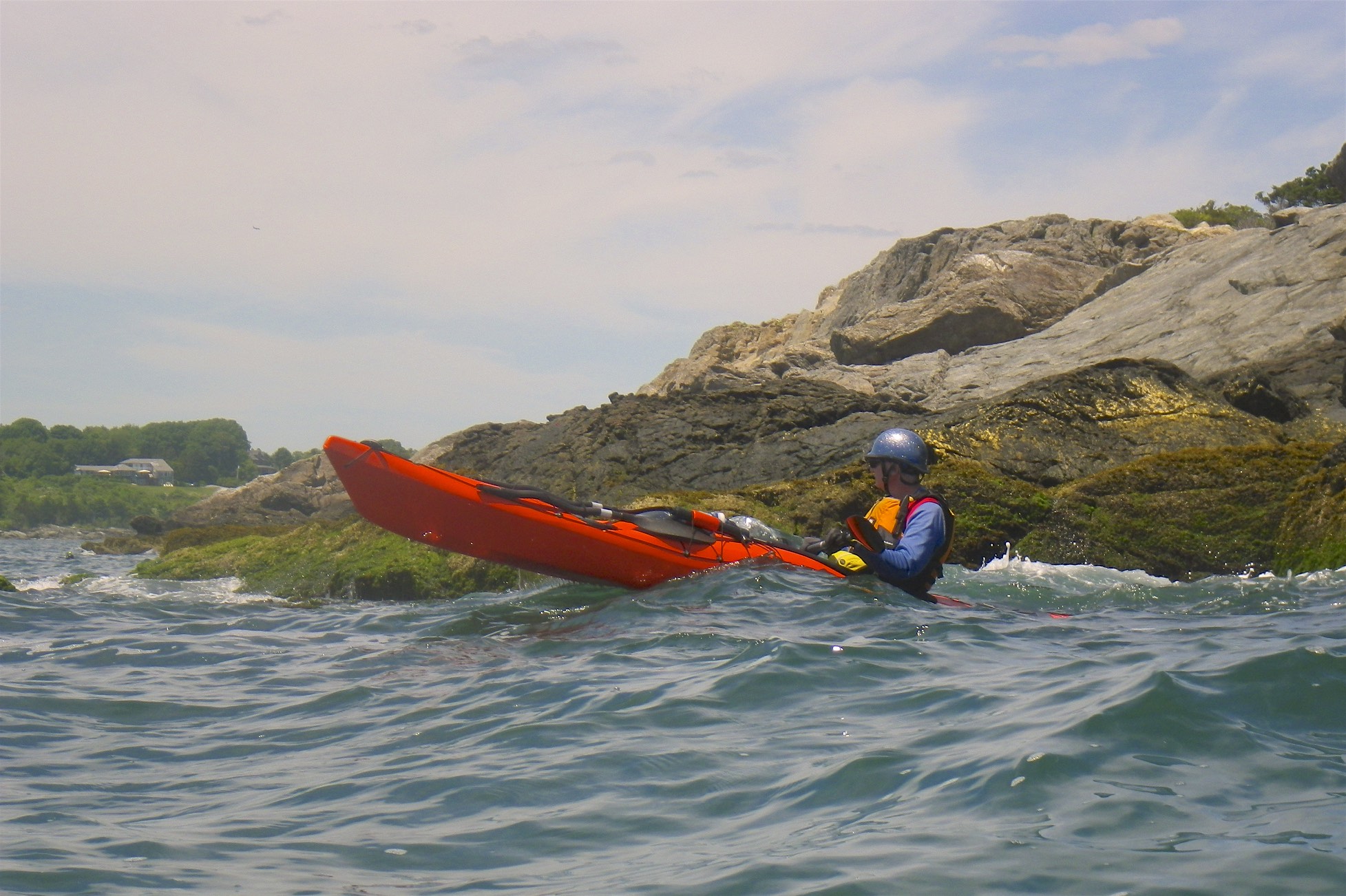
After the break we paddled out around Bull Point to get a better sense of what it is like to paddle in the open water of Narraganset Bay. We paddled into a strong headwind with 1-2 foot rolling waves. We paddled around the small island off Bull Point before heading back into Jamestown Harbor.

Newport Bridge on the trip back
From there, we headed back in the more exposed water at the edge of the mooring field. We now had a tail wing with 1-2 foot rolling waves The views of the Newport Bridge were amazing, but you definitely needed to pay attention to your paddling. Larger boat wake is also more common in the open water, and we had a couple of 2-3 foot waves come through. Everyone made it back fine.

As we came around Tylor Point into Potter Cove it was like a different world with flat, calm water. We helped each other get boats and gear back to the cars before getting on our way after another great trip.


Links:

Thursday, June 8, 2023

Saltwater Paddling for Everyone

In Rhode Island, we are fortunate to have great saltwater paddling not just for sea kayakers, but also for flatwater paddlers. Here are some of our favorite flatwater and sea kayaking venues.

Flatwater (These sites are somewhat protected and are suitable for experienced flatwater paddlers, but you may experience wind and wind-blown waves.)

Exploring the coves
Point Judith Pond
South Kingstown

Point Judith Pond, or the Great Salt Pond is the second largest of the Rhode Island’s South County salt ponds. It is a shallow, four-mile long pond located behind the barrier beaches and sand dunes that form Point Judith. The easiest put-in is boat ramp at Marina Park. From there, you can paddle out into the Upper Pond, through the Narrows, and into Point Judith Pond itself. There are numerous coves and island to explore as you head down to the Port of Galilee at the southern end.

West end of the pond
Ninigret Pond
Charlestown

Ninigret Pond is the largest of Rhode Island’s South County salt ponds. Ningret is separated from the ocean by the fragile barrier island that forms East Beach. It is connected to Green Hill Pond by a small tidal inlet. Putting in at Ninigret Park allows you to explore the west end of the pond, including a short hike across the barrier island for a view of the beach. Putting in at the Charlestown Beach put-in allows you to explore the east end of the pond including the Charlestown Breachway and Green Hill Pond.

Upper Narrows
Narrow River
South Kingstown and Narragansett

The Narrow River, also known at the Pettaquamscutt River, arises at Carr Pond Dam at the Gilbert Stuart Birthplace and flows south for 6-miles forming the border between South Kingstown and Narragansett. There are five distinct sections of the Narrow River – the Upper Pond, the Lower Pond, the Upper Narrows, Pettaquamscutt Cove, and the Lower Narrows. Putting in at the Narrow River Fishing Area allows you to paddle upstream exploring the Upper Narrows and the Upper and Lower Ponds. Putting in at the Sprague Bridge provides easy access to Pettaquamscutt Cove and the Lower Narrows where the river flows into Narragansett Bay.

Wickford Harbor
Wickford Harbor
North Kingstown

Wickford is located on the West Passage of Narragansett Bay, and is built around a large, well-protected harbor. Today, it is a picturesque village whose waterfront streets are lined with shops, restaurants and colonial-era homes. Putting in a Wilson Park allows you to explore the backwaters around Rabbit and Cornelius Islands before heading into Wickford Harbor and down into the Cove.

Sea Kayak (These sites are in open water and more exposed, and are suitable for experienced sea kayakers.)

Sakonnet Point Light
Sakonnet Point
Little Compton

Sakonnet Point includes West Island, East Island, Little Cormorant Rock and the Sakonnet Point Lighthouse. It is one of RICKA’s most popular rock garden venues. The water around the islands is very exposed and can be quite active. RICKA members also enjoy surfing when conditions are right at Surfer’s Beach near the Haffenreffer estate. 

Mansion on Ocean Drive
Kings Beach
Newport

Launch at Kings Beach and you are paddling along the amazing rocky shore of southern Aquidneck Island. If you head east you will pass mansions on the rocky cliffs along Newport’s Ocean Drive and Cliff Walk. Seal Rock lies a third of a mile to the south - a wild, exposed area that is a favorite for advanced rock gardening. If you head west you will pass Brenton Point and will enter the open waters of Narragansett Bay. 

Beavertail Light
Bay Campus
Narragansett

The URI Bay Campus provides access the West Passage of Narragansett Bay. To the south lies Bonnet Shores and Whale Rock - a frequent rock gardening site. From there you can cross to Beavertail at the southern tip of Jamestown - one of the most scenic and exposed-coast locations in RI. 

Rock gardening
Fort Wetherill
Jamestown

Fort Wetherill provides access to the lower East Bay. The southern Jamestown shoreline provides outstanding rock gardening and coastal touring, or head north to The Dumplings for easy tide race play during peak flows. Head east across the East Passage, with due caution in very busy waters, to reach Castle Hill Lighthouse, and from there around Brenton Point for rock gardening and coastal touring.

Newport Bridge
Potter Cove
Jamestown

Potter Cove gives you access to Jamestown, Newport and the coves and islands of the upper East Bay. If you head south, you will pass under the Newport Bridge and into Jamestown Harbor. From there you can cross to Newport Harbor, Rose Island and Gould Island.

Sunday, May 28, 2023

Potter Cove - May 27, 2023

The crew - Erik, Cat, Tony and Mike
Last spring, I had a lot of trouble with an arthritic knee, and thought that I would need to give up kneeling in my canoes. If I was going to sit anyway, I decided that I would get a sea kayak so I could do some ocean trips. I ended up purchasing Capella 166 RM, but didn’t get to take it out on many trips last year.

After a pretty good spring of whitewater paddling this year, I was looking for something a little different to do on Memorial Day Weekend. When I saw that Cat was leading a RICKA level 2 trip from Potter Cove on Saturday, I decided that I would join. I’ve paddled out from Potter Cove in my canoe to get pictures of the Newport Bridge, but I have never paddled up along the shore.

Cat at the North Light
The RICKA Sea Kayak group assigns levels to trips, not to paddlers. Trip levels range from Level 1 (no previous skill required) to Level 5 (long distances in extremely challenging conditions). It is recommended that newer paddlers start off with Level 2 before moving up to Level 3. Level 2 trips tend to be protected coastal paddling, while Level 3 trips tend to be open water with swells and more limited options for landing.  

For this trip we would be putting in at Potter Cove for an up-and-back around the northern tip of Conanicut Island – about 12-miles. Expected conditions were seas of less than one foot, but we'd be paddling against both an incoming tide and a 10 kt headwind on the return leg. The distance and the wind on the return leg may have pushed this trip up to level 3.

Mike at the Newport Bridge
As we headed out I began to feel more comfortable in the easy 1-foot waves. Coming from a canoeing background, I tend to have a high-angle stroke, which is not the most efficient for long-distance cruising. I got some great tips from Cat along the way on a low-angle cruising stroke. The first leg of the trip was uneventful with the tide coming in and the wind to our backs. Putting down the skeg made it easier - duh. We paddled around the northern end of the island at North Light, and took a break for lunch just east of Sand Point.

The trip back was a bit of a slog. After rounding the northern end of the island, we paddled back against the tide and into a headwind. I was glad to the have practiced the more efficient cruising stroke on the way up. We took a break to check out the Park Dock Waterfront Access, so I also had a chance to practice an easy surf landing. We slogged along for the last 5-miles back to Potter Cove, but enjoyed the great views of the Newport Bridge along the way. 


Potter Cove from Erik Eckilson on Vimeo.

Links:

Friday, July 29, 2022

Potter Cove - July 29, 2022

Newport Bridge from Taylor Point
With calm water on Narragansett Bay yesterday, I decided to over to Jamestown today to get some pictures of the Newport Bridge. I put in at Potter Cove since I thought I would get better pictures from the north.

Potter Cove is a long sandy beach facing the East Passage of Narragansett Bay. The beach and Taylor Point, which is just south of the beach, are both part of a town park that is popular for fishing and boating. On most days a southwest wind blows in the afternoon producing strong waves. This morning the breeze was slack and the bay was relatively flat. The sky was cloudy and the sun was low resulting in some interesting pictures of the Newport Bridge.

Newport Bridge looking south
The Newport Bridge was completed in 1969 and is the longest suspension bridge in New England. It spans the East Passage of the Narragansett Bay from Jamestown to Newport. The main span is over 1,600 feet long, and the road deck is more 200 feet above the water. The towers themselves are over 400 feet tall.

I paddled into Jamestown Harbor, but didn’t go very far before heading back.

Fisherman on Taylor Point
Links:

Wednesday, July 29, 2020

Jamestown Harbor and Potter Cove - July 29, 2020

Newport Bridge from Jamestown
I headed back to Jamestown this morning to paddle around Jamestown Harbor and get some pictures of the Newport Bridge.  

The Newport Bridge was completed in 1969 and is the longest suspension bridge in New England. It spans the East Passage of the Narragansett Bay from Jamestown to Newport. The main span is over 1,600 feet long, and the road deck is more 200 feet above the water. The towers themselves are over 400 feet tall.

Fishing at Taylor Point
I put in at the East Ferry Boat Ramp in Jamestown and headed out into Jamestown Harbor. I usually head south toward the Dumplings - a grouping of rocks just off Bull Point. The most prominent of the Dumplings is Clingstone or the "House on the Rock". This time I decided to go north around Taylor Point into Potter Cove.

Potter Cove is a long sandy beach facing the East Passage of Narragansett Bay. The beach and Taylor Point, which is just south of the beach are both part of a town park that is popular for fishing, windsurfing, kayaking and picnicking. On most days a southwest wind blows from morning through the afternoon producing strong waves. Today the breeze was slack and the bay was dead flat. The sky was cloudy resulting in some interesting pictures of the bridge.

Newport Bridge from Taylor Point
Links: