Monday, June 16, 2014

RICKA Meting on the Water - Nipmuc River/Harrisville Pond - June 16, 2014

Heading upstream
It was a beautiful day today – sunny and warm – so I rushed through dinner to get out to paddle at the first RICKA Meeting on the Water on the Nipmuc River in Harrisville.

The Nipmuc River is formed at the confluence of Round Top Brook and the Chockalog River. It flows south about 3 miles into the Clear River, which eventually flows into Harrisville Pond.  The river was low but runnable – 3’, 10cfs on the Harrisville gage.

Back down around the beaver dams
I arrived at the Harrisville Fishing area at about 6:15, and everyone was just getting ready to launch.  The group included one canoe and twelve kayaks.  Frank gave the safety talk and we headed upstream. 

The Nipmuc has some of the cleanest water in the state, and usually we see lots of wildlife.  Beavers are especially active on this section of the river, and we carried over four beaver dams before we decided to turn around.  The run back downstream is always quicker that the trip up. 

After paddling back down, we headed out into the Harrisville Pond before heading home.  Great night on the water.

The crew takes a break
Links:

Wednesday, June 11, 2014

Dead River Weekend – Day Two – June 8, 2014

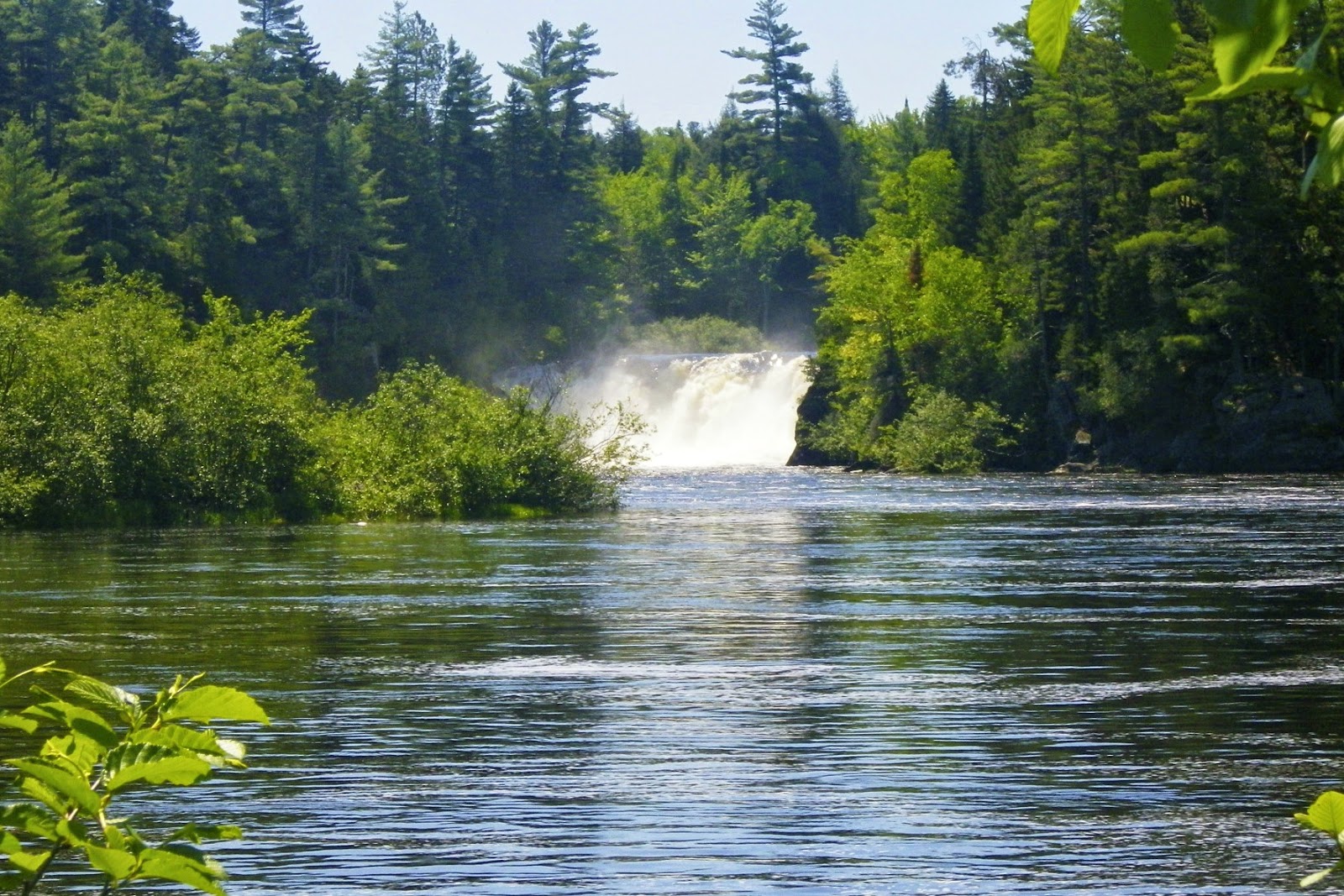
Grand Falls
After a fun night around the campfire, the morning started late for us on Sunday.  Most of us enjoyed a nice breakfast at Riverdrivers before packing up and bringing our boats to the shuttle.  We were still at the campsite at around 9:10 when Kelly came down to tell us that the shuttle was leaving – that got us moving. 

Once at the put-in, we decided to take the short walk to see Grand Falls before getting on the river. It would be a mellower run today with a release of 2,400 cfs, and another 350 cfs coming from Spencer Stream for a total of 2,750 (class II/III). While the waves in Spencer Rips were still 2 – 3 feet, the rapids that followed were significantly smaller than on Saturday.

Mine Field
We stopped for lunch at Hayden’s Landing, and then ran Hayden’s, Gravel Pit and Enchanted Stream before eddying out on river right above Elephant Rock.  I went through the slot first to see if I could get some pictures. The big hole above Elephant Rock that had filled my boat on Saturday was gone, and I made it through fine.

The next major rapid was Mile Long – my nemesis from the day before.  The waves and holes were smaller, but it was still a long, challenging rapid.  Just like on Saturday, I filled my boat about half way down, but this time I was able to get to shore. After emptying my boat, I was able to pick my way through the remaining rocks and holes. 

Andy running Elephant Rock
As we approached Upper and Lower Poplar, I didn’t see much of a difference from the day before.  The waves were a little smaller, but these were still significant class III rapids.  Upper Poplar went quickly, and we proceeded to the final rapid of our trip – Lower Poplar Falls. 

In Lower Poplar, I took the far right line, but the rest of the crew went middle right.  Paul and Jon went a little to far left and had to blast through the big hole at the top.  Jon flipped in the hole as he had the day before  but at the lower level, he was able to roll up and continue down the rapid.

We gathered at the bottom of the rapid both sad and relieved that the run was over.  With just one short swim on Sunday, the run had gone much quicker – about 5 hours.  We headed back to the cabin tired after two great days on the river. 

The crew minus Kelly
Links:
My Pictures

Dead River Weekend – Day One – June 7, 2014

Our cabin at Riverdrivers
I did my first Dead River weekend last year with Mike, Earl and Tommy, and it was so much fun that I decided to go back again this year with Andy, Paul, Pat, and Jon. 

The Dead is a classic New England whitewater river with 14 miles of continuous rapids. Releases are controlled from the Flagstaff Lake Dam above Grand Falls.  Releases can range from 1,200 cfs (class II) to 7,000 cfs (Class IV+). Last year I ran an 1,800 cfs release.  This year, I would be stepping it up by running a 3,500 cfs release (class III) on Saturday, followed by a 2,400 cfs release (class II/III) on Sunday. 

I arrived at Andy’s house at around 10:00 on Friday for the six hour drive up to West Forks, ME. We arrived at our cabin at Riverdrivers (formerly known as Webb’s Campground) at around 4:30 and began to unpack.  Paul, Pat and Jon arrived a couple of hours later.  We lit a fire and settled in for the night in anticipation of a great weekend. 

The shuttle bus at the put-in
We awoke early on Saturday and began to pack up our gear for the shuttle. Old-time whitewater paddlers will remember the Webb’s Shuttle Service then run by Ed Webb.  In those days, the 20-mile shuttle down dirt logging roads was done on the back flatbed trucks.  Today, the trip is done in the relative comfort of an old school bus, but it is still a long, bumpy ride.

When we arrived, the put-in was busy with rafting companies and boaters getting ready to launch. The release was 3,500 cfs, with another 450 cfs coming from the Spencer Stream for a total of 3,950 cfs – a solid class III. We hooked up with Kelly, Wayne and Andy and headed downstream.

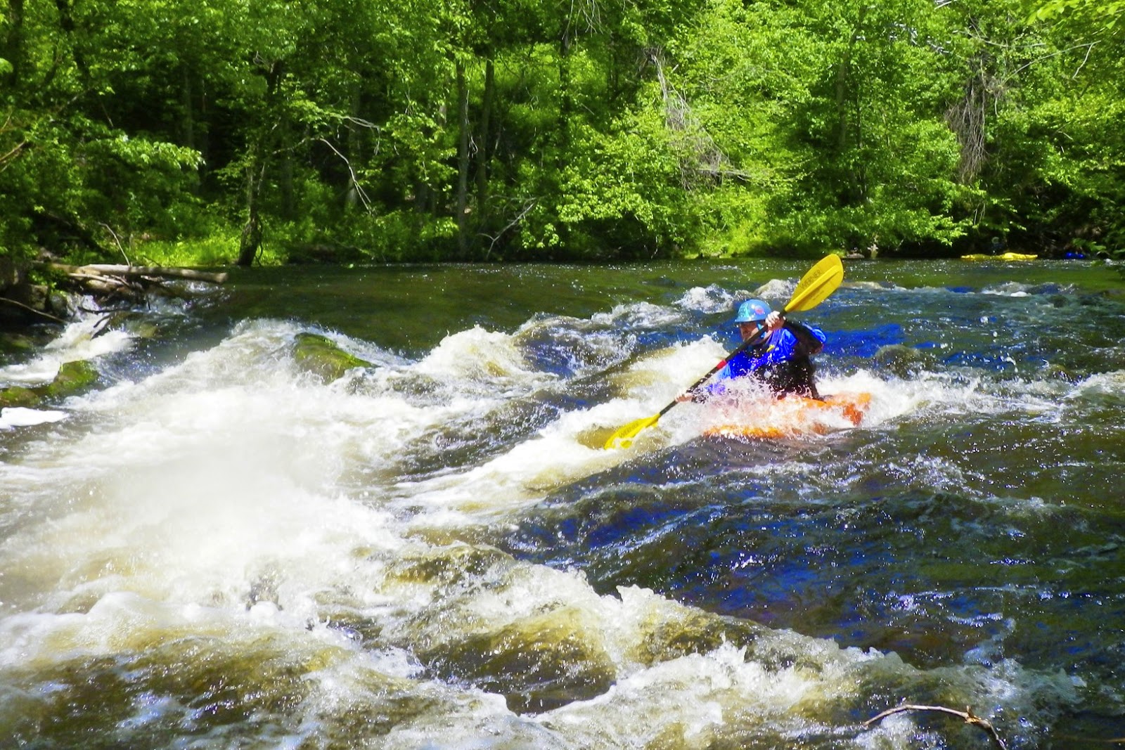
The first major rapid on the river is the Spencer Rips – a short but intense rapid with 2 – 3 foot waves that sets the tone for the rest of the trip.  As I bobbed my way down the rapid, I saw Jon up ahead of me flip, and then quickly roll back up again.  I knew that it was going to be a fun and busy day. 

Jon running Spencer Rips
It turned out to be a fun level for kayaks, but I found it challenging in my canoe.  Water from continuous 2 – 3 foot waves can quickly swamp an open boat.  Big water paddlers in open boats often solve this problem by installing small battery powered electric pumps. Unfortunately, I hadn’t gotten around to getting a pump, so I had to avoid the big waves as much as possible.  Since I was also the only open boater in the group, I was forced to read my own lines, which turned out to be great “read and run” practice. 

At this level, the rapids came at us fast and furious, and we did have a few swims along the way.  Everyone got a chance to rescue boats and paddlers – except me.  By the time I reached the bottom of most of the rapids my boat was full of water and I was looking for a place to bail.  I really need to get a pump!

My only swim was in a long rocky rapid known as “Mile Long” - you can guess why it has that name.  About half way down, I went over a rock into a hole filling my boat with water.  Now it’s possible to paddle a swamped canoe, but it’s difficult.  My options were to try to bail out the canoe while bouncing down the rapid, or try to work my way over to shore.  I decided to paddle over to shore, and got about 15' before I dumped and took a swim.

Andy running Gravel Pit
Once in the water I grabbed my boat and tried to swim to shore, but in the fast moving water, I wasn’t making any progress.  Looking downstream I could see that I was approaching another set of rapids, so I abandoned the canoe and assumed the safe swimming position - on my back with my feet downstream. 

Swimming through rapids is something that I try to practice, but it doesn’t match the real experience.  First, I swam though a series of “haystacks” or standing waves where you breathe in the trough, and hold you breath as you go through the wave - breathe, glug, breathe, glug, breathe, glug. If this continues long enough, it can be though to catch your breath. Fortunately, it was a short set of haystacks. 

After the waves, I could see a horizon line downstream indicating that I was approaching a rock with a hole on the other side.  I tucked into a ball as the pour over pulled me down into the hole.  When I came out the other side, I swam hard toward shore.  Fortunately, Pat had been working my boat toward the same spot.  It was just a short time before I was back in my boat, but the two most difficult rapids remained – Upper and Lower Poplar. 

Jon in Lower Poplar
Upper Poplar is a short but intense rapid filled with rocks and holes.  After Upper poplar is Lower Poplar.  The river turns right as the water tumbles down the left side in huge wave trains and large holes.  I took the sneak route to the right and made it down fine.  Unfortunately, Jon flipped in the large hole at the top, and after several unsuccessful roll attempts, he ended up swimming the rapid.  It was a long and nasty swim, but we got him back in his boat, and continued downstream to our cabin. 

Day one was complete.  It had been a tough day with six of our eight paddlers swimming at least once, and a total of nine swims in all.  The run took us six hours.  Still, it was a lot of fun, and we were looking forward to another run on Sunday.

Wednesday, June 4, 2014

River Bend Farm – Blackstone Valley Paddle Club - June 3, 2014

I made it to my first Blackstone Valley Paddle Club trip last night at River Bend Farm.  We had about 20 paddlers – half went up into Rice City Pond, and the other half did the river/canal loop.  I did the river/canal loop with Ranger Chuck.  Nice trip.


Links:

Saturday, May 31, 2014

Assabet/Concord - Acton to Concord – May 31, 2014

Green tunnels
Last Sunday I paddled though Powder Hollow on the Scantic River – site of the Hazard Powder Company.  Yesterday, we put-in below the Powder Mill Dam on the Assabet River in Acton. Fortunately, the gun powder mills on both of these rivers are gone, and there were no explosions on either day.

Yesterday, I led a RICKA trip in the Assabet River from Acton (Acton Canoe Launch, 63 Powder Mill Road) to Concord (Old Calf Pasture, 299 Lowell Road).  We had twenty boats including two special guests – SuAsCo Al and Tommy T. 

Running the broken dam
We met at the Acton Canoe Launch at 9:30 to unload boats and run the shuttle.  The shuttle was actually the toughest part of the trip, but we got back to the put-in at around 10:45, and began launching the boats.  The river was at a nice level – 2.5 feet on the Maynard gage.  About halfway through the process, I looked up and saw Tommy T. paddling upstream.  He had put-in at the Route 225 Bridge on the Concord River, and paddled upstream about 10 miles to meet us. 

We finally got all the boats in the water around 11:00 and began our decent down through the quickwater below the Powder Mill Dam.  About a mile downstream from the Powder Mill Dam is the broken dam at Damondale.  This dam is breached on river right, and we queued up to run the shoot through the breach before continuing downstream. 

Egg Rock
Below Damondale, the Assabet slows and large trees shade the river forming “green tunnels” along several sections of the river.  It seemed too early for lunch, so we passed the usual lunch spot in West Concord and continued downstream.

Folks were starting to get hungry as we paddled through the Leaning Hemlocks section.  We found the memorial plaque to George Bartlett, checked out the plaque at Egg Rock where the Assabet converges with the Sudbury to form the Concord, and stopped for lunch at the Old Calf Pasture. 

Minute Man Statue
From there, it is just a short paddle up into the Old North Bridge and the Minute Man National Historic Park.  We posed for a picture below the bridge before heading ashore to check out the historic sites including the Minute Man Statue, the 1832 Monument and the Old Manse. 

Tourist gathered on the Old North Bridge as we posed for a picture
Links

Monday, May 26, 2014

River Church - May 25, 2014

Quickwater on the upper section
On Sunday mornings I usually go Saint Joseph’s Church, but Paul and Jeff tell me that it is good for the soul to go to “river church”, so yesterday I decided to hook up with a group that was paddling the Scantic River in Connecticut.

The Scantic arises near Springfield, MA, and flows generally southwest for 40 miles before emptying into the Connecticut River near South Winsor, CT. We would be paddling the 4-mile section from Somersville (Somers) to Hazardville (Enfield).  

Ed Y. running Stokers
In the 1800’s, this section of the Scantic was the home to the Hazard Powder Company, which supplied the Union army with much of its gunpowder during the Civil War. The company disappeared in a mighty blast in 1913; however, some of the foundations are still intact. The State of Connecticut is building a “linear” park along this section of the river with several miles of walking trails in an area now known as “Powder Hollow”.

We had eight boats – seven kayaks (Ed W, Ed Y, Scott, Paul, Roy, Kimberly and Denise), and one canoe (me).  There is no gage on the Scantic, but the Broad Brook gage is a good substitute.  If Broad Brook is above 30, the Scantic should be runable. It's a downstream gage, so it’s not perfect.  Yesterday the Broad Brook gage was around 50, and the Scantic was at a perfect level. 

Ed W. running Chimney
We put-in near the water treatment plant off Quality Avenue in Somersville (Somers). For the first 2 miles the river meanders though a pretty hemlock forest.  It’s mostly quickwater with a couple of easy class I rapids.  After the Route 191 Bridge and a railroad bridge, we portaged the dam at the Springborn Mill on river left. 

Just downstream from the dam is the first of three major rapids – Stokers.  This is a ledge with a 3-foot drop and a rocky shoot 6 to 10 feet from the left bank.  When I ran this rapid last spring I swam it twice.  I didn’t do much better this time.  I lined up on the shoot, made it through the first big drop, only to swim a little downstream.  I did do a nice self-rescue though.

Kimberly running Staircase
Just upstream from Chimney is a nice surf wave that was perfect for an open boat at this level.  I was able to do some back surfing and side surfing, and still got out in one piece   Chimney itself is an “S” turn rapid that starts off as a series of small ledges with a larger drop at the end.  I made it through Chimney fine.

The final rapid is Staircase, which is exactly what you’d expect - a series of ledges that look like a staircase.  The largest ledge at the bottom has a nice wide shoot on river left.  It turned out to be a fun run with a great group – I recommend that everyone go to river church.

A view of the Staircase Rapid from the bidge
Links:

Sunday, May 4, 2014

Ottauquechee River – May 4, 2014

Quechee Gorge
The sky seemed to brighten, and blue sky peeked through the clouds as I crossed into Vermont on Route I-89.  Unfortunately, the sunshine would be short-lived.  

I drove across four states to join Marshall Moore’s NHAMC trip on the Ottauquechee River.  The Ottauquechee arises Green Mountains near Killington and flows generally eastwardly across VT before emptying into Connecticut River. The river is probably best known for the Quechee Gorge – a deep canyon that can be seen as you drive over the Quechee Gorge Bridge on Route 4. We would be going a little further upstream to run the 9-mile section from West Bridgewater and Woodstock.

A typical section of the Ottauquechee
When I arrived in the put-in at the ball fields in West Bridgewater, I found that most of the group had already arrived.  We would have eleven boats, all canoes – 5 polers, 4 OC1s and 2 OC2s. The plan was to put in upstream at the Route 100A bridge in Bridgewater Corners, and take out at the White Cottage Snack Bar about a mile above Woodstock. We quickly ran the shuttle and got on the river.

The river was at a nice level – 3.5 feet, 100 cfs. on the West Bridgewater gage.  At this level, the river is mostly quick water with some easy class I/II rapids. It is certainly pretty as the river twists and turns through woods and farmland. The skies were cloudy, but other that a brief rain shower, we had a great day.

Links: