Sunday, February 25, 2024

Surfing at the Martin Street Bridge - February 25, 2024

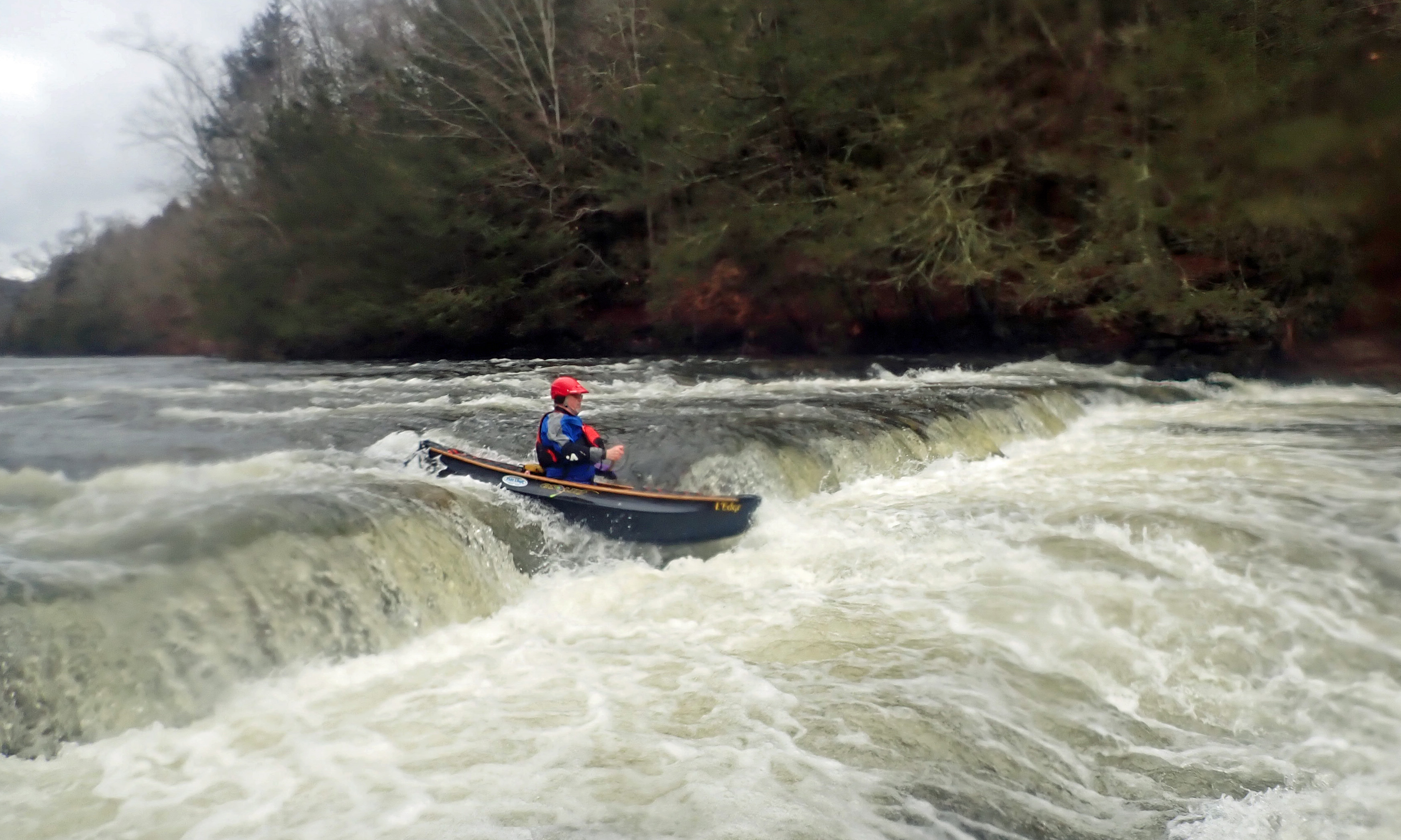
My original plan was to paddle the canal/river loop from Lonsdale to Ashton. I got down to the put-in and had a surprise – the canal was frozen. Well, it is still winter after all. Instead, I ended up surfing at the broken dam below the Martin Street Bridge. The level was great, and it is always fun to surf in my Yellowstone Sole.  Here is about an hour of paddling in about two and a half minutes.


Martin Street Bridge from Erik Eckilson on Vimeo.

Sunday, February 11, 2024

Plummers Landing - February 11, 2024

At the put-in at Plummers Landing
I needed to stay local again this weekend. When I saw a post from José on the RICKA Flatwater message board, I decided to join her for a run on the Blackstone River from Plummers Landing. While I was scouting the take-out at the Stanley Woolen Mill, I saw Bob and Ozzie who would be poling upstream.

I met José at the Plummers Landing put-in on Church Street, and we decided to do the run down to the Tri-River Medical Center at River Bend Farm. The river was at a nice level – 4.2-feet on the Northbridge gage.

Running the twists and turns
This section of the Blackstone is in a considerable state of flux with the river constantly eroding its banks and creating new channels. About a mile downstream, the river has breached the old Blackstone Canal on the right, and much of the water now flows down the old canal trench - stay left to remain in the river. From there the river twists and turns, and it is a challenge to maneuver around the s-turns and through the strainers.There was one strainer that we needed to portage.

Eventually, we entered the calm water of Rice City Pond and paddled over to check out the Goat Hill Lock from the old Blackstone Canal. We meandered our way through Rice City Pond and over to the take-out at the Hartford Avenue Bridge. José wants to paddle River Bend Farm next – sounds good to me. I never did see Bob and Ozzie again.

In the Goat Hill Lock on the Blackstone Canal
Links:

Sunday, February 4, 2024

Hunt River - February 4, 2024

At the put-in
I had things to do yesterday, and I needed to stay local today, so I joined Chuck, Frank, Steve and Earl for an up-and-back trip on the Hunt River in North Kingstown.

The Hunt River arises in East Greenwich at Scrabbletown Brook and flows generally northeast for 11-miles into Potowomut Pond. After Potowomut Pond, the river emerges as the Potowomut River and flows east for 2.5-miles forming the southern shore of Potowomut Neck in Warwick before emptying into Narragansett Bay just south of Greenwich Bay.

Heading upstream
We put-in off Davisville Road in North Kingstown near parking for the Davis Memorial Wildlife Refuge, and just above a stone dam that once powered an old textile mill. There was plenty of water in the river with the gage at 1.5 feet, 100 cfs. The river twists and turns through acres of wetlands that make up this 94-acre Audubon property - surprisingly, no ice.

We paddle upstream until the river was clogged and full of brush before turning around. On the way back we stopped for a break at the Hunt River Preserve of the East Greenwich Land Trust. The group shot had TW asking "Midst the burly, squirrely, grizzly ole men, how dost thee, Erik, keep such a clean chin?"  I'm still going for the baby-faced look.

The crew - Chuck, Erik, Steve, Frank and Earl
Links:

Sunday, January 28, 2024

First Swim of the Year – Salmon – January 27, 2024

Surfing the on the upper Jeremy
I’m off to an early start. I had my first swim of the year at the Route 149 Rapid (aka “ the Old Dam Rapid” or the “Old Mill Rapid”, or simply “where the old dam was”) on the Jeremy River.

After another week of rain and snowmelt, I got an email from Paul asking if I’d be interested in another run on the Salmon. After a ten-year absence, this would be my second run on the Salmon/Jeremy in three weeks. We met at the covered bridge on Comstock Bridge Road in East Hampton. On this trip the canoes (me and Jim) outnumbered the kayak (Paul). The river was low but fluid – 4-feet, 600 cfs. We ran the shuttle up the commuter lot at the intersection of Routes 2 and 149.

Route 149 Rapid - I swam
 the drop at the top
The Jeremy starts off small, and at this level rock dodging was the order of the day. About a mile downstream is the site of an old paper mill dam that has now been removed revealing a new rapid with two drops. The first is a 1 - 2-foot drop where the river takes a hard right turn and Pine Brook joins the river. There is a large wave at the bottom breaking to the right. The second is a 2-foot drop through a jumble of rocks where the old dam stood. The line is to the right of the rocks at the bottom. 

I drifted down the first drop without much momentum, got spun sideways on the breaking wave, and flipped to my offside – first swim of the year. After a feeble attempt to try to get my boat to shore, I let Jim chase it down and focused on getting myself to shore before the next drop. Even with my drysuit, that water was cold!

Running the broken dam
My boat ran the next drop and Jim got it to shore for me below the Route 149 Bridge. The rest of the run was uneventful. From there down the Jeremy is a little bigger with the added flow from Pine Brook, but it was still all about dodging rocks and staying in the deep water channels. The Salmon was actually at a fun level with lots of rocks to dodge, eddies to catch and waves to surf. Paul says 4-feet is his favorite level.

I ran the broken dam first, and was able to get some pictures and video of Jim and Paul coming through. We took turns surfing at the surf wave below the broken dam before heading down to the take-out at the covered bridge. Lesson learned from this trip – don’t just drift into breaking waves at the bottom of a drop. Paddle into it with some momentum so you can break through without flipping. Living the old saying - “if you not swimming you are not trying hard enough”.

Running the broken dam
Links:
My Pictures

Saturday, January 20, 2024

Gardner Hill Town Forest - January 20, 2024

It was too cold for paddling this weekend, so I decided to join Papa Joe and the crew for a hike at the Gardner Hill Town Forest in Stow, MA.

We met at the main parking lot at 86 Bradley Lane in Stow. Gardner Hill includes over 200 acres of white pine forest with lots of interesting glacial features. The 4.1-mile hike took us along Elizabeth Brook and the Assabet River, and then up the wooded summit of Gardner Hill.

Camping at Gardner Hill Town Forest

Al reading the reg's
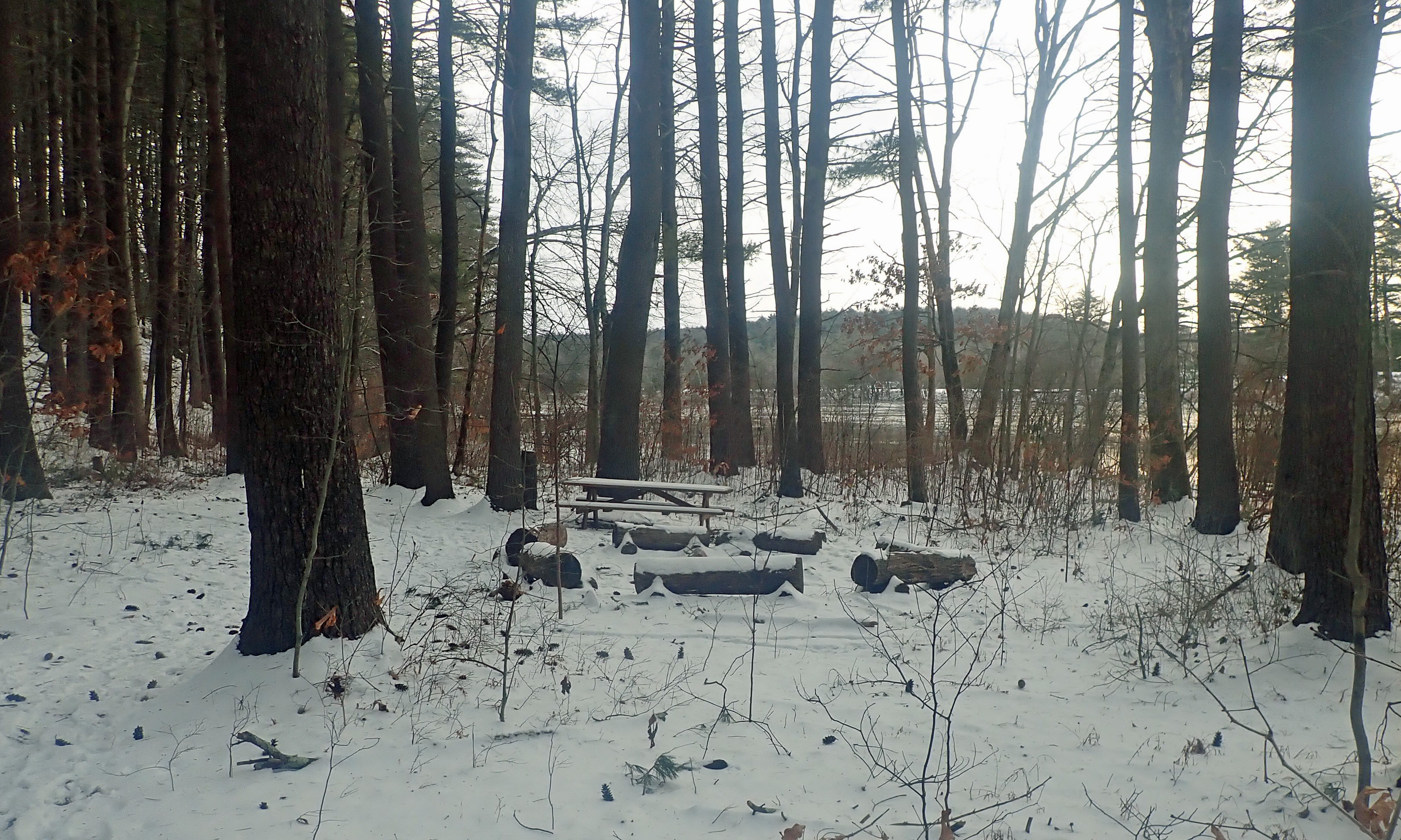
I did a hike with Papa Joe and the crew at the Gardner Hill Town Forest in Stow, and we hiked by a nice campsite along the Assabet River. It has a fire pit, benches, picnic table and nearby boat launch. It can be used for group camping with a permit from the Stow Conservation Commission. I don’t remember exactly where it is, but it is down near the Orange Trail across from the airport. Dan knows where it is and has already talked to the conservation commission about camping there in the spring. I'm in!

The campsite in winter

Monday, January 15, 2024

Salmon River - January 14, 2024

Comstock Covered Bridge
Seven inches of rain and 5 inches of snow melt had all the rivers up this weekend. I was busy on Saturday, but tried to get the local crew together for a Branch River run on Sunday. I had no takers since the day was cold and the river was high (6 feet, 1,200 cfs) and full of wood. There were lots of other options, so I reached out to Paul D. and we decided to do a run on the Salmon River. Paul posted on Where's the Whitewater at? and Dave and Tim joined us as well.

The Salmon River is formed at the confluence of the Blackledge and Jeremy Rivers in Colcester and runs about 10 miles to join the Connecticut River. It’s a pretty river that cuts a steep valley through the hills of southeastern Connecticut. We would be running a 3-mile section in the Salmon River State Forest that was the site of the old Salmon River Slalom race.

The new "Old Dam" Rapid above
Route 149 on the Jeremy River
The Salmon was one of the first whitewater rivers that I ran with Mike B. back in 2007. After that, I ran it a few times with Matt M. including a (shortly after) Christmas run in 2009. The last time I ran it was a summer run back in 2013. At lower levels (600-800 cfs) it is a technical class II with lots of rock-dodging. At higher levels the rocks get buried and there are more long wave trains. 

We met at the covered bridge on Comstock Bridge Road in East Hampton. The original Comstock Bridge was built in 1840 and is one of only three remaining covered bridges in Connecticut. Paul and Dave were there when I arrived, and Tim arrived shortly after. I could see from the parking lot that the river was at a great level.

Running a ledge on the Jeremy
We decided to take-out across the street at the Salmon River Picnic Area off Gulf Road. We knew that we wanted to put-in on the Jeremy River, but figured there would be strainers in the upper section. Rather than putting-in at the commuter lot at the intersection of Routes 2 and 149, we decided to put-in at the old mill site where the dam was removed at Route 149 and 
Paper Mill Road.

You can also put-in on the Blackledge, which is mostly quickwater so it is little less exciting than the Jeremy. The put-in for the Blackledge is the Blackledge Fishing Area off South Main Street near the intersection with Jerry Daniels Road in Marlborough.

A pretty section of the Salmon
As I was getting dressed, I ripped the latex bootie on my NRS drysuit again. I had this drysuit repaired last year, so this was a new bootie. Fortunately, Paul and Tim had duct tape so I could tape it up. Even so, I decided not run the "Old Dam" Rapid (class II+/III-) below where the dam was removed. Instead, I tried to take video of Paul and Tim from the Route 149 bridge, but only managed to get Tim.

At this level (4.8 feet, 1,000 cfs), the Salmon/Jeremy is a nice class II run - mostly long wave trains with some rock dodging and nice surf spots. The banks are lined with hemlock trees and mountain laurel, and small water falls tumbled down the banks into the river. We enjoyed the waves as we worked out way down to the largest rapid on the river – the broken dam.

Tim lining up to run the broken dam
The broken dam is a class II+/III- rapid with 3 drops - each around 2’. I went first in hopes of getting some pictures of the rest of the crew coming through. I took the usual line (slot on the right) and filled up the boat in the large standing waves below. By the time I got to shore, Paul had already run through. I was ready to get some video of Tim and Dave, only to have the battery in my camera die – oh well. They looked good, but you will just have to trust me.

The best surf wave on the river is just below the broken dam. I checked it out with Paul on the way to the take-out. It started to snow as we were loading up, and it was snowing pretty good on the ride home, but I made it home with no problem. Another great trip.

The crew at the put-in - Erik, Tim, Paul and David
Links: