 |
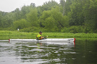
| Conrad heads out |
The Sudbury - a National Wild and Scenic River - arises in Westborough and flows generally northeast for 41-miles to its convergence with the Assabet River at Egg Rock in Concord to form the Concord River. The smaller but faster moving Assabet takes priority as water flows into the Concord River at Egg Rock. The larger but slower moving Sudbury patiently waits its turn, and water backs up to form the huge wetlands in Sudbury and Wayland that are part of the Great Meadows National Wildlife Refuge.
 |
| SuAsCo Al |
We met at 9:00 at the put-in at Sherman’s Bridge Road in Wayland. Our original plan was to run a shuttle down to Lowell Road in Concord, but with rain and the threat of thunderstorms, we decided to skip the shuttle and stay close to the cars in case we needed to get off the river. We launched our boats at around 9:30 and headed west through the marshes toward Route 27.
Al explained that one of the major battles of King Philip’s War – the Sudbury Fight – was fought here in April 1676. As Native American warriors moved east after devastating attacks in the town of Marlborough, residents of Sudbury evacuated to the nearby Haynes Garrison House - a fortified structure where they successfully repelled several attacks.
 |
| Erik, Bill, Conrad and Al at the Sudbury Fight Monument |
The largest battle occurred when hundreds of Native American warriors ambushed a combined force of roughly fifty militiamen from Boston and Watertown coming to support the Sudbury residents. As we approached the Route 27 (Old Sudbury Road) Bridge, we pulled over and hiked a short way down old Route 27 and across the Old Town Bridge to a historical monument marking the burial site of some of these militiamen.
We returned to our boats and paddled under the historic Old Town Bridge. This stone arch bridge was built in 1848 on the site where the earliest bridge across the Sudbury River had been built in the 1640’s. For many years, this was a major east-west passage connecting Boston to points west and south.
 |
| Old Town Bridge |
With higher water, we were able to paddle under the Old Town Bridge and through the swamp grass and bushes that are slowly filling in the “Oxbow” – the original course of the Sudbury River. As we headed back to Sherman's Bridge Road a steady rain began to fall, but with rain gear it was still comfortable.
With 5 miles under our belt, we continued downstream past our put-in at Sherman’s Bridge Road and into the Great Meadows National Wildlife Refuge – a 3,800 acre protected wetland and bird sanctuary along the Sudbury and Concord Rivers. The rain got heavier as we approached Lee's Bridge at Route 117 (South Great Road). We took a break under the bridge to let the worst of the rain pass before heading back. We arrived back at the put-in at around 1:30 after an 11-mile trip. In spite of the rain, it was another fun day on the water, and it is alway great to get a guided tour from SuAsCo Al!
 |
| Erik and Bill with Conrad in the background |
Links:


No comments:
Post a Comment
Note: Only a member of this blog may post a comment.