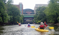
Wednesday, July 31, 2024

Narragansett Bay

Narragansett Bay is the largest estuary in New England. It is made up of three interconnected passages that run north to south: the West Passage, the East Passage, and the Sakonnet River. These passages are actually ancient river valleys that were inundated by sea water:
  • West Passage - separates Conanicut Island from the mainland on the west and has an average depth of 33 feet
  • East Passage - separates Conanicut Island from Aquidneck Island and is deep enough for large ships with an average depth of 44 feet
  • Sakonnet River - separates Aquidneck Island from the mainland on the east. The northern end is known as Mount Hope Bay.

Monday, July 29, 2024

Rocks and Rescue Session at Fort Wetherill – July 28, 2024

Heading out of West Cove
I’ve spent a lot of time practicing strokes in my sea kayak on flatwater, but haven’t had a chance to do many trips. When we did the RICKAMeeting on the Water” out of Fort Wetherill, I was feeling a little uncomfortable in the ocean swells. I knew what I needed to do – relax, and spend more time in those conditions. When I saw that the RICKA Sea Kayak group would be doing a rock play and rescue session at Fort Wetherill, I decided to sign up.

Ask Rhode Island sea kayakers what their favorite paddling spot is, and many will say Fort Wetherill. It provides access to a beautiful section of rocky shore that is much like the coast of Maine. From here you can head north to the Dumplings and Jamestown Harbor for great views of the Newport Bridge, or east to Newport and around Brenton Point for rock gardening and coastal touring, or west to Beavertail to enjoy rock gardening along the southern shore of Conanicut Island.

Paddling in the rocks
For this trip we would be heading west along the southern shore of Conanicut Island. We met at 10:00 at the scuba diving lot to unload our boats and gear. Fort Wetherill is a popular spot for scuba diving and fishing, and the divers and fisherman were out early as well. Eventually the rest of the crew arrived – nine boats. Conditions were easy with waves of 1- 2 feet, light winds from the south, and high tide at 2:30 - that was fine with me. After introductions and the safety talk, we headed out to look for “rock gardening” opportunities.

“Rock gardening” or “rock play” involves catching a ride on ocean swells as they weave their way through the rocky shore. There are two factors to consider when paddling between and over rocks. First, is there enough water and is it deep enough for the time needed to complete the run. Second, what is the route and can I run it in my boat.

Staying close to the cliffs
Entering the feature at the proper time is key. Enter a feature in front of a wave (early) and it can send you skidding into the rocks. Enter a feature after the wave (late) and you might run out of water and get stuck on the feature and then hammered by the next wave. You want to enter the feature with the crest of the wave about at your hip.

After a quick warmup on the water we headed out from Fort Wetherill’s West Cove. We paddled close to the cliffs looking for rock play opportunities. We started off easy and moved to more difficult features. By lunch time we were at Horsehead. Tony Moore and I paddled this section in his tandem kayak back to 2018. We paddled into Horsehead late and got trashed by the waves - see 0.49 here. My timing was better this time.

Run through Horsehead
We paddled across Mackerel Cove for lunch (I need to work on my surf landings and launches), and then continued west toward Beavertail. While the cliffs east of Mackerel Cove are quite vertical with little risk of getting pushed into the rocks, the cliffs west of Mackerel Cove are more sloped. My timing on one feature was bad, and I got pushed up onto the rocks. I had to brace through several waves before I had enough water to work myself off the rocks and paddle through the feature.

We paddled around Shore Point before turning around in Hull Cove. On the way back I stayed out a little further from the rocks taking pictures and getting comfortable paddling in the waves. Once back at Fort Wetherill we did rescue practice. I was the rescuer and the rescuee, and did fine on both. Three tips to remember from this trip - keep your hands wide on the paddle, look where you want to go, and lean forward into a sweeping turn,  Mission accomplished on this trip. 

Heading Back to Fort Wetherill
Links:

Saturday, July 27, 2024

Two Weeks on Salt Water - End of Another Great Vacation

Paddling with RICKA at Point Judith Pond
Our annual summer vacation at the beach ended today, so packing up to go home trumped paddling this morning. With family visits I missed three days of paddling, but that’s OK – first things first. I paddled some of my old favorites like Fort Wetherill and Jamestown Harbor on a trip with RICKA, the Narrow River and Wickford. I missed some old favorites like Dutch Harbor and the Harbor of Refuge. Of course, I spent a lot of time paddling on Point Judith Pond including another fun trip with RICKA.


South County Vacation 2024 from Erik Eckilson on Vimeo.

Friday, July 26, 2024

Port of Galilee - July 26, 2024

Fishing boats in the Port of Galilee
It was a beautiful morning, but very windy, so I decided to stay around the cottage and paddle down to Galilee. I stayed out of the wind and headed south down the east side of Great Island into Bluff Hill Cove and then into the Port of Galilee.

The Port of Galilee was created in 1935 when a harbor was dredged and a dock constructed at the mouth of Point Judith Pond. Connected to the ocean by the Breakaway and the Harbor of Refuge, both completed in 1910, Galilee eventually became the home port for much of Rhode Island's fishing industry. I paddled past the fishing trawlers, lobster boats and charter boats on the Galilee side before crossing over to the Jerusalem side. With low tide, I followed the boat channel on the west side back up the pond before crossing back to the cottage at Plato Island. I got some practice paddling in the wind.


View from Galilee to Jerusalem 
Links:

Thursday, July 25, 2024

Pea Soup Fog on Point Judith Pond – July 24, 2024

Thomas Point
I awoke to pea soup fog this morning - even thicker than the usual pea soup fog. My original plan was to paddle over to Potter Pond, but once I go out on the water I decided that would be a little ambitious. The sea birds were everywhere, so I decided to do a quick trip around Great Island.

Horseshoe Point
Links:
My Pictures

Wednesday, July 24, 2024

Wickford Harbor - July 24, 2024

Wilson Park Kayak Launch
It was a windy, rainy morning, so I decided to head over to Wickford to paddle Wickford Harbor. 

Wickford was established in the early 17th century when Roger Williams purchased land from the Narragansett Indians and established a trading post. In 1637, Williams sold the land to Richard Smith who constructed a large fortified house on the site, giving the house its nickname the “Castle”. That house was burned during King Philip's War, and the structure that can be seen from the put-in today was built in 1678.

Marinas at Mill Cove
Wickford grew to become a major port and shipbuilding center, and today contains a large collection of 17th and 18th century homes. It is a picturesque village whose streets are lined with shops and restaurants, and whose harbor is filled with sailboats and yachts.

I paddled out from Wilson Park into Mill Cove, and then over Wickford Cove and into Wickford Village. From there I paddled out to the breakwater in the outer harbor before returning to Wilson Park. I saw a couple of other kayakers, but otherwise I had the harbor to myself.


Wickford Cove
Links:

Sunday, July 21, 2024

Point Judith Pond with RICKA - July 21, 2024

Heading up the Upper Pond
It was a 12-mile day for me – 2-miles from the cottage to Marina Park, 8-miles for the trip from Marina Park down to Galilee and back, and 2-miles from Marina Park back to the cottage. Still, it was a great day for my annual RICKA Point Judith Pond paddle.

Point Judith Pond, or the Great Salt Pond, is located along the border of Narragansett and South Kingstown, and is the second largest of the Rhode Island’s South County salt ponds. It is a shallow, four-mile long pond located behind the barrier beaches and sand dunes that form Point Judith. The pond is 20 miles around with many pretty islands and coves to explore.

Through the Narrows
I woke up at 5:00 to wind and torrential rain, but fortunately the storm blew over quickly. My family needed my car for the beach, so I paddled up to the put-in at the Marina Park on the Upper Pond. By the time we launched the weather was beautiful with sunny skies and a slight wind from the south.

We had 9 boats – all kayaks. We headed out into the Upper Pond from Marina Park, paddled through the Narrows and out into Congdon Cove in Point Judith Pond. From there, we headed down to Gardner Island where we crossed the boat channel and crossed the pond over to Jonathan Island.

Crossing to Dog Beach
With a wind from the south decided to paddle down the east side of Great Island into Galilee. We paddled across the top of Galilee and took a break for lunch at Dog Beach between Jerusalem and Snug Harbor. It was a little nerve-racking crossing the busy boat channel but we finally made it.

Since the wind was blowing from the south we crossed the boat channel again and returned up the west side of Great Island. With the wind to our backs, the return trip went much faster. Between the wind and the boats traffic there was a lot of choppy water at the top of the pond, but everyone did great.

The crew at Dog Beach
Links:

Friday, July 19, 2024

Narrow River - Sprague Bridge - July 19, 2024

Pettaquamscutt Cove
I was back on the Narrow River this morning to paddle down to the beach at the Narrows at Cormorant Point

I put in at the Sprague Bridge on Boston Neck Road at the John H Chafee National Wildlife Refuge. Established in 1973, the refuge includes over 300-acres of saltmarsh around Pettaquamscutt Cove that provides habitat for shore birds like egrets, herons, cormorants and osprey.

Waves at the beach at Cormorant Point
I headed the other way down to the beach. I paddled out behind the rocks to check out the waves at Cormorant Point and down the beach past the Dunes Club and the Narragansett Town Beach.

On the way back, I took a dump taking a picture of an egret, but was able to do a self-rescue with a paddle float and pump. At least the picture came out OK.

The egret that resulted in self-rescue practice
Links:

Thursday, July 18, 2024

Narrow River - Pollock Avenue - July 18, 2024

It was windy and cloudy this morning, and I wanted to go someplace protected from the wind, so I decided to paddle the upper section of the Narrow River.

The Narrow River, also known at the Pettaquamscutt River, is the tidal extension of the Mattatuxet River. It begins below the Carr Pond Dam at the Gilbert Stuart Birthplace and flows south for 6-miles forming the border between South Kingstown and Narragansett before entering Pettaquamscutt Cove and then flowing out into Narragansett Bay above the Narragansett Town Beach and the Dunes Club.

There are five distinct sections of the Narrow River – the Upper Pond, the Lower Pond, the “Narrows” from Bridgetown Road and Middlebridge Road, the “Flats” at Pettaquamscutt Cove, and the “Narrows” at the mouth of the river where it flows into Narragansett Bay.

I put in at the Narrow River Fishing Area off Pollock Avenue and paddled upstream into the “Narrows” between Bridgetown Road and Middlebridge Road. This section of the river is lined with boat docks and summer houses. Above Bridgetown Road is the Lower Pond, and then the Upper Pond. With the wind I got lazy and didn’t paddle up there.


Links:

Point Judith Pond Islands and Coves - July 17, 2024

Islands in Point Judith Pond
The sunrise was beautiful, so I decided to stay close to home and paddle around the islands and coves at the top of Point Judith Pond. Point Judith Pond has three large islands – Great Island, Harbor Island and Ram Island, and four smaller islands - Jonathan Island, Beach Island, Gardner Island and Plato Island. Ram Island is posted no trespassing. Great Island, Harbor Island, Jonathan Island and Plato Island have houses on them. Gardner Island or Beach Island are the best places to stop for lunch.

I crossed over at Plato and paddled the boat channel up the west side of the Point Judith Pond past the oyster farms to Billington Cove. Egrets and cormorants were everywhere, and the osprey were in their nest at the marina at Billington Cove.

The mooring yard
Links:

Tuesday, July 16, 2024

July Meeting on the Water at Fort Wetherill - July 15, 2024

Launching  at Fort Wetherill
During the summer, RICKA’s monthly meetings are replaced with “Meetings on the Water” – paddles that are intended to get people together who might not normally paddle together, or get people out to venues that they might not normally paddle. For our July “Meeting on the Water” we decided to step it up a bit with a trip out of Fort Wetherill in Jamestown.

Fort Wetherill is a former coastal defense battery and military base located on the granite cliffs across the East Passage from Newport and Fort Adams. Shortly after the Revolutionary War, Fort Dumpling was built on this site to protect this strategic access to Newport Harbor and Narragansett Bay.

Clingstone - the House on the Rock
The site would eventually become Fort Wetherill - part of an extensive coastal defense battery that included Fort Greene on Point Judith, Fort Greble on Dutch Island, Fort Hamilton on Rose Island, and Fort Adams in Newport that protected Narragansett Bay during World War II.

Today, Fort Wetherill is a state park and a favorite of RICKA sea kayakers. They will often head north to the Dumplings for easy tide race play, or they will head west to enjoy rock gardening along the southern shore of Conanicut Island, or they head east to the Castle Hill Lighthouse and from there around Brenton Point for more rock gardening and coastal touring.

Cormorants on the Dumplings
Our trip would not be that ambitious - just a short trip around Bull Point and past the Dumplings into Jamestown Harbor. We met at the at the Scuba Diving Lot at 6:00 to unload out boats and gear. After introductions and the safety talk we headed out of Fort Wetherill’s West Cove and into the open water of Narragansett Bay.

The wind was from the south and there were waves rolling in as we headed west through the cut-thru and around Bull Point. We stayed close to shore as we headed north along the fishing pier. The tide was going out, so we avoided the tricky tidal currents flowing out of the Dumplings.

Newport Bridge is in there somewhere
The Dumplings is a collection of boulders at the southern end of Jamestown Harbor. The most prominent is Clingstone or the "House on the Rock". This massive post and beam home was built in 1905 and has been recently restored. I am always amazed at the number of birds that gather on the Dumplings.

From there it is an easy paddle around Jamestown Harbor. There are usually great views of the Newport Bridge, which spans the East Passage of the Narragansett Bay from Newport to Jamestown. Unfortunately for us, fog rolled in just as we were launching, and the bridge was obscured in the mist.

Pulling in to East Ferry Beach
The Newport Bridge was completed in 1969 and is the longest suspension bridge in New England. The main span is over 1,600 feet long, and the road deck is more 200 feet above the water. The towers themselves are over 400 feet tall.

We took a short break at the East Ferry Beach in Jamestown. The original plan was to stop for an ice cream that the Sugar Shack on the pier, but with the fog we decided to head back early. We broke out headlamps the boat lights for the trip back to Fort Wetherill.

The crew at East Ferry Beach
Links:

Upper Point Judith Pond July 15, 2024

View of Horseshoe Point
I was up early and decided to stay close to the cottage and paddle to Upper Point Judith Pond. I'll be leading a RICKA trip from there next week.

Unlike Rhode Island’s other large salt ponds (Ninigret, Green Hill, Quonochontaug and Winnapaug) that are coastal lagoons, Point Judith Pond is an estuary where the Saugatucket River empties to the sea. I paddled up past Ram Island and Harbor Island, through the Narrows into the Upper Pond, and into the Saugatucket River at Silver Spring Cove. 


Boat ramp on the Upper Pond
Links:

Monday, July 15, 2024

Around Great Island - July 15, 2024

View of Horseshoe Point from Frank's Neck
We have been renting a vacation house at Horseshoe Point on Point Judith Pond for the last 12-years. I always start off my paddling adventures with a trip around Great Island. This year it was a little cloudy and a little gray, but the wind was calm.

Point Judith Pond, or the Great Salt Pond, is the second largest of Rhode Island’s South County salt ponds. Separated in the south behind sand dunes and barrier beaches, Point Judith Pond is connected to the ocean through the Breachway at Galilee.

Boats and jet skis heading out the Breachway
Great Island is one of three large islands on the pond - the other two are Harbor Island and Ram Island. Great Island is about 2-miles long and 1/2-mile wide, and full of summer cottages. I paddled down to Frank’s Neck before heading into Bluff Hill Cove and paddling under the bridge into Galilee.

The fishing village of Galilee was developed in 1935 when the State of Rhode Island dredged out a harbor suitable for commercial fishing vessels. I paddled down into the harbor to snap a few pictures of boats going through the Beachway before heading back up the west side of the island to the cottage.

That's me - houses along Bluff Hill Cove in the background

Wednesday, July 10, 2024

Tville again - July 9, 2024

With 90º temperatures and the river up after recent rains (1.8 feet, 700 cfs), I decided to join Paul’s Tuesday night Tville run with the CT/AMC. We had thunder rumbling in the background, and the skies opened up with rain at the end, but it was still a great night.

Surfing at Cathy's Wave
Links:
River Description from American Whitewater

Monday, July 8, 2024

Lower Wood River - July 7, 2024

Heading out
It has been years since I've paddled the lower section of the Wood River. The first trip that I have record of was July 3, 2010 with Henry, but I know that I paddled it before that. The last time I was here was May 19, 2012 on a camping trip with Jim. Not sure why it took me so long to get back.

The Wood River arises in Sterling, CT and flows 25-miles to the Village of Alton where it merges with the Charles to form the Pawcatuck. It received Wild and Scenic River status in 2019. There are two sections of the Wood River that are popular with paddlers – the upper Wood River from Route 165 in Exeter to the Wyoming Dam with a portage at the Barberville Dam, and the lower Wood River from Switch Road to the Alton Dam with a portage at the Woodville Dam.

One of several blow-downs
I was the lector at 8:00 mass, so I wasn’t sure I would make it in time for the 10:00 shuttle. Fortunately, I did. We put in at around 10:30 from the Switch Road Wood River Access. In the first section the Wood River is… well… wooded. There were a couple of blow downs that we had to maneuver around, and one that we had to portage. The river was at a nice level - 150 cfs, 2.5 ft. on the Hope Valley gage.

The river opened up as we approached the deadwater from the Woodville dam. The banks were lined with white and yellow water lilies, purple pickerelweed, pink swamp roses and white swamp azaleas – very pretty. 

Below the Woodville Dam
We took a break for lunch at the Woodville Dam before portaging the dam. Below the dam there is a short wooded section, but then you enter a large marsh which is the deadwater for the Alton Dam. We stopped at the rope swing for a swim before continuing down to the take-out at the Alton Dam.

We saw a lot of other paddlers on the river, but none of them had on PFDs. I guess they don’t watch the NBC 10 News.

The crew at the put-in
Links:

Saturday, July 6, 2024

Interview on Boating Safety on NBC 10 News

Being interviewed on the front lawn
 by Molly Levine from NBC 10 News
 
What would you say if you had 30-seconds to explain boating safety? This was my attempt in an interview with NBC 10 News after the death of two kayakers in East Providence at Omega Pond on July 4th. Omega Pond is not far from the Providence River where we paddled on July 4th.  Condolences to the families at this difficult time.


Friday, July 5, 2024

Providence - July 4, 2024

Crossing Providence Harbor
I have led a RICKA Flatwater trip on the Providence River on July 4th for the past few years. It seems appropriate since one of the first insurrections of the Revolutionary War – the Gaspee Affair – was carried out on the Providence River in 1772. Providence was also the first colony to declare independence on May 4, 1776, and Rhode Island was the last state to ratify the Constitution in 1790 after additional protections were added by the Bill of Rights.

The Providence River is formed at the convergence of the Woonasquatucket and Moshassuck Rivers in downtown Providence. It flows south through Providence for a mile to its convergence with the Seekonk River at Bold Point/India Point. It then opens up into Providence Harbor and the Green Jacket Shoal before continuing south for 8-miles to the narrows between Conimicut Point in Warwick and Nayatt Point in Barrington where it becomes Narraganset Bay.

Under the I-way Bridge and
through the hurricane barrier
We had a group of nine boats – two canoes and seven kayaks. Surprisingly, this time I was in my sea kayak. It was cloudy and a little windy as we put in at Bold Point across from India Point - the base of operations for the Brown family’s merchant fleet in the second half of the 18th century.

Further up the Seekonk River is the Washington Bridge that carries Route 195 across the Seekonk River. In 1776, George Washington marched his army across the Seekonk River at this point on his way to New York after successfully driving the British out of Boston.

The Providence skyline
We headed out across Providence Harbor towards the Fox Point Hurricane Barrier. The tide was going out and there were a few wind-blown waves. Rounding Fox Point we fought the outgoing current as we passed the tugboats and paddled under the I-way Bridge and through the hurricane barrier into downtown Providence.

Providence was established in 1636 by Puritan theologian Roger Williams who was fleeing religious persecution in Boston. It became a trading center in the 18th century, a manufacturing center in the 19th century, and a financial center in the 20th century. This history can be seen today in the warehouses, mills and office buildings that line the river. We paddled under the Michael S. Van Leesten Memorial Bridge, a pedestrian bridge built on the piers of the old I-195 bridge, and into downtown Providence.

Up the Woonasquatucket River
In the heart of Providence the river passes through Waterplace Park. Completed in 1994, Waterplace Park includes pedestrian bridges over the river that connect over a mile of cobblestone-paved walkways known as the Riverwalk. The park is home to the popular summertime
Waterfire events. Volunteers for Waterfire were loading the braziers for that night's event as we paddled upstream.

We followed the path of Roger Williams up the Providence River to its headwaters at the confluence of the Woonasquatucket and Moshassuck Rivers. We continued up the Woonasquatucket River into the Cove at Waterplace Park. The Woonasquatucket River arises near Primrose Pond and Stump Pond in Smithfield and flows generally southeast for 16-miles to Providence. We paddled under Providence Place and up past the Foundry mill complex before turning around.

Back to Providence Place
It was on the Moshassuck River that Roger Williams established the Providence colony in 1636. The Moshassuck River arises near Lime Rock in Lincoln and flows generally south for 9-miles to Providence. The river became important during the Industrial Revolution, powering numerous mills (including the Moffett Mill on Great Road) and becoming the lower section of the Blackstone Canal.

We had a leisurely paddle back through the city. A strong headwind made crossing back to Bold Point a little more challenging, but we all made it fine. Traffic on the Washington Bridge on the way home wasn’t bad, and I was home by noon to put the awnings on the house.

The crew at the Cove
Links: