Monday, May 29, 2017

Great Swamp - May 28, 2017

Heading out
I’ve been paddling regularly for the past ten years, and its nice that there are still plenty of new trips for me to do.  I was able to do one yesterday – Great Swamp in the towns of West Kingstown and Richmond in Rhode Island’s South County.

Great Swamp is one of the classic Rhode Island paddling trips.  In his book Canoeing Massachusetts, Rhode Island and Connecticut, Ken Weber described it as “perhaps the most intriguing canoe trip in the state” and “an excursion into jungle like retreats that cannot be reached any other way”.  It sure sounds interesting.

Through the swamp grass
Henry D. has been running the Great Swamp trip for RICKA for years, but it is always run in the spring when I have visions of whitewater dancing in my head. This year, I decided it was time, and that was definitely the right decision.  The trip doesn’t have any rapids, but it has everything else – beautiful scenery, lots of challenging twists and turns to maneuver through, and an open water crossing on a wind-blown lake.

We met at Taylor’s Landing (3348 Kingstown Road, West Kingston) for the shuttle down to Biscuit City Landing (Biscuit City Road, Richmond).  We had 11 paddlers in 10 boats  - 3 canoes and 7 kayaks.  The river was at a nice level – 6’. 75 cfs on the West Kingstown gage.

Crossing Worden Pond
We put-in on the Chipuxet River at Taylor’s Landing, and headed south through the Great Swamp Management Area.  At times, shrubs and swamp grass almost overgrew the river.  Fortunately, with the higher water levels, we were able to paddle through without too much difficulty.  The higher water also allowed us to float over the frequent beaver dams along the way.

As we approached Worden Pond, we could see a strong wind from the south kicking up small whitecaps on this large, shallow lake. We hung to the north shore as we headed out into the waves.  After passing Stony Point, we headed for the site of an old seaplane hanger on the northwest corner of the lake, which is an easy place to stop for lunch.  We then headed south past Case Point to resume our trip down the river. 

Great Swamp Impound
From here, there are some differences of opinion on the name of this section of river. Many guidebooks refer to Worden Pond as the source of the Pawcatuck River. In other guides, this is a continuation of the Chipuxet River, which becomes the Charles River when it merges with the Usquepaug (Queens) River just above Biscuit City. The Charles River eventually merges with the Wood River above Burdickville to form the Pawcatuck River.  

Whatever it is called, the river itself is beautiful.  It twists and turns through a pretty hardwood swamp covered with vines – especially poison ivy, which grows so lush that I saw leaves as big as my hand drooping down from many trees. We stopped for a look at the huge impound of the Great Swamp Management Area, and watched as an Osprey brought a fish back to its nest high atop the power lines. 

Approaching Biscuit City Landing
Shortly after the convergence of the Chipuxet and Usqupaug Rivers to form the Charles, we turned right up the small channel that leads to the Biscuit City Landing.  It was a 7-mile trip that took us about 4 hours to run.  I definitely made the right decision on this one. 

That's me enjoying a great day on the river
Links:
My Pictures

Friday, May 26, 2017

Thursday Night Tville - May 25, 2017

It’s been a while since I’ve had my whitewater boat out, and I would really like to do the Great Swamp trip with RICKA this weekend, so I decided to head down to Tville for the CTAMC's Thursday night paddle. Forecast was for rain, so I was a little worried that I would drive all the way down there only to find that the trip was cancelled – fortunately not. We had 8 boats – 7 kayaks (what else is new) and 1 canoe (guess who).  Level was around 2’, 800 cfs.  

It’s been a while since I have run it at this level.  There are lot’s of great surf spots, but the ferry between the two ledges at the bottom is tough. I actually got swept downstream early, but still made it through the shoot. Too bad this is so far away, it makes for a long drive home.

Links: 

Wednesday, May 17, 2017

Blackstone Gorge - May 16, 2017

After a week of cold, wet weather, it was great to have a warm, sunny Tuesday – especially since this Tuesday was the kick-off for the Blackstone Valley Paddle Club’s 17th season. We had 28 boats paddling above the Blackstone Gorge, We explored the diversion to the to the old power plant before heading up stream to the Triad Bridge.

Sunset at the Blackstone Gorge
Links:

Sunday, May 7, 2017

White River - Granville to Stockbridge - May 6, 2017

Clouds and rain on the trip to the put-in
“Is it worth it?” my wife asked as we talked about the 3.5-hour drive and likely rain for Saturday’s trip on the White River in Vermont.  “Is it really worth it?”

“Yes” I said, “it definitely is”.

It was cold and wet when I left my house at 6:00 a.m. for the drive up to the White River.  The drive to a new trip usually includes a mixture of excitement and apprehension, especially when it involves crossing four states. This trip was no exception. It rained as I crossed into MA, and continued raining as I crossed NH and entered VT. The clouds were hanging low in the valleys of the Green Mountains when I met the crew from the NHAMC at the Hancock Overlook on VT-100 in Hancock just south of the Granville town line

At the put-in
The White River arises in the Green Mountains and flows south and then east across the state to empty into the Connecticut River at White River Junction. There are two sections of the White River that are popular for spring trips – the lower Gaysville section from Stockbridge to Bethel, and the upper section from Granville to Stockbridge. Our original plan was the paddle the lower Gaysville section, which has a few more exciting rapids. Due to high water levels, though, the trip was changed to the upper section.

This would be my first trip on the White River, so it really didn’t matter to me which section we paddled. I met the group at the put-in at 10:00, and began to unload my gear. I’d be paddling tandem with my friend Jonathan. The group included one other tandem, four polers, and four solos – all canoes. The river was at a nice level – 7 feet, 4,000 cfs on the West Hartford gage. We ran the shuttle and got on the river at around 11:00.

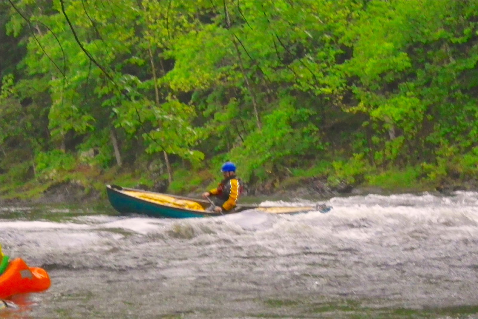
Paddling tandem with Jonathan
The trip was around 14 miles and wound through pretty farms and fields in Vermont's dairy country. The run was mostly quickwater with a couple of easy class II rapids. We worked our way downstream enjoying the rapids when we found them. It rained on and off until around 2:00, but that didn’t seem to dampen anyone’s spirits. At around 2:00, the clouds finally lifted, and we even saw some blue sky. We made it to the take-out in Stockbridge at around 4:00.

With a long drive home ahead of me, I packed my gear quickly, said my goodbyes, and got on my way. The rain started up again when I was half way home, but at that point, I didn’t care.

And yes – the trip was definitely worth it!

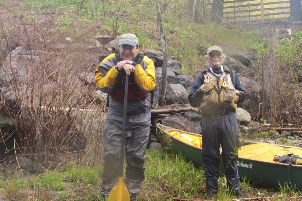
Mutt and Jeff take a break for lunch
Links: