Tuesday, July 30, 2019

Knowlesway Extension Public Access – July 30, 2019

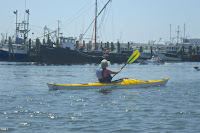
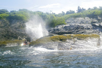
It was foggy this morning, and I needed to finish the August Paddler, so I stayed close to home and paddled down into Bluff Hill Cove to check out the access at the end of Knowlesway Extension.

Knowlesway Extension Waterfront Public Access Point, is located at 220 Knowlesway Ext, Narragansett, RI 02882 on Google Maps.  Coming down Point Judith Road (Route 108) you take a right at the Cumberland Farms across from St. Mary Star of the Sea Church.  There is no public parking, but street parking seems to be permitted. There is a picnic table, and stairs leading down to the water.  

This is a nice option for those looking to paddle the lower end of Point Judith Pond around Great Island and Galilee. The State Boat Launch in Galilee limits parking to vehicles with trailers. Marina Park in the Upper Pond is great, but it is a long way from Galilee if you are just looking for a short paddle.

I found reference to this as a public access point in the Coastal Public Access Inventory for the Narragansett Conservation Commission, on the Coastal Resources Management Council website, and in Google Maps.

Links: 

Monday, July 29, 2019

Point Judith Pond with RICKA – July 28, 2019

Through the Narrows
I was scheduled to lead the RICKA Meeting on the Water at Point Judith Pond last Monday, but I had to cancel due to the threat of thunderstorms (something that I rarely do). I decided to reschedule it for Sunday.

The weather was beautiful with a slight wind from the south that increased as the day went on. We had 8 boats with folks who had all done the trip before. We headed out into the Upper Pond from Marina Park, through the Narrows, and out into Congdon Cove. From there, we headed down to Gardner Island where we crossed the boat channel and headed over to Jonathan Island.  

The crew at Horseshoe Point
With a strong south wind and lots of boat wake, we decided to paddle down the east side of Great Island, which we hoped would be less busy and sheltered from the wind. That way, we would have the wind to our backs as we paddled back up the west side of Great Island. 

As we crossed over to the top of Great Island at Horseshoe Point, Michelle out and was able to get some pictures of the crew. As we paddled down Great Island we were sheltered from the wind until we got well into Bluff Hill Cove. We decided to stop for lunch at the boat ramp in Galilee.  

Through the Port of Galilee
After lunch we paddled under the Great Island Bridge and into the Port of Galilee. With lots of boat traffic, we stayed out of the main boat channels. We paddled around Little Comfort and up the west side of Great Island. With the wind at our backs, it was a quick trip past Harbor Island and back to the Narrows.  

The toughest part of the day is often launching or taking out at the boat ramp at Marina Park. There wasn’t a lot of traffic when we launched, but it was busy as we were taking out. We got out of the way quickly, but still managed to aggravate some motor boaters who thing they own the launch, and the water.

Our route - 8-miles
Links:

Saturday, July 27, 2019

Narrow River - July 27, 2019

View down to the Narrows
It was another beautiful morning, so I decided to head over to the Narrow River to paddle out to the Narrows.  The Narrow River, also known as the Pettaquamscutt River, originates in North Kingstown and flows south into Narragansett Bay at the Narrows above the Narragansett Town Beach. 

I put in at the Sprague Bridge on Boston Neck Road, and paddled down to take some pictures at the rocks at Cormorant Point before heading back. Above the bridge is the John H Chafee Wildlife Refuge. Established in 1973, the refuge at Pettaquamscutt Cove includes over 550 acres of wetland that attracts bird of all species.

Egret in Pettaquamscutt Cove 
Links:

Friday, July 26, 2019

Around Great Island Again - July 26, 2019

After the long paddle yesterday, I decided to stay close to home and do something easy, so I did a trip around Great Island. The water was relatively calm, so I was able to get all the way down to the last buoy before the Breakaway - maybe someday I'll paddle through.

West Passage Lighthouse Tour - July 25, 2019

View from the put-in at the Bay Campus
There are three lighthouses on the West Passage of Narragansett Bay that I have been trying to get pictures of from the water – Dutch Island Light, Beavertail Light, and Plum Beach Light. Dutch Island Light is easy being just outside Dutch Harbor. Beavertail is also easy if you take the pictures from shore – not so much from the water. Plum Beach Light has always eluded me being just outside my comfort level for paddling alone. That changed yesterday when Tony agreed to take me out in one of his sea kayaks. 

Tony needed to return the RICKA Volunteer of the Year trophy, so we decided to take the opportunity to do some paddling. Tony gave me lots of options, but we decided to launch from the URI Bay Campus. We met at 8:30 and unloaded the boats. The day was beautiful, with wind out of the north kicking up 1’ waves. Combined with the usual boat wake, it would be easy for Tony, but a little challenging for me.

Dutch Island Light
We decided to cross over to Dutch Island, and then head south to Beavertail. I would be paddling a 17’ Heritage sit-on-top sea kayak. It seemed a little tippy at first, but I got use to it. My first real test came about half way across the West Passage when a large motorboat sped by creating 2-3’ wake. I bounced over fine and we continued to Dutch Island.

Dutch Island took its name from the Dutch East India Company that established a trading post here around 1636. The first lighthouse was completed on the southern tip of the island in 1826. The original tower was replaced with the current tower in 1857. The lighthouse remained in service until 1979 when it was replaced with a flashing buoy.  It then fell into disrepair until 2007 when it was restored by the Dutch Island Lighthouse Society.

Beavertail Light
From Dutch Island we headed south toward Beavertail. Records from the town of Jamestown make reference to a beacon here as early as 1712. A wooden tower known as the “Newport Light” was built in 1749. It burned and was replaced with a stone tower 4-years later. In 1856, the original stone tower was replaced with the current granite tower. It is 10’ square and 64’ tall. The lighthouse was restored and opened to the public in 1989 and includes a museum is operated by the Beavertail Lighthouse Museum Association.

As we headed south it took me a little while to get use to paddling in a following wind. As we approached Beavertail we also had to deal with rolling waves coming in from the open water. I did my best to click a few pictures of the lighthouse, but I was more concerned about staying upright. When Tony rose up and then disappeared behind a 3 ' rolling wave, I decided that I gone far enough. I clicked my last picture, and we turned around and headed north, taking a break in one of the secluded beaches in the cliffs.  

Tony get a shower
We headed back to Dutch Harbor and took a break for lunch near the boat dock at Fort Getty. From there we crossed back to Dutch Island to get a few more pictures of the lighthouse. We continued up the west side of the island, and then we had a decision to make. We could play it safe and explore Dutch Harbor, or we could head north toward the Jamestown Bridge to get some pictures of the Plum Beach Light. We decided to head to Plum Beach Light.

The sparkplug shaped Plum Beach Light was built in 1899 using pneumatic caisson engineering – a new innovation at the time. The granite base was added in 1922. The light was deactivated in 1941 when the first Jamestown Bridge was built. It remained abandoned until 2003 when the lighthouse's exterior was completely restored by the Friends of the Plum Beach Light.

Plum Beach Light
In order to get to the Plum Beach Light we had to cross the boat channel to the North Kingstown side, and then head north under the Jamestown Bridge.  The wind had died down, but boat wake continued to roll in from across the bay.  Still, it was amazing to sit at the base of this lighthouse that had always seemed just out of reach.  

After clicking a few pictures we turned and headed back to the put-in. In total we paddled 14-miles if you believe Google Maps – it didn’t seem that far, but no wonder I was tired.

Links:

Thursday, July 25, 2019

Poter Pond - July 24, 2019

Fishing boat leaving Galilee
It was another cloudy morning, so I decided to stay close to home and paddle down to Potter Pond. Potter Pond is connected by a tidal inlet to Point Judith Pond at Snug Harbor. To the south are the sand flats and barrier beaches along the East Matunuck State Beach and Matunuck Beach. To the north are woodlands surrounding a deep kettle pond left by a retreating glacier.  

I paddled down the west side of Great Island into the Port of Galilee and sat at the top of the Breachway to watch the boats come and go before crossing over to Snug Harbor at the Snug Harbor Light. It was low tide, so I couldn’t paddle into the sand flats along the inlet, but I could see the beach house at East Matunuck.

Oyster farm near Matunuck

With an outgoing tide, there was good current under the bridge at the Matunuck Oyster Bar on Succotash Road. Once in Potter Pond I stayed in the southern end and paddled down to Segar and Seaweed Coves. An oyster farm takes up a large part of the southern end of the pond, and residents are now fighting the issuance of additional leases - I can see why.  

The wind picked up on Point Judith Pond as I paddled back to the cottage – it was a bit of a slog.


Sand flats on the Inlet
Links:
My Pictures

Tuesday, July 23, 2019

Middle Islands - Point Judith Pond – July 23, 2019

Looking for breakfast
After impressive thunderstorms and rain throughout the night, I was lucky to catch a pause in the storms to paddle around the Middle Islands near the cottage.  The birds were out looking for breakfast, and I got a little practice paddling in the wind with wind-blown waves.  The rain started up again as soon as I got back to the cottage.

Horseshoe Point
Links:

Monday, July 22, 2019

Upper Point Judith Pond - July 22, 2019

Marina Park
I was supposed to lead a RICKA trip on the Upper Point Judith Pond today, so I got up early to check out the put-in at Marina Park. The morning was beautiful, but the forecast for the evening called for thunderstorms. I paddled up past Ram Island and Harbor Island, through the Narrows into the Upper Pond, and back. In the end, I cancelled the RICKA trip. Good thing too - the thunderstorms arrived around 8:15, and they were impressive!

Links: 

Sunday, July 21, 2019

Around Great Island - July 21, 2019

Sunrise - time to start the day
I woke up at 5:30 to an amazing pink sky.  The sun was just starting to rise, so as I usually do, I decided to start my vacation with a paddle around Great Island in the Point Judith Pond. 

Point Judith Pond is the second largest of Rhode Island’s salt ponds. Separated in the south behind sand dunes and barrier beaches, Point Judith Pond is connected to the ocean through the Breachway at Galilee.

Horseshoe Point from Frank Neck
Great Island is one of three large islands on the pond - the other two are Harbor Island and Ram Island. I put-in at our cottage and headed south past Frank's Neck, into Bluff Hill Cove, and under the Great Island Bridge into Galilee.

The fishing village of Galilee was developed in 1935 when the State of Rhode Island dredged out a harbor suitable for commercial fishing vessels. Unlike other fishing villages that developed into tourist centers, Galilee retains the feel of a commercial fishing village.

Fishing boats in Galilee
It was a quiet morning, so I was able to paddle in around the boats. I paddled down close to the last buoy before the Breachway that connects Galilee to the Harbor of Refuge. I crossed over to Jerusalem and paddled up to the large marina at Snug Harbor.  

From there, I crossed back over to Great Island, and paddled past Thomas Point before returning to the cottage.

Snug Harbor Light
Links:

Sunday, July 14, 2019

Merrimack River – Franklin to Boscawen – July 13, 2019

Put-in behind Franklin High School
Our original plan was a low level run on the Lower Winni. Joe said that its good down to 350 cfs, but it dropped below 300 cfs. After that, there was talk of a Pemi Woodstock run, but that's a long drive for me and it also dropped down into the boney range at around 800 cfs. In the end, we decided on the quickwater section of the Merrimack River from Franklin to Boscawen. 

The Merrimack River arises at the confluence of the Pemigewasset and Winnipesaukee Rivers in Franklin and flows south and then east for a 117-miles to before emptying into the Gulf of Maine at Newburyport. Its watershed is one of the largest in New England with major tributaries that include PemigewassetWinnipesaukee, Contoocook, Nashua and the SUASCO (Sudbury, Assabet and Concord) Rivers.

Joe
Some say that the Industrial Revolution started on the banks of the Merrimack River in Lowell, and other major industrial cities like Concord, Manchester, Lawrence, and Haverhill grew up along its banks. In honor of its industrial past, several U.S. naval ships have been named USS Merrimack, including the hull that would be raised by the Confederates to build their ironclad. The changes on the river were also detailed in the early American literary classic A Week on the Concord and Merrimack Rivers by Henry David Thoreau.

We decided to do the 6.5-mile section from Franklin to Boscawen. I met Joe at the take-out at the Boscawen Boat Launch for the shuttle up to the put-in behind the Franklin High School. Patty was waiting at the put-in when we arrived. The river was at a nice level - 7.5 feet, 5300 cfs on Franklin Junction Gage. The day was beautiful – sunny and warm.

Patty
The Merrimack starts out big and wide, and only gets bigger as it heads downstream. This section includes a series of easy riffles interspersed with quickwater. The usual lunch spot was occupied by a group of sunbathers, so we stopped at a hay field a little further downstream. I pulled my boat into the shade, and Patty and I sat in the boat to avoid the ticks.  

It took about 3 hours for the run at a leisurely pace. Below Boscawen, the river flattens out and there are more sand bars – it was busy with tubers.  

Erik
 Links:

Wednesday, July 10, 2019

Monday, July 8, 2019

Pawcatuck – Bradford to Potter Hill – July 7, 2019

Putting in at Bradford
I got up early and headed out to scout a RICKA trip on the Pawcatuck River from Bradford to Potter Hill - Rhode Island’s new Wild and Scenic River. Originally, our plan was to paddle downstream to meet the Paddle Across Rhode Island (PARI) crew as they came upstream on a “sea-to source” trip, but with higher water levels they decided to paddle downstream instead. As we were paddling down from Bradford, the PARI crew was paddling down the Chipuxet River and across Worden Pond.  

It has been a while since I had done this trip, so I wanted to check out the take out and parking at Potter Hill. The take out is on the Westerly side of the river just above the Potter Hill Road Bridge at a small Westerly Land Trust property. Parking is available at the Post Office Landing – a DEM boat launch across the street.  It looks like someone’s driveway, but it is a public access point.

Running the Bradford Dam
We meet at Bradford Landing at 10:00 to run the shuttle, and we were on the water around 10:30. The river was at a nice level – 2.5 feet, 125 cfs. on the Wood River Junction gage.   We paddled under the Route 91 Bridge, and pulled over on the right to portage the new fish weirs at the old Bradford Dam.  

The old Bradford Dam was a 19th century stone and timber structure that provided power to the Bradford textile mills. Built on top of a natural falls, the 6-foot dam spanned the entire width of the river.  Since removing the dam would drop the water level upstream by about 5 feet and negatively impact wetlands, the decision was made to replace the existing dam with the new rock ramp structure.

Polly Coon Footbridge
The new dam is made up of 6 gradually ascending stone weirs, which serve like terraced steps. Pools between the steps give fish a place to rest on their way upstream. Gaps in the weirs create channels for water to flow and fish to swim, including the main current down the middle that forms a nice channel for paddlers. We had about 6 paddlers run the dam, and 2 swims.  

From Bradford to the Route 3 Bridge, the river twists and turns trough the woodlands of the Grills Preserve owned by the Westerly Land Trust and Hopkinton Land Trust. We passed under the Polly Coon Footbridge and continued downstream stopping at the beach off Narragansett Way for lunch. Below the Route 3 Bridge there is more development as the river meanders though open marshland to the Potter Hill Dam.


Lunch at the Beach
Links:

Sunday, July 7, 2019

Lincoln Woods - July 6, 2019

It's been a while since I had my whitewater boat out, so I took it down to Lincoln Woods for some flatwater practice.  I'm not as good as I use to be at carving circles - more practice needed!

Olney Pond at Lincoln Woods

Friday, July 5, 2019

Slatersville Reservoir - July 2, 2019

Had a nice night with the Blackstone Valley Paddle Club at the Slatersville Reservoir. We put in at the State Boat Ramp off Route 102, and paddled up the Branch River to the Route 7 Bridge. 


Links:
My Pictures
Slatersville Reservoir from RI Blueways