Monday, May 28, 2018

River Church - Tville - May 27, 2018

Horseshoe Ledge
As I drove up Blue Hill Avenue in Bloomfield I noticed a bunch of big mega-churches. It was Sunday morning so the parking lots were full. On this Sunday I was glad to be going to a different church - River Church.

It has been almost a year since I took the drive out to Tariffville to run the “Tville” section of the Farmington River. The Farmington arises near Otis, MA and flows generally south and east for 47 miles through Connecticut until it flows into the Connecticut River near Windsor, CT. There are several sections of the Farmington that are popular for whitewater boating – New Boston (class III/IV), Riverton/Satan’s Kingdom (class I/II), Crystal (class II), and of course “Tville” or the Tariffville Gorge (class (II/III).  

Approaching the Playhole
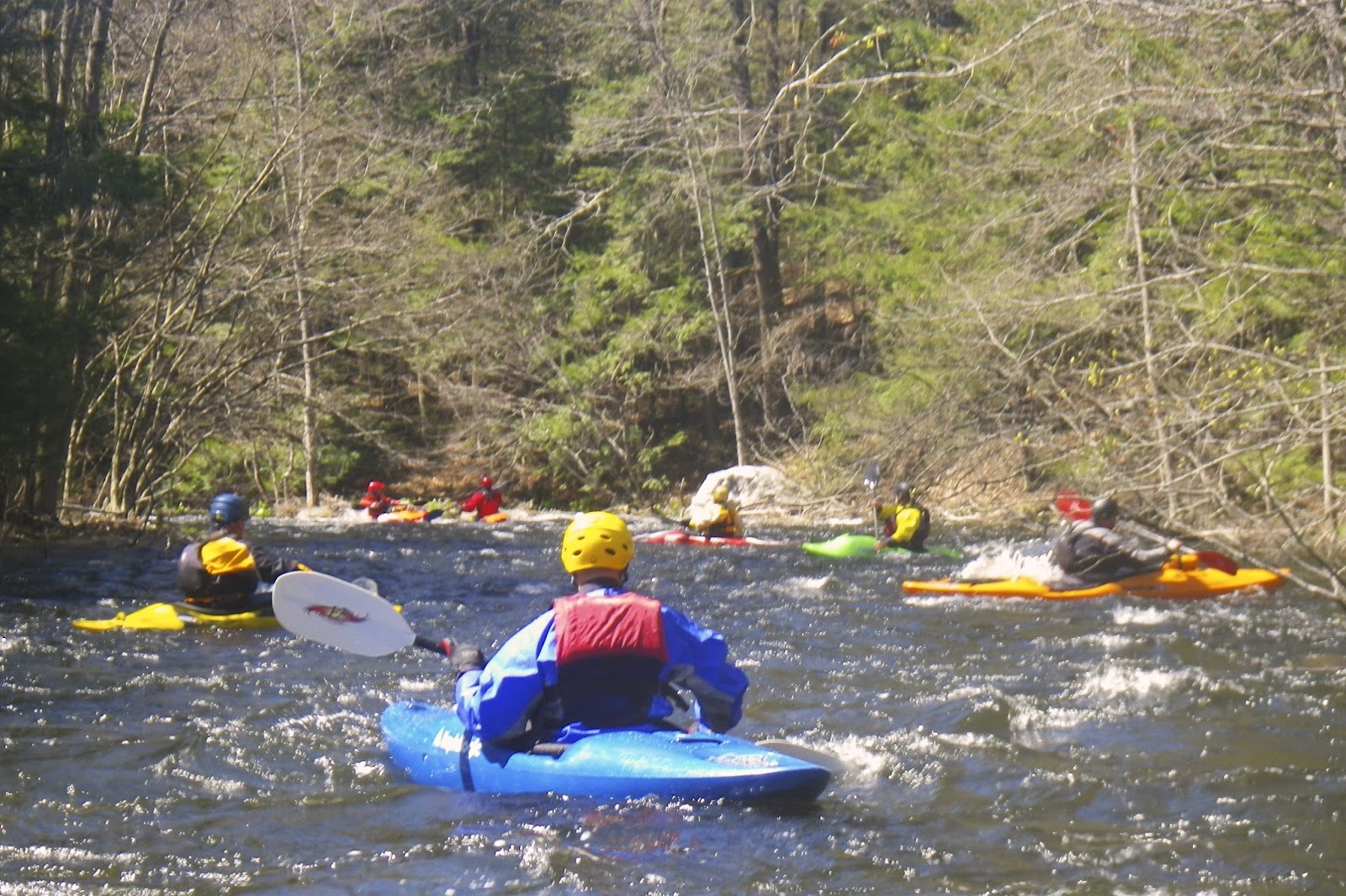
Tville is one of the best-known whitewater runs in southern New England. It is the site of an annual spring slalom race, and has hosted national and Olympic trials.  The run itself is short - just 1.5 miles - but the water runs most of the year, and there are play spots for paddlers of all skill levels.  At yesterday’s level (2 feet, 800 cfs. on the Tariffville gage) it is a class II/III run. 

I met up with the group from the CT/AMC at Tariffville Park to run the shuttle down to the take-out on Tunxis Road. It’s been a while since I have run it at this level. Cathy’s Wave and the Horsehoe Ledge were at a nice level. As you enter the gorge the intensity picks up a bit with the Bridge Abutment Rapid (ran right) and the Playhole (ran left).  The Playhole was at nice level, but I was still too chicken to try.

Typewriter
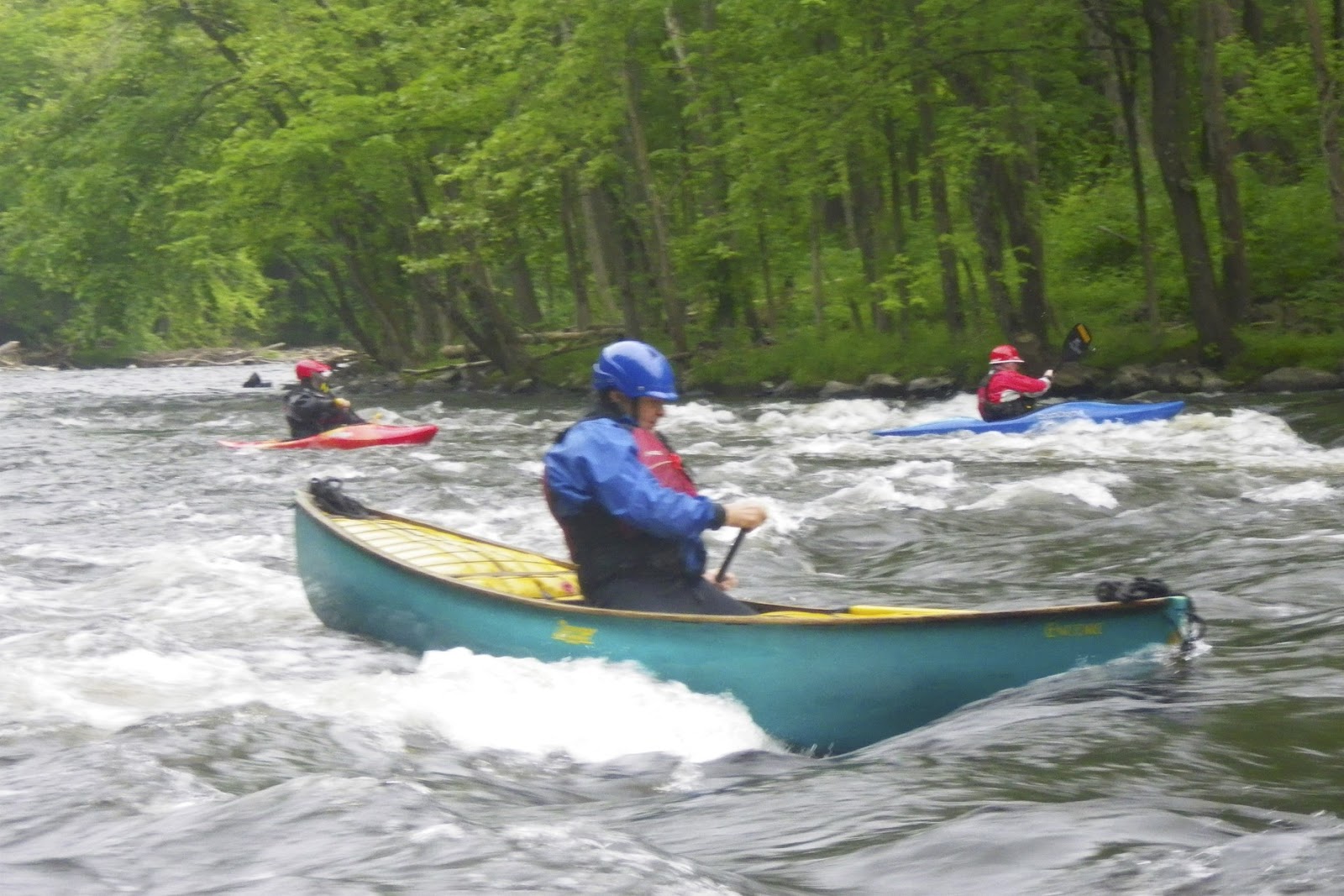
Below the Playhole are a couple of small ledges that I ran to the left.  Below that are the Inquisition Ledges. I ran the first to the right (avoiding the big hole in the center).  From there, I tried to ferry left to run the second drop, but got swept downstream early.  Fortunately I still made it through the shoot. After my second attempt surfing at Typewriter I got swept downstream. 

Below Typewriter
I did earn another poem on P-net from Tom.

Seems to me you’ve positioned yourself semi-church,
under cumuli cathedral though your pew’s about to lurch.
Devil’s wavin’ from big hole so best take righteous direction.
Hell, your positioned halfway there dodgin’ wave in genuflection.

Perhaps naming that red Bell of yours, “A Beady Rosary” might “indulge” a few additional church kitchen passes?

Peace be with you, brother.

Signed,
The Methodless Methodist Married Into the Vatican Mob
(Without a host, mind ya!)
TW

Links:

Saturday, May 26, 2018

Canal/River Loop - Lonsdale to Ashton - May 26, 2018

It was such a nice day that I decided to skip the gym and go paddling. I did the canal/river loop from Lonsdale to Ashton. There were a lot of blow-downs in the canal, but I only had to get out of the boat for one. The river was at a nice level – 2 feet, 500 cfs on the Woonsocket gage. I took a lot of video, but unfortunately I deleted it before down loading it to the computer. Here is all I ended up with.  

Monday, May 21, 2018

Alton to Bradford - May 20, 2018

Running the Broken Dam
The forecast was mixed with rain and thunderstorms early and late, but we were able to catch the window in the middle to run the Wood/Pawcatuck from Alton to Bradford. The river was at a nice level -3 feet, 250 cfs on the Wood River Junction gage.  

Due to work on the bridge below the dam, we had to lift our boats over construction barriers to get the put-in.  Once there, the river was flowing nice. We had an easy run through the broken dam at Burdickville, stopped for lunch and a fire at Burlingame Canoe Campsites (thanks Jim), and did a first run through the new dam at Bradford.

Lunch at Burlingame
I did a little research on the old Bradford Dam. The original dam was a stone and timber structure built between sometime 1819 and 1846 to divert water to the Bradford textile mills. Built on top of a natural falls, the 6-foot dam spanned the entire width of the river.  

Since removing the dam would drop the water level upstream by about 5 feet and negatively impact wetlands, the decision was made to replace the existing dam with the new rock ramp structure. This ramp is made up of 6 gradually ascending stone weirs, which serve like terraced steps. Pools between the steps give fish a place to rest on their way upstream. Gaps in the weirs create channels for water to flow and fish to swim, including the main current down the middle that forms a nice channel for paddlers.


New fish weirs at Bradford
The Bradford Dam is just one of a series of restoration projects on the Pawcatuck River. In 2010, the Lower Shannock Falls Dam was removed and replaced with a short rapid that allows fish to swim upstream, and paddlers to run downstream. In 2013, a rock ramp was built on the downstream side old Kenyon Dam. In 2016, the White Rock Dam in Westerly was removed. Combined with fish ladders at Potter Hill and Upper Shannock Falls, the removal or modification of these dams has opened up 31 miles of the Pawcatuck River to migratory fish.  

Hopefully the water will be at a good level when we do our Bradford to Potter Hill trip on August 18th.  It will be nice to run down the weirs rather than portage like we had to do with the old dam.  

The crew at the put-in
Links:

Monday, May 14, 2018

Camping - Ideas from Jonathan

Sort of random order of rivers that have some kind of riverside camping possibility.
  • St Croix – Vanceboro to Kellyland. Good two/three nigh trip. Guaranteed water. Sort of far but we could stage through our place in Wiscasset. Bring your passport. Self shuttle. 
  • Saco – Don’t laugh. That is where it all started for me. Could make a good 3 day trip from Bartlett to Hiram. All flat water after the first day. Water level unknown. 
  • West Branch Penobscot – Roll Dam to Chesuncook Village. Could work as a three day trip. Quite far away and we probably would not be able to self shuttle. Again we could stage through Wiscasset. 
  • Baskahegan Stream/Lake – This was the trip I did last spring. Basically flat/fast water. Very pretty when the sun is shining. 
Saving this for future reference!

Saturday, May 12, 2018

Connecticut River Camping - Canaan to Bloomfield - May 9-11, 2018

Put-in in Canaan with the
class III rapids upstream
I left my house early Wednesday morning and was driving north up Route I-495 in rush hour traffic. As I came to Route 3 the commuter traffic was headed south toward Boston, but I left the traffic behind and headed north into New Hampshire. It felt good!

After running the section of the upper Connecticut River from Bloomfield, VT (North Stratford, NH) to Lunenburg, VT (South Lancaster, NH) last fall, Bill and I wanted to run the section from Canaan, VT (West Stewarstown, NH) to Blooomfield, VT (North Stratford, NH). We had been planning the trip for months, and it had finally arrived. I met Bill at the Visitor Center in Hooksett for the rest of the drive to the river.  

Monadnock Mountain in VT
When we arrived at the take-out, Earl and Jonathan were already there, and Conrad arrived shortly after. With the crew complete, we consolidated our boats and gear for trip up to the put-in in Canaan. The river was at a great level – 6 feet, 4,000 cfs on the North Stratford gage.  

We unloaded our boats at the boat ramp below the Canaan-West Stewartstown Bridge. Above the bridge, we could see the class III rapids below the Canaan Dam. The river was running fast as we headed out and paddled downstream. This section of the river meanders though farms and fields as it circles Monadnock Mountain in Vermont. After passing the Colebrook Bridge we pulled into the Holbrook Point Campsite.

Campfire cooking
The picnic table and stairs were still chained to a tree when we arrived, so we were likely the first campers to use the site this year. We set up the camp, gathered firewood, and had a nice supper of Fried Fish and Maine Guide Potatoes cooked on the fire by Jonathan before we settling in around the campfire for the night.

On Thursday we were in no rush to get started since we had a relatively short paddle down to the Lyman Falls. Breakfast included Omelets, Home Fries, and Sausage with lots of coffee. After breakfast we started loading our boats. Unfortunately, I wasn’t paying attention and my fully loaded canoe drifted out into the river. Fortunately, Conrad had his drysuit and was able swim out and retrieve it before it hit the current and got swept downstream.  

Campsite at Lyman Falls State Park
The Connecticut River is not known for its wilderness feel, but this section seemed a little more remote with hemlocks lining the banks in several sections. Below the Columbia Covered Bridge there was two miles of intermittent quickwater and class I rips leading to the Lyman Falls - a washed out dam and our destination for the night.

Before running the dam, we checked out the campsites upstream on the NH side, but found them poorly maintained. I ran the dam on the left, and ferried over to the Vermont side to check out the campsites at the Lyman Falls State Park, which were much nicer. In fact, they were the nicest sites that I had seen so far on the river. Jonathan, Bill and Earl followed my lead, and Conrad ran the dam just right of center. 

Conrad surfing at Lyman Falls
We set up camp and had a long lazy afternoon. We were only the second group to use the site this year, so firewood was easy to find and soon we had a large pile to burn. After a little exploring around the campsite, we lit the fire and Jonathan cooked a great dinner of Curried Chicken. After that, there was nothing left to do but enjoy the fire.

It had cooled off significantly when we woke up on Friday morning. The rapids on Thursday had dumped enough water in my boat to contaminate the fuel in my Coleman stove, so all cooking would have to be on the fire. Good thing we brought Jonathan along. We got a fire started, the coffee perking, and breakfast cooking - bacon, pancakes and left-over curried chicken.

Luther's Troopers (or the Canaan Five)
Bill, Conrad, Earl, Jonathan and Erik
After breakfast, we cleared some logs and debris from the launch area (always leave the site better than you found it) before loading our boats. By now the river had dropped about a foot - 5 feet, 3,000 cfs on the North Stratford gage. Conrad and I did a little surfing below the dam before we all headed downstream.

Even at this level, there were some nice class I rips immediately below the Lyman Dam. We were surprised that these easy rapids continued for several miles down to Bloomfield. Unfortunately, Earl and I had to take out there, but Bill, Jonathan and Conrad continued down to the Maidstone Bridge.  

Connecticut River Camping - Canaan to Bloomfield from Erik Eckilson on Vimeo.

Links:

Sunday, May 6, 2018

Otter Brook - May 5, 2018

The May release at Otter Brook usually means the end of the spring whitewater season. If it is, it’s a nice way for it to end.

I hooked up with Paul and Brian for a couple of runs at Lower Otter Brook. The release was 300 cfs as advertised.  We did our first run with a group from the CTAMC – 14 boats, two canoes (me and Dave). That run took two hours. Paul and I did a bomber run for our second run – 40 minutes.  

Links: