Saturday, May 31, 2014

Assabet/Concord - Acton to Concord – May 31, 2014

Green tunnels
Last Sunday I paddled though Powder Hollow on the Scantic River – site of the Hazard Powder Company.  Yesterday, we put-in below the Powder Mill Dam on the Assabet River in Acton. Fortunately, the gun powder mills on both of these rivers are gone, and there were no explosions on either day.

Yesterday, I led a RICKA trip in the Assabet River from Acton (Acton Canoe Launch, 63 Powder Mill Road) to Concord (Old Calf Pasture, 299 Lowell Road).  We had twenty boats including two special guests – SuAsCo Al and Tommy T. 

Running the broken dam
We met at the Acton Canoe Launch at 9:30 to unload boats and run the shuttle.  The shuttle was actually the toughest part of the trip, but we got back to the put-in at around 10:45, and began launching the boats.  The river was at a nice level – 2.5 feet on the Maynard gage.  About halfway through the process, I looked up and saw Tommy T. paddling upstream.  He had put-in at the Route 225 Bridge on the Concord River, and paddled upstream about 10 miles to meet us. 

We finally got all the boats in the water around 11:00 and began our decent down through the quickwater below the Powder Mill Dam.  About a mile downstream from the Powder 
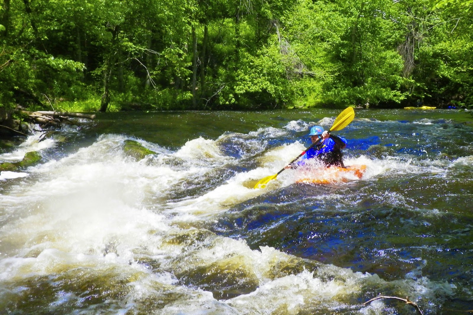
Mill Dam is the broken dam at Damondale.  This dam is breached on river right, and we queued up to run the shoot through the breach before continuing downstream. 

Egg Rock
Below Damondale, the Assabet slows and large trees shade the river forming “green tunnels” along several sections of the river.  It seemed too early for lunch, so we passed the usual lunch spot in West Concord and continued downstream.

Folks were starting to get hungry as we paddled through the Leaning Hemlocks section.  We found the memorial plaque to George Bartlett, checked out the plaque at Egg Rock where the Assabet converges with the Sudbury to form the Concord, and stopped for lunch at the Old Calf Pasture. 

Minute Man Statue
From there, it is just a short paddle up into the Old North Bridge and the Minute Man National Historic Park.  We posed for a picture below the bridge before heading ashore to check out the historic sites including the Minute Man Statue, the 1832 Monument and the Old Manse. 

Tourist gathered on the Old North Bridge as we posed for a picture
Links

Monday, May 26, 2014

River Church - May 25, 2014

Quickwater on the upper section
On Sunday mornings I usually go Saint Joseph’s Church, but Paul and Jeff tell me that it is good for the soul to go to “river church”, so yesterday I decided to hook up with a group that was paddling the Scantic River in Connecticut.

The Scantic arises near Springfield, MA, and flows generally southwest for 40 miles before emptying into the Connecticut River near South Winsor, CT. We would be paddling the 4-mile section from Somersville (Somers) to Hazardville (Enfield).  

Ed Y. running Stokers
In the 1800’s, this section of the Scantic was the home to the Hazard Powder Company, which supplied the Union army with much of its gunpowder during the Civil War. The company disappeared in a mighty blast in 1913; however, some of the foundations are still intact. The State of Connecticut is building a “linear” park along this section of the river with several miles of walking trails in an area now known as “Powder Hollow”.

We had eight boats – seven kayaks (Ed W, Ed Y, Scott, Paul, Roy, Kimberly and Denise), and one canoe (me).  There is no gage on the Scantic, but the Broad Brook gage is a good substitute.  If Broad Brook is above 30, the Scantic should be runable. It's a downstream gage, so it’s not perfect.  Yesterday the Broad Brook gage was around 50, and the Scantic was at a perfect level. 

Ed W. running Chimney
We put-in near the water treatment plant off Quality Avenue in Somersville (Somers). For the first 2 miles the river meanders though a pretty hemlock forest.  It’s mostly quickwater with a couple of easy class I rapids.  After the Route 191 Bridge and a railroad bridge, we portaged the dam at the Springborn Mill on river left. 

Just downstream from the dam is the first of three major rapids – Stokers.  This is a ledge with a 3-foot drop and a rocky shoot 6 to 10 feet from the left bank.  When I ran this rapid last spring I swam it twice.  I didn’t do much better this time.  I lined up on the shoot, made it through the first big drop, only to swim a little downstream.  I did do a nice self-rescue though.

Kimberly running Staircase
Just upstream from Chimney is a nice surf wave that was perfect for an open boat at this level.  I was able to do some back surfing and side surfing, and still got out in one piece   Chimney itself is an “S” turn rapid that starts off as a series of small ledges with a larger drop at the end.  I made it through Chimney fine.

The final rapid is Staircase, which is exactly what you’d expect - a series of ledges that look like a staircase.  The largest ledge at the bottom has a nice wide shoot on river left.  It turned out to be a fun run with a great group – I recommend that everyone go to river church.

A view of the Staircase Rapid from the bidge
Links:

Sunday, May 4, 2014

Ottauquechee River – May 4, 2014

Quechee Gorge
The sky seemed to brighten, and blue sky peeked through the clouds as I crossed into Vermont on Route I-89.  Unfortunately, the sunshine would be short-lived.  

I drove across four states to join Marshall Moore’s NHAMC trip on the Ottauquechee River.  The Ottauquechee arises Green Mountains near Killington and flows generally eastwardly across VT before emptying into Connecticut River. The river is probably best known for the Quechee Gorge – a deep canyon that can be seen as you drive over the Quechee Gorge Bridge on Route 4. We would be going a little further upstream to run the 9-mile section from West Bridgewater and Woodstock.

A typical section of the Ottauquechee
When I arrived in the put-in at the ball fields in West Bridgewater, I found that most of the group had already arrived.  We would have eleven boats, all canoes – 5 polers, 4 OC1s and 2 OC2s. The plan was to put in upstream at the Route 100A bridge in Bridgewater Corners, and take out at the White Cottage Snack Bar about a mile above Woodstock. We quickly ran the shuttle and got on the river.

The river was at a nice level – 3.5 feet, 100 cfs. on the West Bridgewater gage.  At this level, the river is mostly quick water with some easy class I/II rapids. It is certainly pretty as the river twists and turns through woods and farmland. The skies were cloudy, but other that a brief rain shower, we had a great day.

Links: