Sunday, March 30, 2014

Jim O'Brien Memorial Paddle - March 29, 2014

Group picture at the put-in
I didn’t know Jim O’Brien, but I knew of him.  His boating skills were well above mine, so we rarely crossed paths on the river, but he was a friend to many.  It is a great testament to him that his friends still gather to remember him four years after his tragic accident.

About forty-five boaters (including Andy, Duke, Mike and me) gathered on the Knightville section of the Westfield for the Jim O’Brien Memorial Paddle.  It was a dam release weekend, and the river was running between 600 and 700 cfs. – a surprisingly fluid level. When Glenn Stewart offered to bring his Perception Revolution, I jumped at the opportunity to paddle it with him. 

Stand-up paddling the Revolution
The Revolution is described in old Perception marketing materials as a cataraft that can bring whitewater paddling to anyone.  It is simple to paddle, spins on a dime and is amazingly stable.  It is maneuvered with only two strokes – forward and backward.

After a group picture at the put-in, we began our trek downstream.  The Revolution glided over and around rocks, and rode waves easily.  As long as you keep the boat running straight downstream, about the only thing that you can do wrong is get a rock stuck between the pontoons.  It’s a lot of fun to paddle.

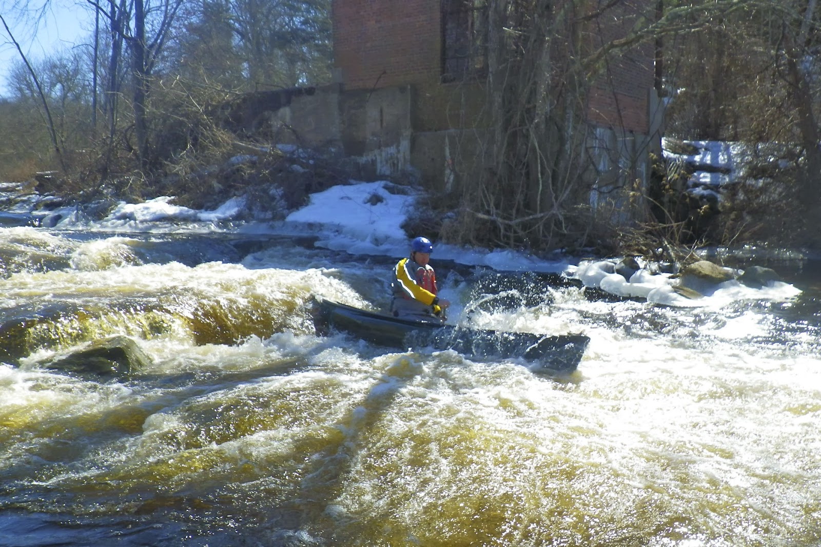
Andy running the Gorge Drop
As we entered the Gorge section I was surprised to see ice ledges lining the river.  There are two significant drops in the Gorge section.  The first has easy haystacks on river right, and a narrow tricky shoot on river left.  Glenn and I decided to take the route on river left.  The river funnels between a mid-stream rock and the bank.  We made it down the drop only to get pushed into the bank at the bottom.  Fortunately, the ice ledge at the bottom was not particularly large, but I still ended up with a nasty bruise on my leg. 

The second drop in this section is known as the Gorge Drop.  The river is divided in the middle by a large rock.  The route is to run just right of the rock, catching the eddy at the bottom if possible, or at least moving left to avoid the large haystacks downstream.  Glenn and I nailed it, and pulled into the eddy to get some pictures of the rest of the crew coming through. Hopefully I’ll get to paddle the Revolution again this summer with Glenn on the Dryway. 

Duke surfing in the Gorge Drop

Links:

Wednesday, March 26, 2014

Sunday, March 23, 2014

Branch River Icebreaker - March 22, 2014

Tommy running Whipple Drop
We call it the Branch River Icebreaker, but we really don’t expect to find ice.  This year there was, which gives you an idea of how cold this winter actually was.

We had a nice crew for our annual Branch River trip – 6 canoes (1 tandem – Jonathan and Ellen, 2 solo – Erik and Jeff, and 3 poling – Mike, Chuck and Tommy) and 3 kayaks (Andy, Bob and Ric).  The river was at a nice level – 3 feet, 275 cfs - little low, but still fluid.

We met at the new put-in below the Stillwater Mill complex.  Once everyone found it, it worked out great.  It was much easier than climbing over the fence and lugging boats down the steep bank up by the dam.  We paddled up to the dam, and I carried my boat up to run the first rapid under the bridge.

Bob running Atlas Pallet
The trip downstream was pleasant and uneventful.  Running Whipple Drop was easy, but it was tough to surf at this level. We found a little ice on the approach to the Oakland Dam.  Fortunately, it was still thick enough to walk on.  Glendale was boney and caused trouble for a couple paddlers, but everyone made it through fine. Atlas Pallet was a straight-shot down the middle.

It started to rain as we approached the portage at the Nasonville Dam, but by the time we reached the take-out, the clouds had cleared and the sun was shining.  Spring arrived just in time!

The crew takes a break at the Oakland Dam
Links:

Sunday, March 16, 2014

Portage through Woonsocket - March 16, 2014

With the warmer weather and snowmelt, I decided to do a quick run at River Island Park.  The river was at a good level - 3.5’, 1,300 cfs on the Woonsocket gage.  The run was uneventful, but the portage back to the car is always a pain.  I got some funny looks as I carted my boat through downtown Woonsocket.

Boat is loaded and ready to go.
On the by-pass in downtown Woonsocket.

Sunday, March 9, 2014

Good for Fish, Good for Paddlers - Pawcatuck River - Biscuit City to Richmond - March 8, 2014

Jim C. running the Kenyon Dam
There has been a lot of work done on rivers in this area to restore access to migratory fish.  I can think of several trips that I have done in the past few months where dams were removed to improve access.  This includes Pawtuxet Falls Dam on the Lower Pawtuxet River and the Spoonville Dam on the Tville section of the Farmington River.   The removal of these dams has restored miles of free-flowing river habitat to river herring, alewife and shad.  These fish are an important part of the ecosystem, providing food for bluefish, striped bass, largemouth bass, herons, ospreys and many other predators.

Perhaps nowhere has this restoration work been more active than on the Pawcatuck River near the Shannock Village.   At one time, this short section of the river contained three dams that blocked access not just to fish, but to paddlers as well.  With the completion of the new Kenyon Dam, access along this section has improved dramatically. 

Approaching the portage at the Horseshoe Dam
I met up with Jim C. and Jim S. to run the section from Biscuit City Road down to Richmond. The Biscuit City Fishing Area launch site was iced in, so we will put in just downstream on Biscuit City Road. The water level was low, but runnable – 2.75 feet,180 cfs on the Wood River Junction Gage.

Just downstream from the put-in is the new Kenyon Dam. As water flows down this minefield of rocks, you might think you are looking at a natural rapid. An 85-foot-long ramp has been constructed on the downstream side of the dam.  This ramp is made up of five gradually ascending stone weirs, which serve like terraced steps. Gaps were left in the weirs to create channels for the water to flow and the fish to swim, including a main current down the middle that forms a nice channel for paddlers. This main channel is a little tricky with a gradual curve to the right, but we all made it through fine. 

Running the Lower Shannock Falls
From the Kenyon Dam to the Horseshoe Dam in Shannock Village, the river twists and turns through a pretty marshland.  We portaged the Horseshoe Dam on the left, and continued down through some easy rapids to the Lower Shannock Falls.

The dam at the site of what is now the Lower Shannock Falls was removed in 2010.  This rocky section of the river curves gradually to the left before ending in a couple of large drops.  Open boats will often take in water at the bottom, but the rapid can easily be portaged on the right. 

Below the Lower Shannock Falls, the river is a combination of flatwater and easy quick water until you reach the Route 112 Bridge and the Carolina Mill Raceway.  We stopped for lunch and a campfire at the Carolina Canoe Campsite before taking out below the Richmond Dam.  

Taking a break at the Carolina Canoe Campsite
Links: