Wednesday, December 31, 2014

2014 Year End Review

Unfortunately, I needed to work on New Years Eve, so my paddling is done for 2014. I always try to do at least one big trip each month, and here are some of the more significant ones:

January – Pawtuxet Cove
December -  Crystal/Boateater

I didn't do much camping this year - just a couple of overnight trips with the Paddle Across Rhode Island crew and RICKA.   Hopefully I will get to do some more camping next year.  Mike is talking about a trip on the Allegheny River in northwest Pennsylvania, and Tommy is talking about doing a couple of sections of the NFCT: Section 1 - Old Forge to Long Lake; Section 5 - Missisquoi; and Sections 9 & 10 - Rangley to Moosehead.

Some of my favorite trips for the year are here:

Monday, December 29, 2014

Functional Freestyle - December 28, 2014

There is an ongoing thread on Paddling.net on freestyle paddling moves, so I took the Yellowstone out to give it a try.  I was able to capture the Axle, Cross Axle, Post and Cross Post on video, but the camera died while I was trying the Wedge, Christie and most of the sideslips. Here is my narrated version.

For me, the easiest turns, and the most effective in the Yellowstone are the post and cross post.  These are good on flatwater, but in moving water, the Axle or Cross Axle are safer bets.  I can get about 90 degrees on the initial skid, and get to about 180 degrees with subsequent forward and cross forward strokes.

Palm rolls and in-water recoveries are not something that I do on a regular basis, but they do help make the initiation and follow-up strokes more effective.  On the wedge, the in-water recovery gets the paddle into position for the bow pry much easier than tying to jam the paddle in place.  For the onside skidding maneuvers (Axle and Post), the palm roll can link follow-on bow draw and J-strokes to power the boat through the turn. 

My leans are wobbly, my transitions aren't very smooth, but I at least I can get through the turn.  This freestyle stuff takes practice, practice, practice...

Saturday, December 27, 2014

Day after Christmas Paddle - Crystal/Boateater on the Farmington - December 26, 2014

Santa was good to me this year with a new PFD, helmet, river knife, whistle and gloves, so I decided to go out and try out my new gear.  I saw a post on the Yakkers Facebook group that Matt, Scott, Tim, Paul and Dave were going to paddle the Crystal section of the Farmington.  It’s been a while since I’ve had my whitewater boat out, so I decided to join in.

The day was relatively warm and the river was at a decent level – 1,100 cfs, 6.5 feet on the Unionville gage.  We put-in off Rt. 179 near Collinsville.  Even though there was no snow, Scott gave the seal launch hill a try.

Scott - seal launch at Crystal from Erik Eckilson on Vimeo.

The run is about 5-miles long and includes a series of easy class I/II rapids with lots of rock gardens with places to play. The first major rapid is Crystal, which is the site of an annual spring slalom race. Its about a quarter mile long and terminates in a nice surf wave. Below Crystal is the Ledge at the Rt. 4 Bridge that we ran to the right. After a short section of flatwater comes the Boateater Rapid – a long wavetrain that we ran just right of center. 

The run took us about 3 hours with no swims – pretty good for us.  Either our skills are getting better, or we are getting old and not taking as many chances.

Surfing above the Crystal Rapid
Links:

Monday, December 15, 2014

River Island Park – December 13, 2014

Lots of rivers were running this weekend, but I had stuff to do around the house, so my paddling was limited to a quick run at River Island Park.  The river was at 4 feet, 1,700 cfs – very fluid, but most of the features were washed out.  I took out below the power lines and carted my boat back to the car.  It’s a lot of work for a short run, but at least I got out and paddled.

Sunday, November 30, 2014

Satan's Kingdom - November 30, 2014

Poling up Rooster Tail
There wasn’t much running around here, and we hadn’t done our annual Farmington River poling trip, so I got out with Matt yesterday to do some poling on the “Tuber’s Run" through Satan’s Kingdom. 

I hadn’t been on this section of the Farmington River in years.  We use to do a couple of trips a year here to play below the Gorge and at Rooster Tail.  This time, we would be poling up from the “Tubers Take-out” on Route 44 just above the intersection with Routes 179 and 202. The river was a nice level for poling (300 cfs. on the Riverton gage with another 100 cfs.from the Still). 

Scott running the Gorge
There are a couple of easy drops to push up before you get to Rooster Tail.  Matt was able to move up Rooster Tail easily.  I got stuck at the last drop, and finally gave up and dragged my boat up the last few feet.  It’s an easy push the rest of the way up to the Gorge. 

While Mat and I were pushing up, Tim and Scott did a first run in their kayaks.  We met up with them at Rooster Tail on their first run, and at the Gorge on their second run.  It was nice to be able to do the downstream run with them.

Matt does some surfing
Links:

Monday, November 24, 2014

Quinebaug - Sturbridge to Southbridge - November 23, 2014

Heading down from the put in
I had a couple of paddling options yesterday, but decided to join Tim and Al on the section of the Quinebaug River from Sturbridge to Southbridge. 

There are a number of good sections of the Quinebaug River.  I have done the sections from Holland Pond to East Brimfield Lake, and from Putnam to Dayville.  Henry always runs a trip from Fabyan Dam to West Thompson Dam – I’d like to do that sometime.  This section is the racecourse for the Sturbridge Lions All American Canoe Race, which runs each spring in late April.

The farm at Old Sturbridge Village
We put in at Turners Field on Route 20 in Sturbridge and took out at Westville Lake in Southbridge - about 6 miles. The river was definitely low (3.5 feet, 200 cfs on the West Brimfield gage).  I wouldn't run it any lower than this. According to Tim, 300 cfs is a good level.  

The first mile is quickwater as the river twists and turns it’s way down to the Mill Pond at Old Sturbridge Village.  We portaged the Mill Pond Dam on the left and continued downstream. Just downstream of Old Sturbridge Village you can see the extensive damage caused by a tornado that touched down in this area on June 1, 2011. The path of the tornado is clearly evident with dead and fallen trees in a wide swath along the river. 

Tim running the low head dam
At Sturbridge Village begins a 3 mile section of flatwater down to a low head dam above the bridge at Old Mashapaug Road.  At higher water, the next mile is an easy Class II rapid.  At yesterday’s level, it was a rock field. There is one large drop at the end that we ran left to right. 

Links:

Sunday, November 16, 2014

River Bend Farm to Millville with Mike B. - November 15, 2014

Mike running the broken dam at Route 16
I had a good time yesterday paddling with one of my oldest paddling buddies – Mike B. I started paddling seriously in 2005, and I think I did my first trip with Mike in 2006. I was a newbie; he had been paddling for years. I did my fist poling trip with Mike, did some of my first whitewater trips with Mike, and did my first extended overnight camping trip with Mike.

Yesterday, Mike, Frank and I got out to paddle the Blackstone from River Bend Farm to the Millville Rapid – about 9 miles. It was a very leisurely trip. We put in at around 10:30 and got off the river at around 2:00.

Franks running the Millville Rapid
Considering how low all the rivers are around here, the Blackstone was at a decent level - 3.5 feet, 500 cfs on the Northbridge gage. Nothing tough, but there were enough twists, turns and blowdowns to keep things interesting.

About half way through the trip we broke one of the cardinal rules of paddling – staying together. As we approached a fork in the river, Mike took the left channel, and Frank and I took the right. I thought that we would reconnect just downstream, but it was probably more like a mile. Just as we were both starting to wonder what happened to the other, we hooked back up.

Temp’s were in the mid 30’s yesterday, and by the end of the trip my feet were starting to get pretty cold. Winter paddling is here! Other than that, it was a great day all around.

Running the broken dam at Route 16
 Links:

Wednesday, November 12, 2014

It’s all brown and grey – Millville Rapid - November 9, 2014

Triad Bridge
The pretty fall foliage is gone, and all that remains are shades of brown and grey.  

I headed over to Millville and put my boat in the water on the Blackstone off Route 122 just above the Triad Bridge.  This allowed me to skip the long section of flatwater above the Blackstone Gorge.  I paddled up past the Millville Lock, portaged the Millville Rapid, and continued upstream towards Uxbridge.  

There was more water in the river than I expected, so I quickly got bored with paddling upstream, and headed back for a little fun in the Millville Rapid.

Millville Rapid

Sunday, November 2, 2014

Down the river without a paddle - River Island Park - November 2, 2014

I’ve been getting really lazy lately about bringing an extra paddle, and today it caught up to me. 

I decided to take my whitewater boat out to River Island Park - a short class I/II section of the Blackstone River near my house.  The level was about 2 feet, 450 cfs.  I was floating downstream after playing on one of the waves, and I dropped my paddle. The paddle ended up in an eddy, but I continued to float downstream.  I started hand paddling frantically, and eventually worked my way over to the tail of the eddy where I was able to grab the paddle.

Lesson learned - no more being lazy.  I need to start bringing an extra paddle.

Sunday, October 19, 2014

Nashua River - Groton to Pepperell - October 19, 2014

Exploring a side channel
I got out on a crisp fall day today to paddle the South Branch of the Nashua River.
The South Branch of the Nashua River arises at the Wachusett Reservoir in Clinton, MA and flows generally northward for 56 miles through north-central MA and southern NH before emptying into the Merrimack River in Nashua NH.  While I had never paddled the South Branch, I had previously paddled the North Branch of the Nashua River from Leominster to the Lancaster. The North Branch rises west of Fitchburg and flows generally southward for 30 miles until it joins the South Branch near Lancaster.
We put in at the Petapawag Canoe Launch off Nod Road in Groton, and took out at the Nashua River Canoe Launch on Canal Street in Pepperell.  The river twists and turns among many islands and side channels that turn this inundated marshland into a giant 5 mile long maze.

Paddling with Bill on one of the side channels
Links:
My Pictures

Monday, October 13, 2014

Blackstone Gorge – October 12, 2014

If you want to get a sense of what the Blackstone River might have looked like before it was dammed in the late 18th and early 19th centuries during the Industrial Revolution, then the Blackstone Gorge is the place to go.  Its steep banks are lined with Hemlock and Mountain Laurel, and its rocky course tumbles over a series of three ledges and a small waterfall at the end.  It’s a great places for some fall foliage pictures.

The final drop in the Blackstone Gorge

Links:
My Pictures

Lookout Rock – October 11, 2014

Checking out the view from Lookout Rock
Lesson number 1 – if you are going on a pre-dawn hike, make sure you know where the trail is!

I decided to try to catch the sunrise from Lookout Rock in the Blackstone River and Canal Heritage Park in Uxbridge. It was still dark when I arrived at the parking lot on Hartford Avenue.  I got my flashlight out and headed off on the King Phillip Trail, only to lose my way after a couple of hundred yards.  After a couple of aborted attempts, I decided to hike in from the parking lot on Wolf Hill Road instead.

Unfortunately, there was no sunrise due to the clouds, but the view of the river snaking through the valley below was still spectacular.

Looking north toward Rice City Pond and River Bend Farm
Links:
My Pictures

Sunday, September 28, 2014

Pawcatuck River Overnight - September 27-28, 2014

Heading out from Bradford Landing
There is something therapeutic about canoe camping.  You paddle in, set up camp, have dinner, and then settle in for a long relaxing evening around the campfire. 

I did my first canoe camping trip with the RICKA Wilderness Group a couple of years ago, and I’ve been hooked ever since.  Since then I’ve done short overnight trips, and multi-day excursions.  This summer I had the good fortune to spend a night camping with the Paddle Across Rhode Island crew on the Pawcatuck River, and decided that I wanted to do it again.  I posted the idea on the Flatwater Message Board and this trip was born. 

Arriving at the campsites
We are fortunate to have a couple of very nice paddle-in campsites on the Pawcatuck River in Rhode Island.  There is the Carolina Canoe Campsite in the Carolina Management Area just upstream from the Richmond Landing.  It’s a small site, but very nice.  Then there are the Burlingame Canoe Campsites in the Burlingame Management Area upstream from the Bradford Landing.  At Burlingame there is a large open field suitable for groups, and five smaller wooded sites.  All these sites are available on a first come first serve basis, and can get crowded in the warm summer months.

We would be doing a short overnight trip at the Burlingame Canoe Campsites with the RICKA Flatwater Group.  Our original plan was to paddle down from Richmond Landing, but with low water levels in the river, we decided to paddle up from Bradford instead.  We met at the Bradford Landing at 2:00 for the trip up to the campsites. 

Setting up camp
One of the challenges of canoe/kayak camping is that everything that you bring needs to fit in your boat.  While you can carry more in a canoe or kayak than you can in a backpack, space is still limited, and drybags are needed to keep your gear dry.  Everyone carried their own gear, and we divided up the group gear as best we could.  With our gear packed and our boats loaded we headed off the campsite. 

We couldn’t have asked for a nicer day.  It was sunny and warm, and the leaves were just beginning to turn.  It’s a short paddle from Bradford up to the Burlingame Canoe Campsites.  When we arrived, we found that a family had already pitched their tents in the big site at the field, so we scouted out the smaller wooded sites. We chose a grass-covered site with a nice fire ring, and everyone spread out to pitch their tents.  Some found space near the river where they could hear the running water.  Others stayed closer to the fire ring. 

Settling in around the campfire
Jim had dropped off some firewood earlier in the day, so we were able to enjoy snacks and dinner around the campfire.  Everything tastes better when you cook it outside, and this trip was no exception.  Tom was our grill master.  He turned out great hamburgers, hot dogs and marinated vegetable skewers from Lindsay.  Dinner was followed by Henry’s delicious Blueberry Dump Cake from the Dutch oven.  With dinner complete, there was nothing left to do but sit back and enjoy the fire.  We talked, napped (at least some of us) and enjoyed the great outdoors. 

At around 10:30, I finally turned in for the night.  Before I knew it, the morning light was streaming through my tent, and I could hear someone out by the fire ring.  Even without looking I knew it was Jim because he is always the first one up.  Before long, we soon had a nice fire going and a pot of coffee perking on the stove. 

Dutch oven cooking
Slowly the group emerged from their tents for a cup of coffee, and a piece of apple or blueberry pie from Mike.  After a few cups of coffee, I was ambitious enough try a Blueberry Breakfast Bake in the Dutch oven.  It turned out great.  When we had all eaten our fill and had way too much coffee, we decided it was time to pack up and head for home.  Everyone packed up their own gear, and then helped out with the group gear.  With our boats packed, we took one group picture before heading back to Bradford. 

The trip back to Bradford was slow and leisurely – no one was in a rush.  By 11:00 our cars were packed and we were saying our goodbyes, but not before agreeing to do this again next year.

Packed up at the end of a great trip
Links:

Tuesday, September 16, 2014

RICKA Picnic - Goddard Memorial State Park - September 14, 2014


I went to the RICKA Picnic at the Goddard Memorial State Park in Warwick.  This year, we put in at the boat ramp to avoid the wind and waves at the beach.  I paddled tandem with Jim in his newly restored Mad River TW Special.  Nice boat, but very tight up front for the bow paddler.


Links:

Saturday, September 6, 2014

Five miles of history – a trip up the Seekonk River – September 5, 2014

It was a beautiful day, so I decided to take the afternoon off to do some paddling. I headed down to Bold Point Park in East Providence to paddle up the Seekonk River to the Pawtucket Falls.

Brown University Boathouse
The Seekonk River is the tidal extension of the Blackstone River.  It begins at sea level just below the Pawtucket Falls. I had always wondered why the name changed at this point, and now I know – the two rivers could not be more different. The Blackstone River is freshwater with lots of twists and turns. The Seekonk River is a saltwater estuary that is linked to several important events in Rhode Island’s history.

I put in at Bold Point Park and paddled up though the narrows between Bold Point in East Providence and India Point in Providence. India Point was the first port of Providence. It was established in 1680 and was the base of operations for John Brown’s East India fleet in the second half of the 18th century. John Brown and his brothers would go on to found Brown University.

I paddled by the Brown University Boat House and under the George Washington Bridge that carries Route 195 across the Seekonk River. In 1781, George Washington marched his army across the Seekonk River at this point on his way to a siege of British forces in New York.

"Stuck-open" Bridge
Above the George Washington Bridge is the “Stuck-open” Bridge.  Also known as the Crook Point Bascule Bridge, this railroad bridge was constructed in 1908 and has been abandoned in the open position since 1976. A bascule bridge is a drawbridge with a counterweight that continuously balances a span through its upward swing to provide clearance for boat traffic.

Just before the “Stuck-open” Bridge on the Providence side of the river is Roger Williams Park. It was on this site that Roger Williams first landed in what would become Providence after rowing down the Ten Mille River and across the Seekonk River in 1636. Williams would eventually row around India Point and up the Providence River to establish the Providence colony in what is now downtown Providence.

Above the “Stuck-open” Bridge is the Henderson Bridge and Bailey’s Cove. From here, the Seekonk River is wide open and very susceptible to wind, which gets channeled up the course of the river. I paddled up the more scenic Providence side along Blackstone Park, the Narragansett Boat Club and the Swan Point Cemetery. The Ten Mile River and the Omega Dam join the Seekonk River on the East Providence side.

Narragansett Boat Club
Just upstream from the Henderson Bridge is the Narragansett Boat Club. The club was established in 1838, and it constructed its boathouse on the Seekonk River just after the Civil War. For many years this boathouse was a gathering spot for the social elite of Providence.

Further upstream is Swan Point and the Swan Point Cemetery. Established in 1858 and redesigned in 1886, the Swan Point Cemetery is the final resting place for many of Providence’s most important citizens. I paddled past Stony Point at the far end of the Swan Point Cemetery into Pawtucket at Bensley Point.

From here, the river narrows as I paddled past the School Street and the Taft Street boat ramps. Seagulls filled the air, fishermen lined to the shore and a large school of small silver fish seemed to be jumping out of the water just about everywhere. I was told that these fish were pogies or menhadens that spend their juvenile years in the less saline waters of tidal estuaries like the Seekonk River. I paddled under the Division Street Bridge, under the new Route 95 Bridge, and up to the Pawtucket Falls under the Main Street Bridge. 

Pawtucket Falls and the Slater Mill
The Pawtucket Falls is the largest waterfall on the Blackstone River. As I looked upstream over the falls I could see the old Slater Mill. Built in 1793 by Samuel Slater, the Slater Mill was the first successful water powered textile mill in the United States.  t began the American Industrial Revolution, and made Pawtucket an important industrial city as a variety of textile mills and machine shops grew up along the banks of the Blackstone River. 

With nowhere left to go, it was time to turn around and began my trip back downstream. For most of the trip upstream, the wind had been at my back kicking up small rolling waves. In addition to the wind, the tide was coming in, so I knew it would be a long slog paddling back downstream. I made surprisingly good progress by switching sides frequently and maintaining momentum. 

By the time I reached the Narragansett Boat Club the sculling crews were out on the river. There were big 8-man boats from Brown University, and a mixture of smaller boats from the Narragansett Boat Club. I matched paces with an eight-woman shell for a while, and was feeling pretty smug until the coach picked up the pace and the boat disappeared into the distance. 

Eight-(wo)man shell from Brown University
Paddling under the George Washington Bridge, I was glad to be on the water, and not fighting the traffic on the highway.  It was another great afternoon on a very historic, and surprisingly scenic river.


Links:

Monday, August 25, 2014

Lower Deerfield - August 23, 2014

Mike and Frank
Once each summer, RICKA runs and “easy” whitewater trip for experienced flatwater paddlers on the lower Deerfield River. This year, we decided to do the 10-mile run from the Zoar Picnic Area down to Crab Apple Rafting.

The Fife Brook Dam controls the water in this section of the river, and timing is everything with this trip. Launch too early and you will out run the water. Launch too late and the water will out run you. Either way, you will end up high and dry. We launched around 2:00, three hours after the scheduled release, and hit it just right.

Cheryl
We had 10 paddlers in 9 boats – two canoes and seven kayaks.  I got to paddle tandem with Henry. The forecast called for clouds with a slight chance of showers.  We had plenty of clouds, but the rain never materialized.

Most of the class I/II rapids come early in the trip. There are three rapids in quick succession just downstream from the put in. All three can be run easily straight down the middle. We had one short swim in the second rapid, but otherwise everyone did great.

Pizza time
From the East Charlemont Picnic Area (just after the Indian Bridge) down to Crab Apple Rafting the river is mostly quickwater with a few easy riffles. The biggest challenge is watching where the water goes so you don’t end up beached in the cobbles in the middle of the river. 

Took us about 3 ½ hours to do the run down to Crab Apple.  On the way home we stopped at Shelburne Falls to check out the Bridge of Flowers and get some pizza at Buckland Pizza.

Bridge of Flowers

Wednesday, August 13, 2014

Spring Lake with the Blackstone Valley Paddle Club - August 12, 2014

The summer must be coming to an end because it was "pizza night" with the Blackstone Valley Paddle Club.  We put-in at the Spring Lake Boat Ramp on Black Hut Road, and paddled around the lake to Steve and Julie’s house.  Small group but still a good time.

Links:

Sunday, August 10, 2014

Lincoln Woods - August 10, 2014

I wanted to paddle today, but I also wanted to go swimming, so I decided to go down to Lincoln Woods to paddle Olney Pond.
  
Olney Pond is named after one of the area’s principal families. In the early 1800s, the Olney’s created a dam at the eastern end of their property making a waterfall sufficient to run a small thread mill. Thread Mill Brook leads southeasterly from the dam to other ponds along the Moshassuck as it loops its way back to Providence.

Small islands dot this 126-acre pond. The shores are surrounded by woodlands, and the edge is lined with granite and quartz boulders. I thought it would be quiet there today, but it was actually pretty busy.  Red and yellow rental boats dotted the pond.  I paddled around the pond exploring the shoreline and the small coves and islands.  The sky was bright blue with puffy white clouds.

My canoe flipped just before I got back to the boat ramp – imagine that ;-)

Blue sky and white, puffy clouds
Links:

Monday, August 4, 2014

Riverton Poling - August 3, 2014

After two weeks of paddling on saltwater, it was nice to get out on a freshwater river.  On the last day of my vacation, I met up with Matt to go poling on the Riverton Section of the Farmington. 

The first time I did this trip with Matt was back in 2006. It’s a bit of a drive for me, but it is always worth it.  The river was running at about 500 CFS (400 cfs from Goodwin Dam and 100 cfs from the Still River).  It's a great level for poling, but a little too low for paddling.  Flatwater sections are interspersed with quickwater and easy rapids.

We put-in below the Goodwin Dam off Hogback Road.  The initial section was shallow and rocky, but has some great spots to practice attaining.  After passing the old Hitchcock Chair Factory the Still River joins on the left adding to the flow. The river then enters the American Legion/Peoples State Forests. 

Further downstream, fishermen lined the banks for most of the trip.  We got a few scowls as we passed, but most of them were  OK.  We took out at the parking lot at the Satan’s Kingdom State Recreation Area – about 10 miles. 

Links:
My Pictures

Thursday, July 31, 2014

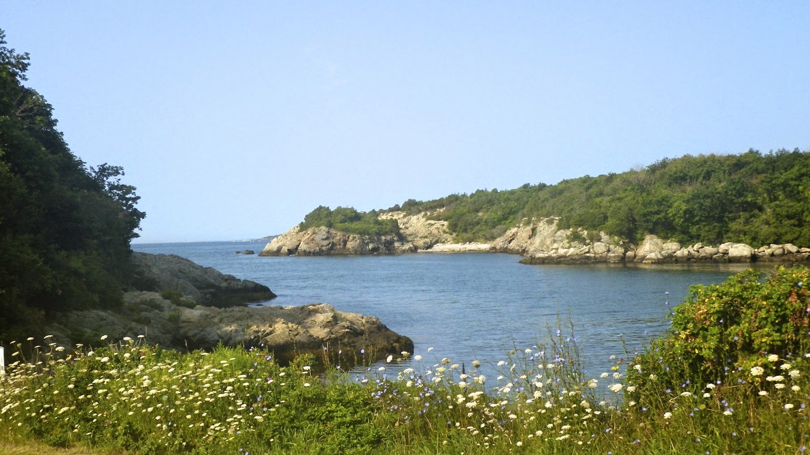
Fort Wetherill – July 31, 2014

Newport Bridge
I had worked my way through all my usual paddling spots in Narragansett – Point Judith Pondthe Harbor of Refuge, Pier 5, the Narrow River and the URI Bay Campus - so I decided to head over to Jamestown to paddle at Dutch Harbor.  I thought the water would be relatively calm, and I could get some pictures of the Dutch Island Light.

On the way over, I caught the sunrise over the salt marsh at Zeek's Creek and had some great views of the Newport Bridge. The only access to Dutch Harbor that I know of is at the town boat ramp at Fort Getty, and the guy at the gate wanted to charge me $30! So instead I drove down to Beavertail to see the Beavertail Light, and then went to Fort Wetherill. 

Beavertail Light
Fort Wetherill is former coastal defense battery and training camp located on 100-foot high granite cliffs across the East Passage from Newport and Fort Adams State Park.  I put in at the boat ramp at around 7:30 – high tide was around 11:30.  The paddle was great - 1 to 2 foot rolling waves, and absolutely beautiful scenery.

I know this is a popular spot for the sea kayakers, but flatwater paddlers (with the right skills and equipment) would love this trip as well (in the right conditions). 

View from the Put-in at Fort Wetherill
Links: