Sunday, January 29, 2017

Mass Central Rail Trail - Holden, MA - January 28, 2017

The crew heads out
I saw that Hiking Joe was doing a hike along the Quinipoxet River, so I decided to join in.  There were 9 of us who hiked 5 miles of the Mass Central Rail Trail along the along the Quinapoxet River in Holden, MA.

The Mass Central Rail Trail follows the route to the old Massachusetts Center Railroad that connected Boston to Northampton.  We would be hiking a section in the Wachusett Greenway. We met at the parking lot for the Mass Central Trail on Manning Road (265 Manning Street, Jefferson (Holden), MA), and hiked up the street to Springdale Road. We the hiked down Springdale road past the remnants of the old Springdale Mill Village to access the rail trail.

The rail trail itself was wide and clear, but we broke off into the woods at several places to follow the river.  We were near 100 feet in elevation and the 2-3 inches of snow made the walking extra crunchy.

Links:

Sunday, January 8, 2017

Assabet through Maynard - January 7, 2017

Ben Smith Dam
There was snow in the forecast for the afternoon, so a morning run that was close to home was in order.  Fortunately, the class II section of the Assabet River in Maynard was running, so that is where we went. 

The Assabet River arises in Westborough and flows approximately 34 miles west to meet with the Sudbury River at Egg Rock in Concord to form the Concord River.  There’s lots of great flatwater paddling on the Assabet including the section from Gleasondale to the Ben Smith Dam, and from the PowdermIll Dam down to Egg Rock.  The section through Maynard is an easy class II with some nice surf waves by the Ben Smith Dam and along Walnut Street near the mills. 

Brooke below the Ben Smith Dam
In 1847, textile manufacturer Amory Maynard purchased land in what is now Maynard from a farmer named Ben Smith and built a dam to power his textile mills.  Originally known as Assabet Village, this became the town of Maynard in 1871.  Maynard’s downtown textile mills, now Clock Tower Place, were the home of Digital Equipment Corporation from the 1960’s to the 1990’s.  Digital became a major computer company with 140,000 employees in 1987. 

I met Andy and Brooke at around 10:00 in the parking lot on the left side of the Ben Smith Dam to run the shuttle. The river was at a nice level – 3 feet, 400 cfs on the Maynard gage.  We played in the waves below the Ben Smith Dam before heading downstream.  There are six bridges over the Assabet River as it flows through Maynard.  The first is the double arch Great Road Bridge.  Either side is runable.  A pipe runs along the downstream end producing a surfwave (Crack Baby) that can be caught from the left side. 

Andy at the Mill Waves
The next bridge is the triple arch Mill Street Bridge.  We ran the far left arch due to wood on the right side.  Generally, all three arches are runable.  After some easy riffles and flatwater comes the Florida Road Bridge.  The river then turns right along Walnut Street and mills.  There are a couple of nice surfwaves (Mill Waves) before you reach the Main Street Bridge.  
Downstream from the Main Street Bridge, the river then turns left as it goes under the Walnut Street Bridge.  There are a few more riffles an one more substantial rapid as you approach the Waltham Street Bridge and the take out at the Elks Hall.  We spent about and hour and a half on the river, and it just started to snow just as we finished up.  Fortunately, we were close to home because the roads were slow for the drive home.

Here's another poem by Tom (canoeswithduckheads) that was posted on P-net.

Ole Blackfly don't mind the cold,
he runs red hot when rivers fold,
with liquid motion he flows on yet,
some take that Option Assabet.

TW


Snow falling and water on the lens, but still a happy crew
Links:

Sunday, January 1, 2017

New Year’s Day on the Housatonic – January 1, 2017

West Cornwal Covered Bridge
One of the rivers that has been on my to-do list for a while is the Housatonic.  When I saw that a group would be paddling it on New Year’s Day, I decided to tag along. 

The Housatonic originates in the Berkshire Hills of western MA and flows south for 150 miles along the western border of MA and CT before emptying into Long Island Sound.  There’s lots of great paddling along the Housatonic River. The best-known whitewater section is a class IV run known as Bulls Bridge - it's well above my skill set.  There is also a pretty flatwater section from Ashley Falls (MA) to Falls Village (CT), and a nice quickwater run from Falls Village to Kent.  We would be running part of the quickwater run – putting in above the Covered Bridge in West Cornwall, and taking out at the at Housatonic Meadows State Park.

Running the Covered Bridge Rapid
The day was sunny and traffic was light as I did the 3-hour drive out to western CT.  A light snow covered the Northwest Hills as I met the group at the Covered Bridge in West Cornwall.  We ran the shuttle, dropping our boats off on River Road above the Covered Bridge, and leaving cars at the picnic area below the campground at the Housatonic Meadows State Park.  The river was at a medium-low level – 3 feet, 900 cfs. I guess you can run it down to about 500 cfs, and medium flow is around 2,000 cfs.

The West Cornwall Covered Bridge was first constructed in 1762, and is one of the earliest bridges across the Housatonic River.  Beneath the Covered Bridge is a short class I/II rapid known appropriately enough at the “Covered Bridge Rapid”.  This is the site of an annual spring slalom race.  We spent some time playing in the rapids before heading downstream.

Playing in the Covered Bridge Rapid
A little ways below the Covered Bridge Rapid is a shorter class I/II rapid known at the Ledges.  From there, the river alternated between flatwater, quickwater and riffles.  It took us a couple of hours to do the 5-mile run. 

I’d love to come back in the summer and spend a night or two at the Housatonic Meadows Campground.  We could paddle from Falls Village to the campground on day 1. Paddle from the Campground to Kent on day 2.  And maybe even do the section from Ashley Falls to Falls Village on day 3.  We’ll see.

A pretty section of the Housatonic
Links:

Saturday, December 31, 2016

2016 Year End Review

First successful run through
Stokers on the Scantic
2016 started off with a swim on the Lower Winni on New Year's Day, and ended today with an uneventful run at River Island Park.  In between, it was a great year for paddling.  

I did 62 trips this year, which is a little above my 7-year average of 57 trips. I got on a few new rivers including the Lower WinniNeponsetBungaySaco and SheepscotI did a few less RICKA trips, but I did lead or co-lead trips on the AssabetPawcatuck and Sudbury, and organized a SUP Demo at Lincoln Woods. Here are some of the year's more significant trips:
Paddling my new Wildfire on the
Pawcatuck River
In February, I finally got the composite Wildfire that I've always wanted, and I've been loving it. I did get one good camping trip in – the Moose River Bow in ME. I was going to do a fall camping trip with Jonathan, but we ended up doing day trips instead – the Saco and SheepscotI also got to paddle every day of my summer vacation in Narragansett.  

I did a little more hiking this year, even though we didn’t have as much snow. 
Here are some of my favorite trips from 2016 from RICKA Movie night.


RICKA Movie Night - My Favorite Trips of 2016 from Erik Eckilson on Vimeo.

In terms of my resolutions from last yearI didn’t do so well on rolling practice, but I did get a camping trip in, and did paddle in all six New England States. Resolutions for next year;
  • Practice rolling – I’ll keep including it until I do it.
  • Do at least one camping trip – hopefully two with one in the spring and one in the fall
Overall it was another great year, and there are still plenty of rivers I would like to paddle. 

Tuesday, December 27, 2016

Manville Dam - December 26, 2016

I went down to the Manville Dam for a quick, late-afternoon paddle.  Considering how low some of the other rivers are, I am surprised that the Blackstone has so much water - 2 feet, 500 cfs.


Link:
Manville Gage

Wednesday, December 7, 2016

Bring on Winter!

The first snow of the year has come and gone, and it got me thinking about all the great winter trips I’ve done.  There is nothing like paddling in the snow, but lately it seems that snow brings out the hiking boots and snowshoes more than the canoe.  Oh well, let's see what happens this year - bring on winter!


Sunday, December 4, 2016

Tville - December 3, 2016

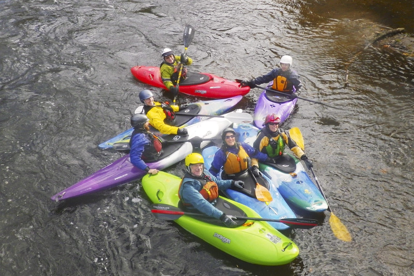
The crew
We finally got some rain last week, and the message boards were busy on Thursday and Friday with people getting out to paddle.  Unfortunately, I had to work, so I watched as the gages gradually dropped.  By Saturday, the options were pretty limited, but an old stand by was running – Tville on the Farmington River in CT.

Tville (or the Traffiville Gorge) is a class II/III run just north of Hartford.  It’s only a mile and a half long, but it has something for everyone – some easy surfwaves at the beginning, a bigger play hole in the middle, and some fun rapids and ledges as you run though the gorge.

Party Wave
Temps were in the 40’s, and there was a brisk wind blowing as we put in at Tarrifville Park.  We had 8 boats – one canoe (guess who) and 7 kayaks (Merrie, Jo-Ann, Shawn, Dennis, Sollie, Brad and Benjamin).  Level was 1.5 feet, 500 cfs - low, but runnable.  

We took our time and played on the easy surf waves above the gorge.  Entering the gorge, we ran Bridge Abutment, Play Hole, Ledges and Typewriter.  Run took us about 2 1/2  hours.

Surfing at Cathy's Wave
Links: