Tuesday, July 5, 2022

Providence River – July 4, 2022

Heading out from Bold Point
I decided to lead a RICKA trip on the Providence River on July 4th. 
It seemed appropriate since one of the first insurrections of the Revolutionary War – the Gaspee Affair – was carried out by Providence patriots on the Providence River in 1772. Providence was also the first colony to declare independence on May 4, 1776, and Rhode Island was the last state to ratify the Constitution in 1790 after protections were added by the Bill of Rights.

The Providence River is formed at the convergence of the Woonasquatucket and Moshassuck Rivers in downtown Providence. It flows south through Providence for a mile to its convergence with the Seekonk River at Bold Point/India Point. It then opens up into Providence Harbor and the Green Jacket Shoal before continuing south for 8-miles to the narrows between Conimicut Point in Warwick and Nayatt Point in Barrington where it becomes Narraganset Bay.

Past the tug boats
We put-in a little after 9:00 a.m. at Bold Point in East Providence and headed out across Providence Harbor towards the Fox Point Hurricane Barrier. The water was calm with just a slight hint of wind-blown waves. Rounding Fox Point we passed the tugboats before paddling under the I-way Bridge, through the hurricane barrier, and into downtown Providence.

Providence was established in 1636 by Puritan theologian Roger Williams who was fleeing religious persecution in Boston. It became a major trading center in the 18th century, a manufacturing center in the 19th century, and a financial center in the 20th century. This history can be seen today in the warehouses, mills and office buildings that line the river. We paddled under the new pedestrian walking bridge built on the piers of the old I-195 bridge and into downtown Providence.

Providence skyline
In the heart of Providence the river passes through Waterplace Park. Completed in 1994, Waterplace Park includes pedestrian bridges over the river that connect over a mile of cobblestone-paved walkways known as the Riverwalk. The park is home to the popular summertime Waterfire events.

We followed the path of Roger Willams up the Providence River to its headwaters at the confluence of the Woonasquatucket and Moshassuck Rivers. Roger Williams continued up the Moshassuck River and settled on its east bank on land that is now the Roger Williams National Memorial. The Moshassuck River arises near Lime Rock in Lincoln and flows generally south for 9-miles to Providence. The river became very important during the Industrial Revolution, powering numerous mills (including the Moffett Mill on Great Road) and becoming the lower section of the Blackstone Canal.

Up the Woonasquatucket River
We paddled up the Woonasquatucket River into the Cove at Waterplace Park. The Woonasquatucket River arises near Primrose Pond and Stump Pond in Smithfield and flows generally southeast for 16-miles to Providence. The tide was up, so we were able to paddle up about a mile to the US Rubber Lofts before turning around.

We paddled back down through the city and arrived back at Bold Point at around noon - plenty of time to enjoy the rest of the day.

In the Cove at Waterplace Park
Links:

Wednesday, June 29, 2022

Rice City Pond with the BVPC – June 28, 2022

Hartford Avenue Bridge
For the past two weeks I was
out for weeknight whitewater trips with the CTAMC at Tville. This week, I led a flatwater trip with the Blackstone Valley Paddle Club at River Bend Farm.

The Blackstone Valley Paddle Club was established in 2000 by the Blackstone River Valley National Heritage Corridor (now Park and Corridor) as a way to get folks out on waterways of the Blackstone River Valley. Over the years, the club has continued weekday trips (usually on Tuesday evenings) throughout the summer, getting thousands of people out on the water. We had a good turn-out for this trip with 25 boats including 5 canoes. 

Up the Blackstone Canal
River Bend Farm
is part of the Blackstone River Canal and Heritage Park – a 1.000-acre state park in Uxbridge, MA with hiking trails, paddling on the Blackstone River and Canal and historical sites like the Blackstone Canal’s Goat Hill Lock, King Philip’s Lookout and the Stanley Woolen Mill.

Usually, we offer the opportunity for paddlers to do either the River/Canal Loop, or Rice City Pond. I scouted the River/Canal Loop over the weekend, and found it low and tricky in spots. The current often takes you into strainers that can be difficult to avoid. The bottom of the canal was also green with duckweed. We decided to skip the River/Canal Loop and just do the trip to Rice City Pond. Even with Monday’s rain the water level was still low – 2.5 feet on the Northbridge Gage. 

Bob poling up the shallows
We put-in at the Tri-River Medical Center and paddled upstream under the Stone Arch Bridge at Hartford Avenue. After paddling under the bridge there are great views of Rice City Pond with the rolling hills upstream. We paddled up an old section of the Blackstone Canal to the Goat Hill Lock - one of only two remaining locks. The other is the Millville Lock above the Blackstone Gorge. 
Unfortunately, it was too shallow to get such a big group up to see the lock itself.

The Blackstone Canal opened in 1828 and utilized a series of 49 locks to move the barges up and down the 450-foot difference in elevation from Providence to Worcester. The canal operated until 1847 when it was replaced by the Providence & Worcester Railroad. 

Heading up the Blackstone River
Following the demise of the Blackstone Canal, the section through what is now River Bend Farm was purchased by the Taft family who converted it to a mill race for their Central Woolen Mill. They built the dam that created Rice City Pond, and constructed new headgates to control the flow of water down to the mill. The Central Woolen Mill, later known as the Stanley Woolen Mill, would become one of the most successful woolen manufacturers in the country.

We paddled across the top of Rice City Pond and up a section of the Blackstone River before shallow water forced us to turn around and head back to the put-in – nice night.

Links:

Saturday, June 25, 2022

Scouting River Bend Farm – June 25, 2022

I’ll be leading the Blackstone Valley Paddle Club trip at River Bend Farm on Tuesday, so I went out today to check it out. We usually do two separate trips here – one group paddling the canal/river loop, the other paddling Rice City Pond. First I paddled around Rice City Pond - it was low in spots (2.6 feet on the Northbridge gage), but fine as long as I stayed in the main channel. Then I paddled the canal/river loop - it was low with several difficult strainers, and the bottom of the canal was green with duckweed. We decided to skip the canal/river loop and just paddle Rice City Pond.

Great Blue Herron in Rice City Pond

Friday, June 24, 2022

Starting the summer off right - Tville Again - June 23, 2022

The kayak crew
The first day of summer was on Tuesday, and it would have been a great night to paddle. Unfortunately, I had stuff to do at work, so I was glad to see that the CTAMC also had a Thursday night Tville trip. We had 11 paddlers from five states - RI, MA, CT, NY and NJ. Level was low, but still good for the summer - 1.5 feet, 500 cfs. No swims for me this time.

Running the Double Drop/Inquisition Ledges
Links:

Wednesday, June 15, 2022

It was a two-swim night – Tville – June 14, 2022

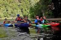
The crew
It's been over a month since I had my whitewater boat out, so I decided to join the CTAMC for a Tuesday night run at Tville. At yesterday’s level – 1.6 feet, 550 cfs - it is a class II/III run.

It was a little low at the put-in, but there was plenty of water at Cathy’s Wave and Brown's Ledge for some easy open-boat surfing. I ran the Bridge Abutment Rapid first and got some pictures of the rest of the group coming through. As usual, I ran the rapids above the playhole to the left. Even at this level, the playhole was too big for me to try surfing. Below the play hole are a couple of small ledges that I ran to the left.
Inquisition Ledges
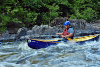
Below that are the Inquisition Ledges, or the "Double-Drop". I ran the first ledge to the right (avoiding the big hole in the center). From there, I tried to ferry across, but it is a tough off-side ferry. I got pushed downstream toward the rocks, and just barely made it through the slot at the second ledge. I had my first swim of the night in the squirrely water below the Inquisition Ledges. I wasn’t paying attention and over I went.

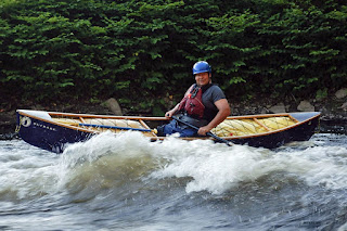
My second swim of the night was in Typewriter. I got spun into a side surf that I couldn’t get out of, and over I went. I was the captain of the swim team but it was still great to be back. Second and third swims of the year - the first was hat the Piscat.
Typewriter
Links:

Sunday, June 12, 2022

Stepping Stone Falls - June 12, 2022

Stepping Stone Falls
Michelle and I were looking for something to do, so we decided to do a hike at Stepping Stone Falls in the Arcadia Management Area.

At over 14,000-acres, the Arcadia Management Area is the state’s largest recreational area with great hiking and paddling. I have paddled the Upper Wood River many times. There are also miles of well-marked and maintained trails. The only other hike I had done here is the Mount Tom Trail.

Ben Utter Trail
Steppingstone Falls is pretty little waterfall on the Wood River that drops 10-feet over about 100-feet of distance. The water flows over a series of granite ledges with the largest being around 3-feet.

Typically, folks start this hike at the trailhead for the Ben Utter Trail on Plains Road in Exeter and hike up to the falls. I got the directions wrong, so we started at the falls on Falls River Road in West Greenwich. We hiked down the Ben Utter Trail to the Pavilion, then down the Tanners Washout to the River Trail, then back up the River Trail to the falls. It was enough for us. We had a nice picnic lunch at the falls.

Stepping Stone Falls
Links:

Sunday, June 5, 2022

Hopedale Pond and Parklands - June 4, 2022

Heading out from the boat ramp
I needed to stay local this weekend, but wanted to paddle something different. I was working on the July issue of the Paddler, and saw that Hopedale Pond was on the schedule for the Blackstone Valley Paddle Club. I knew this was an historic site, so I decided to check it out.

Like Woonsocket, Hopedale was settled in the middle of the 17th century and remained a small farming and milling community until the middle of the 19th century. In 1842, Adin Ballou established a commune in the village, which ended in bankruptcy in 1854. The property was then purchased by the Draper brothers, who began manufacturing textile looms. The Draper Corporation would eventually become one of the largest textile machinery makers in the country.

Beaver dam at the top of the pond
As I drove into Hopedale I was surprised to see a huge open space where the massive Draper Mill had once stood. After being vacant for 40-years, it was demolished in 2020. The impact of the company can still be seen around town, though, in the buildings that were donated by its owners and in the Hopedale Pond and Parklands.

The Hopedale Pond was the power source for the village’s original manufacturing operations. It sits on the Mill River, which flows south for 17-miles from North Pond in Hopkinton, though Upton, Milford, Hopedale, Mendon, and Blackstone, to Woonsocket where it flows into the Blackstone River.

Rustic Bridge
The Hopedale Parklands that surround the pond were purchased by the town in 1899. In 1900, the town hired landscape architect Warren H. Manning to design the park, which included walking trails through natural woodlands with a rustic stone bridge and picnic areas. In 2014, Mark Andolina, Jr., a Boy Scout from Hopedale Troop 1, created a trail map and installed new markers along the walking trails.

I put-in at the boat ramp at the old bathhouse on Hopedale Street and headed north into the pond. The pond seemed low, but I was able to make it to the top with a minimum of scraping by staying in the main channel. I paddled under the old stone bridge and found a huge beaver dam just up stream. Perhaps this is the reason for the low water, or maybe they are just letting out more water from the dam. I'd like to come back and check out the walking trails sometime.

Hopedale Parklands Trail Map
Links