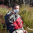
The annual Piscat Drawdown and BBQ has become a tradition for me. This was the first whitewater trip that I did after attending the NHAMC Whitewater School in 2005 and launched a hobby I love, so it holds a special place in my heart. I headed up for a solo run in my Millbrook Outrage.
The Piscataquog River begins in Deering, NH, and winds for 35 miles before joining the Merrimack River in Manchester. We would be paddling the Class II section below Gregg’s Falls Dam. We met at the dam at 10:00 and shuttled vehicles to the take-out behind the County Center and Prison. The flow was 800 cfs, with a reading of 5.5 feet on the Goffstown gauge.
I paddled the first run with Jonathan, Gwen, and Greg. This roughly three-mile section has its most consistent rapids in the first mile: a rocky stretch below the put-in, another beneath the power lines, and a third leading to the surf wave above Henry Bridge. Beyond the bridge, the river is mostly quickwater to the take-out, with a squirt line in a strong recirculating current at a sharp right turn and one final rocky drop just above the take-out.
My knee was a little sore when I reached the take-out, so I skipped the second run. We returned to the dam for the BBQ—the steak tips were delicious.
Links:
My Pictures
River Description from American Whitewater
Goffstown Gage
Saturday, October 31, 2026
Sunday, October 25, 2026
Trust at Both Ends: The Silent Language of Tandem Paddling
The more I paddle, the more I find myself reaching out to other paddlers to paddle tandem. The advantages are obvious: you have two people to provide power, and you have paddles on both sides of the boat to brace in the event of an upset.
Yet, for many, tandem paddling means a strong/experienced paddler in the stern calling the shots with a weaker/less experienced paddler in the bow who just goes along for the ride. To me, that isn’t tandem paddling. That’s just paddling solo from the stern with a person in the bow for ballast.
The Power of Teamwork
Real tandem paddling is about teamwork between equal partners and sharing responsibility. To be a good tandem paddler, you first need to be a good solo paddler. In a solo boat, you are both the bow and the stern paddler, providing all the power and control. You have to know the strokes and maneuvers to handle various conditions—skills you carry over into a tandem boat.
In a tandem, the skills are the same, but the responsibility gets split. The common belief that "the bow provides power and the stern steers" doesn’t quite capture the coordination between good partners:
- The Bow Sets the Course: Because the bow paddler has the best view of what is ahead, they choose the line.
- The Stern Executes the Turn: Steering strokes are often less effective at the bow, so the stern paddler executes the maneuvers, taking the bow’s lead.
Trust and Silent Communication
This setup requires trust at both ends of the boat. The stern must trust the bow's course, and the bow must trust that the stern will follow their lead.
While communication is critical, a good tandem team often doesn't need to talk at all. The stern paddler reads the river and watches the bow paddler’s strokes to decide what to do next. If the bow executes a sweep toward a nearby eddy, the stern follows. If a rock appears and the bow begins an onside draw to side-slip around it, the stern mirrors the move. In fast-moving water, there usually isn't time for words anyway.
The Ultimate Test: Big Waves
One of the most challenging environments for a tandem team is open water with big waves. Solo paddlers have the upper hand here; their lighter stems let them bob up and down easily. A tandem boat, weighted down at both ends, is much more likely to submarine into oncoming waves or spin out in the troughs.
In big waves, the bow paddler has to maintain forward momentum up and down the faces, while the stern paddler sets the quartering angle and stands ready to rudder. Once a boat gets caught in a trough parallel to the waves, staying upright is incredibly difficult, let alone getting back on course.
My Tandem Checklist
I’m blessed to have several great tandem partners. For me, the ideal partner fits a specific profile:
- They are a righty (since I paddle on the left).
- They are experienced paddling solo in moving water.
- They are comfortable in the bow.
Personally, I’d prefer to paddle in the bow myself. However, I’m heavier than most of my friends, so I almost always end up in the stern.
If you want to be your own boss, you absolutely can’t beat solo paddling. But if you can get comfortable splitting responsibilities and relying on a partner, tandem paddling is the way to go. With two engines providing power, a tandem team will outrun all but the strongest solo paddlers. Thanks to longer boats and a shared workload, you can ultimately paddle further, faster, and much more efficiently than going it alone.
Thursday, October 22, 2026
Borderland State Park - October 22, 2026
![]() |
| Pond Walk Trail |
Borderland was established in 1906 when Oakes Ames, a Harvard botanist and his wife Blanche purchased land on the border of Sharon and Easton. They built a mansion and created a nature preserve with woodland paths, roadways and man-made ponds.
![]() |
| Shelter on Leach Pond |
We started at the main entrance and hiked 5.1-miles on the Pond Walk Trail, on Mountain St. to the Granite Hills Loop, and back on the Pond Walk Trail. The fall foliage was beautiful. Brunch was at the Wagon Wheel Diner.
![]() |
| The crew at Upper Leach Pond |
Monday, October 19, 2026
Fife Brook - October 18, 2026
![]() |
| Running Freight Train |
It was a balmy 28 degrees when I left my house – definitely dry suit weather. High temperature for the day reached 59 degrees, so we were comfortable as long as we stayed in the sun and kept out of the wind.
![]() |
| Below Zoar Gap |
We did a lot of playing at the top, drifted a little too far right and had a wet run through Zoar Gap, and then continued down to Shunpike – 4 hours on the river, and my knee felt great. Here is the 1:22 cut from Aaron's video.
Friday, October 16, 2026
Manville Dam - October 16, 2026
Last December I was walking to work and felt a sharp pain in my knee stepping off the curb to cross the street at South Station. Turns out I tore the meniscus in my left knee. It has kept me out of my whitewater solo boats ever since. I tried NSAIDS and cortisone shots, but they didn’t help. The doctor didn't recommend surgery, and told me to be patient and focus on physical therapy. That is what I did, and finally feels like I am making progress.
I took my Millbrook Outrage out today down at the Manville Dam. I was able to kneel on the pedestal with no knee pain. My ankles and quad’s were a little sore - it's going to take a little while to get them stretched out again. I’m hoping to do a Fife run on Sunday with Aaron, and maybe I’ll take my solo boat. Or maybe not – I do love paddling tandem.
Thursday, October 8, 2026
Mercy Woods - October 8, 2026
![]() |
| Heading out on the Mercy Trail |
The Mercy Woods is a Cumberland Land Trust property that has 5.7-miles of trails including the Mercy Loop (2.3-miles), the Ridge Trail (2.1-miles) and the Stone Wall, Fisher, Fern, Fiske, Deer and Grape connecting trails. A short section of the Ridge Trail north of the Fern connecting trail is also part of the Warner Trail.
![]() |
| Cairn where the Mercy Trail meets the Ridge Trail |
After the hike we went out for breakfast at the Village Griddle in Plainville.
Links:
Wednesday, October 7, 2026
Connecticut River Camping - Woodsville to North Thetford - October 2-6, 2026
![]() |
| Getting ready to launch at Woodsville |
I wanted to get in one more multi-night trip before winter, so I reached out to Jonathan to see if he was interested. His only availability happened to be the same weekend that Aaron and his friend Cory were planning a trip on the Connecticut River, so we decided to join in.
![]() |
| Heading out from Woodsville |
This time we would be doing a four-day/three-night trip. We looked at lots of options, but decided to do the section from Woodsville to North Thetford. The scenery is nice, there are lots of well-spaced campsites and there should be plenty of water.
![]() |
| Running the small rapids |
Cory was waiting at the put-in when we arrived, so we unpacked our gear, loaded our boats and headed out. The river started off shallow but there were some small rapids to run if you picked the right line. If you picked the wrong line you would be dragging your boat over the rocks. We did a little of both.
![]() |
| Small plane flying low over the river |
As we were paddling downstream we heard what sounded like a large boat heading for us. It turned out to be a small plane flying low over the river. It did a fly-by and was gone.
![]() |
| Vaughan Meadow Campsite |
Dinner was Jonathan’s haddock with Maine-guide potatoes. The stars were amazing with a clear view of the Milky Way across the horizon. We sat around the fire until around 10:00, and then called it a night. Total miles for the day – 15.
![]() |
| Boat is loaded and ready to go |
This would be a relatively short paddling day, so we took our time. As we paddled along we heard what sounded like lawn mowers getting closer. It turned out to be a pair of parasails flying overhead. A littler further downstream we had another small plane zip by us at a low altitude following the river.
![]() |
| Cory cooking dinner |
There was a chance of showers between 7:00 and 8:00 the next morning, so I got up early to take down my tent. We had a nice breakfast of French toast and bacon cooked by Cory. Then we headed out to paddle one of the prettier sections of the river passing Mount Sawyer and the Fairlee Palisades. We took a break for lunch at Orford Landing.
![]() |
| Fairlee Palisades |
We were able to get our tents up before the skies opened up again. A couple of bands of rain and some hail came through before the skies finally cleared and we had an amazing rainbow over the river. Dinner was Aaron’s chili – also delicious. It was a chilly night, so I was toasty and warm in my sleeping bag a little after 9:00. Total miles for the day – 10.
![]() |
| Roaring Brook Campsite |
We packed up camp and headed out for the short paddle down to the take-out at North Thetford Landing. It took a little while to get everyone back to their cars, but we were soon on our way after another great trip. Total miles for the day – 2. Total miles for the trip - 34.
Links:
My Pictures
Friday, October 2, 2026
Charles River/Boston Harbor - October 1, 2026
![]() |
| View of Back Bay |
I made my first trip back to Boston since my retirement to paddle the Charles River and Boston Harbor. I have been wanting to do this trip for years, so when Steve N. posted it on the RICKA Flatwater Message Board, I was in.
The Charles River arises at Echo Lake in Hopkinton, and flows generally east for 85-miles, zigzagging through 22 cities and towns in eastern MA before emptying into Boston Harbor. I’ve done lots of great trips on the Charles, but never this section around Boston.
![]() |
| Massachusetts Avenue Bridge |
We launched across from Boston University and paddled down the Charles River into the Back Bay. This area was originally a large tidal marsh that was filled from the 1850's to the 1880's, transforming it into the grid-patterned Victorian-era brownstone and high-rise neighborhood that we know today.
![]() |
| Longfellow Bridge |
The granite towers also contain medallions with the carved reliefs of Viking ships. The Viking motif was a deliberate nod to the unproven myth that Leif Erikson had sailed up the Charles River and established a settlement named Norumbega around 1000 AD.
![]() |
| Museum of Science |
From the Museum of Science, we under I-93 to the new Charles River Dam. In 1978, the Army Corps of Engineers replaced the old Charles River Dam with this new dam and locks under what is now the Zakim Bridge. The locks are named for Colonel Richard Gridley, who was General George Washington's first army engineer.
![]() |
| Entering the locks |
Once in the harbor we headed for the Charlestown Navy Yard - one of the oldest shipbuilding facilities in the United States. It was established in 1800 and operated until 1974. Today it is part of the Boston National Historical Park and is home for the USS Constitution.
![]() |
| USS Constitution and the Bunker Hill Monument |
We crossed over to the Boston side of the harbor and had great views of Old Ironsides and the Bunker Hill Monument on the Charlestown side, and the TD/Boston Garden and the Zakim Bunker Hill Bridge on the Boston side.
![]() |
| Boston Tea Party Ship |
We paddled down as far as the Tea Party Ship in the Fort Point Channel before turning around. The trip back was uneventful until we hit an afternoon headwind on the Charles River near the take-out. Total milage for the day was 10.4-miles.
Subscribe to:
Posts (Atom)