
 |
| Checking in at Telos Checkpoint |
The Penobscot River drains much of vast wilderness area in north central Maine known as the North Maine Woods. With is four branches (North, South, East and West), the Penobscot is the second largest river system in Maine (behind the St. John) and the longest entirely in the state. The North Branch and South Branch combine to form the West Branch at Seeboomic Lake. The West Branch and East Branch converge in Medway to form the main stem of the Penobscot
 |
| Paddling down Lobster Stream |
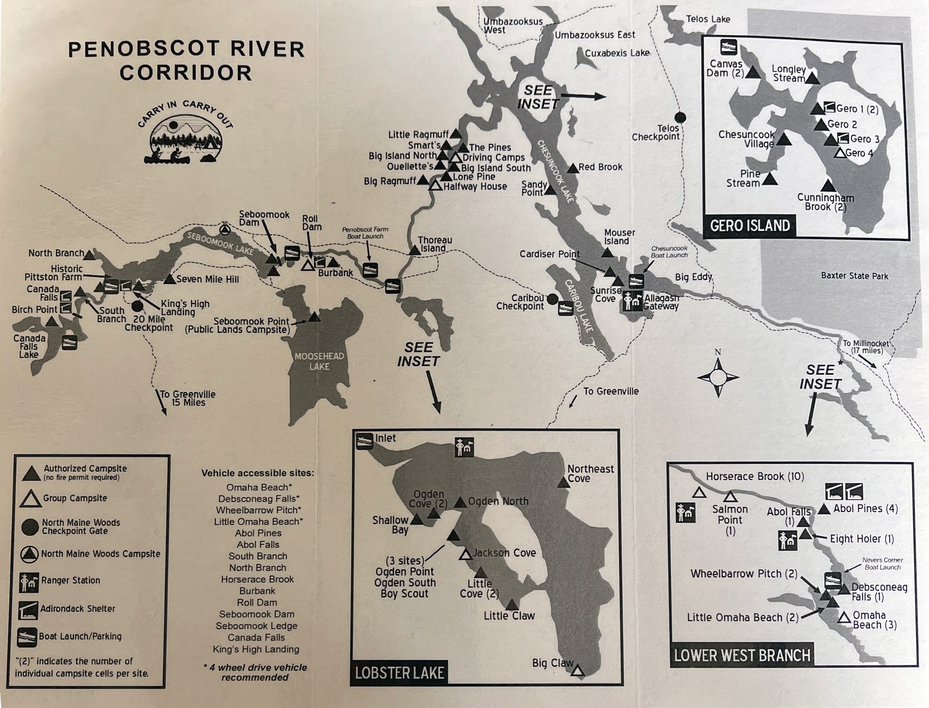
We did not do anything that ambitious. We put in at Lobster Stream and took out at Umbazooksus West on the northeast corner of Chesuncook Lake - 5 days, 4 nights with a stop at Lobster Lake.
 |
| Sandy beach at Ogden Point Campsite |
We were up early on Wednesday for the drive to Northwoods Outfitters in Greenville, who would be providing our shuttle. We had our boats and gear loaded by 9:00, and we were on our way. It was a 3-hour drive to Lobster Stream on the dirt logging roads. After unloading our gear and a quick lunch we were on our way down Lobster Stream to our first campsite on Lobster Lake – Ogden Cove.
 |
| Paddling down the Penobscot River |
The winds continued to pick up over the afternoon, with significant gusts in the late afternoon and early evening. We found whatever shelter we could, and had to rebuild the firepit with a larger wind screen in the back before lighting a fire. We cooked dinner, enjoyed a beautiful sunset and sat around the fire until around 10:00 when we called it a night. Total paddling for day 1 – about 3-miles.
 |
| Pine Steam Campsite |
Once again, everyone crossed with no problem. We took a quick break at the Lobster Stream put-in before continuing down the Penobscot River. Our objective was to get to the campsite at Pine Stream, which is one of the most popular on the river. We passed numerous empty sites along the way, and we were surprised that there weren’t more people on the river on the lead-up to Memorial Day weekend.
 |
| Paddling Pine Stream |
We were back on our way, and made it to Pine Stream at around 3:00. We set up camp, gathered wood, prepared diner, and enjoyed another amazing sunset. After the long paddle, much of it against the wind, I was in bed early – around 9:00. Total paddling for day 2 – around 18-miles.
 |
| Gero Island 1 Campsite |
Back in camp we cooked dinner and apple crisp for dessert in the reflector oven. We enjoyed and other great sunset before heading off to bed. Total miles on day 3 - around 10-miles.
 |
| View of Mount Katahdin |
We got up early on Sunday for the short trip to Umbazooksus West to meet the shuttle. We arrived around 10:00, and the shuttle arrived around 10:30. We were back in Greenville at around 2:00 and got on the road after a quick lunch. Total miles on day 5 – about 5-miles. No rain on the trip, but it poured on the way home – that’s the way it should be.
 |
| The crew at the take-out - Aaron, Bill, Erik and Matt |




No comments:
Post a Comment
Note: Only a member of this blog may post a comment.