 |
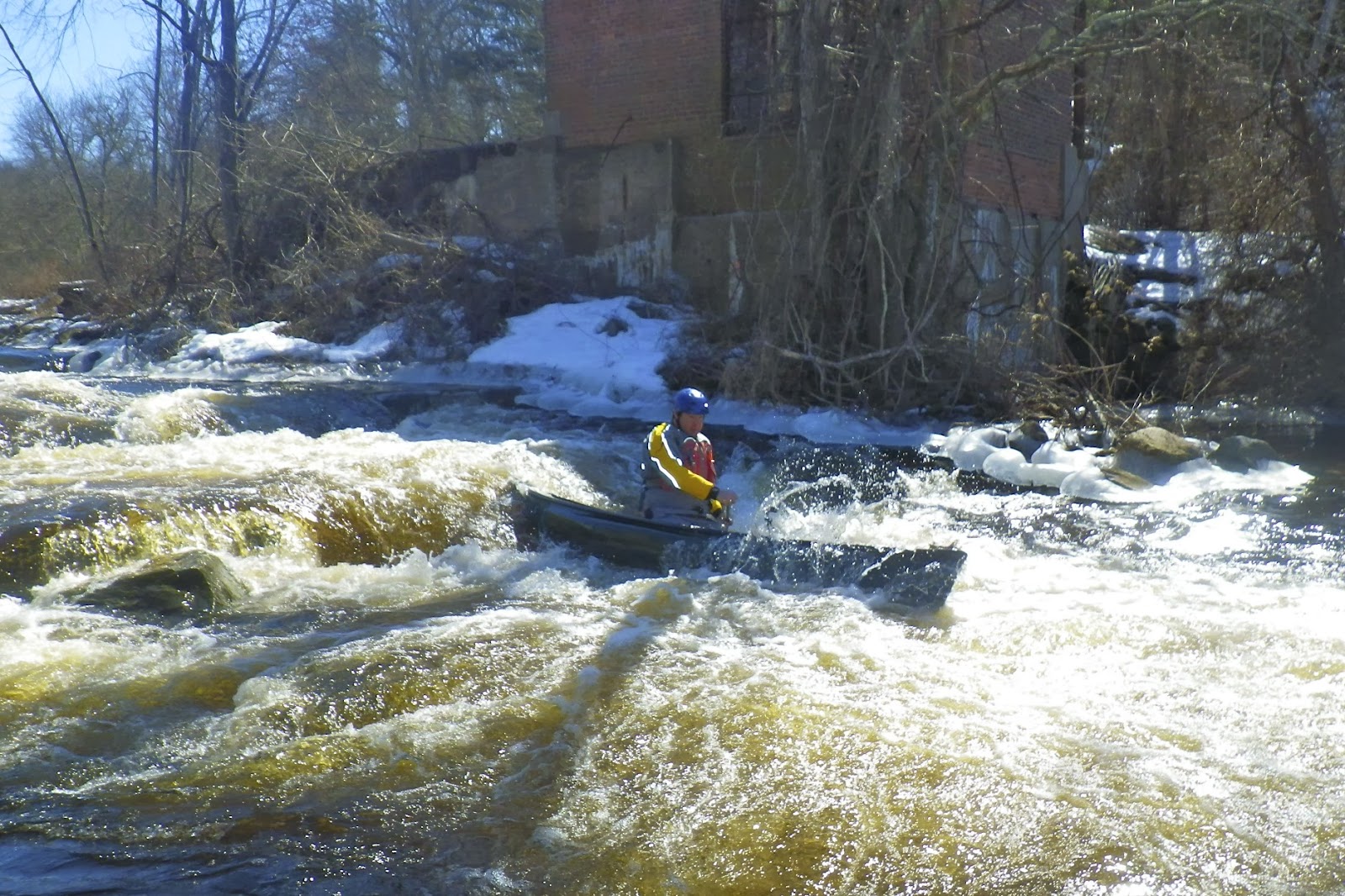
| Jim C. running the Kenyon Dam |
There has been a lot of work done on rivers in this area to restore access to migratory fish. I can
think of several trips that I have done in the past few months where dams were removed to improve access.
This includes Pawtuxet Falls Dam on the Lower Pawtuxet River and the
Spoonville Dam on the Tville section of the Farmington River. The removal of these dams has restored miles of free-flowing river
habitat to river herring, alewife and shad. These fish are an important part of the ecosystem, providing
food for bluefish, striped bass, largemouth bass, herons, ospreys and many
other predators.
Perhaps nowhere has this restoration
work been more active than on the Pawcatuck River near the Shannock
Village. At one time, this
short section of the river contained three dams that blocked access not just to
fish, but to paddlers as well.
With the completion of the new Kenyon Dam, access along this section has improved
dramatically.
 |
| Approaching the portage at the Horseshoe Dam |
I met up with Jim C. and Jim S. to
run the section from Biscuit City Road down to Richmond. The
Biscuit City Fishing Area launch site was iced in, so we will put in just downstream on Biscuit City Road. The water level was low, but runnable – 2.75 feet,180 cfs on the Wood River Junction Gage.
Just downstream from the put-in is
the new Kenyon Dam. As water flows down this minefield
of rocks, you might think you are looking at a natural rapid. An 85-foot-long ramp has been constructed on the downstream side of the dam. This ramp is made up of five
gradually ascending stone weirs, which serve like terraced steps. Gaps were
left in the weirs to create channels for the water to flow and the fish to
swim, including a main current down the middle that forms a nice channel for
paddlers. This main channel is a little tricky with a gradual curve to the
right, but we all made it through fine.
 |
| Running the Lower Shannock Falls |
From the Kenyon Dam to the Horseshoe
Dam in Shannock Village, the river twists and turns through a pretty
marshland. We portaged the
Horseshoe Dam on the left, and continued down through some easy rapids to the
Lower Shannock Falls.
The dam at the site of what is now
the Lower Shannock Falls was removed in 2010. This rocky section of the river curves gradually to the left
before ending in a couple of large
drops. Open boats will
often take in water at the bottom, but the rapid can easily be portaged on the
right.
Below the Lower Shannock Falls, the
river is a combination of flatwater and easy quick water until you reach the Route 112 Bridge
and the Carolina Mill Raceway. We stopped for lunch and a campfire at the Carolina Canoe Campsite before
taking out below the Richmond Dam.
 |
| Taking a break at the Carolina Canoe Campsite |
Links:


No comments:
Post a Comment
Note: Only a member of this blog may post a comment.