Tuesday, September 22, 2015

Ninigret Pond - September 19, 2015

Paddling with Bill in the Spirit II
Although I have done a lot of paddling in South County, I had never paddled Ninigret Pond in Charlestown.  That changed when the RICKA Picnic was held there last Saturday.

Ninigret Pond is the largest of Rhode Island’s South County salt ponds, which include Point Judith Pond (a tidal estuary), and Green Hill, Quonochontaug and Winnapaug Ponds (coastal lagoons).  Like all coastal lagoons, the Ninigret Pond itself is separated from the ocean by a barrier island.  It is also connected to Green Hill Pond by a small channel

Taking a break at the beach
We put in at the boat launch at Ninigret Park and paddled west along the barrier island.  Other than a few houses on the north shore along Route 1, it is quiet and undeveloped.  We hiked across the barrier island to take a quick swim at the beach before heading back for the picnic. 

It was a nice trip, and nice to paddle tandem with Bill in my Spirit II.

View across Ninigret Pond
Links:

Monday, September 7, 2015

Fife Brook - September 6, 2015


We did our RICKA trip on the Lower Deerfield a few weeks ago, but it has been quite a while since I paddled the Fife Brook section.  I was able to get out yesterday with some folks from the NHAMC.  Release was 1,000 cfs – nice level.  We had 3 canoes (me, Joe and Abby) and 4 kayaks.  I took the right line at Zoar Gap and made it through fine. 

Zoar Gap
Links:

Sunday, August 23, 2015

Lower Deerfield – August 22, 2015

Sandy and Earl
We had canoes and kayaks, long boats and short boats, paddlers, one poler and one dog.  We spent most of the day dodging tubers and rafts, but you still couldn’t have asked for a nicer day. 

Once each summer, RICKA runs and “easy” whitewater trip for experienced flatwater paddlers on the lower Deerfield River. This year, we decided to do the 7-mile run from the Zoar Picnic Area down to Charlemont Achademy.

The lone poler - Fred
The Fife Brook Dam controls the water in this section of the river, and timing is everything with this trip. We launched around 1:30, two and a half hours after the scheduled release, and hit it just right.

We had 11 paddlers – two canoes and nine kayaks. Most of the class I/II rapids come early in the trip, and everyone got through with no problem. It took us about 3 hours to finish the run down to Charlemont.  On the way home we stopped for BBQ at Smokey Joes – good day.

A little surfing

Sunday, August 9, 2015

Dead River – August 8, 2015

Waiting for the shuttle
Sometimes it doesn't pay to play it safe. At least that's what happened to me yesterday on the Dead.

I wasn't able to run the Dead in June or July, and knew that things would be busy in September, so decided to head up to the Forks for the August release. I wasn't sure who I would paddle with until I saw that Charlie Sweet was leading a trip for the Boston AMC. It turned out to be a small group (Charlie, Rich, Josh and me), but all open boaters.

Rich does some surfing
With the large group of MVP'ers at the Forks for Family Step-up Weekend, the shuttle took forever. We finally got on the road around 10:00, and got to the river about 45 minutes later. With two trailers attached to the bus, they stopped at the top and made us carry down the hill. We finally got on the water around 11:00. 

The release was 2,400 cfs with another 100 cfs coming from Spencer Stream - a nice class II/III. We ran through Spencer Rips, Minefield and a bunch of other unnamed rapids before stopping for lunch at Hayden's. After lunch we ran Hayden's, Gravel Pit, Elephant Rock, Mile Long and Upper Poplar in quick succession. Before we knew it, we were set to run Lower Poplar.

Charlie below Minefield
I followed Rich into Lower Poplar taking a middle right line along the seam of the rapid. About a quarter of the way down, Rich went left into the rapid, but I went right along what I thought would be an easier line into the rock garden. Before long, I got hung up on a shallow rock and flipped. Fortunately I was close to shore, so I was able to get my boat to shore quickly. Soon I was back in my boat and finishing the run, but like I said, sometimes it doesn’t pay to play it safe. 

We were back in the campground around 5:00 - a six hour run that was a lot of fun.

Kelly runs the slot at Elephant Rock
Links:
My Pictures
Spencer Stream Gage
River Description from American Whitewater

Saturday, August 1, 2015

One Last Trip around Great Island - July 31, 2015

Low hanging clouds hung on the water as I went out for one last trip around Great Island.  Unfortunately, our summer vacation in Galilee ends today.  Goodbye Horseshoe Point.

Horseshoe Point on Great Island
Links:

Thursday, July 30, 2015

Upper Narrow River - July 30, 2015

Gilbert Stuart Birthplace
I’ve paddled the lower section of the Narrow River several times, but today I decided to paddle the upper section from the Gilbert Stuart Birthplace to Bridgetown Road.  I put into the Gilbert Stuart Stream and pushed my way through the shallow water into the Upper Pond. I then paddled south to the Casey’s Sill - a shallow sandbar between the Upper and Lower Ponds named for nearby Casey Farm (c. 1750).  I paddled through the Lower Pond to Bridgetown Road before turning around and heading back.

Lower Pond
Links:

Wednesday, July 29, 2015

Port of Galilee - July 29, 2015

Port of Galilee
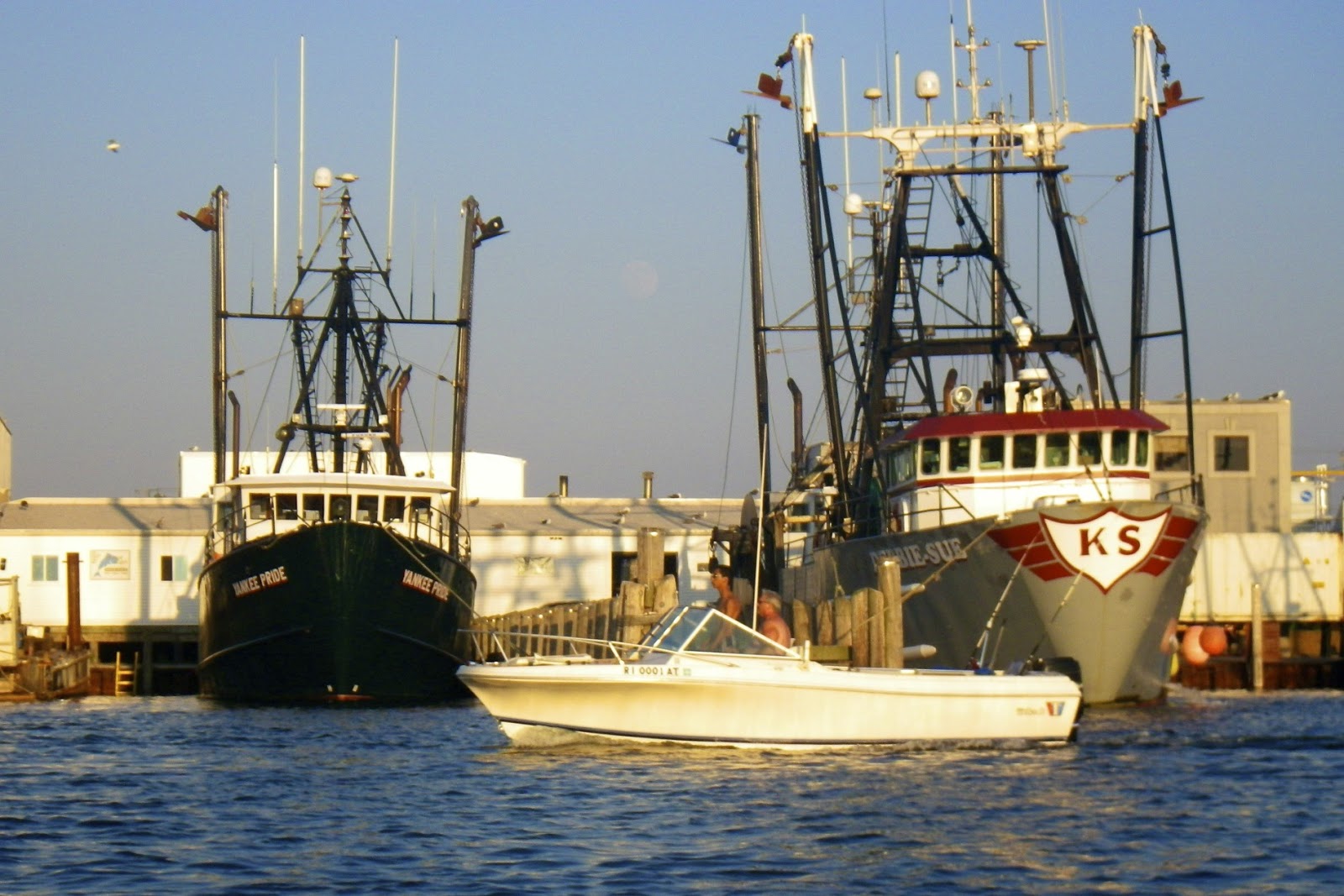
I didn’t get to paddle this morning, so I put my boat in the water at the dock near the cottage after supper, and padded south along Great Island to the Port of Galilee.  I knew that the evening light would be better for getting pictures of the fishing boats in the harbor.

Great Island is about 2 miles long and 1/2 mile wide, and full of summer cottages.  I headed south into a moderate headwind and easy rolling waves past Thomas Point and Little Comfort and into the Port of Galilee.  

Fishing boats
The Port of Galilee was created in 1935 when a harbor was dredged and a dock constructed at the mouth of Point Judith Pond. Connected to the ocean by the Harbor of Refuge and Breachway, both completed in 1910, Galilee eventually became the home port for much of Rhode Island's fishing industry.

There was an eclectic collection of ships docked in the harbor - large fishing trawlers, smaller lobster and shellfish boats and charter boats. Generations of fishermen have sailed from the Port of Galilee to work the waters of the Point Judith Pond, the Rhode Island and Block Island Sounds and beyond at the edge of the continental shelf.

Lobster boat
Links: