Monday, December 31, 2018

2018 Year End Review

Ice-out on the Quinebaug 
2018 was a funny year in terms of weather. The rivers froze up early, so I didn't get out for my usual New Year's Day paddle. I did a hike with Bill instead. After bone-chilling cold in early January, the rivers iced-out in mid-January, and were open for the rest of the winter. I did a lot more paddling in January and February this year than I had ever done before. Then we had the second wettest fall on record – great weather for paddling. 

Lincoln Woods with Michelle
I did 62 trips, which is a little better than my nine-year average of 59 trips. Little Suncook was the only new river this year, but I did paddle two new sections of the Sudbury River in Sudbury and Wayland. I led BVPC trips at River Bend Farm and Chocolatville, and one RICKA trip on the Pawcatuck from Richmond to Bradford. I also ran a tandem canoe training for the June RICKA meeting, organized the RICKA SUP Night, and did a RICKA Sea Kayak trip with Tony in his tandem sit-on-top at Fort Weatherill.

Stokers on the Scantic
I did couple of Tville trips, the Scantic, and Otter Brook with the CTAMC. I did the Upper Winni and Little Suncook with the NHAMCI had two swims this year – the bottom of Staircase on the Scantic and the play hole at Tville

Here are some of the more significant trips:
Here are some of my favorite trips from the 2018 RICKA Movie Night.


I paddled almost every day of my summer vacation in South County - we had some rainy days and fog this year.


I did two camping trips on the Upper Connecticut River with Bill and Jonathan - Canaan to Bloomfield in the spring.


And Woodsville to Orford in the fall.


Papa Joe crew at Borderland State Park
I also got in a few hikes with the Papa Joe hiking group.
In terms of my resolutions from last year, I didn’t do so well on rolling practice, but I did get some camping in. Resolutions for next year;
  • Step-up my whitewater paddling - I need to get on some more challenging rivers
  • Get back to the Dead this summer
  • Do another Connecticutt River camping trip – maybe Lunenburg to the Woodville
  • Practice rolling – I’ll keep including it until I do it - need to go to a rolling clinic
Overall it was another great year, and there are still plenty of rivers to paddle, plenty of trails to hike, and plenty of places to go camping. Unfortunately, today I am fighting a cold, so the last day of the year will be spent on the couch resting up so I can paddle on New Year's Day 2019! 

Callahan State Park - December 30, 2018

This year started off with a hike, and ended with a hike.  I joined the Papa Joe group for a hike at Callahan State Park.

Callahan State Park includes 958 acres of woodland in Framingham, Marlborough and Southborough. The park is managed by the Department of Conservation and Recreation and includes 7 miles of trails for hiking, mountain biking, cross-country skiing, and horseback riding. Parking areas are located on Millwood Street, Edmands Road, and Broadmeadow Road.

We met at the trailhead on Edmands Road in Framingham. The trail looped through softwood and hardwood forests with a few streams to cross.  Unfortunately, I got called out early due to an issue with my Mom, but it was still a great hike. 

Links:

Sunday, December 30, 2018

River Island Park - December 29, 2018

I stayed local yesterday and spent a couple of hours down at River Island Park – about a half-mile of quickwater with a couple of easy surf waves.  Usually the best surf spots are below the Bernan and Court Street Bridges, but yesterday those were washed out and the best surfing was directly below the Woonsocket Falls at the Globe Bridge. Level was 3.5 feet, 1,700 cfs. I paddled down and carted my boat back.  Not a bad way to spend the morning.

Saturday, December 15, 2018

Manville Dam - December 15, 2018

Five years ago today I went paddling down at the Manville Dam. I was back there again today for a late afternoon paddle. The temp’s were warm and there was no snow on the ground this year. It was nice to take a break and get out on the water for a little while.

Links:

Saturday, December 1, 2018

Santa’s Reindeer – Wickford Harbor – December 1, 2018

Santa's Elves at the beach
I was debating what to do this morning, and my options included a hike with the Papa Joe group (always a good option), a run on the Quabaug (I need to do that again) or an easy trip escorting Santa into Wickford Village. I opted for the easy trip in Wickford.

Wickford is located on the West Passage of Narragansett Bay, and is built around a large, well-protected harbor. It was settled in the early 17th century when Roger William purchased land from the Narragansett Indians and established a trading post. Wickford grew to become a major port and shipbuilding center.

Ready to go!
Today, Wickford is a picturesque village whose waterfront streets are lined with shops, restaurants and colonial-era homes. Each year the North Kingstown Chamber of Commerce organizes the Festival of Lights in the village with holiday themed actives. Since 2010, RICKA has participated in this event by escorting Santa down the harbor for his big arrival at the Town Dock.

I arrived at the put-in at the end of Main Street next to Gardners Wharf Seafood around 11:30 to decorate my boat with reindeer and elf cut-outs. We met Santa around 12:15 for the paddle down to the town dock. I was amazed at the size of the crowd. After escorting Santa, we took a little time to paddle the backwaters of Wickford.

Sunday, November 25, 2018

Borderland State Park - November 25, 2018

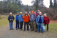
The crew
Usually I paddle at least once over the Thanksgiving holiday, but it didn’t work out this year.  Instead I did the Papa Joe hike at the Borderland State Park. 

Borderland State Park was of the former estate of the Ames family. In 1906, Oakes Ames and his wife Blanche purchased this land on the border of Sharon and Easton where they built a mansion and created a nature preserve with woodland paths and roadways and man-made ponds. Today the park includes 1,843 acres with more than 20 miles of trails including sections of the  of the Bay Circuit Trail.

We started at the main entrance, and hiked 6.3 miles around Leach Pond and through the park. It didn’t rain during the hike, but the many of the trails were flooded.  Still a good time.  

Links:

Sunday, November 11, 2018

A Windy Day on the Sudbury - November 10, 2018

Heading out - Erik, Bill and Al
After hiking last week, Bill, Al, Jonathan and I decided to do some paddling on Saturday. Throughout the week we debated locations, but potential rain, wind and high water kept us close to home. In the end, we decided to paddle the section of the Sudbury River from River Street/Route 27 in Wayland.  

The Sudbury - a National Wild and Scenic River - arises in Westborough and flows generally northeast for 41-miles to its convergence with the Assabet River at Egg Rock in Concord to form the Concord River. In Sudbury and Wayland, it forms the huge wetlands that are part of the Great Meadows National Wildlife Refuge. In hindsight these wide-open marshes weren’t the best choice on a day when strong wind gusts were forecast.

Portage at Pelham Island Road
Bill, Al and I had paddled up to the Route 27 Bridge from Sherman's Road back in August, so this would be continuation of that trip. We met at the put-in on River Road (Route 27) in Wayland, and checked out the Old Town Bridge before paddling west toward Route 20.  The water was high, the sky was cloudy, but fortunately we didn’t get any rain. 

With the high water, we had to portage the Pelham Island Bridge. As we continued upstream toward Heard Pond the wind picked up. After 3 miles, and knowing that we would be paddling into the wind on the return trip, we decided to turn around and head back to the put-in. Wind gusts of 25-miles per hour made for a long slog back – especially for Jonathan who was paddling solo. Even so, it was a good time.

The Crew - Al, Jonathan, Erik and Bill
Links:

Saturday, November 3, 2018

Hop Brook/Memorial Forest - November 3, 3028

Planning the trail
The forecast was for clouds and rain but warm temperatures, so why not go for a hike. I have been looking forward to the first hike of the year for Papa Joe’s “Winter” hiking group.  

The first hike was at the Hop Brook Conservation Area. Straddling the border of Sudbury and Marlborough, this 615 acre track of public and private land includes the Hop Brook Conservation Area, the Memorial Forest and Wildlife Sanctuary, the Marlborough State Forest, and other conservation land owned by Sudbury and Marlborough.

Heading out
Bill was at my house at 7:30 for the drive to the trailhead at 347 Dutton Road in Sudbury.  We had 11 hikers for this 5-mile loop. It rained on and off throughout the hike, and we were constantly avoiding flooded trails, but it is a great area with gentle terrain and lots of features. We stopped for brunch at the Sunnyside Café in Marlborough. 

Plenty of rain 
Links:

Sunday, October 21, 2018

Little Suncook - October 20, 2018

The crew meets at the put-in
It was 6:00 a.m. when I headed out to meet Paul at the Wendy’s on Route 495 in Milford  for a trip to New Hampshire for a new whitewater river – the Little Suncook.

The Little Suncook is a short river (just 4-miles long) that flows generally west from Northwood Lake in the town of Epsom through Bixbey Pond to join the Suncook River near the Epsom Traffic Circle. The river can be difficult to catch running during spring runoff, after periods of heavy rain, and in the fall for the annual drawdown of Northwood Lake. Unfortunately, there is no USGS gage on the river.  

Looking upstream from the put-in
We headed north to meet Joe and a group from the NHAMC at the rest area on Route 202 in Epsom. As we checked out the river from the put-in we found a narrow, creek-like river with lots of rocks, drops and waves. With the dam release, the water was in the trees making eddies tough to catch. We knew that we would have to be on our toes due to the constant twists and turns.  

We ran the shuttle down to the take out behind the Cumberland Farms (16 Black Hall Road, Epsom). We had 8 boats – 4 canoes (Joe, Harry, Charlie and me) and 4 kayaks (Eric, Tim, Brian and Paul). We skipped the top class III/IV rapid, but even so, the river gets your attention quickly with a tricky class II+ rapid just downstream of the put-in. We had our first swim there as Joe dumped in a shallow drop.  He got out of the water easily, but his boat went about ¼ mile before Harry was able to get it into one of the shore eddies.  

Running the upper rapid
We after the first set of rapids, we continued downstream into Bixby Pond – the impound from the Bixbie Pond Dam that we portaged on the right. The dam can be run on the left, and Eric made it look easy.

Below the Bixby Pond Dam the river alternates between quickwater and rapids with three challenging class II+/III rapids.  The first is a short technical rapid about a quarter mile below the dam. The second is at Center Hill Road - Tim had a swim here. The third is about a mile downstream under a small footbridge where there are several holes, drops and big waves – Tim and Brian had swims here. While Brian got his boat to shore quickly, Tim’s boat traveled downstream and got pinned on a large strainer – it took a while to get it off.  

One picture of me
With 4 swims and one pinned boat, the 3-mile trip took us about 2 1/2 hours, which meant we didn’t have time for a second run. Still a fun run and I will be back. I was in the upper section and caught this paddler as he came through, which happened to be Mike Rock - small world. 

Monday, October 15, 2018

Planning for the Connecticut River - Mount Orne Covered Bridge (Lunenburg) to Woodville

Bill and I have been working our way through the weekend trips on the Upper Connecticut River. We've done the sections from Canaan, VT to Blooomfield, VT, Bloomfield, VT to Lunenburg, VT and Woodsville, NH to Orford, NH. With the easy stuff done, its time to deal with the dams on the section from Lunenburg to the Woodville - 39-miles, five dams, three (or maybe four) nights. Here's a potential itinerary: 

Put-in - Mount Orne Covered Bridge – mile 307- small parking area and hand-carry launch, just south of the Mount Orne Covered Bridge on the Vermont side of the river.

Portage and Intermediate Campsite - Gilman Dam – mile 302- take out river left on the NH side in a small cove marked by a portage sign. Follow trail through grassy field where camping is allowed. Put in after the dam. (Length: 0.2. Percentage wheelable: 0.95.)

First Night - Dalton Primitive Campsite – mile 299- located just north of the high tension line that crosses the narrow, north arm of the reservoir, on the New Hampshire side.

Portage - Moore Dam - mile 290- take out river right on the VT side and descend along a well-marked portage trail, mostly on grass. (Length: 0.33. Percentage wheelable: 0.95.)

Second Night - Moore Primitive Campsite – mile 290- recently established campsite for paddlers only on the NH side. Features include five tent platforms, picnic tables, and fire rings. No toilet facilities (yet) but one can walk about 1/4 mile downriver on the trail to the boatramp and use its porta potty.

Portage - Comerford Dam – mile 282 - take out river left on the NH side by boat access. Walk along dam access road before descending the steep, mowed embankment adjacent to the dam. Descend stairs to a path. Walk downstream toward a gravelly beach. Warning - river levels can rise unexpectedly here - by as much as 3'! Do not leave unattended gear close to the river, and listen for sirens. (Length: 0.36. Percentage wheelable: 0.75.)

Third Night - Stevenson Campsite – mile 280 - located on a shady river terrace on the NH side of the river, across from the north end of Stevens Island.

Portage - McIndoe Falls Portage – mile 276 - take out river left on the NH side and follow timber access stairs up to McIndoes Falls Rd. Follow path across road down to a landing beach. (Length: 0.1. Percentage wheelable: 0.5)

Optional Forth Night - Stephan's Island Campsite – mile 273 - peaceful island with sandy beach, towering pines, and rocky knoll located on the second island between McIndoe Falls and Dodge Falls. 

Optional Forth Night - Fiddlehead Island Campsite – mile 273 - a large but often overgrown campsite located on the third wooded island between McIndoe Falls and Dodge Falls. 

Optional Forth Night - Dodge Falls Campsite – mile 272 - small campsite at the portage of Ryegate Dam, about .5 miles north of Dodge Falls. Small shelter. Portable toilet near dam.

Portage - Ryegate Dam – mile 272 - take out river left after sharp bend. Follow trail past the campsite, along edge of field, down an access road, and along a rough path to the river. Warning - put-in is rocky with difficult footing. (Length: 0.3. Percentage wheelable: 0.8.) 

Take out - Woodsville Access – mile 268 - small, sandy beach in town of Woodsville. Downstream of bridge, on Connecticut Street. Unimproved ramp, car-top access only.

This one we are planning to do in the spring.

Link:
Connecticut River Paddlers Trail

Sunday, October 14, 2018

Little Suncook

I'm going to try the lower section of Little Suncook this weekend with Joe and the NHAMC. This will be the annual release/drawdown. The upper section is class III/IV - I'll skip that. The lower section is class II+ with a 6-foot dam that can be run, but I'll probably portage. Here is Joe's video - kind of looks like the Shepaug.


Links:
River Description from American Whitewater
Joe's Video

Tuesday, October 9, 2018

Connecticut River Camping - Woodsville to Orford - October 6 - 8, 2018

Woodville Access
Bill arrived at my house at my house at 6:00 a.m. for the drive up to New Hampshire. We planned to be at the boat launch in Orford, NH by 10:00 a.m. for our next trip on the Connecticut River. 

The Connecticut River is the longest river in New England flowing south for approximately 400 miles from the Canadian border through four states before emptying into Long Island Sound. With work and family obligations, its tough for me to do long camping trips, so Bill and I have been doing 3-day trips on the upper Connecticut River. We ran the section from Bloomfield, VT to Lunenburg, VT last fall. In the spring, we ran the section from Canaan, VT to Blooomfield, VT. This trip would be on the section from Woodsville, NH to Orford, NH. 

Bath-Haverhill Covered Bridge
When we arrived at the boat launch in Orford (mile 240), Al and Jonathan were already there, and Conrad arrived shortly after. With the crew complete, we consolidated our gear for trip up to Woodsville (mile 268).  We put-in at a small beach off Connecticut Street just below the Route 302/Railroad Street Bridge. 

Before heading downstream, we paddled upstream to the mouth of the Ammonoosuc River to see the Bath-Haverhill Covered Bridge. Built in 1827, this bridge is the oldest covered bridge in the State of New Hampshire. The bridge was closed in 1999 and restored for foot traffic in 2004. After checking out the bridge, we started our trip downstream.

Hartdale Farm
About 2 miles below the Route 302/Railroad Street Bridge we came to the Howard Island Campsite (mile 265) on the New Hampshire side – a grassy campsite accessible from a cobblestone bank. We continued downstream to our destination for the evening - Harkdale Farm Campsite (mile 259). Hartdale Farm is a wooded site on the VT side. We set up the camp, gathered firewood, and had a nice supper of fried fish and Maine guide potatoes cooked by Jonathan before settling in around the campfire for the night.

We awoke the next morning to drizzle, so I took my tent down early to try to keep it dry. I got the fire lit and the coffee started, and Jonathan prepared a tradition English breakfast with eggs-in-a-hole, sausage and fried tomatoes. After a leisurely breakfast, we packed up and headed out for our 13-mile paddle down to the Underhill Campsite. 

Paddle the Border Cookout
After 4-miles we took a break at Bedell Bridge State Park (mile 255) – the site of an old covered bridge.  As we continued past the Newbury Boat Launch (beside the Haverhill/Newbury Bridge on the VT side), we noticed lots of kayaks heading downstream. We learned that this was the Paddle the Border event sponsored by the Upper Valley Land Trust, who maintains many of the campsites on the VT side. About 100 participants were headed down to Bugbee Landing for a cookout and music by the Strawberry Farm Band. It sounded good to us, so we joined in. 

We paddled past the Vaughan Meadow Campsite (mile 253) – a wooded campsite on the VT side about a mile below the old Bedell Bridge abutment. After another 4-miles we came to the Waits River on river right. We paddled a short way up the Waits River to the Bugbee Landing in Bradford (mile 249).  We had our fill of hamburgers, hot dogs and pulled pork, and enjoyed the bluegrass music before heading out again.  From there, we had about 4-miles to paddle to the Underhill Campsite.  (Camping is also allowed at Bugbee Landing in a mowed area adjacent to the boat launch.)

Heading to the Take-out
The Underhill Campsite (mile 246) is located just west of Piermont Village at the mouth of Eastman Brook. It is a wooded site up a steep bank on the New Hampshire side of the river. We lugged our gear up the stairs and followed our usual routine - set up camp, gather firewood, cook supper (pasta and sauce prepared by Bill), and then gather around the campfire for the night.

We awoke the next day to foggy skies and mist. Once again Jonathan prepared breakfast, and then we packed up for the final leg of our journey. The Connecticut River is not known for its wilderness feel, but this section seemed a little more remote with hemlocks lining the banks in several sections. We also paddled past the steep cliffs of Saywer Mountain and the Palisades in Fairlee, VT before taking out at Orford Boat Launch (mile 240) near the Pastures Campground.  The rain started just as we pulled out of the boat launch for the ride home. Perfect timing.

Sunday, September 30, 2018

Packing for the Upper Connecticut River Trip

I started packing for next weekend’s trip on the Connecticut River. The last two trips have been in the Great North Woods. This time we will be a little further south in the Upper Valley. We will be doing 28-miles in three days from Woodsville, NH to Orford, VT.  

Put-in - Woodsville Access – mile 268 – a small, sandy beach in town of Woodsville, NH downstream of the bridge on Connecticut Street. 

Intermediate Campsite - Howard Island Campsite - mile 265 - about 2 miles below the Woodsville Bridge. The northern campsite is located at the northeast end of this island with access on a moderately-sloped cobblestone bank. The southern campsite is at the southwestern corner of the island.


First night- Harkdale Farm Campsite – mile 259– campsite on the VT side at second large oxbow downstream of Howard Island, across from high eroding sand bank that meets small brook with fallen trees.


Intermediate Access - Bedell Bridge State Park – mile 255 - boat ramp and picnic area at a park on the site of a former covered bridge. 

Intermediate campsite - Vaughan Meadow Campsite – mile 253- located on the Vermont side one mile below the old Bedell Bridge abutment. Located on a wooded bank after the river turns from SE to S, a few hundred yards north of the Bradford line.

Intermediate Access/Campsite - Bugbee Landing Access Point/Campsite – mile 248 – a small dock and boat ramp at the mouth of Waits River. The school allows camping in a mowed area adjacent to the boat launch.

Second night - Underhill Campsite – mile 246- past Bug's Island and located on the NH side at the mouth of Eastman Brook, before the river veers west.

Take-out - Orford Boat Landing – mile 240

I got all my camping gear together, but I still need to figure out the food. The weather should be nice, and hopefully the foliage will be peak.


Links:

Branch River – September 29, 2018

Paul running Atlas Pallet Rapid
I was trying to decide where to paddle, and really didn't feel like driving, so I talked Paul into a local run on the Branch. Level was 4 feet / 500 cfs, which is as high as I have run it in a while. No bouncing off rocks, and I actually had to dump out the boat a couple of times. There were three strainers in the upper section – two we were able to paddle over due to the high water, one we had to portage.  Nice trip as always.

Surfing at the Atlas Pallet Rapid
Links:

Sunday, September 23, 2018

Westfest - September 22, 2018

The first shuttle
Some people said it was the last day of summer. Other people said it was the first day of fall. Either way, it was a great day to be on the water, and I spent it on the West River in Jamaica, VT at Westfest.

The West River runs 54-miles across VT from Mount Holly in the Green Mountains to Brattleboro where it joins the Connecticut River. While blocked by two large flood control dams – Ball Mountain and Townshend – there are still two sections of the West that are used for whitewater paddling during dam releases in the spring and fall – the upper West (class III) from Ball Mountain Dam to the Jamaica State Park, and the lower West (class II) from the Jamaica State Park to Route 100.

A typical section of the West River
Westfest, held during the fall release, is the place to see and be seen for whitewater paddlers in the northeast. Just about everyone who paddles whitewater is there. The staff from the Jamaica State Park runs a shuttle on the upper section that allows paddlers to easily do 3 or 4 runs a day – a big draw for many people.

Since I started paddling on the West, I always paddled it with folks from RICKA. Over the years the group has grown, and then shrank. For the past couple of years it has been just Paul and I, but the great thing about Westfest is that there are always people that you know to paddle with.  

Dave running Initiation
We got an early start and arrived at the Jamaica State Park at around 8:30. We parked, unloaded our gear, changed up, and were on the shuttle for our first run at around 9:00. As we got on the water at the footbridge at Cobb Brook, we joined Paul G. for our first run. With the recent rains, the level was a little higher than usual – between 1,800 and 1,900 on the Jamaica, VT gage. At this level, the rocks were buried and there were lots of long wave trains.  

The most difficult rapid on this section of the river is the Dumplings. The typical route is a “S” turn starting just left of some large rocks in the middle of the river, then right though some large standing waves. The turns were a little trickier and the waves were a little bigger, but we made it though fine. From there it is an easy run back to the Jamaica State Park for another ride on the shuttle.  

Paul running Initiation
We ended up doing four runs on the day. On the last run Paul and Dave D carried their boats up to the Ball Mountain Dam to run the most difficult rapid on the river – Initiation. Initiation is a half-mile rapid with continuous 3-foot waves, big rocks and nasty pour-overs. A misstate here usually leads to a long swim, so I decided to skip this rapid and take some pictures instead.  

From my perch on a rock about halfway down the rapid, I saw Dave and Paul catch an eddy above a large pour-over upstream. From there they pealed-out, ferried around the pour-over, and bobbed down the waves though the rest of the rapid – nicely done. We ran the rest of the river and were on our way home around 4:00 after another great day on the water.  

Erik and Dave approaching the take-out
Links:

Sunday, September 16, 2018

Lincoln Woods Go! Paddle - September 16, 2018

I went out with Michelle in the Spirit II to paddle the Blackstone Heritage Corridor Go! paddle at Lincoln Woods.

Links:
My Pictures
Lincoln Woods from RI Blueways

Blackstone Gorge - September 15, 2018

I decided to head over to the Blackstone Gorge to paddle up to the Millville Rapid. The level was around 3.5 on the Northbridge gage, but there was a lot water running though the Gorge, so I hiked down the to the Gorge Drop at the bottom. The ledges seemed a little scratchy, but the Gorge Drop was running. I paddled up to the Millville Rapid and set up the camera to catch my run through. Unfortunately, it shut off before I came through.

Gorge Drop in the Blackstone Gorge
Links

Friday, September 7, 2018

Second Swim of the Year - Thursday Night Tville – September 6, 2018

There were thunderstorms on the drive down, and heavy rain on the drive back, but in between we had just a few sprinkles and another fun night on the river. Level was 1.5 feet, 500 cfs – low but still fluid. We put in at the Mill off Route 189 just above Cathy’s Wave.  I had my second swim of the year at the playhole. I immediately got spun around, then the stern sank back into the hole and the boat filled up with water – over I went.  Easy self rescue though and another poem from TW.
Within those holes that spin us,
is found some thoughts to pin us,
corkboard mementos
soddenly to dry, 
so laugh at failures

hope there shan't die,
and should the blackness
take in our light,

to other worlds
let's flow a flight,
up from such depths
by aqueous assist, 
non-acquiescent

of waters' persist.
Learnin' and turnin' the riparian dawn,
an E-squared factor keeps paddlin' on.

TW


Links