Sunday, May 28, 2023

Potter Cove - May 27, 2023

The crew - Erik, Cat, Tony and Mike
Last spring, I had a lot of trouble with an arthritic knee, and thought that I would need to give up kneeling in my canoes. If I was going to sit anyway, I decided that I would get a sea kayak so I could do some ocean trips. I ended up purchasing Capella 166 RM, but didn’t get to take it out on many trips last year.

After a pretty good spring of whitewater paddling this year, I was looking for something a little different to do on Memorial Day Weekend. When I saw that Cat was leading a RICKA level 2 trip from Potter Cove on Saturday, I decided that I would join. I’ve paddled out from Potter Cove in my canoe to get pictures of the Newport Bridge, but I have never paddled up along the shore.
Cat at the North Light
The RICKA Sea Kayak group assigns levels to trips, not to paddlers. Trip levels range from Level 1 (no previous skill required) to Level 5 (long distances in extremely challenging conditions). It is recommended that newer paddlers start off with Level 2 before moving up to Level 3. Level 2 trips tend to be protected coastal paddling, while Level 3 trips tend to be open water with swells and more limited options for landing.  

For this trip we would be putting in at Potter Cove for an up-and-back around the northern tip of Conanicut Island – about 12-miles. Expected conditions were seas of less than one foot, but we'd be paddling against both an incoming tide and a 10 kt headwind on the return leg. The distance and the wind on the return leg may have pushed this trip up to level 3.

Mike at the Newport Bridge
As we headed out I began to feel more comfortable in the easy 1-foot waves. Coming from a canoeing background, I tend to have a high-angle stroke, which is not the most efficient for long-distance cruising. I got some great tips from Cat along the way on a low-angle cruising stroke. The first leg of the trip was uneventful with the tide coming in and the wind to our backs. Putting down the skeg made it easier - duh. We paddled around the northern end of the island at North Light, and took a break for lunch just east of Sand Point.

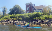
The trip back was a bit of a slog. After rounding the northern end of the island, we paddled back against the tide and into a headwind. I was glad to the have practiced the more efficient cruising stroke on the way up. We took a break to check out the Park Dock Waterfront Access, so I also had a chance to practice an easy surf landing. We slogged along for the last 5-miles back to Potter Cove, but enjoyed the great views of the Newport Bridge along the way. 


Potter Cove from Erik Eckilson on Vimeo.

Links:

Wednesday, May 24, 2023

West River with the BVPC - May 23, 2023

The open boaters 
I saw on Facebook that Danny and Bill would be joining the Tuesday night trip with the Blackstone Valley Paddle Club on the West River in Uxbridge, so I decided to join as well. Open boaters make every trip better.

The West River in MA (not to be confused with the West River in VT) arises at Silver Lake and Cider Mill Pond in Grafton and flows south for approximately 13-miles to its convergence with the Blackstone River in Uxbridge. The river was a source of power for several textile mills during the early stages of the Industrial Revolution.

Heading out
As part of the flood control work completed after Hurricanes Connie and Diane in 1955, a large flood control dam was built on the West River by the Army Corps of Engineers. The flood control land now includes 600 acres of woodland and marshland along the river and upstream in the towns of Uxbridge, Northbridge and Upton.

On this trip we would be paddling from West River Road in Uxbridge up to the flood control dam. By late spring or early summer, the backwater from the dam just above Mendon Street (Route 16) is full of invasive weeds, so this trip needs to be done early in the season. We paddled upstream over two beaver dams. The river that twists and turns through pretty woodlands and marshland as we made our way up the West Hill Dam and back.

The crew at the put-in
Links:

Sunday, May 21, 2023

Housatonic - River Road to Housatonic Meadows - May 20, 2023

Jeff D. running the slalom course
It was slalom race weekend on the Housatonic, so I decided to join Paul D. for his trip on the Covered Bridge section so I could try my luck on the race course. It’s a 3-hour drive from my house, so I needed to get an early start.

The Housatonic originates in the Berkshire Hills of western MA and flows south for 150 miles along the western border of MA and CT before emptying into Long Island Sound. There’s a lot of great paddling on the Housatonic River. The best-known whitewater section is a class IV run known as Bulls Bridge - it's well above my skill level. There are also a couple of nice flatwater sections - one in MA - Sheffield to Ashley Falls, and one mostly in CT - Ashley Falls to Falls Village that we paddled as a fall foliage trip a few years ago.

Rescue practice
We would be running the quickwater section from River Road in Cornwall to the Picnic Area at Housatonic Meadows State Park in Sharon. We met at the picnic area and ran the shuttle up to River Road. This section is about 6-milles of quickwater with a couple of class II rapids – the Covered Bridge Rapid where the slalom course was set up, and the Ledges. The river was low and scratchy (2.5 feet, 500 cfs.) – I don’t think I’d make the trip again at that level. We put in on River Road, and paddled down to the Covered Bridge to run the slalom gates.

In whitewater slalom, racers compete to run a course of upstream and downstream gates set up in the rapids. Each gate consists of two poles hanging from a wire strung across the river. There are 18-25 numbered gates in a course that must be run in the proper order, with green gates being run downstream and red gates being run upstream. Upstream gates are typically placed in eddies. Downstream gates are often offset to require ferries or rapid turns. If a gate is hit a 2-second penalty is given. If a gate is missed a 50-second penalty is given. The paddler’s head and part of the boat must pass through the gate. In New England, slalom races are organized as part of the New England Slalom Series.

Surfing at the Ledges
I brought my Yellowstone Solo, so I knew running the gates would be a challenge – it was. I missed 6 of the 22 gates. The Yellowstone Solo doesn’t spin or side slip as fast a dedicated whitewater or slalom boat, but it was a lot more comfortable when I was running the quickwater sections downstream. Due to the low water, all of the gates were set up as downstream gates, which was unusual. Typically, there are 4 to 6 upstream gates included in the course.

After running the slalom course, we took some time practicing rescues and boat recoveries before heading downstream. We stopped for lunch at the Housatonic Meadows State Park Campground. It was pouring rain for the second half of our trip, the ride home, and most of the night. Over two-inches of rain fell, which gave the river a much needed boost for the slalom race today. Oh well, it was still a fun day.

The crew at the put-in above the Covered Bridge
Links:

Wednesday, May 17, 2023

Lackey Dam with the BVPC - May 16, 2023

Heading out on the pond
With Mother’s Day and our recent trip to Florida, it’s been a couple of weeks since I was out in my canoe. I decided to join the Tuesday night trip with the Blackstone Valley Paddle Club.

The Blackstone Valley Paddle Club was established in 2000 by the Blackstone River Valley National Heritage Corridor (now Park and Corridor) as a way to get folks out on waterways of the Blackstone River Valley. Over the years, the club has continued its Tuesday night summer trips getting thousands of people out on the water.

Up the Mumford River
This paddle would be on the Mumford River above the Lackey Dam. The Mumford River arises at Manchaug Pond in Sutton and Douglas, and flows 18-miles east until it joins the Blackstone River in Uxbridge. The many dams along the river provided power to 19th century textile mills. We had a good turn-out for this trip with 15 boats, including 2 canoes.

The crew was heading out when I arrived, so I paddled sweep with Cheryl and Tom. Early in the season the pond is clear, but later in the summer it will get choked-up with water chestnuts. We could see the young water chestnut plants growing up in the shallow water. We paddled up the pond into the Mumford River and up beyond Route 146. Fallen trees make this a little challenging once you get into the river, but you can actually make it quite a ways up.

Heading back down the pond to the put-in
Links
My Pictures