Monday, January 31, 2022

Blackall Family and Ballou Farm Preserve – January 30, 2022

Steve and Bill at the trailhead
The Blizzard of 2022 dropped 18 to 24-inches of light fluffy snow across much of southern New England. I knew that I wanted to take advantage of the snow and go snowshoeing, so when Bill suggested the Blackall/Ballou Preserve just a mile from my house, I jumped at the opportunity. This would be my third hike at a Cumberland Land Trust property. It was nice to have Steve join us as well.

When most people think about the early development of the Blackstone River Valley, they usually think about the development of textile mills along the Blackstone River. It is easy to forget that for generations before the development of the mills the people in the Blackstone River Valley were primarily farmers. The old farmland land that is part of this this Cumberland Land Trust property was previously owned by the Ballou and Blackall families.

Heading out on unbroken trails
As early as the seventeenth century, this part of Cumberland was known as the Ballou Neighborhood. The patriarch of the Ballou family was Maturin Ballou who was recorded as a settler in Providence as early as 1646. At his death around 1685 his estate included his Providence homestead that was left to his daughter Hannah, and a large parcel in the “Outlands” of the “Attleborough Gore” in what is now Cumberland that was left to his sons John, James and Peter.

Settlement of the “Outlands” increased dramatically after the end of King Philip's War in 1678. James, who lived in what is now Albion, owned the west side of the parcel on the border with what is now Woonsocket. We know this because he donated the land for the Elder Ballou Meeting House that was located there. The Elder Ballou Meeting House was erected in 1732 and was one of the oldest churches in the state when it was destroyed by fire in the 1960’s. His son Obadiah Ballou settled on the property and in 1749 donated land for the cemetery across the street that contains the graves of generations of the Ballou family.

Back at the trailhead
Today, the Blackall Family and Ballou Farm Preserve consists of 184-acres with about 3.3-miles of trails. Based on its location just southwest of the Elder Ballou Meeting House it was no doubt part of Obadiah Ballou's original homestead. For most of the 20th century the Blackall family owned and farmed the northern section of this property. The western half of the Blackall property was sold and developed as Highland Corporate Park. The eastern half of the property was conserved as open space.

We started at the trailhead on West Wrentham Road (there are also trailheads at the Dollar Tree Plaza and Old West Wrentham Road), and headed west through the woods on the blue blazed trail. The trail was unbroken until we reached the west side where people had hiked in from the Dollar Tree Plaza and the Highland Hills Apartments. There is another 1.5-miles of trails to the north on the on the red and yellow blazed trails, but we saved that for another day. We stayed on the blue trail and looped back to the cars. We did about 1.5-miles, but that was enough. I forgot what a workout snowshoeing can be!

Links:

Saturday, January 22, 2022

Noon Hill/Shattuck Reservation - January 22, 2022

That's me
It was another chilly morning with no paddling trips that I could see, so I decided to join Papa Joe for his trip at Noon Hill/Shattuck Reservation in Medfield, MA.

Noon Hill is a prominent summit and scenic vista surrounded by 204-acres of open space. It offers 4.5 miles of hiking trails and is part of a larger network of open space that includes the Shattuck Reservation located to the northwest along the Charles River. A system of trails spans the two properties, some of which are part of the Bay Circuit Trail.

The crew on Noon Hill
We headed out from the parking lot at 158 Noon Hill Road in Medfield on the yellow blazed trail to Noon Hill. At 370-feet, Noon Hill rises gently above the surrounding landscape giving great views to the southeast of neighboring Walpole and Norfolk.

Icy conditions along with rocks and roots that could snag on micospikes made the trails a little treacherous. On the way down from Noon Hill we had the first accident – a face-plant resulting in a cut on the bridge of the nose. After the cut was bandaged, the decision was made to head back to the cars before heading out again.

Not who you want at your trip
On our second attempt, we headed out past the skaters on Holt Pond and crossed the street onto the red blazed trail in the Shattuck Reservation. Before we reached the Charles River, though, we our second accident - another face-plant resulting in a nasty bump on the head and sprained wrist. This time an ambulance was called as a precaution, which brought our hike to an end. Thankfully both are home doing fine. 

Shit happens - nice to be with a group that is prepared and knows how to respond when it does. Hike ended up being about 3.5-miles.

Links;

Saturday, January 15, 2022

River Island Park - January 15, 2022

Bernon Mills
I’ve been hiking more than paddling lately, so I wanted to get my canoe out for at least a short trip. At 15-degrees I knew that any flatwater would be frozen solid, so it was back to River Island Park. I was nice and warm with two layers of insulation under my drysuit and my neoprene helmet liner, but a thin layer of ice froze inside the boat making it real heavy to carry back up the flood control levy to the cart. It's just under a mile back to the car, and the wind was brutal in a couple of spots. Other than that it was fine. No wind on the river and at 2.3', 588 cfs, the river was at a nice, easy level.

Court Street Bridge
Links:

White Cedar Swamp/Burlingame/Goldstar Preserves – January 15, 2022

Bundled up at 5 degrees
It was a brisk 5-degrees when I headed out for my next hike at a Cumberland Land Trust property - this time the White Cedar Swamp/Burlingame/Goldstar Preserves.

The combined preserve consists of three properties acquired from 2003 to 2017. On Nate Whipple Highway is the 23-acre Atlantic White Cedar Swamp Preserve. Bog bridges now allow easy access to the property that had once been flooded by beaver dams. On Pound Road is the 38-acre Gold Star Preserve that was donated by a developer who was subdividing an adjacent property for house lots. To the east is the 72-acre Burlingame Preserve with miles of stonewalls that separated hay fields, pastures and woodlots in the 1800's. 

Miles of stone walls
I started at the White Cedar Swamp trailhead on Nate Whipple Highway and followed the white blazed Cedar Swamp Trail (0.69-miles) over the bog bridges. Continuing on the Cedar Swamp Trail will take you to the Goldstar Preserve and trailhead on Pound Road, but I followed the red blazed Burlingame Loop (1.52-miles) around the perimeter of the property. 
The Blue (0.27-miles), Orange (0.31-miles) and Green (0.21-miles) trails cut across the Burlingame Preserve creating shortcuts. 

All the trails are well marked and the combined property includes 153-acres with 3.13-miles of trails. To the east of the Burlingame Preserve is the privately owned Cumberland Beagle Club.

Links:

Sunday, January 9, 2022

Mercy Woods – January 9, 2022

Trailhead on Wrentham Road
For years I wondered why cars were parked at the turn-off on Wrentham Road just before you crossed into MA. Now I know. At least some were probably hiking on the trails of what is now the Cumberland Land Trust’s Mercy Woods Preserve.

In 2018, the Sisters of Mercy sold 229-acres of provincial land to the Town of Cumberland. The Cumberland Recreation department will eventually use 18-acres for sports fields. The remaining 211-acres will remain as open space managed by the Cumberland Land Trust.

Ridge Trail
The Mercy Woods Preserve currently has 5.7-miles of trails including the Mercy Loop (2.3-miles), the Ridge Trail (2.1-miles) and the Stone Wall, Fisher, Fern, Fiske, Deer and Grape connecting trails. A short section of the Ridge Trail north of the Fern connecting trail is also part of the Warner Trail connecting Sharon, MA to Diamond Hill.

I started at the turn-off on Wrentham Road and did a 3.3-mile perimeter hike along the Ridge Trail (south) and Mercy Loop (north). It was fine, but next time I will probably do the section of the Mercy Loop east of Mount St. Rita since it doesn’t run so close to Wrentham Road. I’d also like to find the Warner Trail and the connection to Diamond Hill.

Links:

Noanet Woodlands – January 8, 2022

Iron Mill Pond 
With Friday’s snow I knew that I wanted to get out somewhere this weekend. I didn’t see any paddling trips, so a Papa Joe hike it would be. This weekend’s hike was at Noanet Woods.

I had done this trip several times before, and it is a nice hike. In 1923, Amelia Peabody purchased Powissett Farm in Dover, and over the next six decades acquired hundreds of acres of nearby open space, including the Noanet Woodlands. I remember going to Powissett Farm as a kid to buy pigs. Now Powissett Farm is also Trustees of Reservations property.

The crew at Noanet Peak
Noanet Woods
has 17 miles of trails adjacent to the Hale Reservation. On this trip we stayed in Noanet Woods and hiked in a clockwise direction on the Peabody and Noanet Peak Trails to Noanet Peak (with its view of the Boston skyline) and the Iron Mill Dam before heading back to the cars – about 3.3 miles.

It was 16-degrees when we headed out at 8:30, and 26-degrees when we got back to the cars at 11:00, but it never felt cold. I love the view of Boston from Noanet Peak.

Boston skyline from Noanet Peak
Links:

Saturday, January 1, 2022

Blackstone Gorge - January 1, 2022

Heading out
There were lots of options for a New Year’s Day/First Day paddle – the Winni, Tville, Crystal or the Ware. After hiking yesterday I decided that I wanted to stay close to home, so I paddled the Blackstone Gorge with the RICKA crew.

We put in at the Rolling Dam and paddled up to Millville. We had six boats – 2 canoes and 4 kayak’s. The temperature was a balmy 50-degrees, there was mist on the water which added a magical touch, and the rain held off until we packed up to leave. Nice way to start 2022.

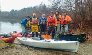
The crew - Steve, Erik. Earl Jim, Frank and Chuck
Links: