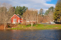
I really want to get out to do some spring camping, but nothing was coming together, so I booked some sites on Lake Umbagog for June 7 - 10.
Umbagog Lake is located along the border of NH and ME near Errol, NH. The lake runs almost 11 miles north to south and is fed by the Magalloway River, the Rapid River, and the Dead Cambridge River. It is the source of the Androscoggin River. The lake is part of the Umbagog National Wildlife Refuge and Umbagog Lake State Park.
Umbagog Lake State Park includes a base camp with 27 sites at the southernmost end of the lake that can be accessed from NH Rt. 26. There are 33 wilderness campsites located around the lake that are accessible only by boat. I crossed the upper end of Lake Umbagog when we did the Magalloway, Rapid and Androscoggin Rivers last fall.
Bill and Earl have signed on, and here is the trip we planned:
Day 1 – meet at Umbagog Lake State Park and shuttle a car to the Errol Dam. Put in at the base camp and explore the southern end of the lake including the Dead Cambridge River. Head north to Big Island. Camp at site R9 on Big Island - 6 miles.
Day 2 – paddle north past Pine Tree Point and east to the mouth of the Rapid River. Camp at site R15 – 10 miles.
Day 3 – paddle up the Rapid River to the whitewater section - hike up the trail if we want. Paddle back along the north shore to the mouth of the Androscoggin. Camp at site R28 - 7 miles.
Day 4 – paddle back down the Androscoggin to the dam - 4 miles.
Bill and I will be paddling my Spirit II. Earl will be in his kayak. Extended forecast looks good for now - partly clouding and in the 80's. We can get firewood at the base camp, but Earl says we shouldn't need it - there is plenty around.
 |
| Lake Umbagog from the Magalloway River |
Links:


